About This Program
|
In the wake of the devastating western Kentucky tornado outbreak of December 10-11, 2021, the National Weather Service (NWS) Forecast office in Paducah, KY, and local community leaders began to brainstorm ways to build resilience and preparedness ahead of dangerous weather. Early in 2022, NWS Paducah and NWS Headquarters were approached by Kenny Garrett, director of the Henderson County, KY, Office of Emergency Management, about collaborating on a project that would combine the outreach resources of NOAA’s Weather-Ready Nation Ambassador program with a needs-based weather safety assessment and recommendation model for interested organizations. Working together, a team composed of staff from the Henderson County Office of Emergency Management and from the National Weather Service devised the Henderson County Weather-Ready Community demonstration. |
 |
Project Guidelines
The Henderson County Weather-Ready Community demonstration is currently designed with three core elements:
Needs assessment checklist: The checklist is done by emergency management staff and provides an external review of existing safety procedures, employee behaviors, and a summary of any potential hazards that may have been observed.
Safety walkthrough: Emergency management staff conduct a walkthrough to identify existing sheltering options that meet FEMA or American Red Cross recommendations.
Recommendations document: After the walkthrough, a recommendations document is prepared that includes photographs of recommended sheltering locations, an analysis of the existing emergency action and safety plans, and a commitment to make follow-up visits to provide annual all-hazards safety training and safety plan updates and recommendations.
Force-multiplier: Ensuring the participating organization stays aware of the latest NWS forecasts and distributes NWS hazardous weather information, forecasts, and safety information to their staff members and community partners.
Participants
As of June 2024, 13 organizations in and near Henderson County have completed the process to become full partners in the Weather-Ready Community demonstration. Several additional organizations in Henderson County are currently going through the process to complete the program. Moving forward, staff from both Henderson County Emergency Management and NWS Paducah will continue to collaborate to create a preliminary roadmap that could potentially assist other communities and NWS offices in future weather safety and preparedness efforts!
AMG Aluminum North America |
Henderson County Kentucky Public Library |
Pittsburg Tank and Tower Group |
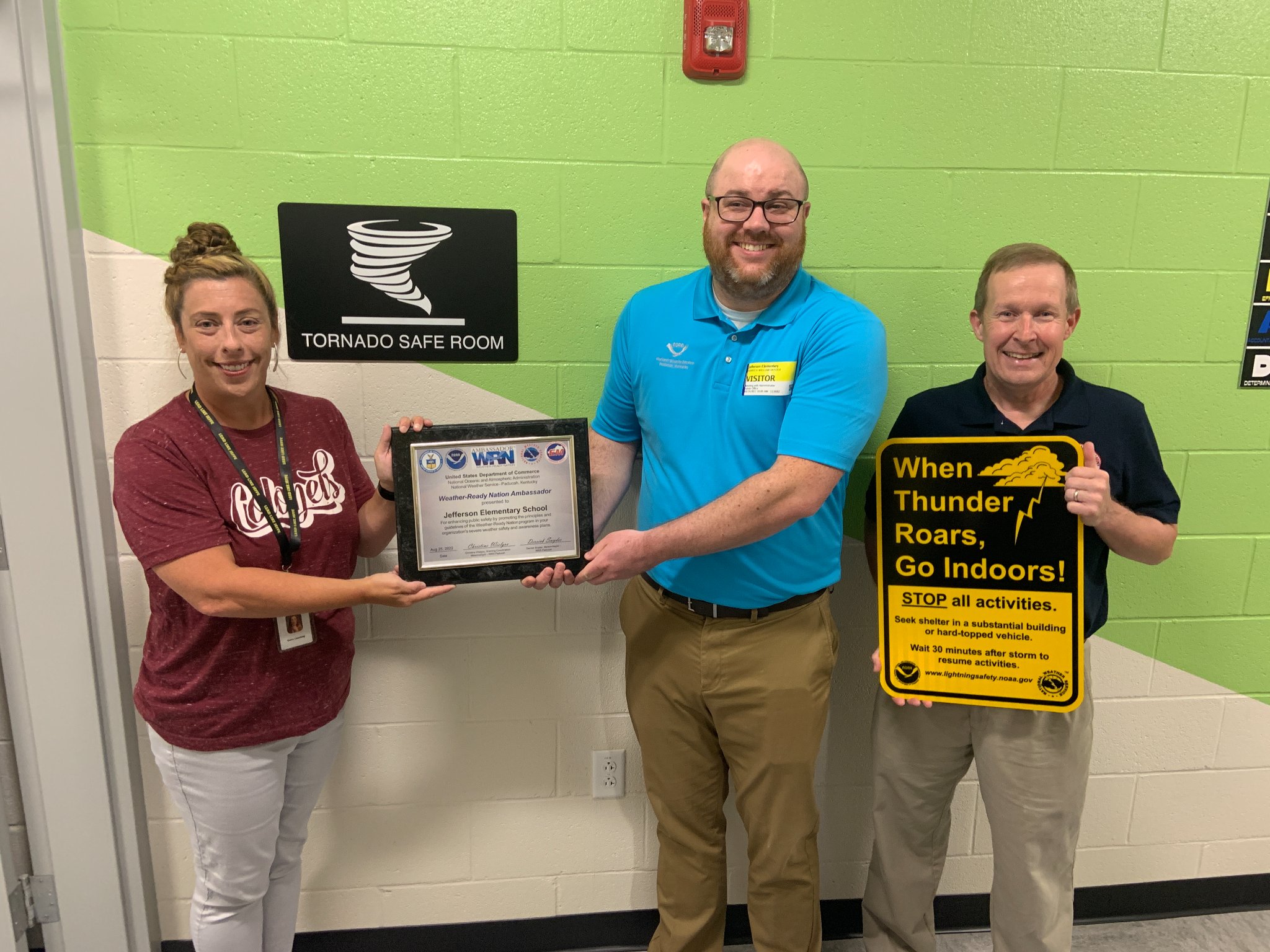
Jefferson Elementary School |
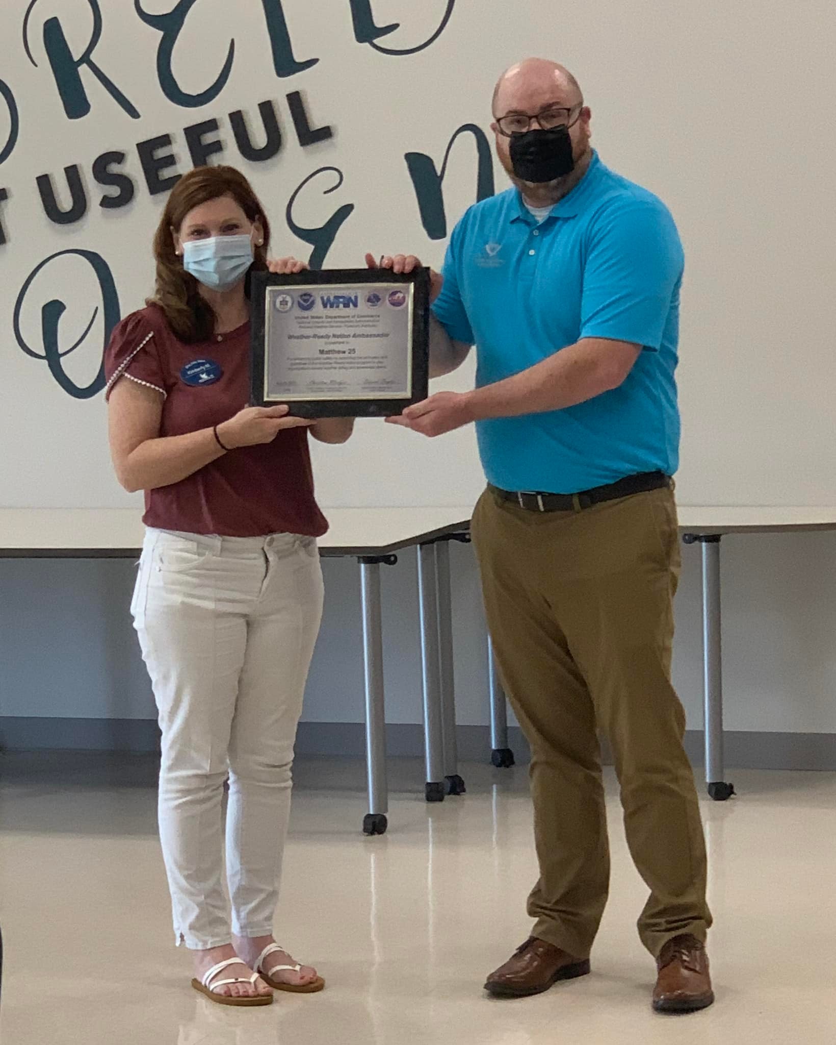
Matthew 25 |
Henderson Nursing and Rehabilitation Center |
Redbanks Nursing Home |
Dana Incorporated |
Henderson First United Methodist Church |
Brenntag Mid-South |
Holy Name of Jesus Catholic Church |
Deaconess Henderson Children’s Enrichment Center |
Deaconess Women's Hospital |
 |
 |
 |
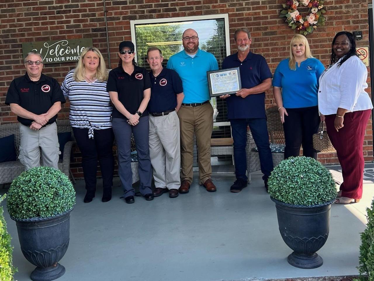 |
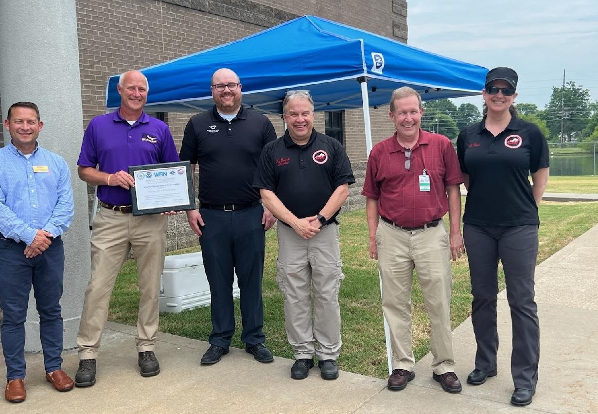
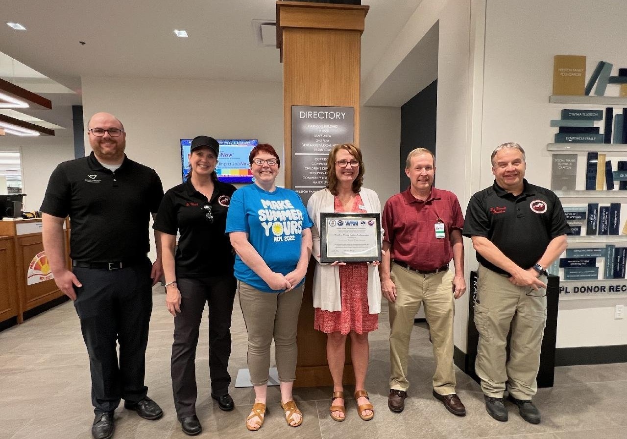
| Weather-Ready Community ceremony at AMG Aluminum North America on July 8, 2022, in Robards, KY. | Weather-Ready Community ceremony at Pittsburg Tank and Tower Group on July 8, 2022, in Henderson, KY. | Weather-Ready Community ceremony at the Henderson County Public Library on July 8, 2022, in Henderson, KY. | Weather-Ready Community ceremony at Henderson Nursing and Rehabilitation Center on August 19, 2022, in Henderson, KY. |
 |
 |
 |
 |
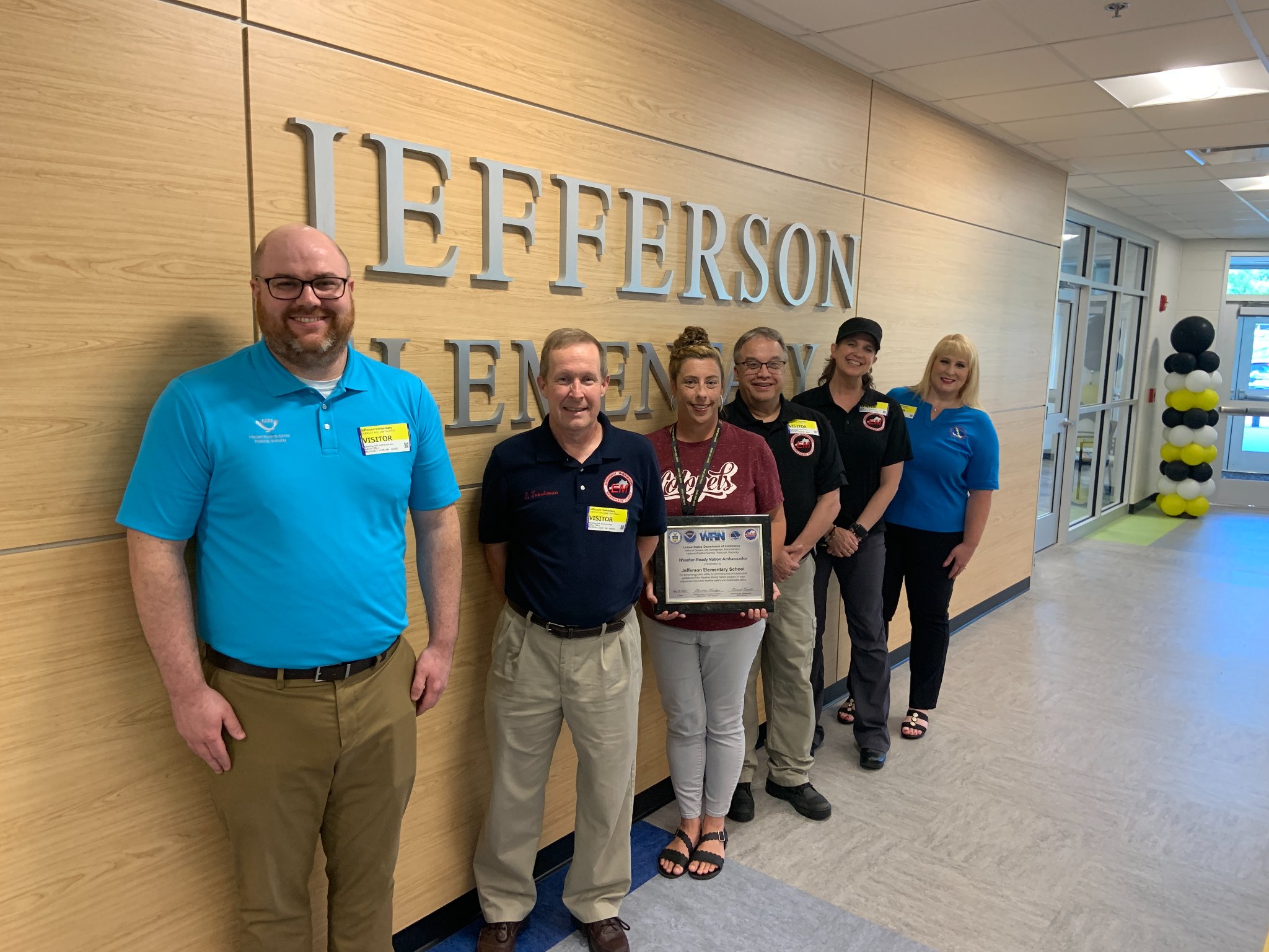
| Weather-Ready Community ceremony at Jefferson Elementary School on August 19, 2022, in Henderson, KY. | Weather-Ready Community ceremony at Jefferson Elementary School on August 19, 2022, in Henderson, KY. | Weather-Ready Community ceremony at Henderson First United Methodist Church on August 19, 2022, in Henderson, KY. | Weather-Ready Community ceremony at Redbanks Nursing Home on August 19, 2022, in Henderson, KY. |
 |
 |
 |
 |
| Weather-Ready Community ceremony at Matthew 25 on August 19, 2022, in Henderson, KY. | Weather-Ready Community ceremony at Matthew 25 on August 19, 2022, in Henderson, KY. | Weather-Ready Community presentation at Dana Incorporation on August 19, 2022, in Henderson, KY. | Weather-Ready Community Logo |
Contact
nws paducah:
nws Headquarters:
Henderson county office of emergency management:
 |
Media use of NWS Web News Stories is encouraged! Please acknowledge the NWS as the source of any news information accessed from this site. |
|

