On this page, you will learn what types of flooding are typical in Idaho and how to protect yourself, your family and your home. You can also find out more about significant Idaho floods. Finally, you'll find links to NWS offices that provide forecast and safety information for Idaho as well as links to our partners who play a significant role in keeping you safe.
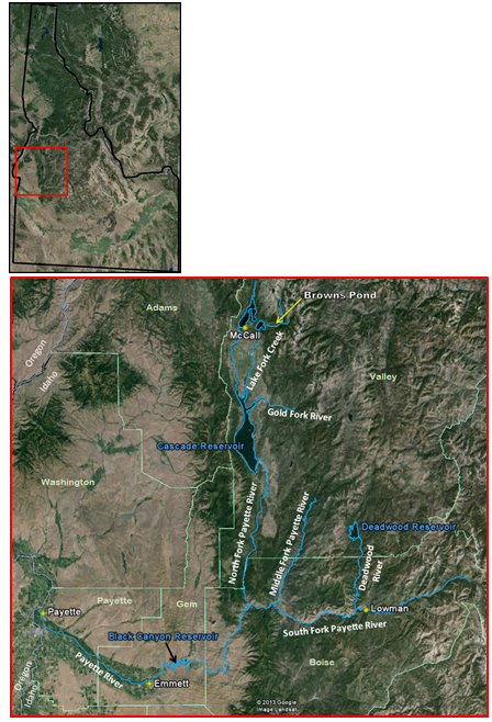
Widespread flooding occurred along creeks and small tributary rivers in the Payette Basin as well as along the main stem of the Payette River. Flooding also occurred in other areas of central Idaho, including Adams, Idaho, Lewis, and Washington counties. In Valley County, significant flooding occurred on Lake Fork Creek and Gold Fork River. Numerous roads were washed out and several bridges were destroyed. On Lake Fork Creek, an earthen dam associated with Browns Pond collapsed. Several people and animals were rescued during the peak of the flood. People were evacuated from the Gold Fork Hot Springs area along the Gold Fork River.
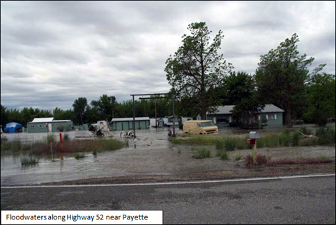
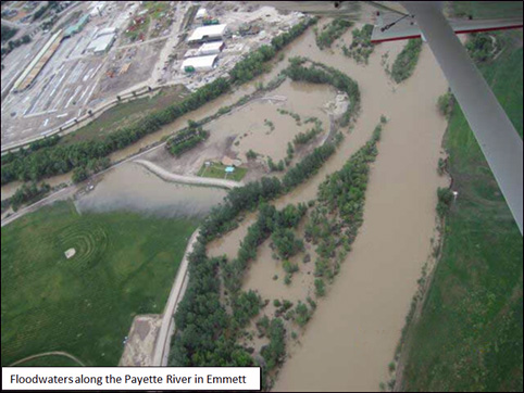
Main stem river flooding occurred on the South Fork of the Payette River in Boise County and caused minor flooding in Lowman. Flooding along the Payette River was magnified downstream in Gem County and Payette County. Near Emmett, water flooded a portion of State Highway 52 and a county bridge was washed out. Floodwaters impacted railroad tracks, numerous county roads, and caused extensive agricultural flooding. In Payette County, 42 homes and 6 businesses were impacted by floodwaters.
 |
| No fatalities occurred. Damage to homes, businesses and roads was estimated at 2.4 million dollars in Payette County. Estimated damage to roads in Valley County was at least 1.3 million dollars. Total public assistance cost estimate for all counties was over 5.3 million dollars (Idaho Severe Storms and Flooding, FEMA-1927-DR). |
 |
 |
Learn More:
Impacted: Northern Idaho and North-Central Idaho
Presidential Disaster Declaration for Boundary, Bonner, Kootenai, Shoshone, Benewah, Latah, Nez Perce, Lewis, Clearwater, and Idaho Counties as well as the Nez Perce Tribe.
Record crests observed on Palouse, Orofino and Lapwai Creeks. The Coeur d'Alene and St Joe Rivers experienced their 2nd highest crests on record during this event.
No fatalities.
At least $30,000,000 of damage to infrastructure and homes.
Significant events/stories
A near-record river crest combined with ice breached several different levee sections in the community of St Maries, ID, resulting in the inundation of over 100 homes, some up to their rooftops. As rivers and creeks began to flood and erode highways and county roads, ingress/egress to several regions was cut off and many communities had to be evacuated. Helicopters airlifted several residents to safety in the Coeur d'Alene River basin and other rescues were undertaken in boats and atvs. As the Coeur d'Alene River was rising, residents of Cataldo continued to build an emergency sandbag dike, even after the National Guard was pulled out for safety reasons. The river eventually broke through the sandbag dike, flooding Cataldo and forcing the evacuation of its residents. The outlet dam on Winchester Lake was overtopped and the dam nearly failed. Downstream of the dam, record flows on Lapwai Creek overtopped the Culdesac levee and forced the evacuation of a portion of the town. In total, several hundred homes and dozens of businesses experienced severe flood damage. Several homes were completely destroyed. A summary of the event can be found at theIdaho State Mitigation Plan (Section 3.3 - Flood)
|
|
 |
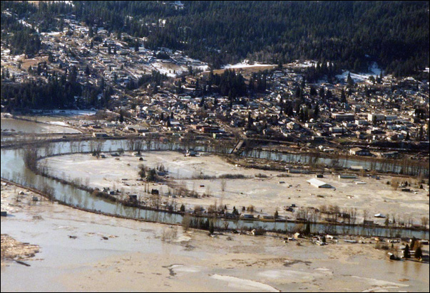
| Flood aerial view, June 18, 1997 |
|
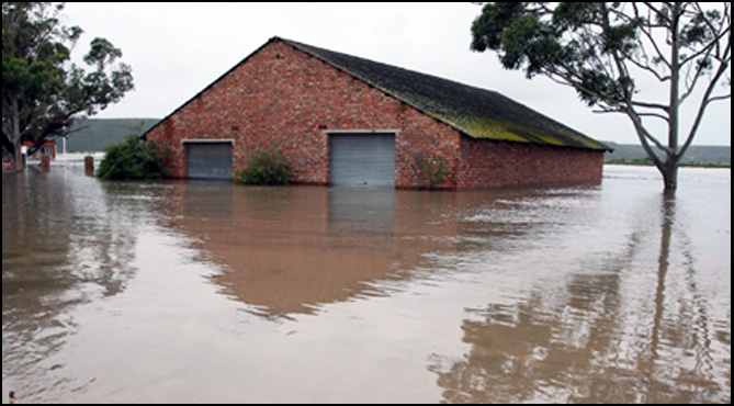
| Flooded building |
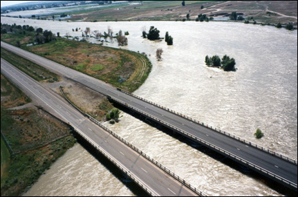 |
| Interstate 15 crossing Snake River near the city of Blackfoot, Idaho |
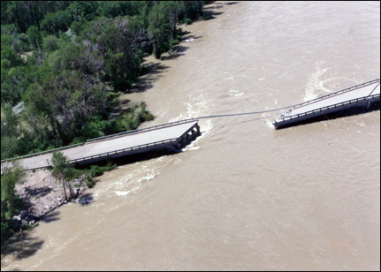 |
| South Twin bridge collapse (between Archer and Ririe, Idaho) |
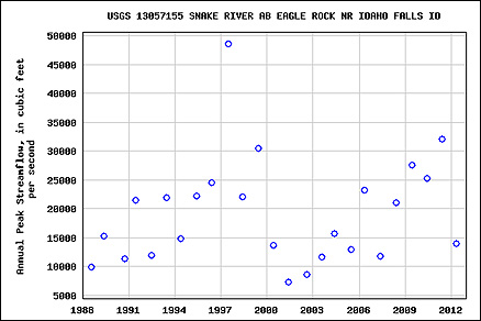 |
| Point graphical representation of yearly highest peaks in observed history |
Learn More:
 |
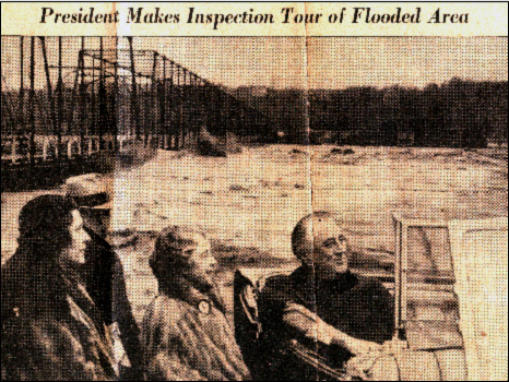
| This flood marker, inside the National Aquarium at Baltimore's Inner Harbor, is a reminder of the extreme flooding Isabel brought to the region |
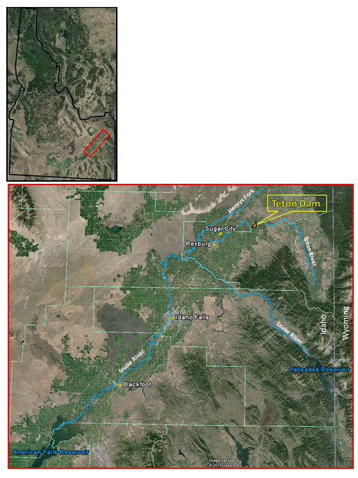
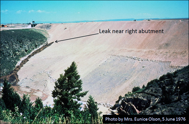
The reservoir behind the newly constructed dam was filled for the first time ig the spring of 1976. On Thursday, June 3, water began seeping from the canyon wall about 750 feet downstream from the dam. By early Saturday, June 5, a new leak had appeared near the right abutment. Late Saturday morning, a whirlpool developed in the reservoir above the dam and the hole on the downstream side had grown to more than 25 feet in diameter. The dam collapsed at 11:57 am, unleashing a torrent of water down the Teton River Valley. The reservoir drained in less than 6 hours with a maximum discharge from the dam estimated at 2.3 million cubic-feet per second.
The flood wave tore through downstream communities including Sugar City and Rexburg, and then traveled down the Snake River Valley causing major flooding in communities along the Snake River. The flood wave crest reached the city of Blackfoot during the early morning hours on Monday, June 7. Officials were concerned that American Falls Reservoir would not be able to hold the floodwaters, but in the end the American Falls Dam held.
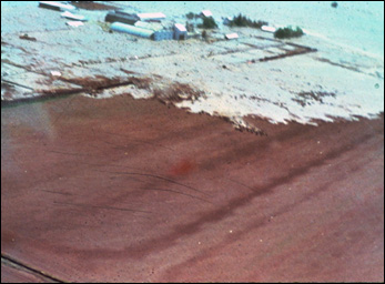
Sugar City and surrounding areas were hardest hit by the Teton Dam collapse. Floodwaters made numerous roads impassable, homes were swept off foundations, vehicles, farm equipment, machinery, and livestock were washed away. Hundreds of farms, homes, and businesses were damaged or destroyed. In Idaho Falls, water was up to 4 feet deep in the western part of the city. Evacuations ahead of the floodwaters forced thousands of people into shelters and emergency housing.
The flood caused 11 deaths and near $2 billion in damage.
 |
 |
 |
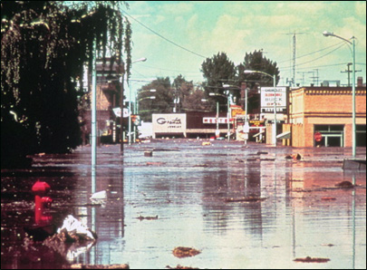
| Advancing floodwaters (unknown photographer) | Floodwaters in downtown Rexburg (unknown photographer) |
 |
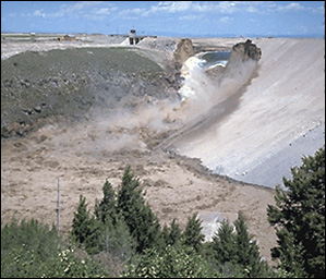
| Teton Dam collapse (Photos: Bureau of Reclamation) |
Learn More:
|
||||||