On this page you learn what types of flooding are typical in South Carolina and how do you protect yourself, your family and your home. You will also find out more about significant South Carolina floods. Finally, you'll find links to NWS offices that provide forecast and safety information for South Carolina, as well as links to our partners who play a significant role in keeping you safe
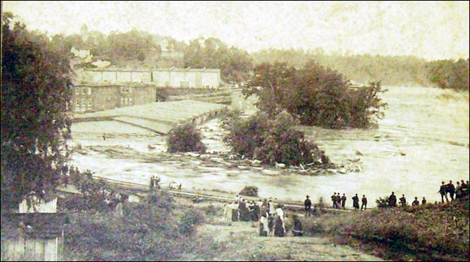
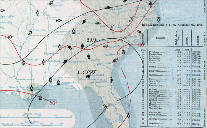
Intense rains occurred across the Palmetto State from August 26–30, 1908. An area of low pressure developed in the Gulf of America on August 20 and strengthened as it moved northeast and off the North Carolina coast by the morning of the 27th. The heavy rainfall, which lasted over 48 hours, caused the most extensive flood event on record, when all major rivers in the state rose from 9 to 22 feet above flood stage. Anderson, SC, received 12 inches of rainfall in 24 hours. Most of the rain fell in less than 16 hours. The intensity of the rainfall resulted in several floods having recurrence intervals of greater than 50 years. Over 80 percent of the state was affected by flooding. In a paper written by Linda Horton about the event in 2008, she chronicles some of the highlights of the destruction and loss of life:
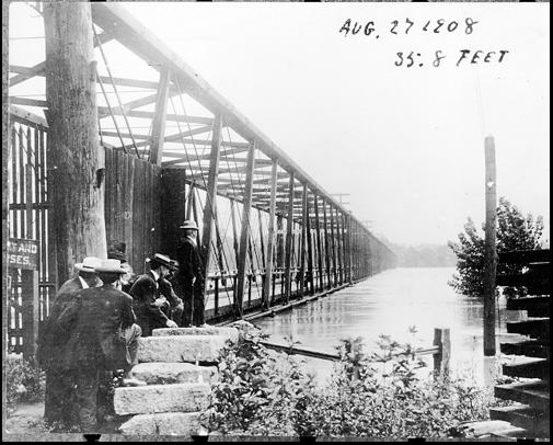
Below are images of some of the flooding along the Congaree River at Columbia, SC. The river crested at 39.8 feet on August 27, 1908. The flood stage at Columbia was 19.0 feet.
 |
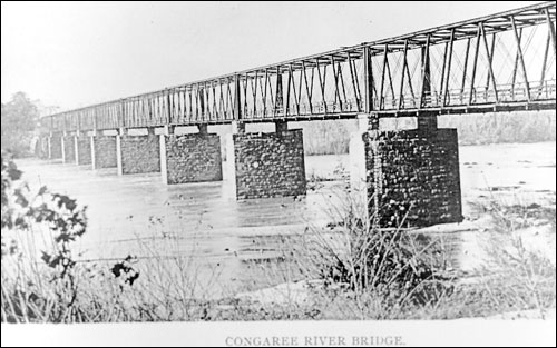 |
| Photo courtesy of Richland County Library Archives | Photo Courtesy of Richland County Library Archives |
 |
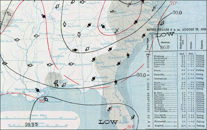 |
| 8 AM Surface Weather Map on August 26th | 8 AM Surface Weather Map on August 27th |
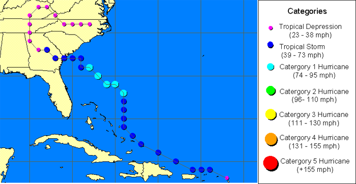
The Southeast Hurricane of 1940 came ashore near Beaufort, SC, on August 11, 1940 with winds of 105 mph. Flooding occurred across the state from the 11th through the 19th.
The storm moved inland in a northwesterly direction. Rainfall totals of 7 to 12 inches were recorded in the southern and northwestern sections of the state. The largest 24 hour rainfall total was 10.84 inches recorded near Beaufort. The greatest rainfall amount for the event was 22.49 inches in the town of Long Creek. The number of those killed is still in dispute, but between 30 and 50 people lost their lives due to the storm surge and fresh water flooding.
Early press reports said that 35 were dead. According to the Monthly Weather Review, the deaths were low because of hurricane warnings and evacuations; however, modern sources indicate that 40 people died during this storm. Property and crop damage was estimated to be $10 million ($160 million in 2013). The flooding from this hurricane was the greatest on record at the time for the North Pacolet River at Fingerville. The recurrence intervals at this site and on the Broad River near Carlisle were greater than 100 years.
 |
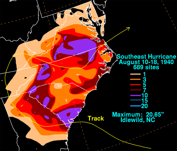 |
| Track of Southeast Hurricane of 1940, Image courtesy of SC State Climate Office | Total rainfall map of the event across the area. |
The flooding that occurred from September 17-23, 1945 was produced by heavy rainfall associated with the ninth tropical storm of the season, which was also the most intense. The hurricane originally made landfall near Homestead, FL, but moved north through Florida then off the coast near Jacksonville. The tropical storm then came ashore near Hilton Head Island and moved northward through eastern South Carolina. All of the rivers in the state, except the Saluda River, exceeded flood stage during the second half of the month. The Great Pee Dee River at Cheraw reached 49.4 feet, the highest reading ever recorded up to that time. Flood stage at Cheraw is 30 feet. The Lynches River at Effingham recorded its largest flood on record. The river crested at 21.2 feet on the September 22, 1945. Flood stage at Effingham is 14.0 feet. There was 1 death attributed to the flooding with a loss of property and crops at nearly $7 million. In today's dollars that would approximately total $88 million.
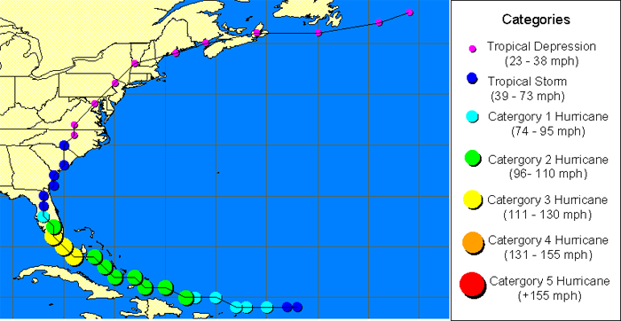 |
| Track of the Homestead Hurricane of 1945 |
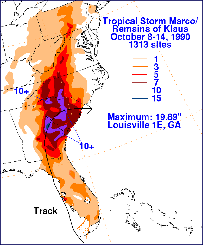
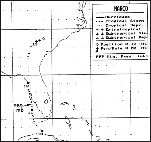
The flooding that occurred during October 10-13 and October 22, 1990, was the result of the remnants of Hurricane Klaus, Tropical Storm Marco and their northward movement and interaction along a stalled frontal boundary.
The event produced major flooding across the state, especially central South Carolina. There were 5 deaths blamed on the flooding. The flooding caused 4 deaths in Kershaw County, when a dam burst, sending water across a road trapping the people in their vehicle. Another death occurred in Spartanburg County when a toddler drowned in a rain-swollen creek. In the Pee Dee and Santee River Basins, the floods washed out or caused the closing of more than 120 bridges on secondary road systems. There were 17 earthen dams that failed and 81 that were damaged from overtopping. The government declared 13 counties Federal Disaster Areas. The total damage of property and crops was around $12 million ($22 million in 2013 dollars).
Rainfall totals were excessive, including one unofficial report of nearly 17 inches in the town of Rembert. These rainfall totals were some of the highest recorded in 100 years. Here are some official rainfall totals during the 4 day event:
Pageland, 13.96 inches
Clarks Hill, 10.80 inches
Kershaw, 9.85 inches
Orangeburg, 9.99 inches
Camden, 9.62 inches
Spartanburg, 8.40 inches
McCormick, 8.25 inches
Aiken, 8.00 inches
Edgefield, 6.57 inches
Greenwood, 4.85 inches
Catawba, 4.36 inches
Several rivers and streams in the Pee Dee and Santee River Basins recorded discharge recurrence intervals of greater than 100 years including the Black Creek at McBee, Black Creek near Hartsville, Fork Creek near Jefferson, Scape Ore Swamp near Bishopville, and Antley Spring Branch at Southern Railroad near St. Matthews.
 |
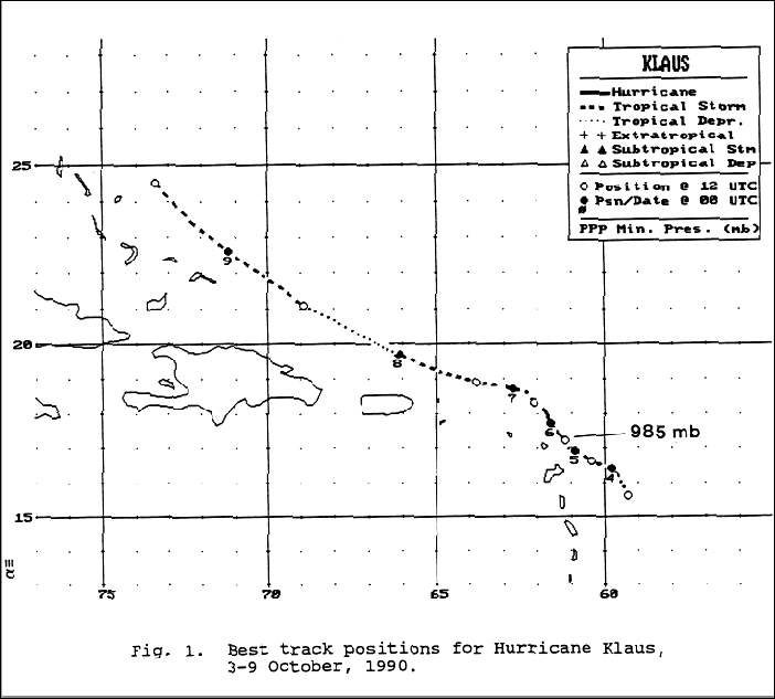 |
| Rainfall Total Map for Tropical Storm Marco & the remnants of Klaus from October 8th-14th, 1990 | Track of Hurricane Klaus |
 |
 |
| Track of Tropical Storm Marco | Property Damage Map across South Carolina |
Learn More:
|
||||||