Overview
|
Multiple rounds of severe thunderstorms brought damaging straight-line winds, large hail, tornadoes, and flooding to the Missouri Ozarks and southeastern Kansas from May 27th into the early morning hours of May 28th. Over 130 reports of severe weather and flooding were received from the Missouri Ozarks and southeastern Kansas alone. This severe weather outbreak stretched from Kansas and Oklahoma, east into the southern Appalachians with well over 700 reports of severe weather. Some of the main highlights across the Missouri Ozarks included:
This severe weather outbreak was the result of extreme amounts of instability in the atmosphere combined with strong wind shear. This type of volatile atmosphere resulted in multiple thunderstorm line segments which produced straight-line winds over 70 mph at times, along with embedded tornadoes. Supercell thunderstorms also developed and were responsible for the very large hail.
|
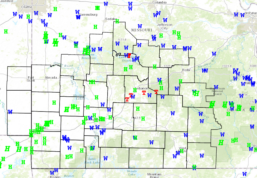 Summary of Tornado (Red), Wind (Blue), and Hail (Green) Reports from the Storm Prediction Center for 27 May 2017 |
Tornadoes and Wind Damage Surveys:
|
|
||||||||||
|
||||||||||
|
Tornado -
Track Map 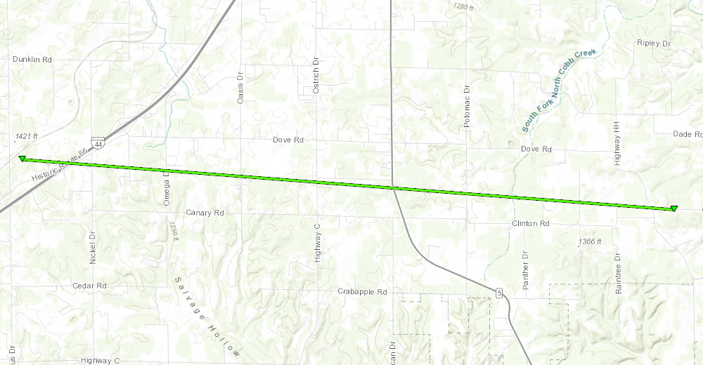 
Downloadable KMZ File |
||||||||||||||||
|
Tornado -
Track Map 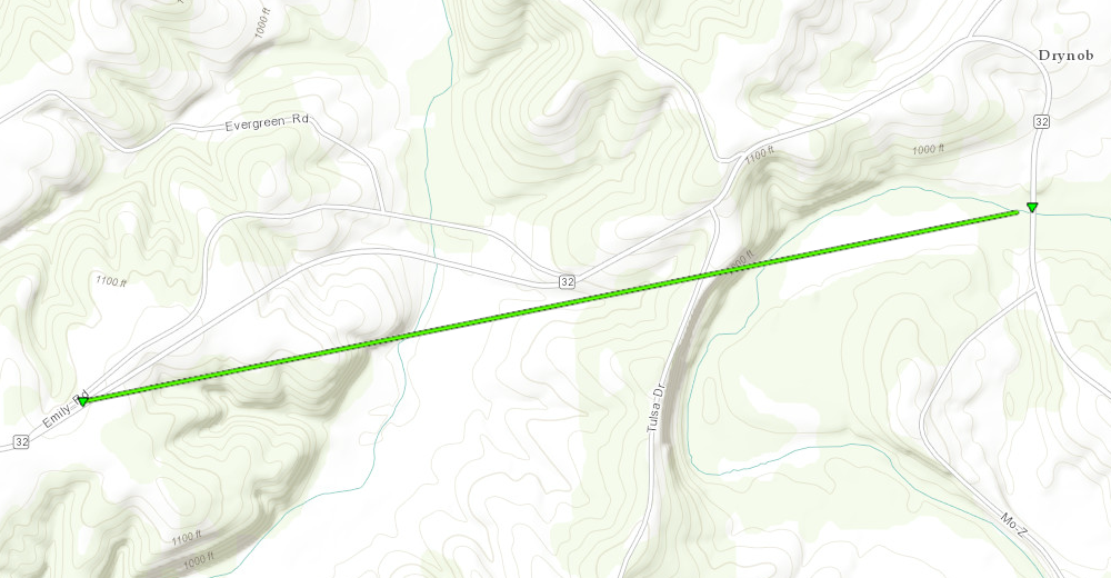
Downloadable KMZ File |
||||||||||||||||
|
Tornado -
Track Map 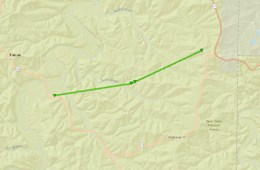
Downloadable KMZ File |
||||||||||||||||
|
Tornado -
Track Map 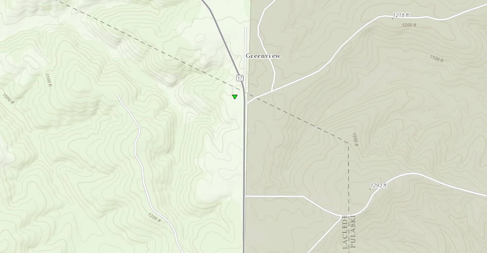
Downloadable KMZ File |
||||||||||||||||
|
Tornado -
Track Map 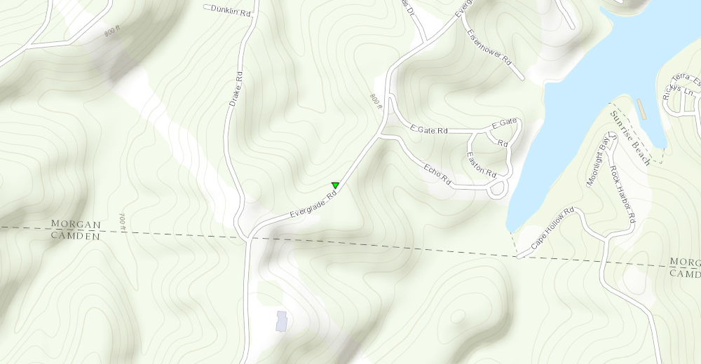
Downloadable KMZ File |
||||||||||||||||
|
Tornado -
Track Map 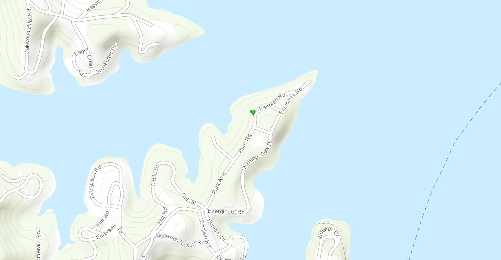
Downloadable KMZ File |
||||||||||||||||
|
Significant Wind Damage -
Track Map 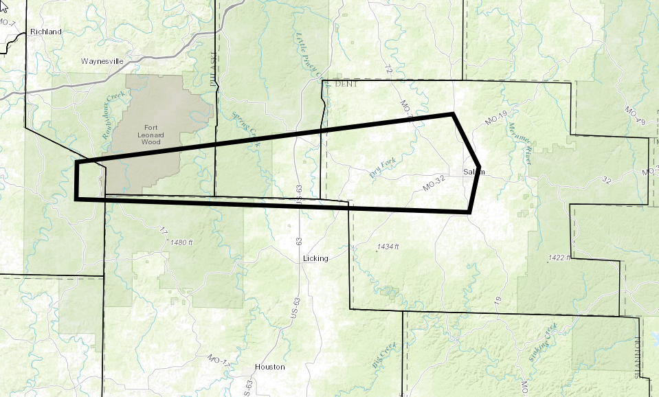
Downloadable KMZ File |
||||||||||||||||
The Enhanced Fujita (EF) Scale classifies tornadoes into the following categories:
| EF0 Weak 65-85 mph |
EF1 Moderate 86-110 mph |
EF2 Significant 111-135 mph |
EF3 Severe 136-165 mph |
EF4 Extreme 166-200 mph |
EF5 Catastrophic 200+ mph |
 |
|||||
Flooding
|
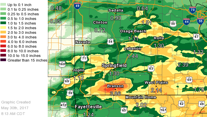
Copious amounts of moisture in the atmosphere in combination with multiple rounds of thunderstorms resulted in heavy rainfall across parts of the Missouri Ozarks. General rainfall amounts ranged from 1-3" over many areas. However, there were localized areas that received much higher amounts. The heaviest rainfall occurred in the Branson area where 3-6" of rain fell in about a 2-3 hour stretch. This resulted in significant flash flooding of local creeks including Fall, Cooper, and Roark Creeks. Multiple businesses and the Branson Campground were flooded as these creeks rose out of their banks. Multiple water rescues were also conducted near these creeks as water rose at a rapid pace. Fall Creek rose from 1-2 feet to 10-15 feet in just 15 minutes. Unfortunately, there were two fatalities due to a vehicle getting stuck in flood waters along Fall Creek Road. |
Radar:
Radar Loop from 9 AM March 27th to 3 AM March 28th

Radar Image at 2:57 PM (Phillipsburg, MO Tornado)

 |
Media use of NWS Web News Stories is encouraged! Please acknowledge the NWS as the source of any news information accessed from this site. |
|


 Weather Story
 Weather Map
 Local Radar