 |
Severe Storms and Flooding - January 12th, 2005
National Weather Service, Springfield, MO
|
 |
Event Summary
For the second time during the first 15 days in January, a strong storm system pushed across the Missouri Ozarks and southeast Kansas. This second storm system like its predecessor had been organizing along the west coast of the United States for several days, and allowing warm air and plenty of moisture to work into the central portion of the United States. A front boundary remained stationary over the forecast area for several days before the main front and upper level storm system moved in on January 12th.
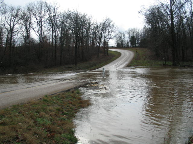
With the ground already saturated from the previous weeks heavy rain and flooding, any significant rainfall with this event would likely lead to additional river and runoff flooding. Numerous flood potential outlooks and Hazardous Weather Outlooks were issued for several days in advance of this storm system to prepare for the possibility of flooding with this system. A flood watch was issued during the afternoon of January 11th on the possibility of flooding on the 12th.
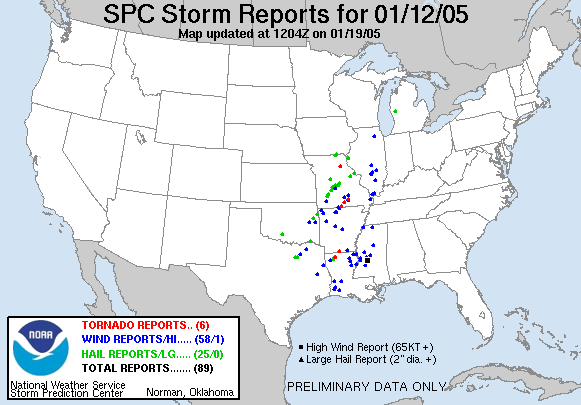
In addition to the potential of heavy rain and flooding, there was a severe weather threat as strong wind shear was occurring out ahead of this storm system. The main threats highlighted in the hazardous weather outlooks were with straight line wind damage...large hail...and isolated tornadoes.
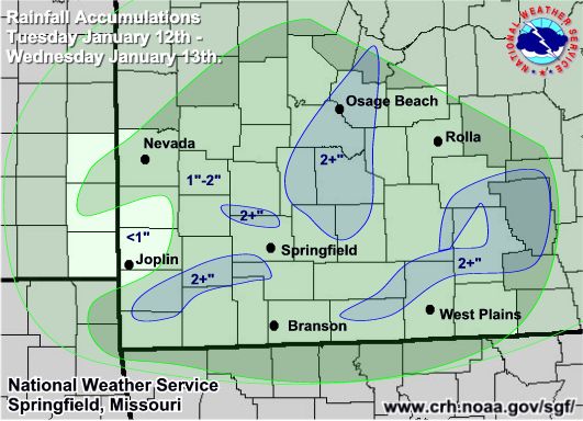
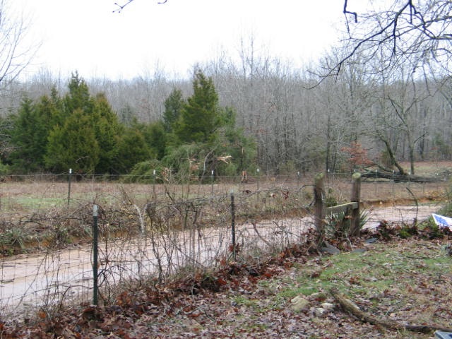
Several inches of rainfall occurred throughout the area on afternoon and evening of the 12th, which quickly led to river flooding and runoff flooding. A link to the map of precipitaton totals is listed below.
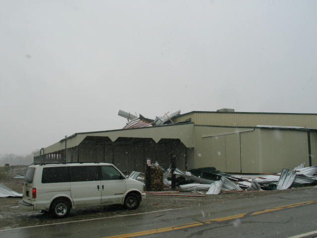
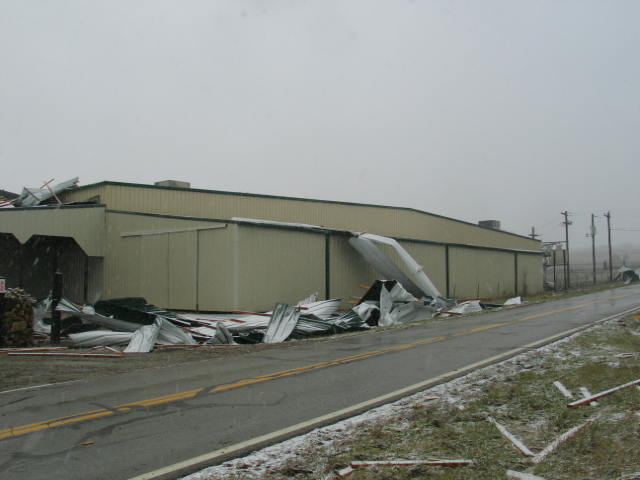
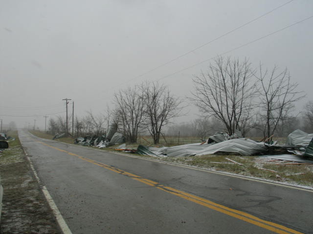
Several lines of convective storms developed out ahead of the cold front by mid afternoon on the 12th and a few of these lines developed bow segments which produced wind damage. Several storms also produce severe hail, one of which tracked from Greene county all the way into eastern Missouri.
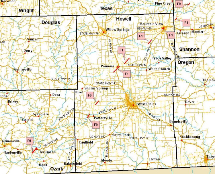
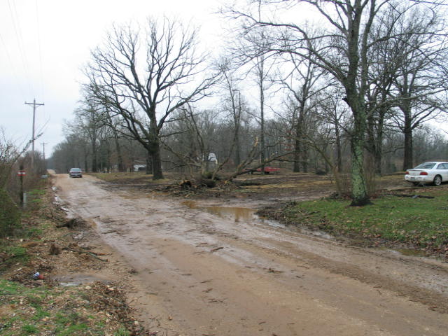
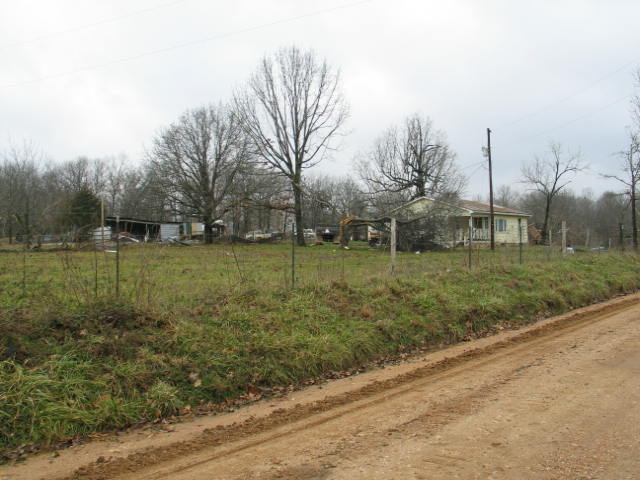
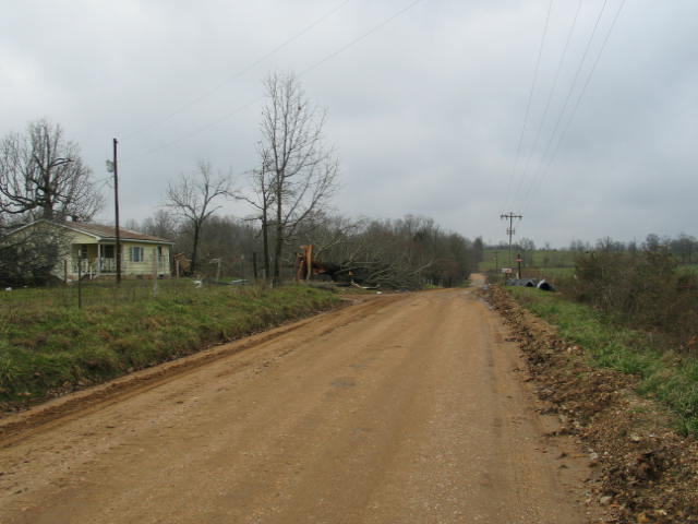
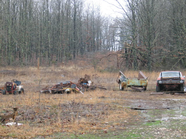
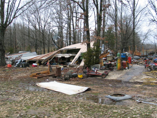
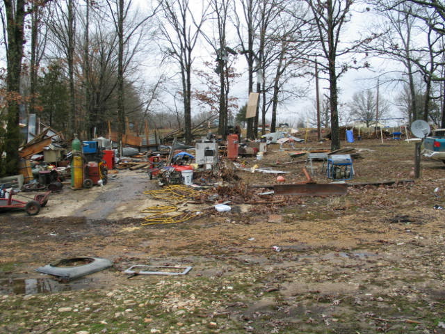
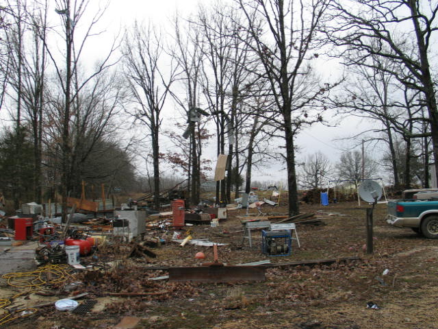
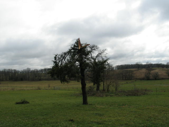
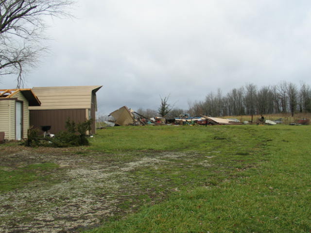
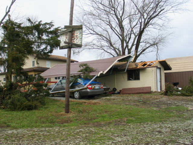
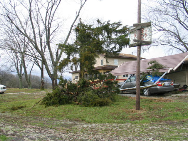
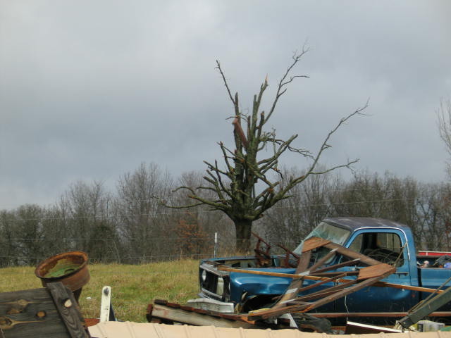
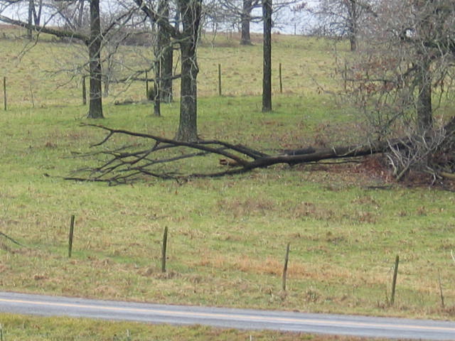
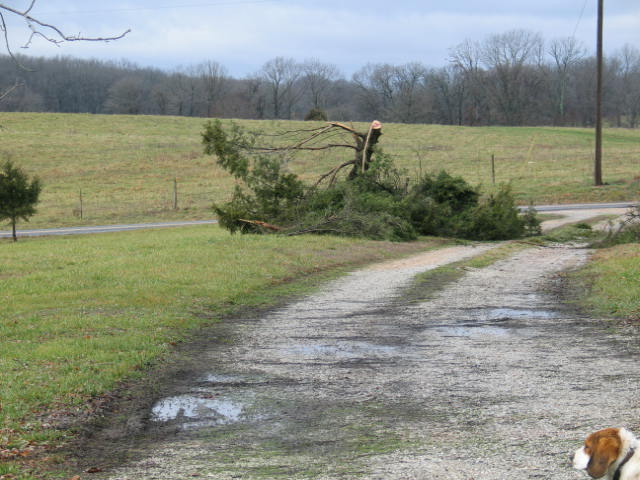
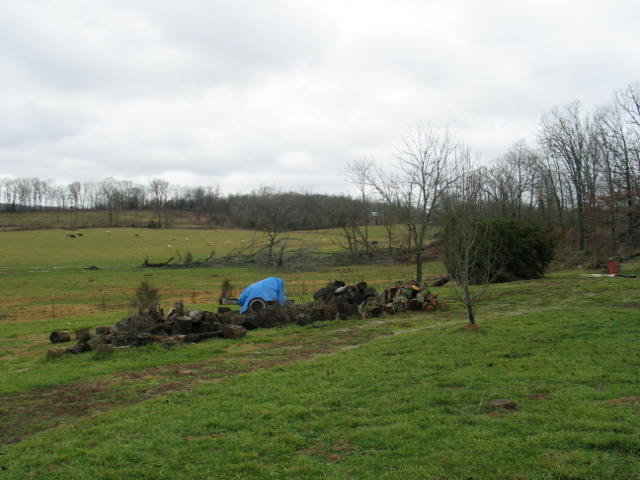
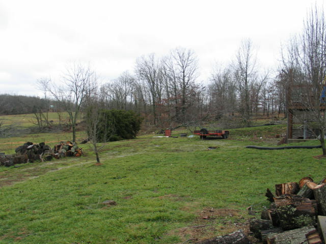
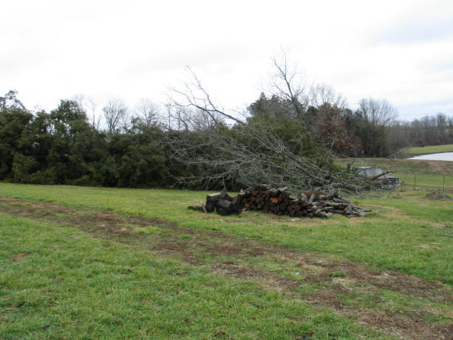
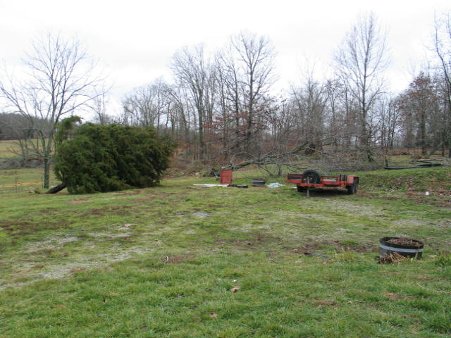
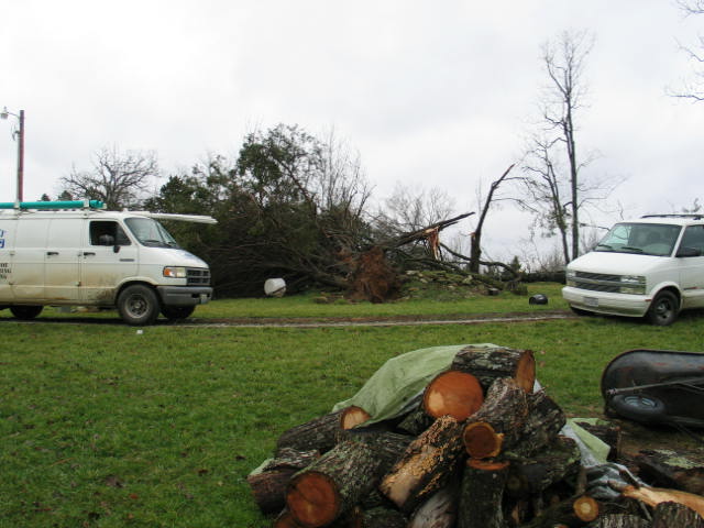
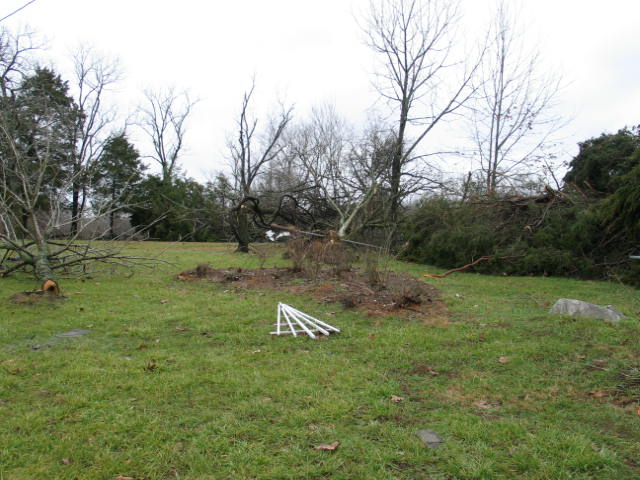
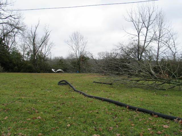
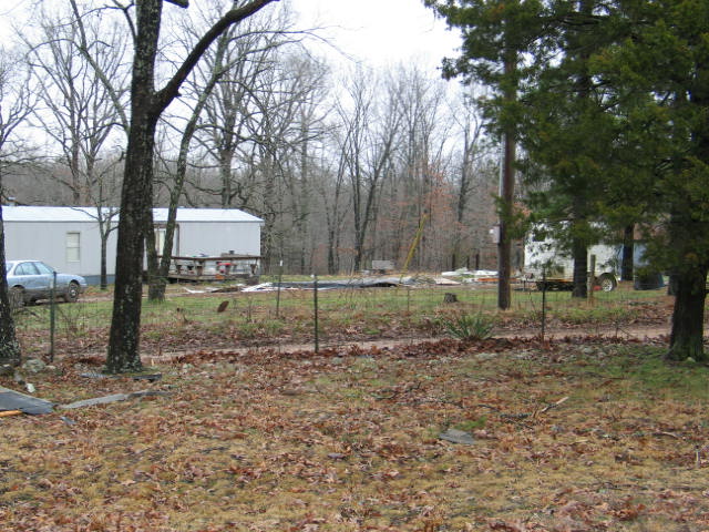
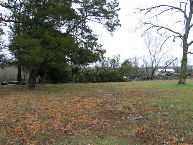
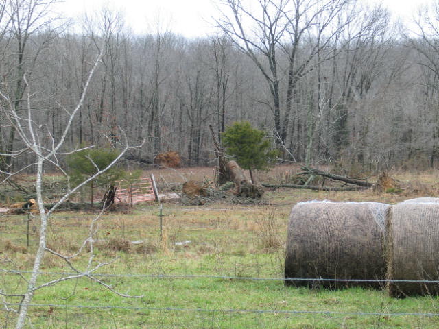
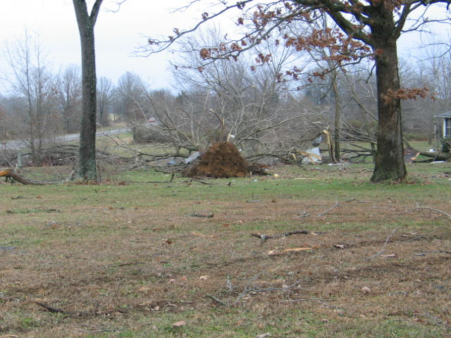
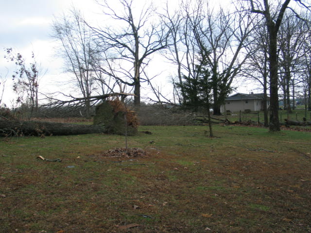
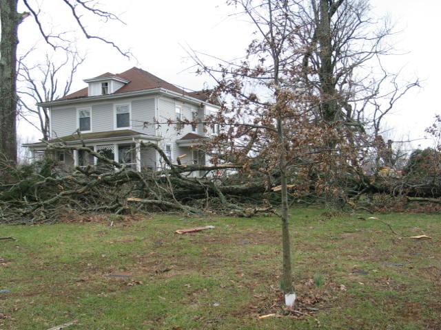
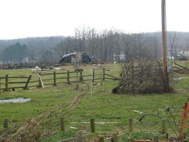
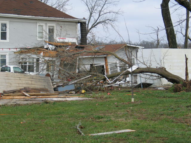
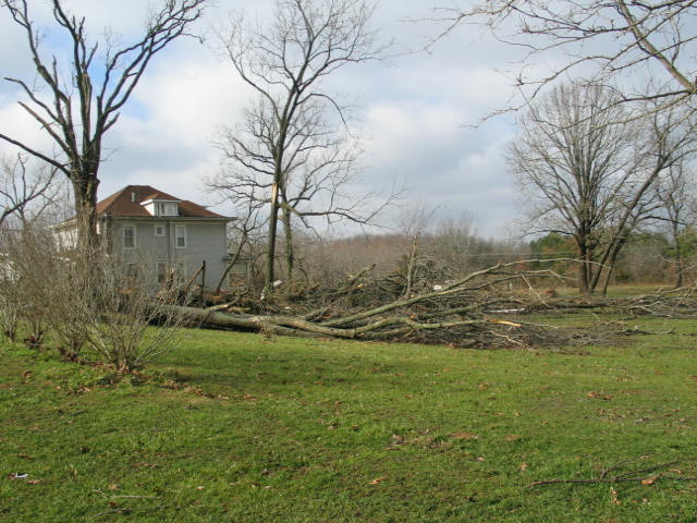
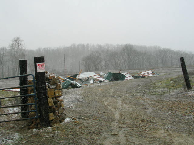
The most damaging storms developed ahead of the front later in the evening over north central Arkansas and moved into south central Missouri. These storms featured a bowing segment with a persistent broad mesocyclone producing wind damage, and eventually an F1 tornado which tracked across portions of Ozarks, Howell and Shannon Counties. The tornadoes and straight line winds did damage to trees and power lines, along with structural damage homes and mobil homes.
Rainfall Amounts Through January 12th
Springfield
6.41
Tied 5th alltime wettest January
9.31 in. is the record set in 1916
Joplin
4.73
3rd wettest January
6.95 in. is the record set in 1949
West Plains
4.07
not in top 10 yet
11.37 is the record set in 1949
Rolla / Vichy
6.61
New record
breaks old record of 5.57 set back in 1950
As the colder air started filtering in behind the cold front, rain changed to freezing rain and then a mixture of freezing rain, sleet and snow on the morning of the 13th. Most areas in the Missouri Ozarks and southeast Kansas received an inch or less of snowfall. Heavier snow fell to the northeast of the area near St. Louis, where up to 5 inches fell.
Event Maps
Event Storm Reports


 Weather Story
 Weather Map
 Local Radar