|
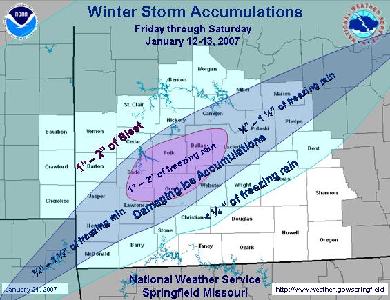
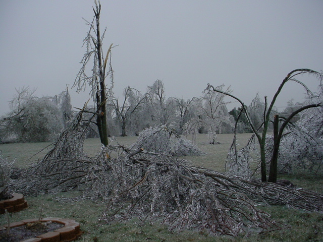
The Historic January 12-14 Ice Storm left over 200,000 southwest Missourians without power and a landscape resembling a war zone. While the region was still coping with the damage from the November 30-December 1, 2006 ice storm, the January 12-14 Ice Storm have not been experienced since the December 1987 Ice Storm, in terms of power outages.
|
 |
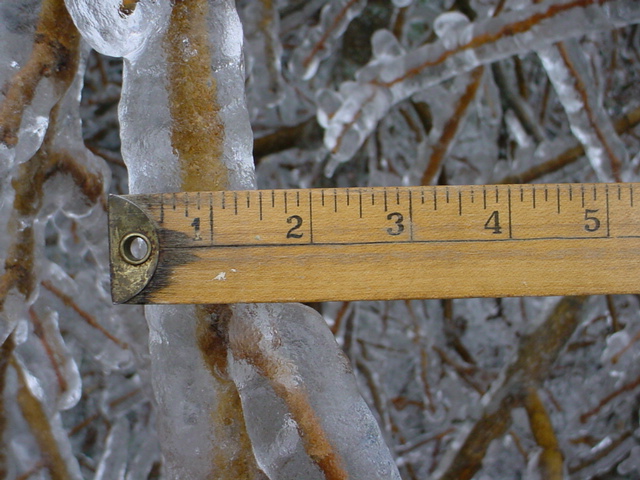
The ice accumulations resulted in widepread downed trees and powerlines. Approximately 200,000 residences were without power and power will not be restored for days if not weeks for many. In addition, several structres collapsed due to the weight of ice and snow across southeast Kansas.
Much colder temperatures followed the ice storm with lows falling into the single digits Monday and Tuesday nights.

 |
 |
| County | Accumulations | Remarks |
| Bourbon | 1/4 to 1/2" Ice | Several trees down and scattered power outages |
| Crawford | 1/4 to 1/2" Ice | Scattered trees down and power outages |
| Cherokee |
1/4 to 1/2" Ice 1 to 3" Snow |
Numerous downed trees and power outages |
| Vernon |
1/4 to 1/2" Ice ~ 1" of Sleet & Snow |
Several trees down and scattered power outages |
| Barton |
1/2 to 1/2" Ice 3 to 5" Sleet & Snow |
Numerous downed trees and scattered power outages |
| Jasper |
1/4 to 1/2" Ice 3 to 5" Sleet & Snow |
Numerous downed trees and power outages |
| Newton |
1" Ice 1 to 3" Sleet & Snow |
Numerous downed trees and power outages |
| McDonald | 1/4 to 1/2" Ice | Numerous downed trees and power outages |
| St. Clair |
1/4" Ice 2 to 5" Sleet & Snow |
Scattered downed trees and power outages |
| Cedar |
1/4 to 1/2" Ice 2 to 5" Sleet & Snow |
Numerous trees down and power outages |
| Dade |
1 to 1.5" Ice 1 to 4" Sleet & Snow |
Numerous downed trees and power outages |
| Lawrence |
1 to 1.5" Ice 1 to 2" Sleet & Snow |
Widespread downed trees and power outages |
| Barry | 1/2 to 1" Ice | Widespread downed trees and power outages |
| Benton | 1/2 to 1" Ice | Scattered downed trees and power outages |
| Hickory | 1/2 to 1" Ice | Numerous downed trees and power outages |
| Polk | 1 to 1.5" Ice | Widespread downed trees and power outages |
| Greene | 1 to 1.5 Ice | Widespread downed trees and power outages |
| Christian | 1/2 to 1" Ice | Numerous downed trees and power outages |
| Taney | 1/4" Ice | |
| Morgan |
1/4 to 1/2" Ice
|
Scattered trees down and power outages |
|
Camden |
1/2 to 1" Ice | Numerous downed trees and power outages |
| Dallas | 1 to 2" Ice | Widespead downed trees and power outages |
| Laclede | 1/2 to 1" Ice | Numerous downed trees and power outages |
| Webster | 1/2 to 1.5" Ice | Widespread downed trees and power outages |
| Wright | 1/4 to 1" Ice | Numerous downed trees and power outages |
| Douglas | 1/8 to 1/2" Ice | |
| Ozark | Minor Flooding | |
| Miller | 1/2 to 1" Ice | Numerous downed trees and power outages |
| Maries | 1/4 to 1" Ice | Numerous downed trees and power outages |
| Pulaski | 1/2 to 1.5" Ice | Widespread downed trees and power lines |
| Phelps | 1/4 to 1" Ice | |
| Dent | 1/4" Ice | |
| Texas | 1/4 to 3/4" Ice | |
| Shannon | Up to 1/4" Ice | Flooding |
| Howell | Flooding | |
| Oregon | Flooding |

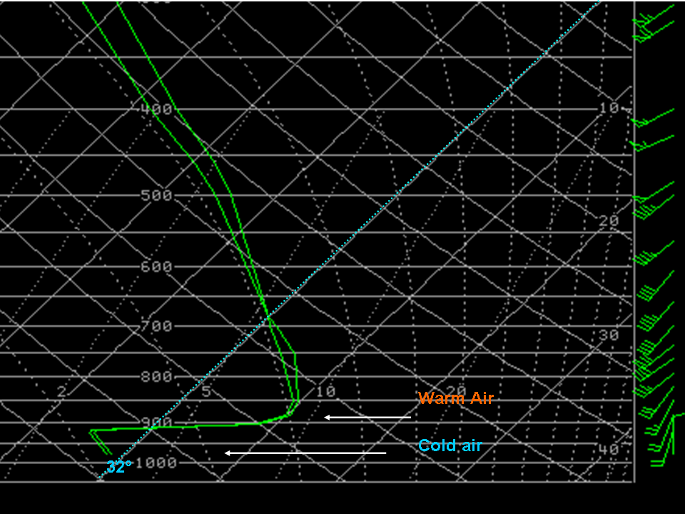
Freezing rain occurs when rain ralls into a layer of cold sub-freezing air near the earth's surface. Since this sub-freezing layer is shallow the rain falling into it has no time to refreeze into sleet or snow. However, the rain droplets freezing on contact with surfaces that are at freezing or below.