Springfield, MO
Weather Forecast Office
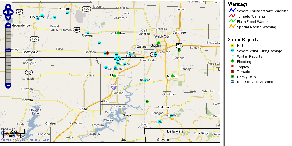
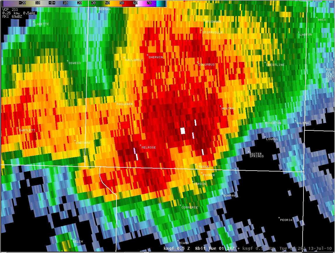
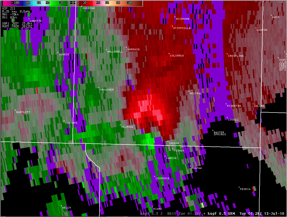
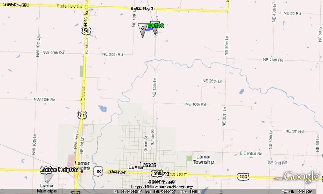
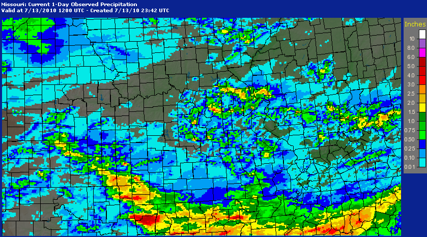
Thunderstorms Monday afternoon and evening of July 12th produced two tornadoes along with scattered reports of damaging winds and flooding. The first tornado occurred in Barton County 3 miles north of Lamar at 3:47 PM where thunderstorms rapidly developed along a boundary. A second tornado touched down in Cherokee County Kansas at 8:25 PM. This tornado was associated with a large and intense thunderstorm that tracked southeast from Cherokee County Kansas into Newton, McDonald and Barry Counties in far southwest Missouri.
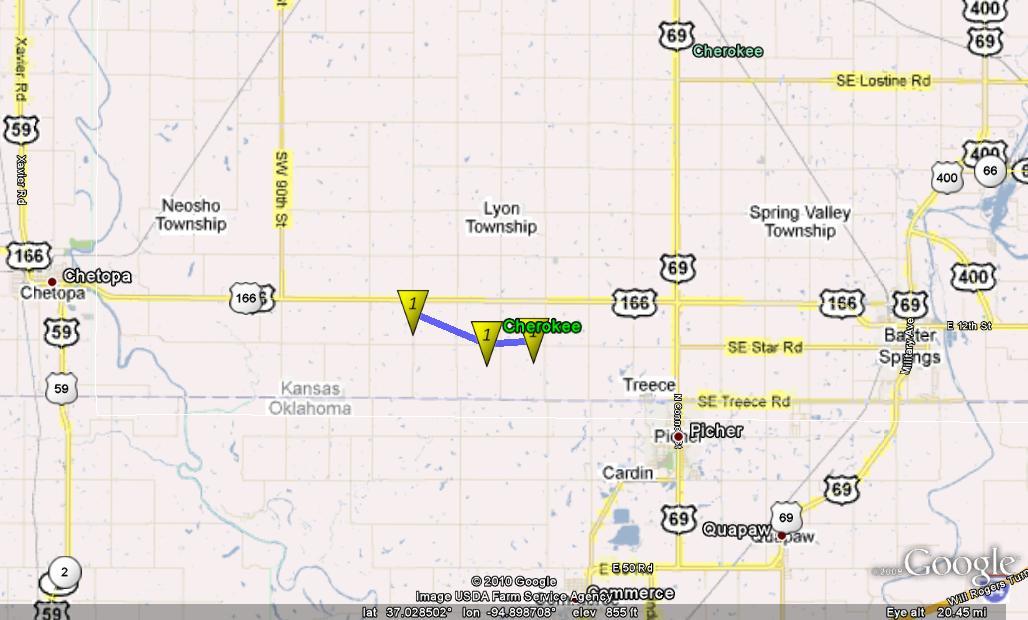
| Time | 8:25 - 8:35 PM CDT |
| Location | 6 mi. WNW of Treece, KS |
| EF Rating | 1 |
| Estimate Wind Speed | 90 mph |
| Path Length | ~ 3 miles broken path |
| Path Width | ~ 60 yards |
| Damage | Uprooted and snapped several large trees, blew over two large grain bins, heaviily damaged two well constructed outbuildings, and damaged one home. |
|
Time |
3:47 PM CDT |
|
Location |
3 mi. north of Lamar - Barton County Missouri |
|
EF Rating |
0 |
|
Estimate Wind Speed |
75 mph |
|
Path Length |
one quarter mile |
|
Path Width |
~ 100 yards |
|
Damage |
Two trees uprooted |
Current Hazards
Experimental Graphical Hazardous Weather Outlook
Submit a storm report
Local Storm Reports
Current Conditions
Observations
Lake Levels
Snowfall Analysis
Road Conditions
Satellite
CoCoRaHS
Graphical Conditions
Precip. Analysis
Forecasts
Forecast Discussion
Fire Weather
Aviation
GIS Forecast Maps
Activity Planner
Severe Weather
Winter Weather
Hurricanes
FAA Center Weather
Space Weather
Climatology
Records and Normals
Monthly Climate Summary
Local
National
Drought
Climate Science
Astronomical Data
US Dept of Commerce
National Oceanic and Atmospheric Administration
National Weather Service
Springfield, MO
Springfield-Branson National Airport
5805 West Highway EE
Springfield, MO 65802-8430
Business: 417-863-8028 Recording: 417-869-4491
Comments? Questions? Please Contact Us.


 Weather Story
 Weather Map
 Local Radar