
The atmospheric river over the Pacific Northwest will begin to subside today, but lingering rainfall will exacerbate ongoing catastrophic major river flooding, and landslides will continue across portions of western Washington and northwest Oregon for several days. Arctic air will plummet southward into the Northern Plains today, bringing cold air in the single digits to the region by Friday. Read More >
Overview
Scattered light showers occurred during the late afternoon of November 1st, 2018. A landspout tornado developed from one of these showers near the town of Iberia, MO causing some minor tree damage. (A landspout tornado is defined as a tornado that does not arise from organized storm-scale rotation and therefore is NOT associated with a wall cloud or a mesocyclone. Landspouts typically are observed beneath cumulonimbus or towering cumulus clouds often as no more than a dust whirl.)Tornadoes:
|
|
||||||||||
|
||||||||||
|
Landspout Tornado - 2 S Iberia
Track Map 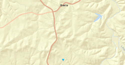 
Downloadable KMZ File |
||||||||||||||||
The Enhanced Fujita (EF) Scale classifies tornadoes into the following categories:
| EF0 Weak 65-85 mph |
EF1 Moderate 86-110 mph |
EF2 Significant 111-135 mph |
EF3 Severe 136-165 mph |
EF4 Extreme 166-200 mph |
EF5 Catastrophic 200+ mph |
 |
|||||
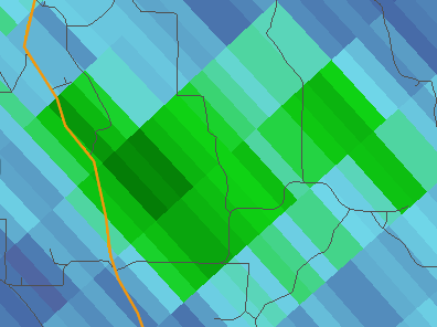
Radar:
Radar images from the time of the Landspout tornado (526 pm)
 |
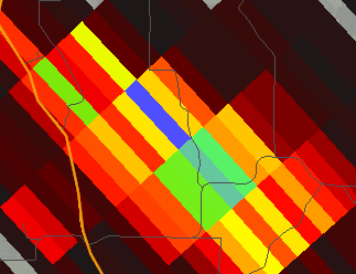 |
| Very weak reflectivity at the time of landspout | CC drop at the time of landspout |
 |
Media use of NWS Web News Stories is encouraged! Please acknowledge the NWS as the source of any news information accessed from this site. |
|


 Weather Story
 Weather Map
 Local Radar