National Weather Service United States Department of Commerce
Click a location below for detailed forecast.

Last Map Update: Fri, Apr 3, 2026 at 9:22:20 am CDT

Strong to severe thunderstorms are possible Friday afternoon into Friday night. The main hazards will be large hail and damaging winds. Storms should begin to develop by early afternoon, with coverage increasing in the afternoon and evening.
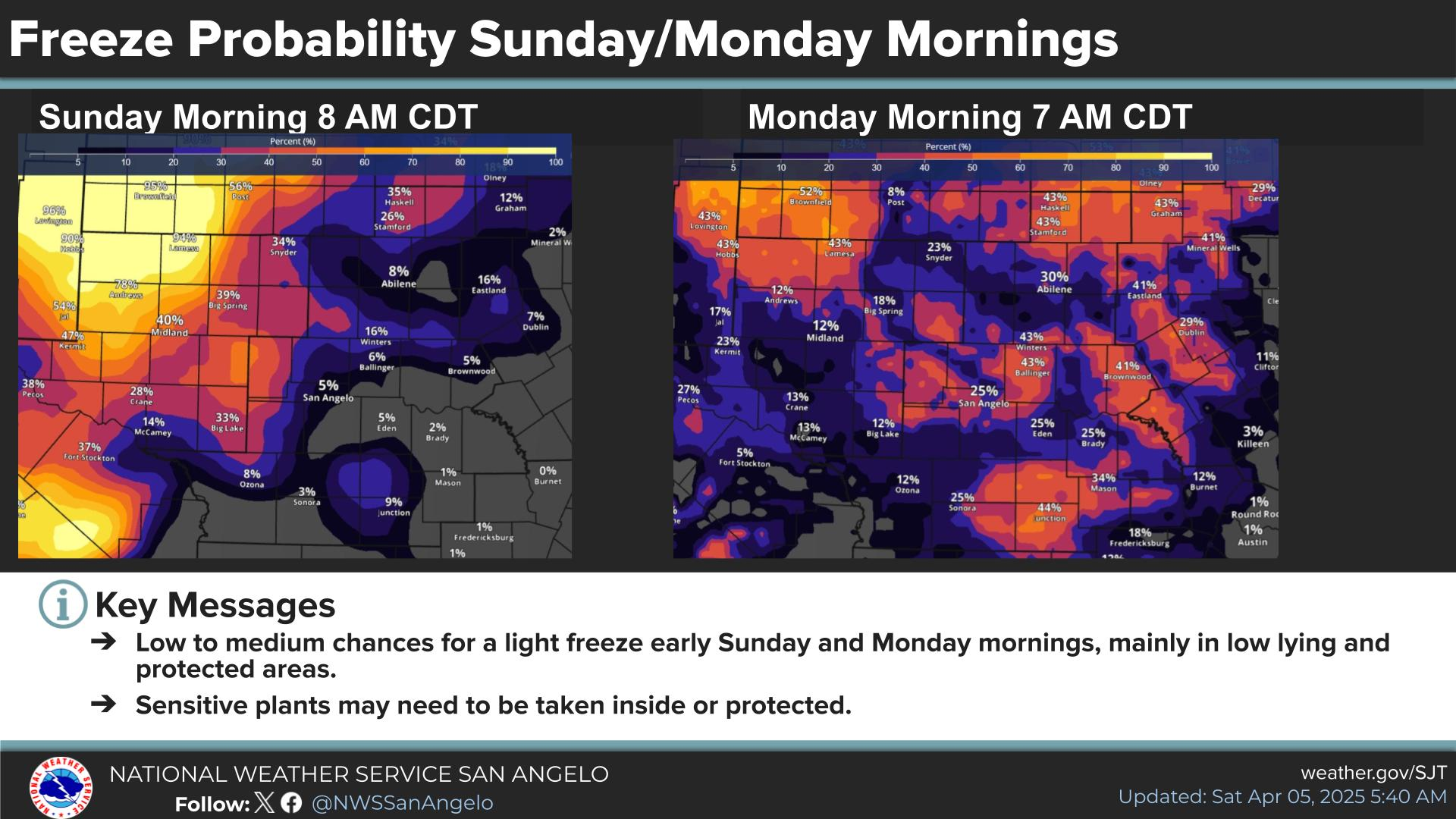
Showers and thunderstorms are expected to develop this afternoon, increasing in coverage by late in the afternoon and into the evening hours. Localized rainfall amounts over an inch are possible which may lead to flooding in low-lying and urban areas. The highest risk for flooding appears to be north of a San Angelo to Brady line.
Rain chances will increase Friday into Saturday. Strong to severe thunderstorms are possible Friday afternoon into Friday night. In addition, locally heavy rainfall is possible, which may result in flooding.
Cooler temperatures this weekend, with a gradual warm-up next week. Showers and thunderstorms likely this afternoon into Saturday. A few showers and thunderstorms may linger across our southern counties into Sunday.


Current WeatherCurrent Weather RadarRadar SatelliteSatellite Forecast MapsForecast Maps Hourly ForecastHourly Forecast Lakes & RiversLakes & Rivers
Hazards OutlookHazards Outlook Hi-Res RadarHi-Res Radar Fire WeatherFire Weather Winter WeatherWinter Weather DiscussionDiscussion Briefing VideoBriefing Video
ClimateClimate Storm ReportStorm Report Text ProductsText Products AviationAviation DroughtDrought SkywarnSkywarn