National Weather Service United States Department of Commerce

Areas of Severe Thunderstorms and Excessive Rainfall Overnight into Monday

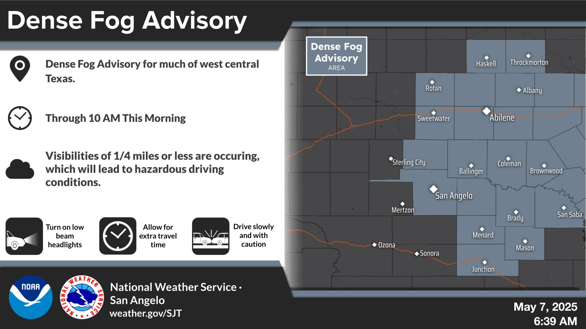
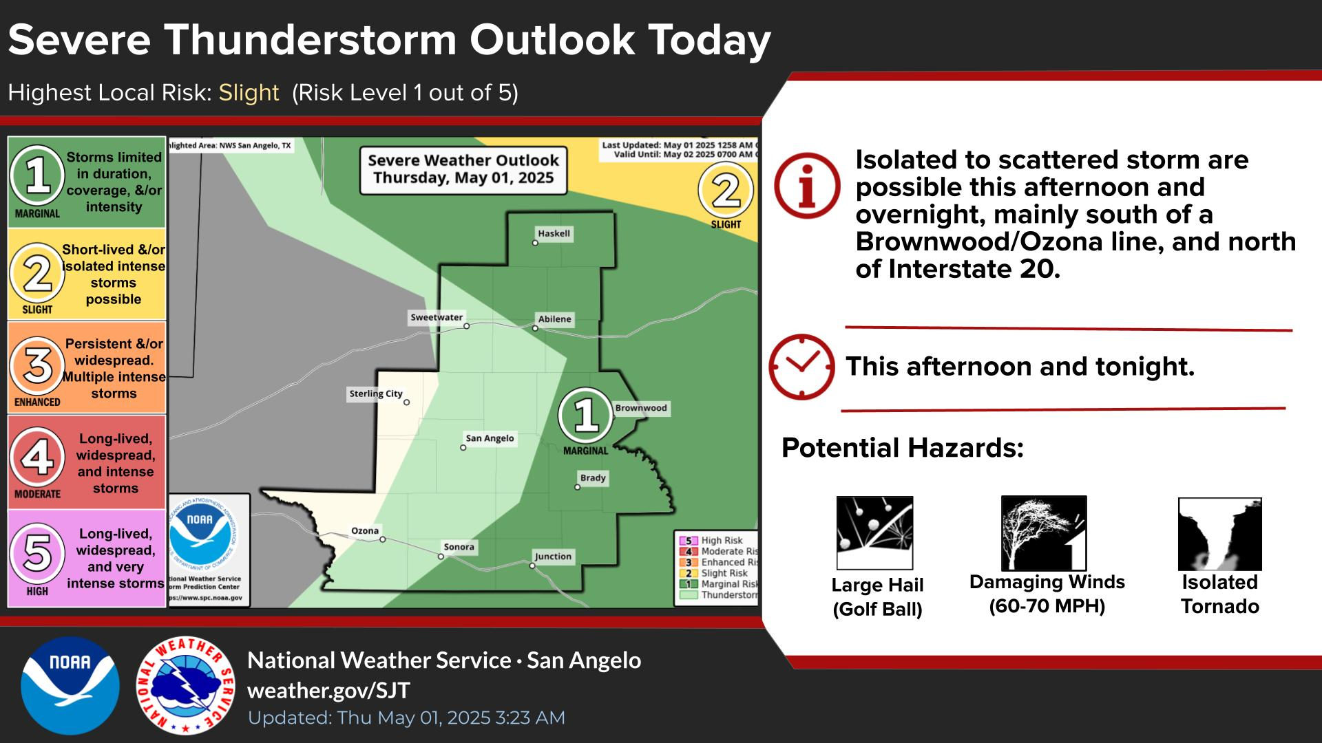
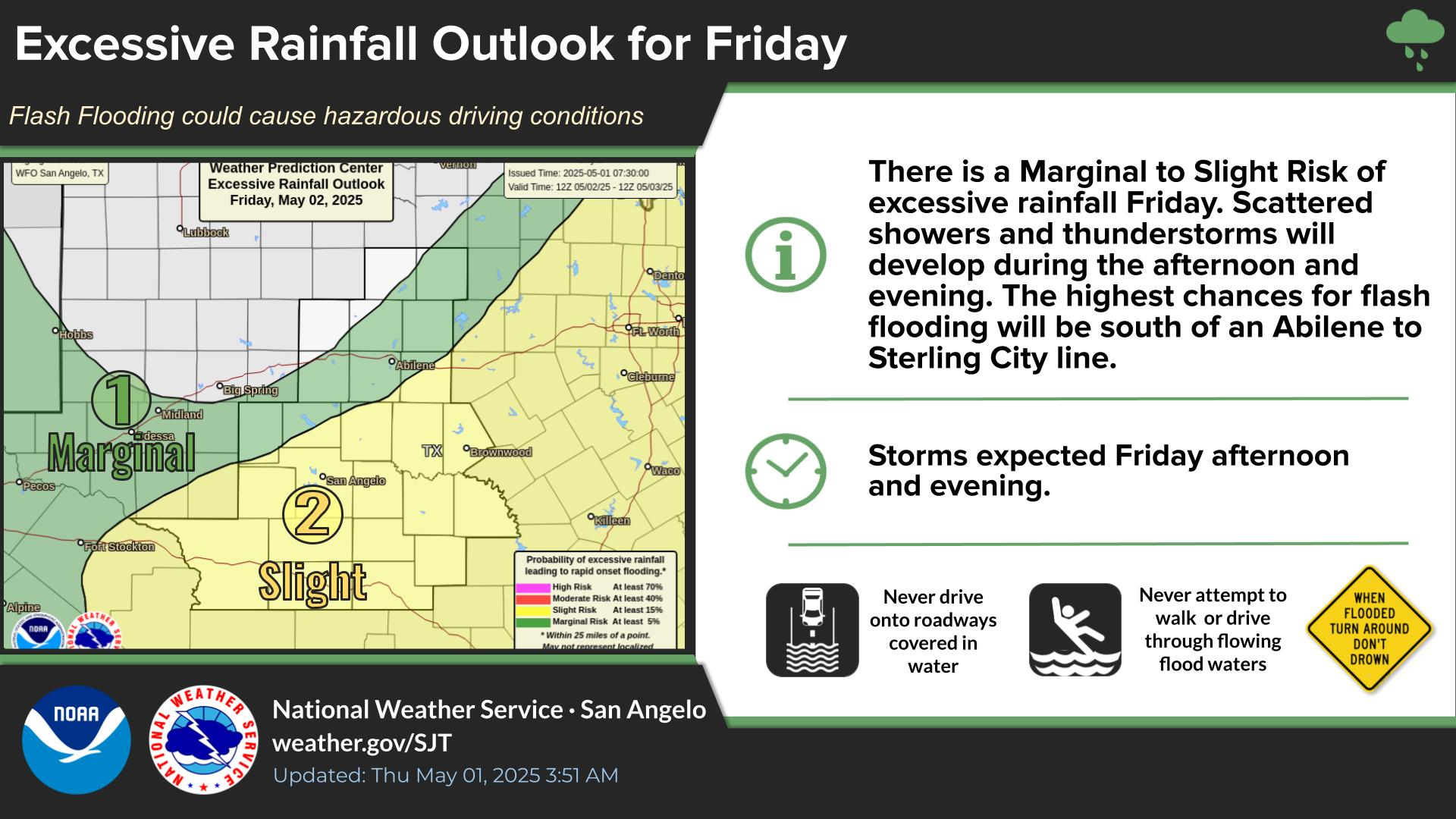
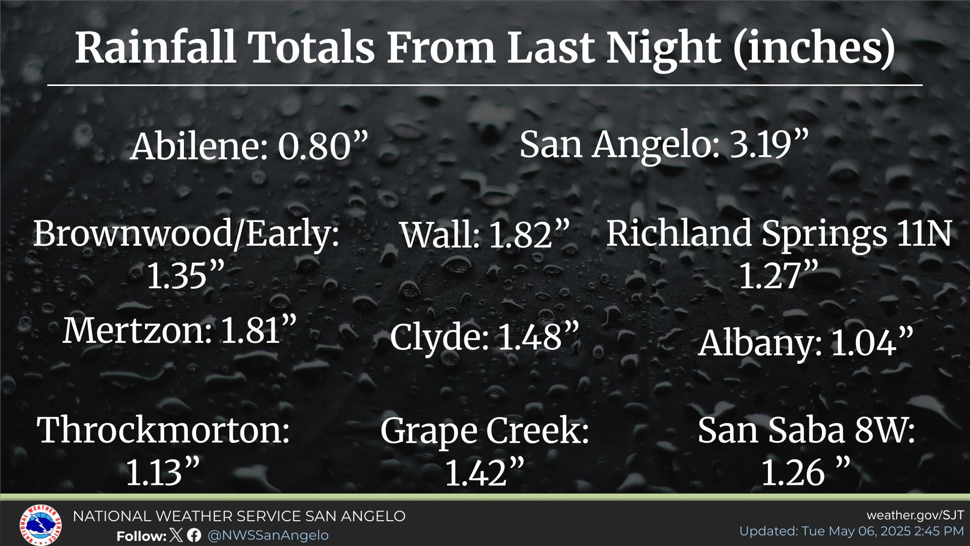
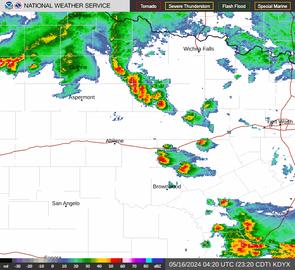
Severe thunderstorms with destructive winds, very large hail, a couple tornadoes, and excessive rainfall will move across southern Oklahoma and northern Texas overnight. On Monday, scattered damaging winds, a couple tornadoes, and isolated large hail is possible across the Southeast U.S. into the Upper Ohio Valley. Excessive rainfall may bring flooding in the northern Gulf Coast and Northeast US. Read More >

Dyess AFB Radar
A PDS (Particularly Dangerous Situation) Severe Thunderstorm Watch has been issued for the Big Country and will be in effect through 11 PM. The main concern this evening will be very strong and damaging winds (gusts up to 105 mph are possible). However, storms will also have the potential to produce very large hail (4+ inches) and a few tornadoes.
A complex of thunderstorms will move south/southeast into the area this evening into tonight. Recent rainfall combined with an additional 1-3 inches of rain may result in flooding.
Widespread and intense severe thunderstorms are expected this evening through late tonight north of a Sweetwater to Brownwood line. Strong and damaging winds (60-80+ mph), large to very large hail (potentially up to softball size), and the potential for isolated tornadoes will be possible. South of this line, storms are expected to be more scattered to isolated, with large hail, damaging winds, and lower potential for an isolated tornado.
Several rounds of showers and thunderstorms are expected Tuesday and Wednesday. Some of these storms may produce rounds of heavy rainfall across West Central Texas.
There will be a scheduled outage of the NOAA Weather Radio Transmitters in our forecast area from June 10th to June 12th, while our office system undergoes a required update. All forecasts and warnings will still be sent out; however, they will not be played on the NOAA Weather Radio. We do have chances for storms on these days and we apologize for any inconvenience these updates may cause, but this update is required and scheduled months in advance. Ensure you have multiple other ways to receive warnings, which can include your cell phone, local TV stations, or online at weather.gov/sjt.