Light showers were spreading east into the Concho Valley, Crockett County and along the I-10 Corridor from Sonora to Junction. Rainfall amounts from a trace to a few hundredths inch expected.
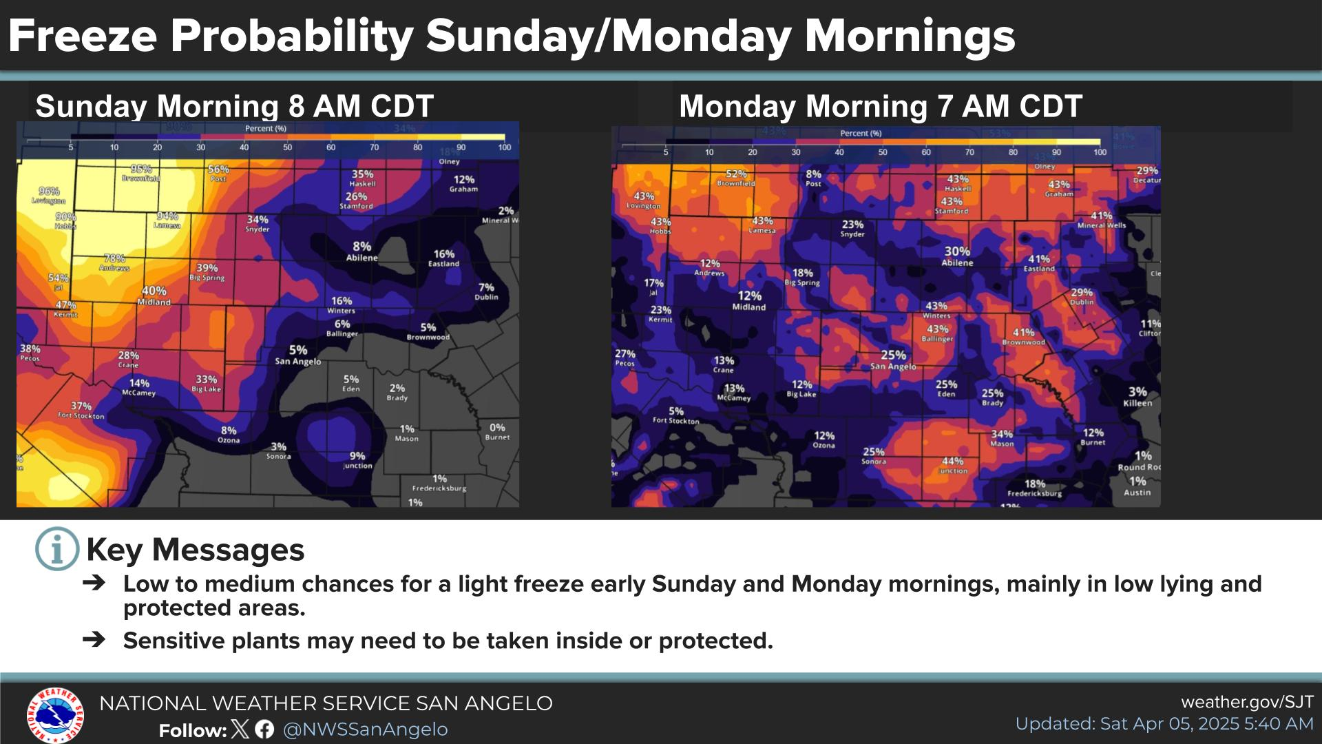
Mostly cloudy. Isolated to scattered light showers possible for western areas. Only a few hundredths of precipitation expected by areas affected by these showers.
There is the potential for severe thunderstorms, along the locally heavy rainfall this weekend. It's still very early, however, and a lot uncertainly remains.
Cooler than normal through Tuesday, warming temperatures the rest of the week, and mainly dry through Thursday. There is increasing confidence in a chance for widespread showers and thunderstorms again this weekend.


 Current Weather
 Radar
Radar Satellite
 Forecast Maps
 Hourly Forecast
 Lakes & Rivers
 Hazards Outlook
 Hi-Res Radar
 Fire Weather
 Winter Weather
 Discussion
 Briefing Video
 Climate
 Storm Report
 Text Products
 Aviation
 Drought
 Skywarn