
Severe thunderstorms producing damaging winds, hail, and a few tornadoes are expected through Tuesday across parts of the central Plains and lower to mid Missouri Valley. Heavy to excessive rainfall could produce flooding across portions of the Ohio Valley into the Central Appalachians through Tuesday. Read More >
Last Map Update: Tue, Jun 17, 2025 at 4:58:44 am AST
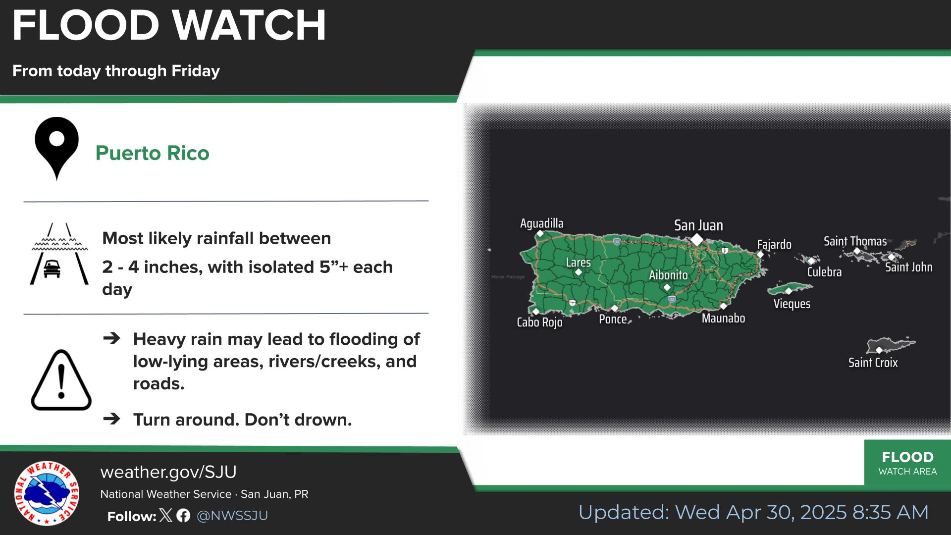
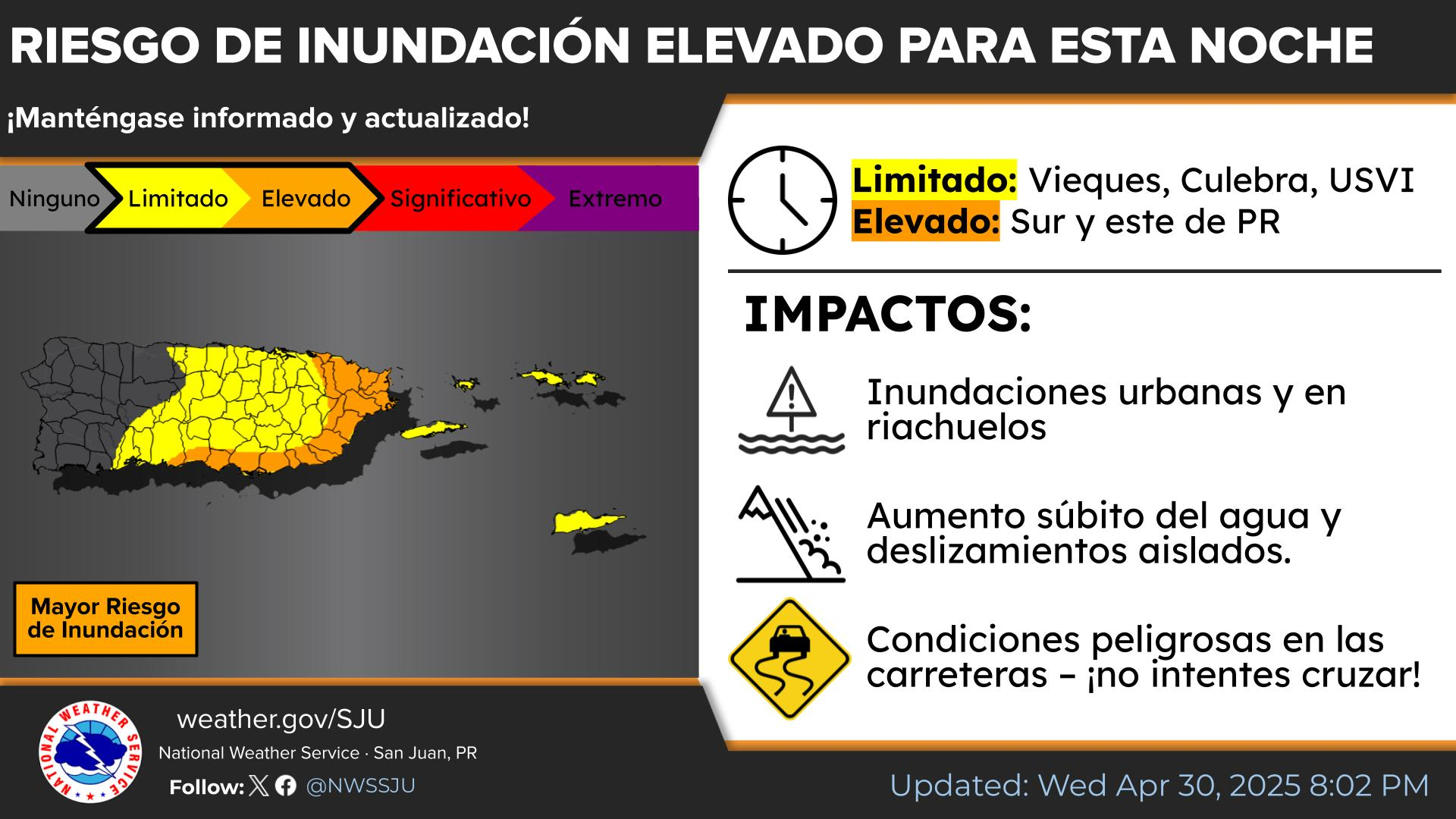


 Graphical Hazardous Weather Outlook
 Tropical Analysis
 Tropical Weather
 Regional Satellite
 Puerto Rico and US Virgin Islands
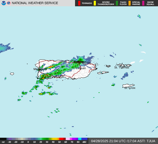
 Local Radar