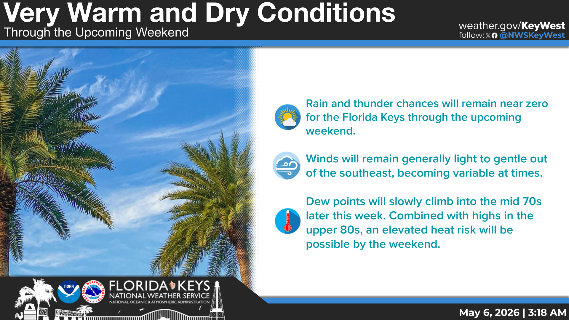
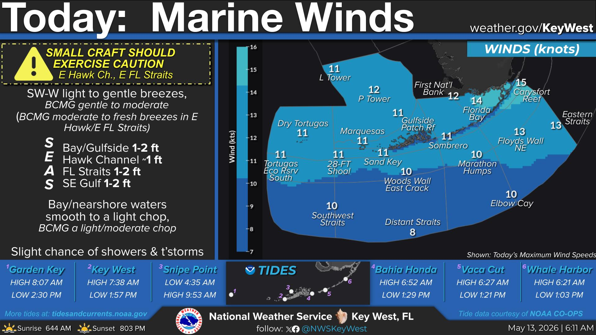
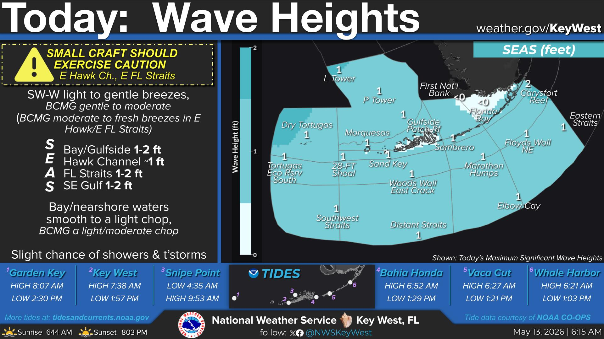
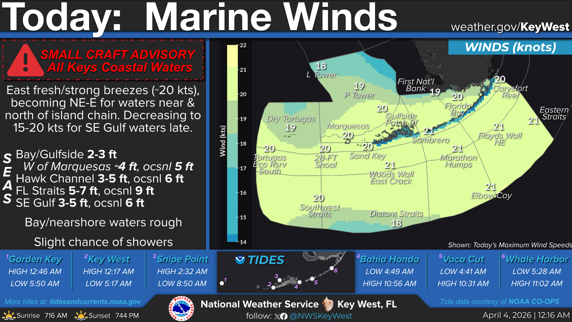
National Weather Service United States Department of Commerce

Pacific Storm Moves Inland; Clipper System for the Northeast; Strong Storm Impacting Alaska

In Alaska, a powerful storm will bring dangerous seas, blizzard conditions, strong winds and bitterly cold across the state through mid-week. Meanwhile, Pacific storm will move inland across California with lower elevation rain and accumulating mountain snow; Strong winds will affect the central Great Basin. A clipper system to bring snow and gusty winds for the Northeast corridor into Wednesday. Read More >

Click a location below for detailed forecast.

Last Map Update: Tue, Feb 10, 2026 at 5:10:43 pm EST

Last week was the coldest start to February for the Florida Keys in over 45 years! This graphic takes a look at how the average weekly temperature stacked up, as well as the coldest temperatures observed along the island chain between February 1st and 7th. For a more encompassing list, check out our accompanying Public Information Statement... https://mesonet.agron.iastate.edu/wx/afos/p.php?pil=PNSKEY&e=202602082244
A nice week of weather continues for the Florida Keys. Overall, expect nil rain chances through the remainder of the week along with near normal temperatures.
TONIGHT... Mostly clear. Lows in the lower to mid 60s. East winds near 10 mph, decreasing to 5 to 10 mph.
Small Craft Should Exercise Caution in the Florida Straits for winds increasing to 15-20 knots! TONIGHT... Generally east moderate breezes, becoming fresh across the Florida Straits; Florida Bay NE-E gentle breezes; North of the islands NE-E moderate breezes. Seas: Bay/Gulfside ~1 ft; West of the Marquesas 2-3 ft; Hawk Channel 2-3 ft; West of Cosgrove 3-4 ft; Florida Straits 3-5 ft, occasionally 6 ft; SE Gulf 1-3 ft. Bay waters becoming smooth to a light chop, nearshore waters becoming a light to moderate chop.


Text Product Selector
(Selected product opens in a new window) 


Sunrise & Sunset

Sunrise & Sunset


Moon Rise & Set

Moon Rise & Set


Moon Illumination

Moon Illumination


Tide Information

Tide Information


Tropical

Tropical


Coastal Flooding

Coastal Flooding


Tallship

Marine


Nearshore Waves

Wave Prediction


Thumbnail for a local waterspouts website, showing 4 waterspouts.

Waterspouts


Airplane

Aviation


Key West & Marathon Climographs 2020

Climographs


Tropical

Forecast Discussion


NOAA Weather Radio

NOAA Weather Radio