Key West, FL
Weather Forecast Office
 |
Tropical Cyclones |
 |
The Florida Keys have a long history of tropical cyclone impacts.
Explore the links below to learn more!
 |
 |
||
|
Florida Keys Tropical Cyclone History (includes storm history that dates back to the 1600s, Strongest Tropical Cyclones by wind speed, Most Intense Tropical Cyclones by minimum central sea level pressure, Florida Keys Tropical Cyclone Climatology, and a Tropical Cyclones by Date Calendar) |
15 Worst Hurricanes in Florida Keys History (featuring: 1622 Hurricane, Great Havana Hurricane of 1846, 1906 Hurricane, 1909 Hurricane, Cuba 1910 Hurricane, Bahamas 1929 Hurricane, Labor Day Hurricane of 1935, September 1948 Hurricane, October 1948 Hurricane, Hurricane Donna 1960, Hurricane Betsy 1965, Hurricane Georges 1998, Hurricane Wilma 2005, and Hurricane Irma 2017) |
 |
 |
||
|
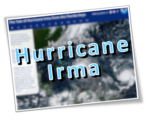
Hurricane Irma in the Florida Keys (before, during, and after Category 4 Hurricane Irma made landfall in the Florida Keys -- includes satellite and radar imagery, National Hurricane Center graphics and products, observed and estimated peak wind speeds, rainfall totals, high water marks, storm surge observations, storm damage photos, and a NOAA Hurricane Irma Post-Event Imagery Swipe Map showing before/after images) |
Florida Keys Storm Graphics Archive This is a collection of past Florida Keys storm graphics (history, impacts, and/or observations) created by NWS Key West staff |
Current Hazards
Hazardous Outlook
National Outlooks
National Hazards
Tropical Hazards
Coastal Flooding
Submit Storm Reports
Current Weather
Observations
Latest Sounding
Satellite Images
Rivers and Lakes
Precipitation Estimate
Hydrology
Forecasts
Local
Forecast Discussion
Activity Planner
Graphical Forecast
Tropical Weather
Fire Weather
Aviation Weather
Marine Weather
Climate
Local Observed Climate
National
Radar Imagery
Key West Radar
Miami Radar
Other National Radars
US Dept of Commerce
National Oceanic and Atmospheric Administration
National Weather Service
Key West, FL
1315 White Street
Key West, FL 33040
(305) 295-1316
Comments? Questions? Please Contact Us.

