National Weather Service United States Department of Commerce

Heavy to Excessive Rainfall in the Southeast; Critical Fire Weather in the Northern Plains/Upper Midwest and Southwest

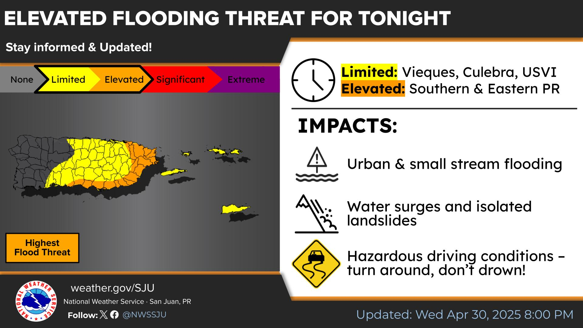
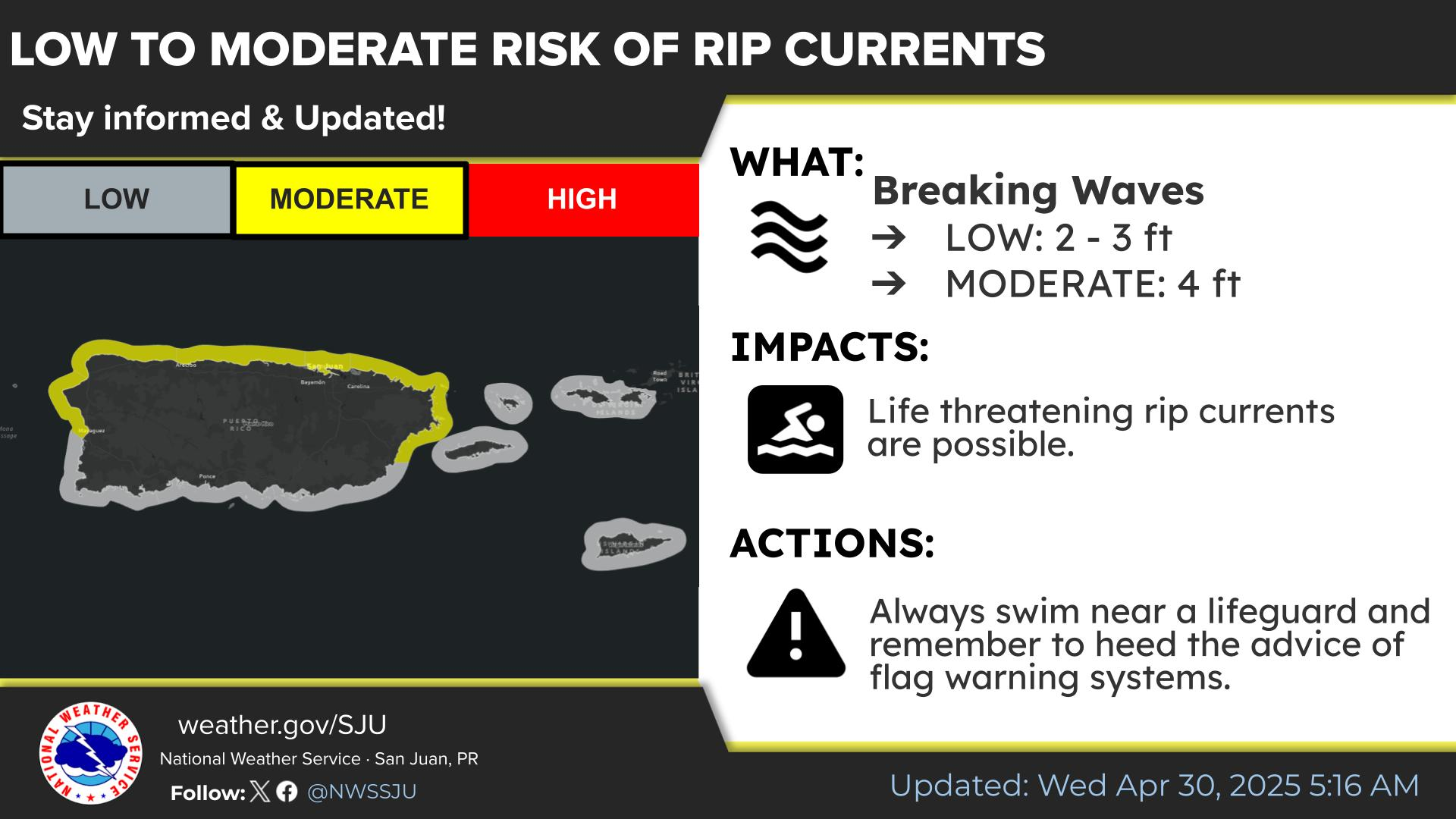
A slow-moving storm system will continue to bring thunderstorms, heavy rain and flooding potential from Southeast Florida, into the Southern to Central Appalachians and the Mid-Atlantic regions today into Wednesday. Gusty winds and dry fuels will support widespread critical fire weather in the northern Plains into the Upper Midwest and the Southwest. Read More >

Click a location below for detailed forecast.

Last Map Update: Tue, May 13, 2025 at 6:52:41 am AST

For today, there is a limited to elevated flood risk for the western interior of Puerto Rico during the afternoon hours. Breezy conditions are expected along the coastal areas of the islands. A Small Craft Advisory is in effect for the Atlantic and Caribbean waters, as well as the Anegada Passage. Para hoy, existe un riesgo de inundaciones de limitado a elevado en los sectores del oeste interior de Puerto Rico durante horas de la tarde. Se esperan condiciones ventosas a lo largo de las zonas costeras de las islas. Una advertencia para embarcaciones pequeñas está en efecto para las aguas del Atlántico, el Caribe y el Paso de Anegada.
May 13th: There is a moderate risk of rip current for Puerto Rico and the US Virgin Islands. Residents and visitors should exercise caution across the local exposed beaches.
TJUA Radar - Cayey, P.R.