
A frontal boundary extending from the western High Plains to the Southeast will focus additional showers and thunderstorms this weekend. Some of these storms may become severe, alongside frequent lightning, and isolated instances of flash flooding. Meanwhile dry conditions will continue for the Great Basin where fire weather concerns linger. For the mid-Atlantic and Northeast, seasonable weather. Read More >
Last Map Update: Sat, Aug 2, 2025 at 3:26:18 am AST


 Graphical Hazardous Weather Outlook
 Tropical Analysis
 Tropical Weather
 Regional Satellite
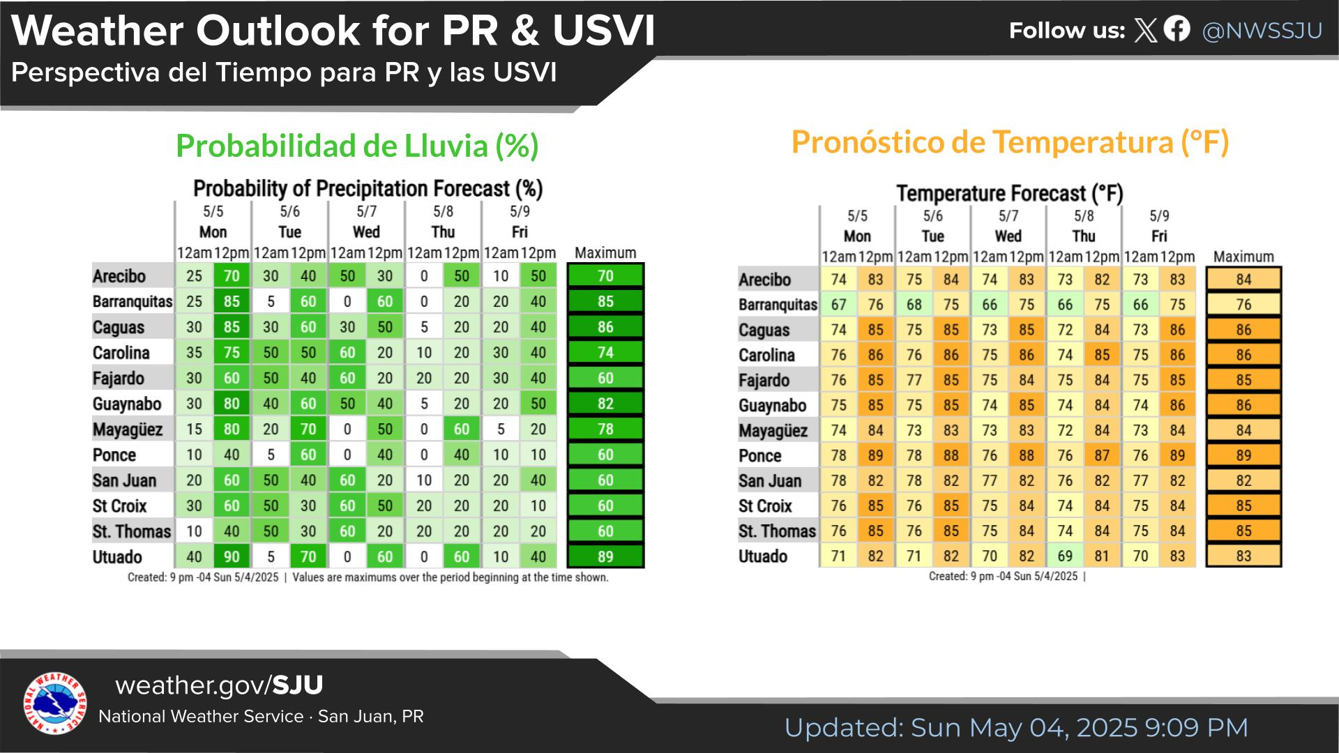
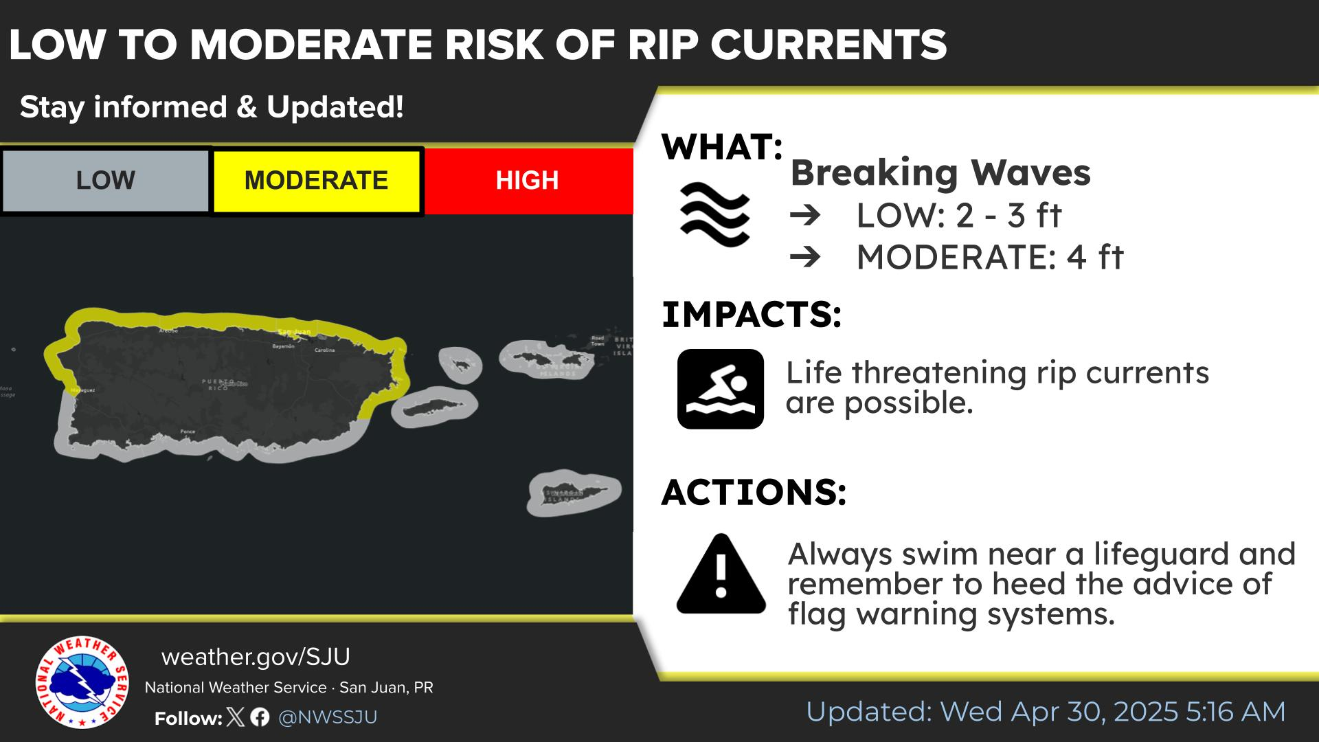
 Puerto Rico and US Virgin Islands