
Dangerous and extreme heat will remain across portions of the southern U.S. this week. Heavy rainfall may bring significant flash flooding across portions of the Mid-Atlantic and Northeast through the night, and additional flash flooding concerns across New England on Wednesday. Monsoonal thunderstorms will bring a flash flood risk to the Four Corners region, especially in burn scar areas Read More >
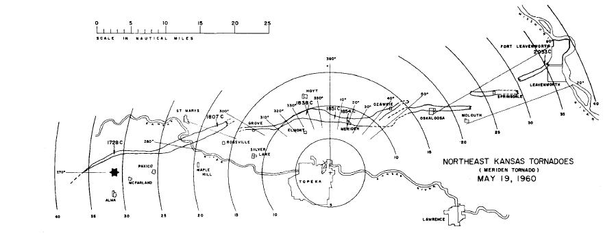
During the afternoon of May 19, 1960, an F4 tornado tracked across NE Kansas. There was one fatality in Shawnee County and 25 serious injuries. The tornado began just south of Wamego and tracked to near Leavenworth. Meriden, KS, was almost completely demolished, and the northern portion of Oskaloosa sustained significant damage as well. At times, the tornado was almost 2 miles wide.
R.A. Garrett, who was the official in charge at the U.S. Weather Bureau office in Topeka (the forerunner to today's National Weather Service), produced a detailed study, which can be found here:
/media/top/mwr-090-06-0231.pdf
Here are several figures from the study

The tornado track was approximately 70 miles long, although there was evidence of multiple tornadoes along the track, as shown in the next image:
Several pictures of this tornado were taken by troopers from The Kansas Highway Patrol. Here is a photograph of the tornado just north of Rossville:

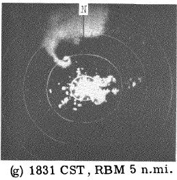
Weather radar technology in 1960 was primative compared to today's WSR-88D network. Here is a photograph of the radar scope as the tornado moved just north ot Topeka.
Although not the same tornado, here is an example of a similiar 'hook echo' feature as seen on the WSR-88D. This data is from the recent Oklahoma City tornado outbreak of May 10, 2010:
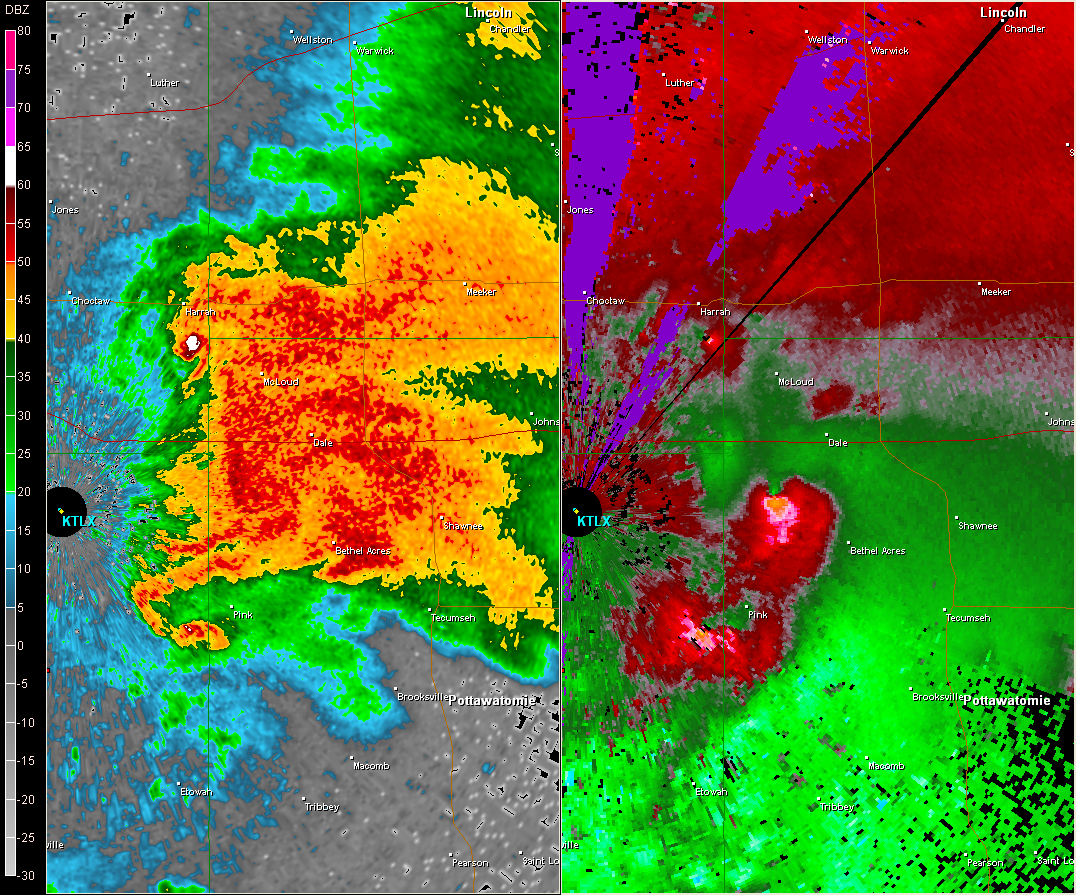
The WSR-88D data includes a much better resolution reflectivity product (left image) and also includes data on the winds inside of storms (right image). The 'wind' image on the right shows 3 probable tornadoes - can you find them?

