Heat expands across the Desert Southwest, Plains, Mississippi Valley and Midwest into Monday. Fire weather concerns continue for portions of the Intermountain West. Active monsoonal moisture fuels thunderstorms over the Southwest with possible flash flooding. Tropical cyclone Fausto in the Pacific, should weaken as it approaches Hawaii; Dangerous surf, swells and rip currents are expected. Read More >
Overview
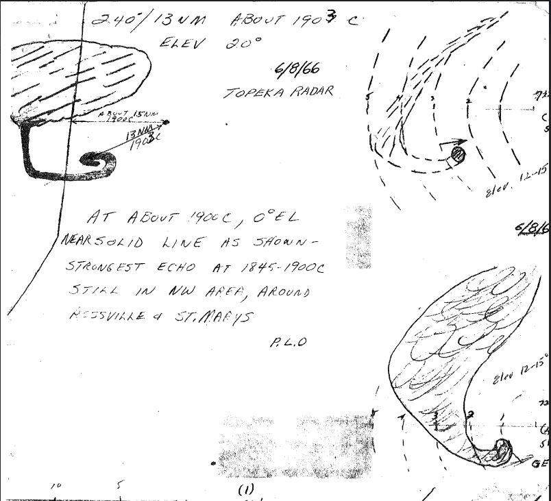
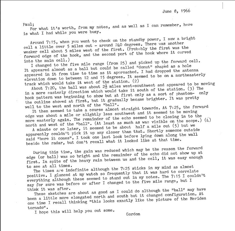
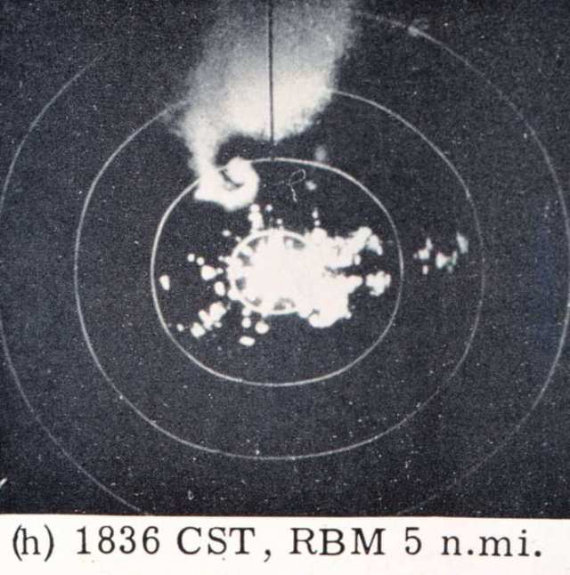
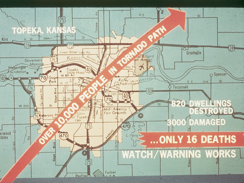
Additional info on this event can be found below. A tornado track map along with scans related to radar observation back in 1966 is contained within the Tornado tab. Additional damage photos can be found in the Photos and Video tab. In the Environment tab, there is a look at the meteorological environment that existed prior to and during the 1966 Topeka tornado. Environmental parameters including CAPE, wind shear and storm relative helicity are calculated for June 8th 1966 from upper air soundings. Additionally, surface and upper air maps analyzed during the day are included. Finally the Additional tab contains scans of the Tornado Watch issued that day, forecasts for northeast Kansas, and the initial severe weather statement during the tornado.
 |
 |
 |
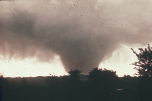
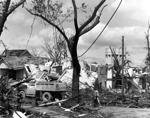
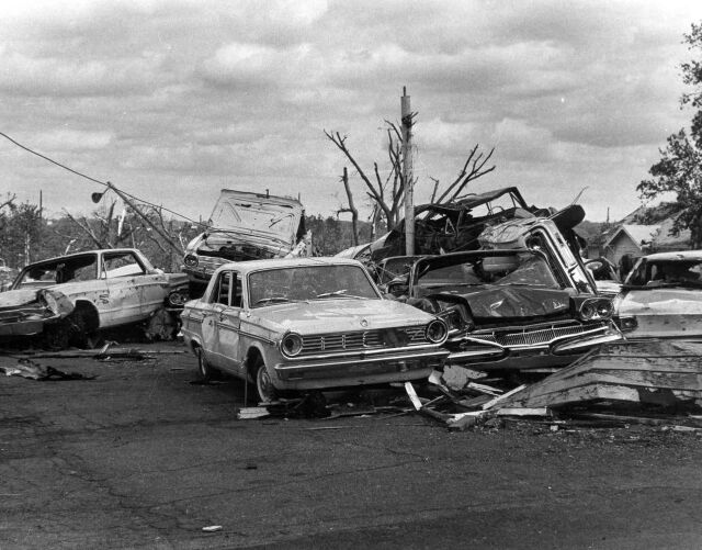
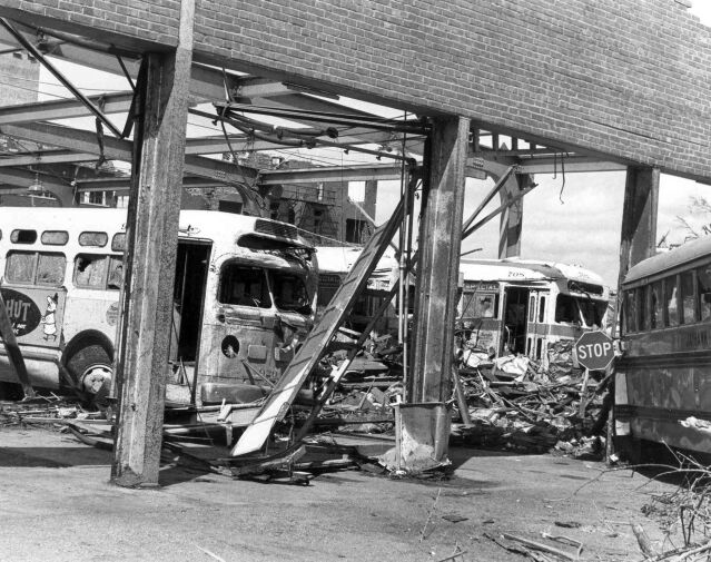
| June 8th 1966 Topeka Tornado | June 8th 1966 Topeka Tornado | June 8th 1966 Topeka Tornado Track |
Tornadoes:
|
Tornado - LOCATION
Track Map 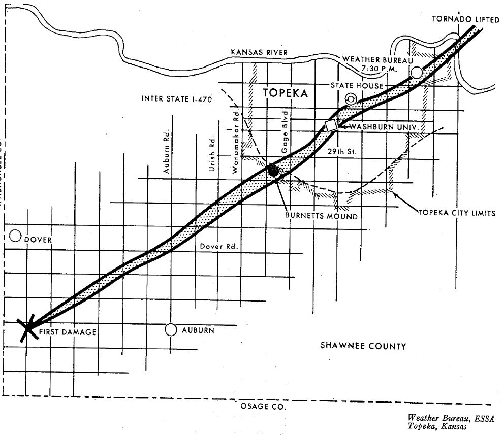
|
||||||||||||||
|
The Enhanced Fujita (EF) Scale classifies tornadoes into the following categories:
| EF0 Weak 65-85 mph |
EF1 Moderate 86-110 mph |
EF2 Significant 111-135 mph |
EF3 Severe 136-165 mph |
EF4 Extreme 166-200 mph |
EF5 Catastrophic 200+ mph |
 |
|||||
Photos & Video:
Header
 |
 |
 |
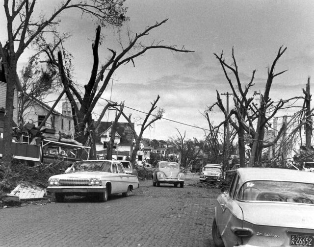 |
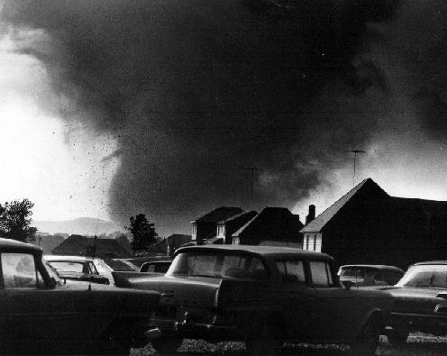
| Topeka Damage TCJ | Topeka Damage TCJ | Topeka Damage TCJ | Topeka Damage TCJ |
Environment
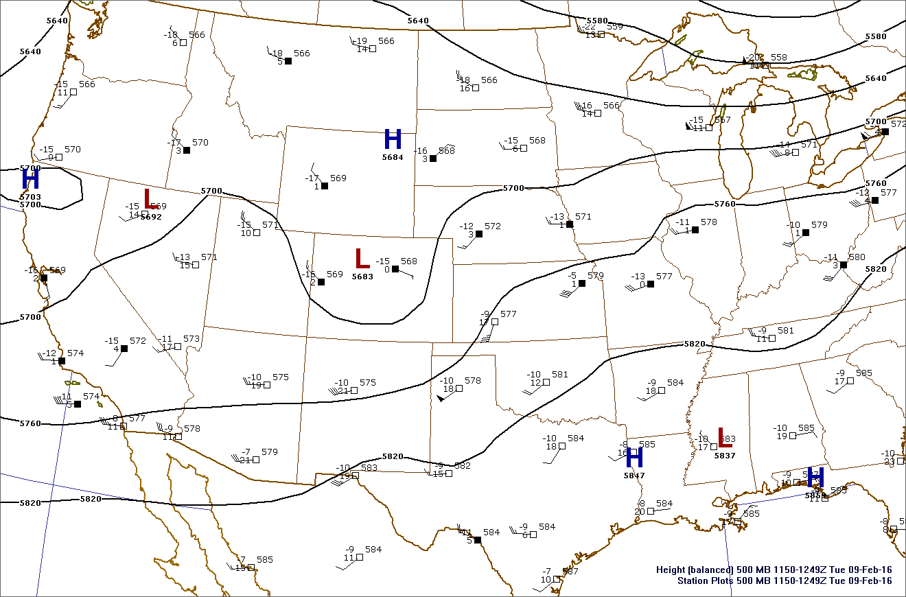
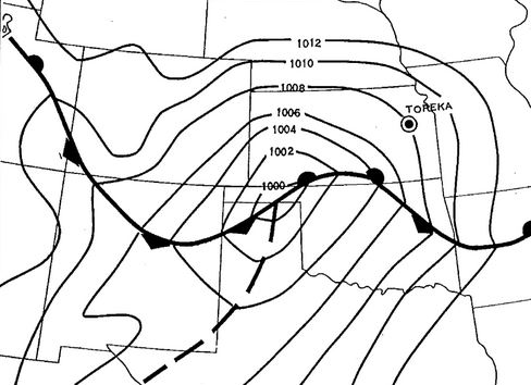
On the morning of June 8th 1966, an upper level trough at 500 mb (~18,000 feet above the ground) was crossing the Rockies and heading for the Central Plains (Fig. 1). The surface map at 6 AM (Fig. 2) showed a strong low pressure system over the Oklahoma Panhandle with a warm front moving north out of Oklahoma into southern Kansas. By 6 PM, the low had intensified and was located near Manhattan, with a warm front extending eastward, just to the north of I70 (Fig. 3). One can see from this surface map that temperatures were in the lower to middle 80s over east central and southeast Kansas, while just a couple hundred miles to the north, temperatures were only in the 40s in central and western Nebraska. This is a very strong front for early June.
 |
 |
 |
| Figure 1: 6 AM June 8th 500mb Chart | Figure 2: 6 AM June 8th Surface Map | Figure 3: 6 PM June 8th Surface Map |
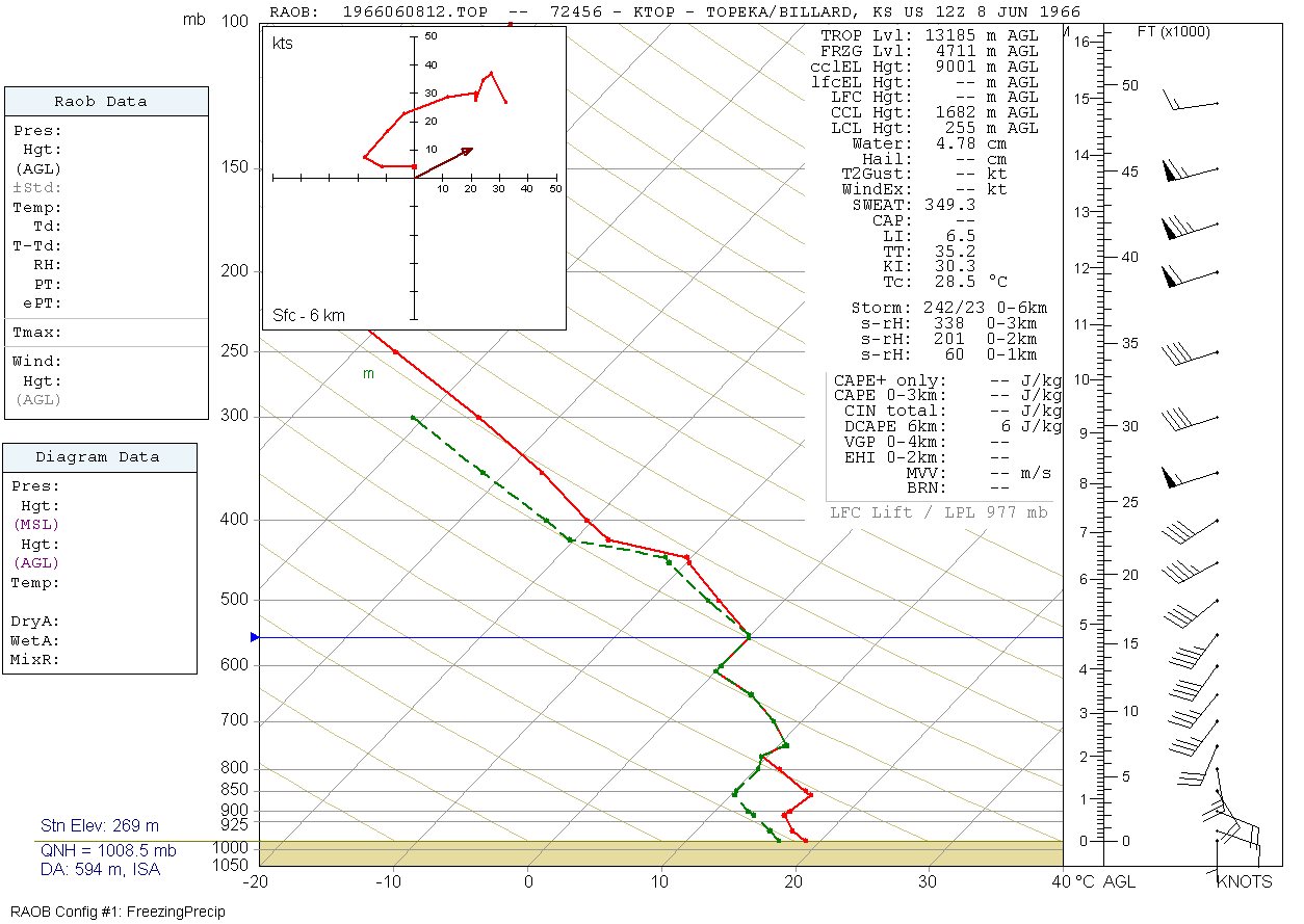
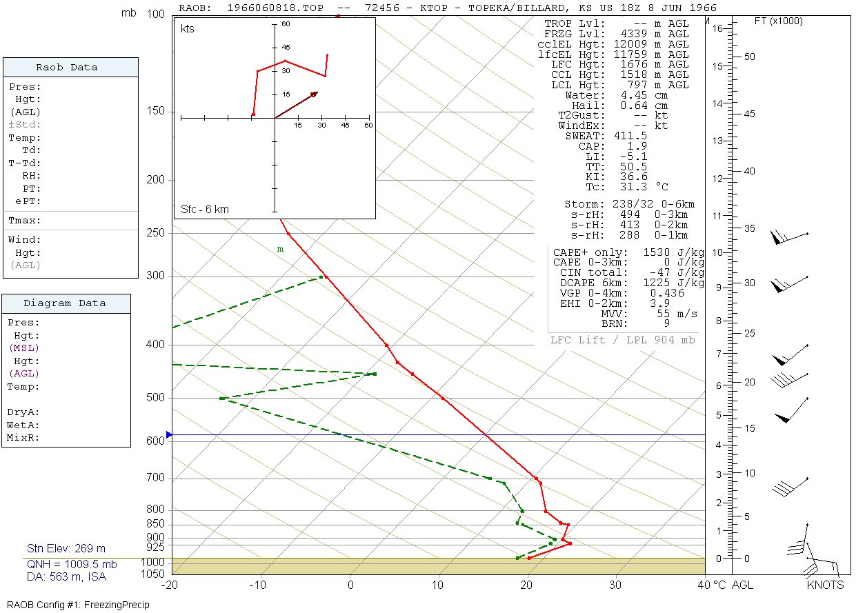
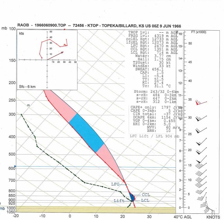
Below are SkewT diagrams of the Topeka Upper Air Observations on June 8th 1966. A SkewT is a plot of temperature, moisture and wind as you go up in the atmosphere. In the soundings below, the red line is temperature and the dashed green line is dewpoint (a measure of moisture in the air). On the right are wind barbs. The morning upper air sounding at Topeka (Fig. 4) shows a saturated environment, as the balloon was caught up in nearby showers and thunderstorms. A special sounding was released near noontime in anticipation of the afternoon and evening severe weather (Fig. 5). It still shows relatively cool air at low-levels remaining from the morning thunderstorms. Figure 6 depicts the Topeka sounding at 6 PM, just shortly before the tornado. It shows winds changing direction from southeast at low-levels, to southwest at 50 mph at 5000 feet above the ground, to west-southwest at 60 mph at 20,000 feet above ground level. This is something that meteorologists refer to as vertical wind shear, and this vertical wind profile is typical of environments in which strong tornadoes form. Additionally, one can see that the low-level temperatures had warmed and the instability had increased since noon.
 |
 |
 |
| Figure 4: 6 AM (12Z) June 8th Topeka Sounding and Hodograph | Figure 5: Noon (18Z) June 8th Topeka Sounding and Hodograph | Figure 6: 6 PM (00Z) June 8th Topeka Sounding and Hodograph |
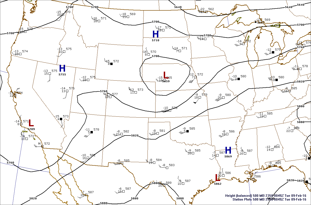
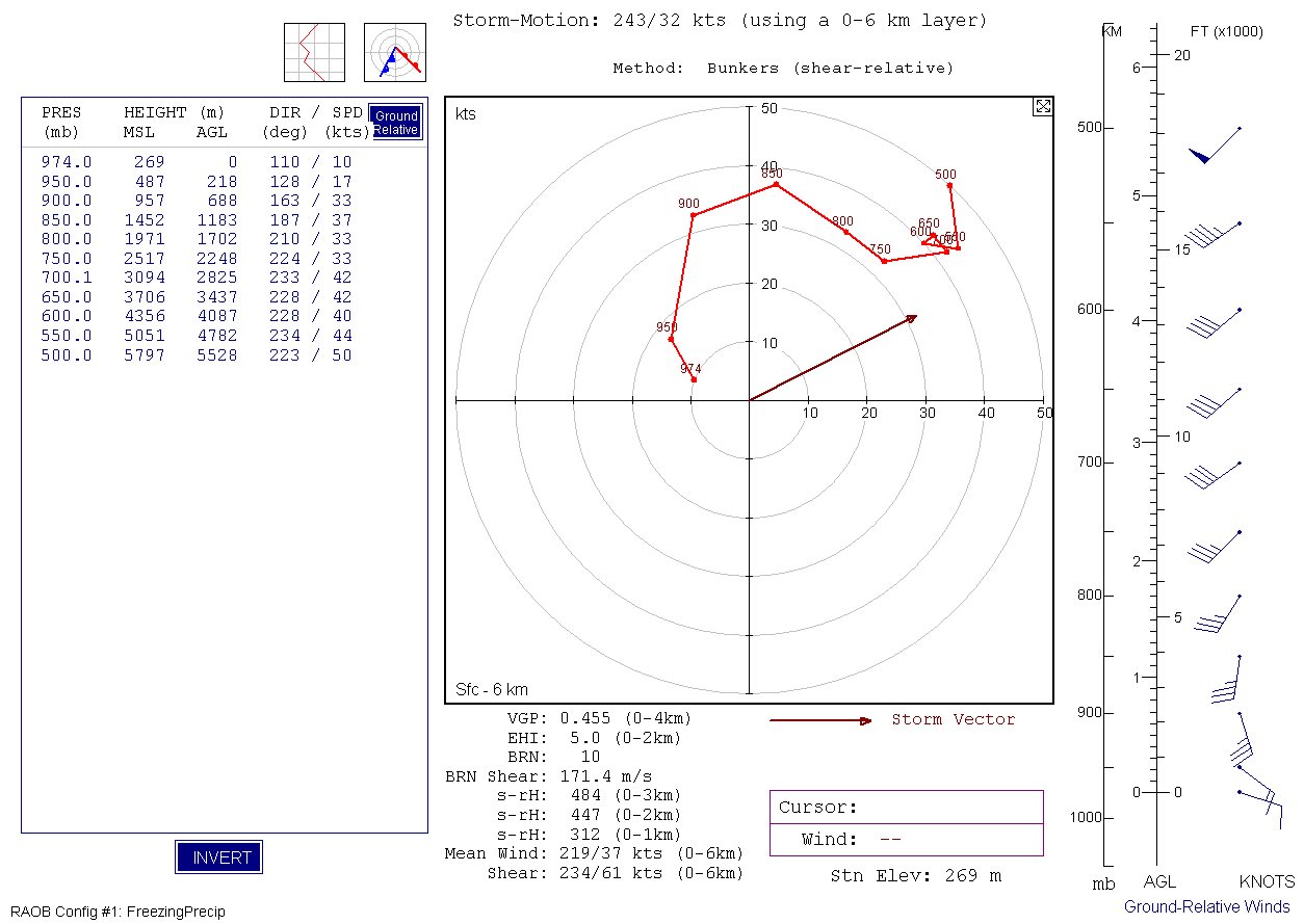
The upper level trough at 500 mb at 6 PM was directly over the Central Plains (Fig. 7), with west-southwest winds at 60 mph measured on the Topeka sounding. Figure 8 shows the hodograph from the 6 PM Topeka sounding, and is another way of looking at how the winds change direction and speed with height. A measure of magnitude of low-level wind shear is something called Storm-Relative Helicity (s-rH on the hodograph display) and the 0-1 km (surface to ~3,500 feet above ground level) s-rH was over 300. This is a very large value and an indication of the potential for strong low-level rotation in any storms that persist. Finally, Figure 9 shows a trace of the atmospheric pressure at the Weather Bureau office at Billard Airport in Topeka as the tornado crossed the airport. Also on that figure is something called a composite chart. This chart was used by severe weather forecasters in the 1960s to delineate areas conducive for severe thunderstorms and tornadoes.
 |
 |
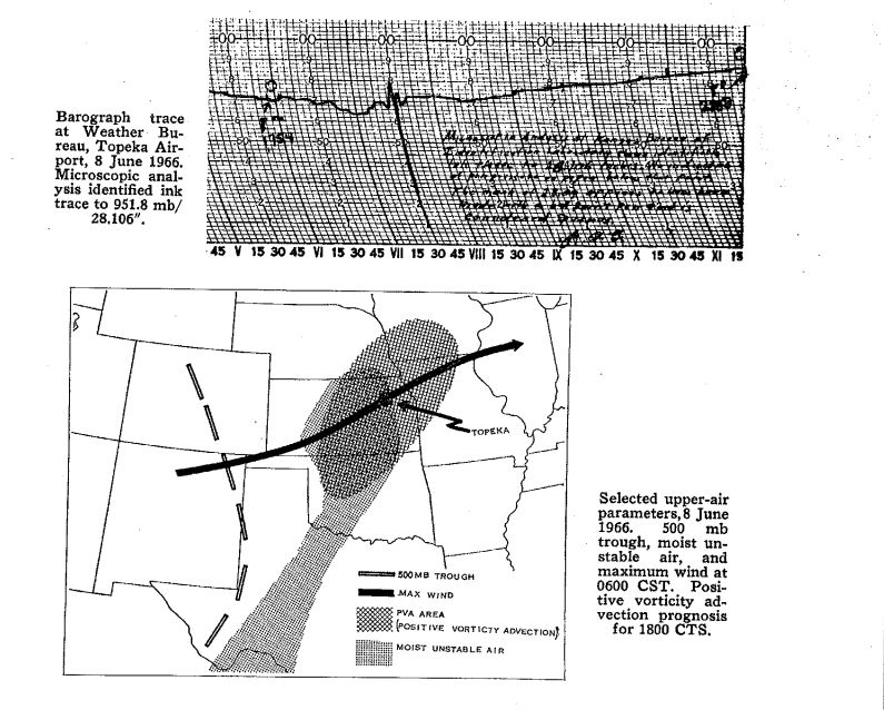 |
| Figure 7: 6 PM June 8th 500mb Chart | Figure 8: 6 PM June 8th Topeka Hodograph | Figure 9: Surface pressure trace (from a barograph) at Topeka Billard Airport as tornado passed nearby, and composite chart of upper air parameters used for tornado forecasting in the 1960s. |
Additional Information
The Forecast
 |
 |
 |
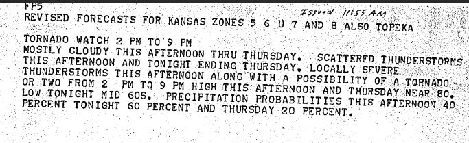 |
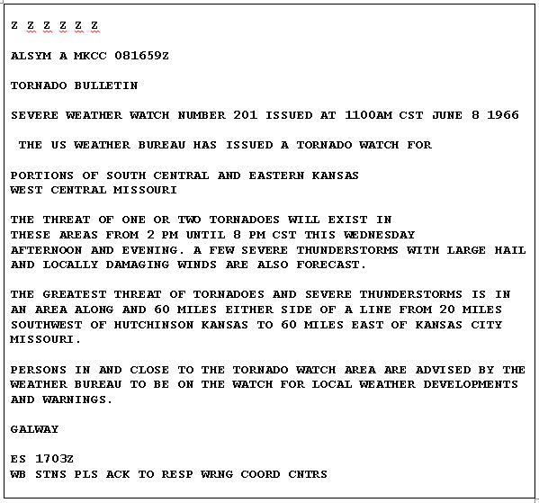
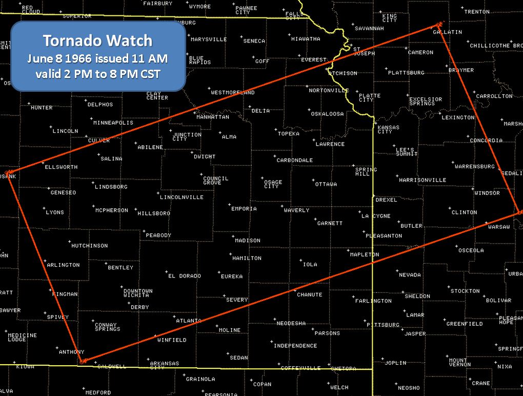
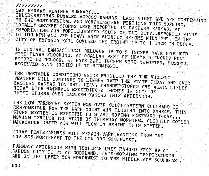
| Tornado Watch issued 11am June 8th 1966 | Tornado Watch Box for June 8th 1966 | 5am Weather Outlook | 1115 am Forecast Update |
.JPG) |
 |
||
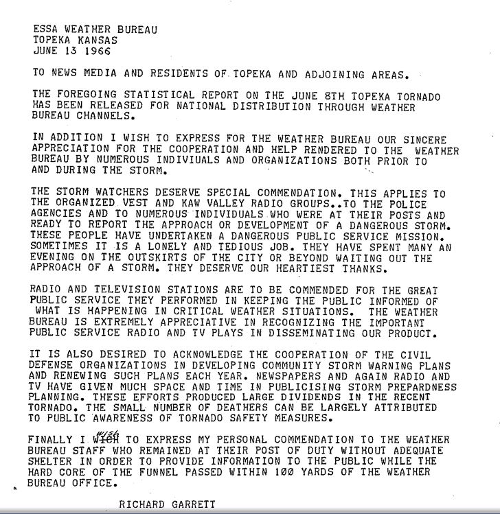
| Initial NWS Topeka Tornado Statement | Statement of Thanks to EM, Spotters and Media partners from Richard Garrett |
Other Sources of Information
 |
Media use of NWS Web News Stories is encouraged! Please acknowledge the NWS as the source of any news information accessed from this site. |
|