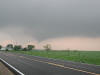
Scattered thunderstorms with severe gusts, hail and a tornado risk are possible near a cold front from the Ohio Valley to the Mid-Atlantic tonight. Tropical Storm Bertha is expected to bring tropical storm conditions to portions of the Gulf Coast from the panhandle of Florida into Louisiana through Wednesday. Read More >
Nine tornadoes struck the Topeka National Weather Service County Warning Area during the late afternoon and evening hours of Thursday May 8th. One supercell produced five tornadoes as it crossed Osage and Douglas counties. The tornado with the longest path with this storm began 13 miles southwest of Lyndon and continued for 25 miles before ending six miles south of Overbrook. The worst damage with this tornado was rated F3 on the Fujita tornado damage scale. It produced extensive damage in Osage county and was 1/4 to 1/2 miles wide through most of its life.
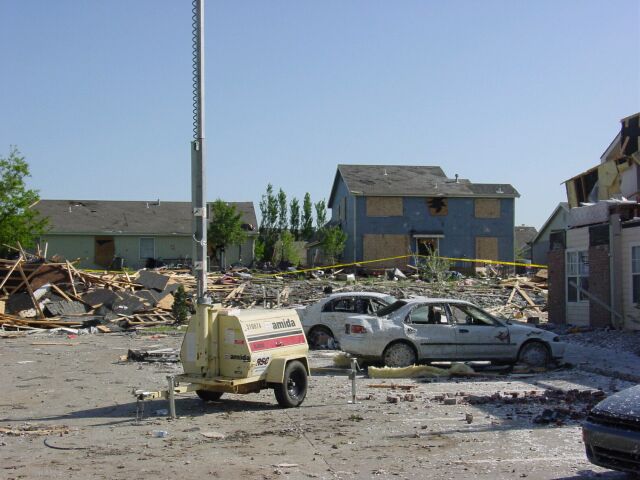
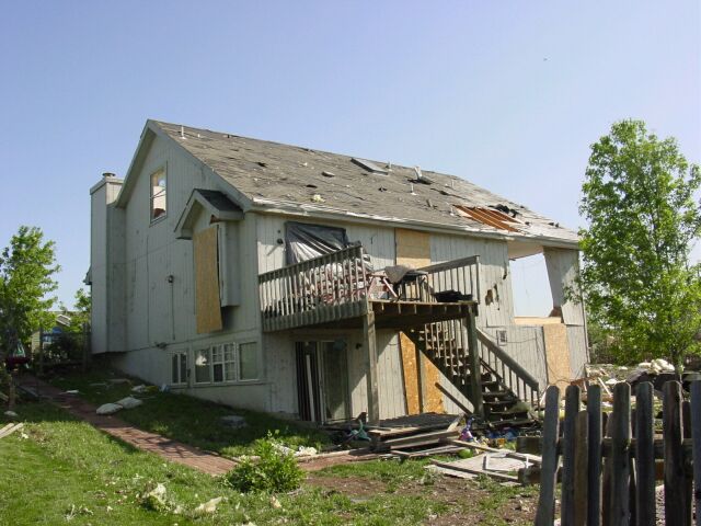
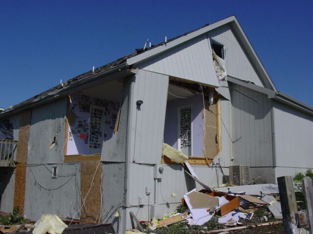
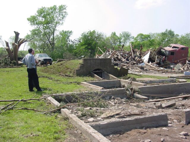
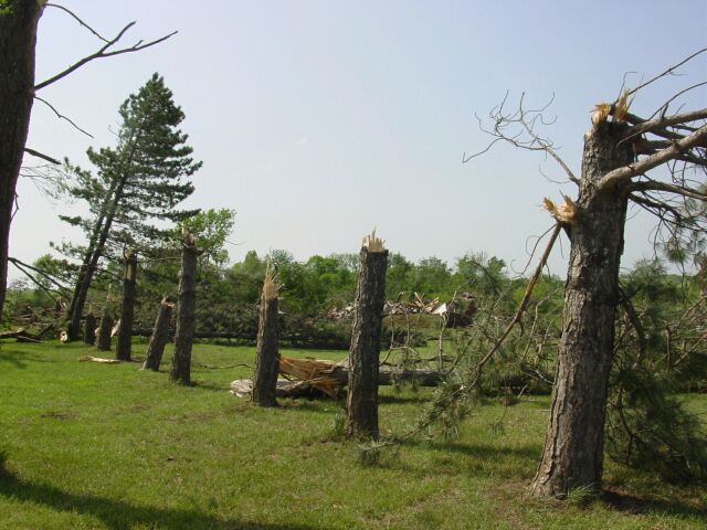
The storm survey has now been completed, see the write up below, and there are some damage photos taken during the storm survey on May 9th at the end of this discussion.
Osage County
|
|
|
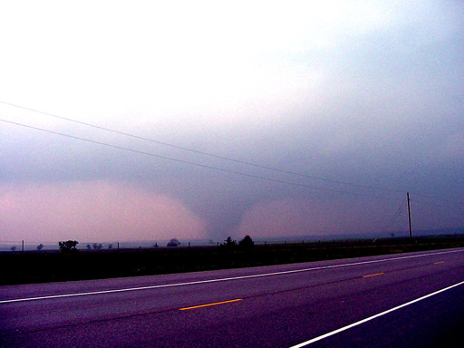
| The Osage county tornado one mile west northwest of Lyndon about 6:51 pm CDT (photo by Adam Burnett). |
The Osage tornado a few minutes later located one mile northwest of Lyndon about 6:54 pm CDT (photo by Adam Burnett).
|
|
Video still from Tim Marshall, taken in the vicinity of Lyndon in Osage County: |
Douglas County
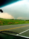
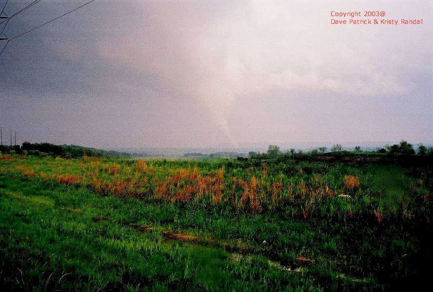
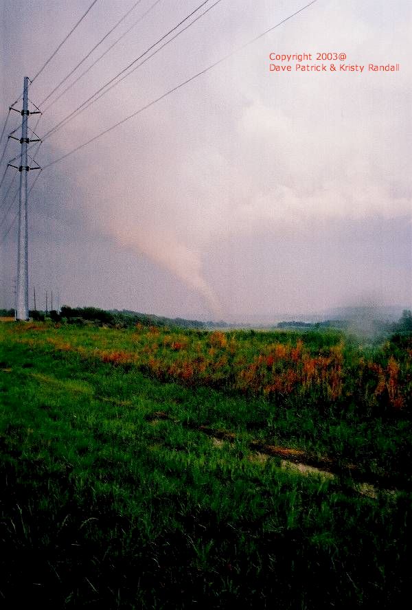
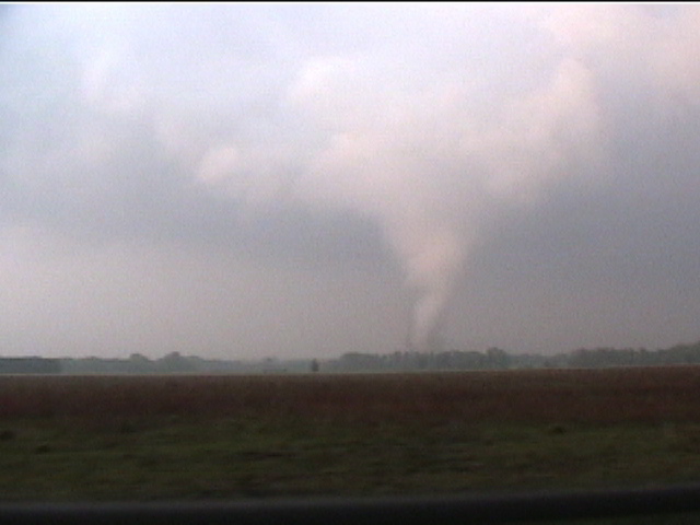
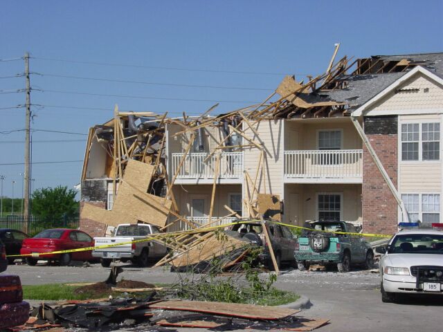
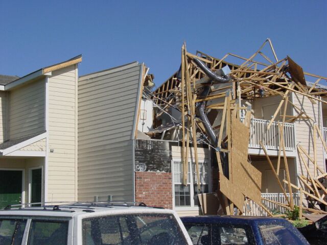
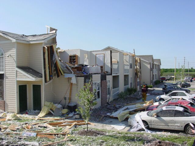
The same storm produced an additional tornado just southwest of Lawrence which moved into the southwestern parts of the city. Dave Patrick sent us a very nice series of pictures taken of the Lawrence tornado:
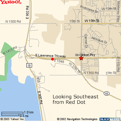
Below is series of images in chronological order from the May 8th F2 tornado that hit southwest Lawrence causing extensive damage to the Aberdeen Apartments and many houses. All photos are courtesy of Dave Patrick. The red dot on the map is where Dave took the pictures from looking southeast through east-southeast as the tornado moves off to the northeast.
|
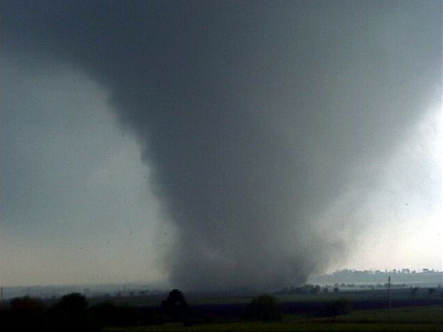
The tornado shortly before it moved into the southwestern sections of the city of Lawrence (photo by Kris Tilford). |
Yet another tornado (brief touchdown) near Globe, SW Douglas County. Not the same tornado that hit Lawrence. Photo Courtesy of Roger Edwards.
|
|
|
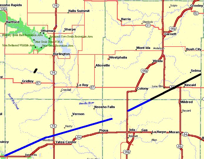
Preliminary tracks of the tornadoes across Osage and Douglas counties. Preliminary damage reports indicate that extensive damage was done to an apartment complex and numerous homes in southwest Lawrence. The tornado also destroyed outbuildings and power poles north and west of Lyndon in Osage county.
|
|
|
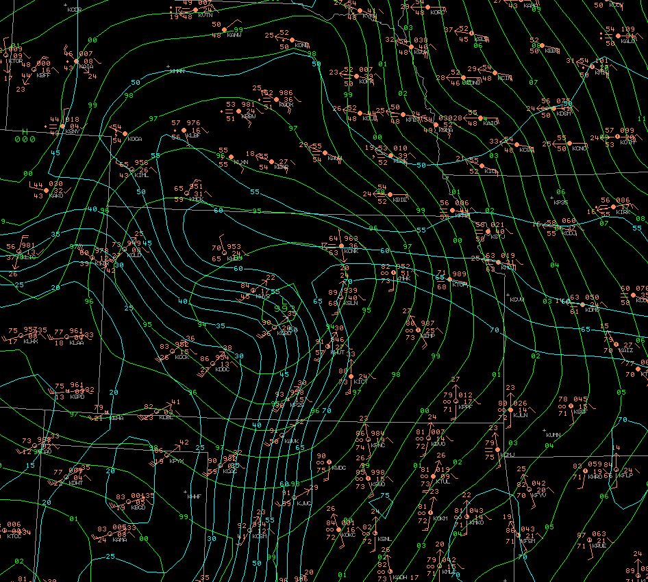
A surface map from 4 pm on Thursday May 8th. The map shows a warm front across Northeast Kansas from Concordia to Topeka. Temperatures south of the warm front jumped dramatically. Between Salina and Concordia (about 50 miles) the temperature varied 25 degrees! A dryline can be seen across Central Kansas, just east of a line from Russell to Medicine Lodge. As the dryline moved through, dew point temperatures fell nearly 40 degrees! The tornadic storms developed along both the dryline and the warm front. |
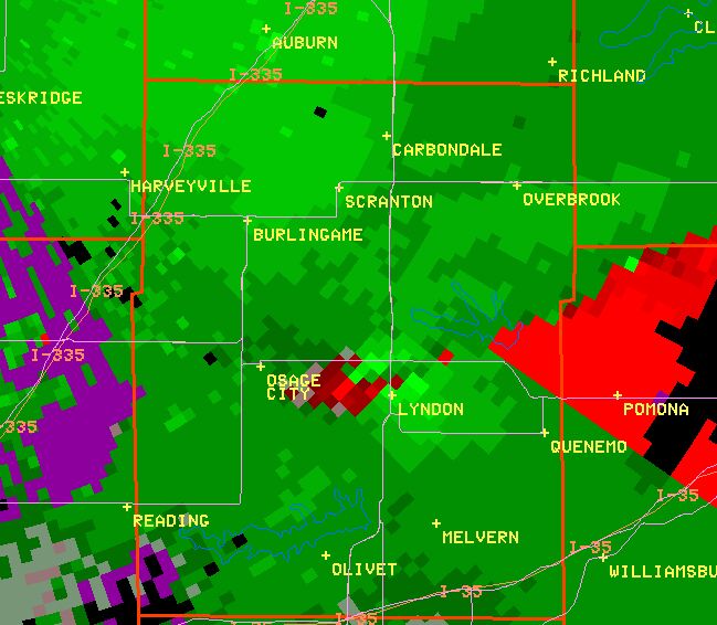
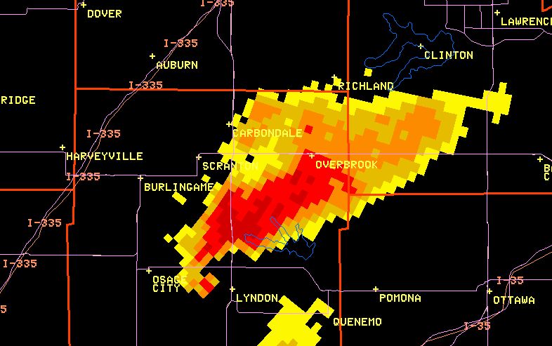
A Storm Relative Velocity image from the Topeka WSR-88D. The image shows the tornadic circulation located about two miles west of Lyndon. The green colors represent air that is moving toward the radar while red colors represent air that is moving away from the radar. The bright green and bright red color pixels located next each other between Lyndon and Osage City indicate air that is spinning rapidly counter-clockwise.
|
|
A reflectivity image from the Topeka WSR-88D. This image shows the tornadic storm with the classic "hook" echo. The tornado is located about 2 miles west of Lyndon at this time. |
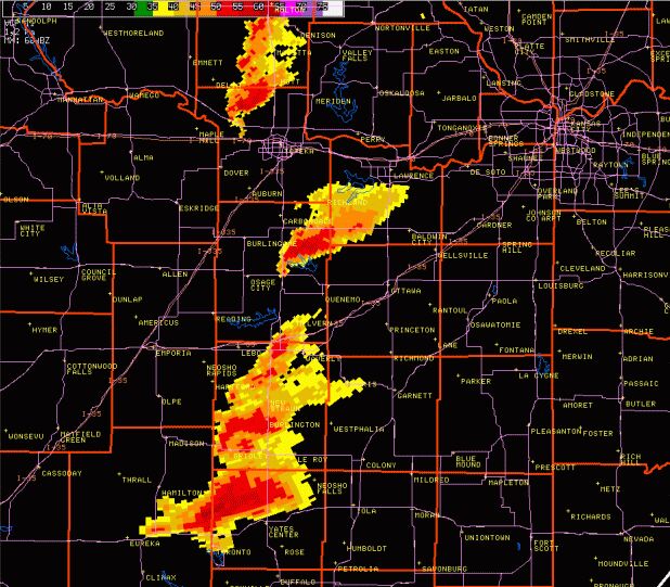
A Topeka WSR-88D image from the evening of May 8th. The image shows four tornadic supercells. |
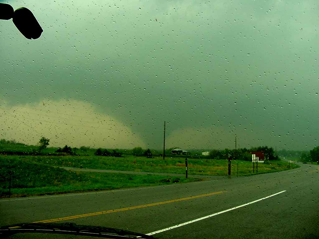
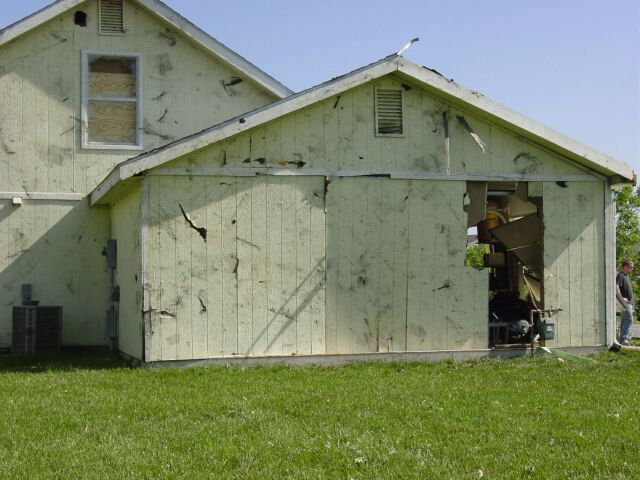
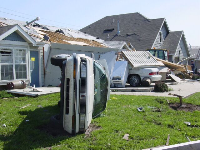
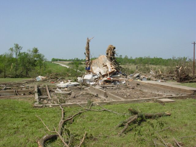
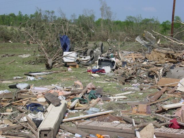
These images were taken in Lawrence and rural Osage county during the storm survey.
 |
 |
 |
 |
 |
 |
 |
 |
 |
 |
 |
 |
PUBLIC INFORMATION STATEMENT...RETRANSMISSION
NATIONAL WEATHER SERVICE TOPEKA KS
224 PM CDT SAT MAY 10 2003

                 ...TORNADO DAMAGE SURVEY COMPLETED...

A DAMAGE SURVEY...BOTH BY GROUND AND AIR...OF THE MAY 8 TORNADOES
WAS CONDUCTED BY TOPEKA NATIONAL WEATHER SERVICE PERSONNEL TODAY.

RESULTS OF THE SURVEY SHOW THAT NINE TORNADOES WERE CONFIRMED ACROSS
THE TOPEKA NWS COUNTY WARNING AREA FOR THURSDAY MAY 8. THERE WERE NO
DEATHS BUT FOUR INJURIES WERE REPORTED. BY COUNTY THE BREAKDOWN
SHOWS ONE TORNADO EACH IN JEFFERSON, CLOUD, POTTAWATOMIE AND
ANDERSON COUNTIES...TWO TORNADOES IN OSAGE COUNTY...AND THREE
TORNADOS IN DOUGLAS COUNTY.

IN ANDERSON COUNTY...AN 800 YARD WIDE F2 TORNADO HAD ABOUT A 15 MILE
PATH FROM 5 MILES SOUTHEAST OF COLONY TO 5 MILES NORTHEAST OF
KINCAID. PRELIMINARY REPORTS SHOW 3 INJURIES, SEVEN HOMES DESTROYED
AND SEVERAL DAMAGED.

IN DOUGLAS COUNTY...3 TORNADOES CONFIRMED...A BRIEF F0 TOUCHDOWN
ABOUT 4 MILES WEST OF GLOBE ALONG HIGHWAY 56. ABOUT 2 MILES
NORTHWEST OF LONE STAR...AN F1 TORNADO PRODUCED A BRIEF DAMAGE
PATH...WHILE AN F2 TORNADO HIT SOUTHWEST LAWRENCE FROM THE 27TH AND
WAKARUSA AREA NORTH ABOUT 3/4 OF A MILE. THE LAWRENCE TORNADO VARIED
IN WIDTH FROM ABOUT 75 YARDS TO ABOUT 250 YARDS WITH ONE INJURY
REPORTED AND 40 STRUCTURES DAMAGED...EXTENSIVE DAMAGE TO 8 APARTMENT
BUILDINGS.

IN CLOUD COUNTY...A BRIEF F0 TORNADO HIT NEAR JAMESTOWN WITH NO
DAMAGE REPORTED.

IN JEFFERSON COUNTY...A BRIEF F0 TORNADO HIT NEAR OZAWKIE WITH NO
REPORTED DAMAGE.

IN POTTAWATOMIE COUNTY...A BRIEF F0 TORNADO HIT 4 MILES SOUTHEAST OF
WAMEGO WITH NO DAMAGE REPORTED.

IN OSAGE COUNTY...TWO TORNADOES CONFIRMED...THE FIRST, AN F1,
BEGAN ABOUT 3 MILES SOUTH OF READING...CONTINUED NORTHEAST 6 MILES.
THE SECOND, AN F3, BEGAN 13 MILES SOUTHWEST OF LYNDON AND
CONTINUED FOR 25 MILES BEFORE ENDING ABOUT 6 MILES SOUTH OF
OVERBROOK. THE TORNADO PRODUCED EXTENSIVE DAMAGE ACROSS IT'S TRACK
WITH A WIDTH THAT VARIED FROM 1/4 TO 1/2 MILE.

GRAPHICAL MAPS, TORNADO PHOTOS, RADAR AND OTHER MAY 8 TORNADO DATA
ARE AVAILABLE ON THE NWS TOPEKA WEB SITE AT: WWW.CRH.NOAA.GOV/TOP

$$
AKULOW
PRELIMINARY LOCAL STORM REPORT
NATIONAL WEATHER SERVICE TOPEKA KS
939 AM CDT FRI MAY 09 2003

TIME(LST)  .....CITY LOCATION..... STATE   ...EVENT/REMARKS...
           ....COUNTY LOCATION....

0240 AM    HOPE                      KS    .75 INCH HAIL
05/08/03   DICKINSON

0249 AM    HERINGTON                 KS    1 INCH HAIL
05/08/03   DICKINSON

0312 AM    SOLOMON                   KS    1 INCH HAIL
05/08/03   DICKINSON

0338 AM    CONCORDIA                 KS    .75 INCH HAIL
05/08/03   CLOUD

0352 AM    BUCKEYE                   KS    1 INCH HAIL
05/08/03   DICKINSON

0400 AM    11 E MANCHESTER           KS    .88 INCH HAIL
05/08/03   DICKINSON

0408 AM    1 NE UPLAND               KS    1.75 INCH HAIL
05/08/03   DICKINSON

0417 AM    MILFORD                   KS    1.75 INCH HAIL
05/08/03   GEARY

0429 AM    KEATS                     KS    60 MPH TSTM GUST
05/08/03   RILEY                           NO DAMAGE.

0600 AM    2 S LE ROY                KS    .75 INCH HAIL
05/08/03   COFFEY

0633 AM    5 SW GARNETT              KS    1.75 INCH HAIL
05/08/03   ANDERSON

0638 AM    1 S WELDA                 KS    1.75 INCH HAIL
05/08/03   ANDERSON

0712 AM    2 S LILLIS                KS    .75 INCH HAIL
05/08/03   MARSHALL

0720 AM    4 SW CENTRALIA            KS    .75 INCH HAIL
05/08/03   NEMAHA

0232 PM    JAMESTOWN                 KS    TORNADO
05/08/03   CLOUD                           SPOTTER REPORT NEAR
                                           JAMESTOWN

0256 PM    2 W TALMO                 KS    1.75 INCH HAIL
05/08/03   REPUBLIC

0309 PM    3 E WAYNE                 KS    1.75 INCH HAIL
05/08/03   REPUBLIC

0350 PM    8 S HADDAM                KS    .88 INCH HAIL
05/08/03   WASHINGTON

0400 PM    3 W LILLIS                KS    TORNADO
05/08/03   MARSHALL                        110 YARD WIDE TORNADO
                                           BRIEFLY TOUCHED DOWN
                                           AND DESTROYED SOME
                                           FENCE AND A SMALL TREE.

0403 PM    1 W MORROWVILLE           KS    .75 INCH HAIL
05/08/03   WASHINGTON

0404 PM    4 S MORROWVILLE           KS    1.75 INCH HAIL
05/08/03   WASHINGTON

0407 PM    2 NNW WASHINGTON          KS    1 INCH HAIL
05/08/03   WASHINGTON

0417 PM    MORROWVILLE               KS    1.75 INCH HAIL
05/08/03   WASHINGTON

0420 PM    HERKIMER                  KS    1 INCH HAIL
05/08/03   MARSHALL

0450 PM    1 W HANOVER               KS    1 INCH HAIL
05/08/03   WASHINGTON

0502 PM    8 W EMPORIA               KS    60 MPH TSTM GUST
05/08/03   LYON

0502 PM    8 W EMPORIA               KS    .75 INCH HAIL
05/08/03   LYON

0505 PM    4 SE WAMEGO               KS    TORNADO
05/08/03   POTTAWATOMIE                    PUBLIC REPORTED

0512 PM    1 W PAXICO                KS    65 MPH TSTM GUST
05/08/03   WABAUNSEE

0531 PM    3 SSE READING             KS    TORNADO
05/08/03   LYON

0536 PM    6 S OSAGE CITY            KS    TORNADO
05/08/03   OSAGE                           SPOTTER REPORTED

0545 PM    1 W LYNDON                KS    TORNADO
05/08/03   OSAGE                           LARGE TORNADO REPORTED
                                           BY SPOTTERS

0605 PM    POMONA RES                KS    TORNADO
05/08/03   OSAGE                           HIGHWAY PATROL SPOTTED
                                           NEAR POMONA LAKE

0610 PM    5 SW BURLINGTON           KS    TORNADO
05/08/03   COFFEY                          REPORTED BY EM

0617 PM    GLOBE                     KS    TORNADO
05/08/03   DOUGLAS                         REPORTED BY EM

0618 PM    5 SW PLEASANT GROVE       KS    TORNADO
05/08/03   DOUGLAS

0624 PM    OZAWKIE                   KS    TORNADO
05/08/03   JEFFERSON                       NEAR OZAWKIE

0626 PM    2 W LONE STAR             KS    TORNADO
05/08/03   DOUGLAS

0635 PM    2 S CLINTON               KS    TORNADO
05/08/03   DOUGLAS                         REPORTED BY SHERIFF

0637 PM    NORTONVILLE               KS    1 INCH HAIL
05/08/03   JEFFERSON

0638 PM    LAWRENCE                  KS    TORNADO
05/08/03   DOUGLAS                         JUST WEST OF 33RD AND
                                           IOWA.

0640 PM    LONE ELM                  KS    TORNADO
05/08/03   ANDERSON                        REPORTED BY DISPATCH

0648 PM    KINCAID                   KS    TORNADO
05/08/03   ANDERSON                        HOUSE DESTROYED NUST
                                           NORTH OF KINCAID