
Dangerous and extreme heat will remain across portions of the southern U.S. this week. A heat wave over the Southwest U.S. will intensify this week, peaking and expanding into the Intermountain West and northern High Plains this weekend. Multiple rounds of thunderstorms will produce heavy to excessive rainfall with significant flash flooding across portions of southern New England today. Read More >
Topeka, KS
Weather Forecast Office
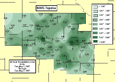
The same upper level low pressure system that helped to trigger shower and thunderstorm development across the Central Plains Friday night produced widespread heavy rain across the region Saturday and Sunday. This caused extensive river flooding across northeastern Kansas, and ponding of water over roadways and low lying areas across the region. Numerous reports of flooded roadways and homes were received.
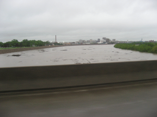 |
| Kansas River from Sardou Bridge in Topeka morning of May 7. |
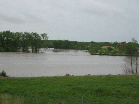 |
| Flooding east of Oakland Expressway to south of Kansas River, morning of May 7. |
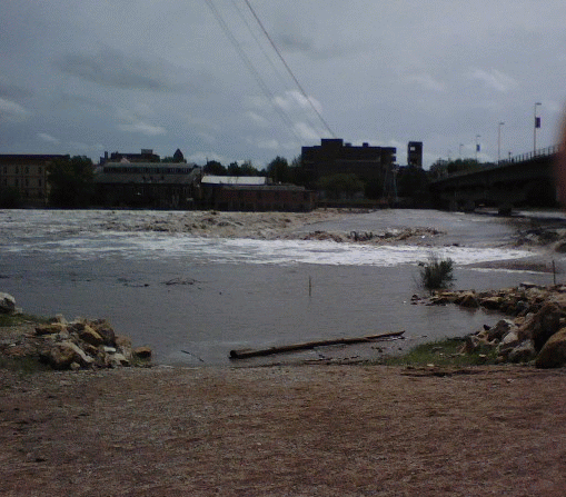 |
| The Kansas River at Lawrence, Monday afternoon, May 7. |
Cooperative Observers, Automated Surface Observation Stations, and Storm Spotters all reported rainfall amounts during the period to the National Weather Service at Topeka. Several Cooperative Observers also record and report river levels for local creeks and streams.
The National Weather Service Flood Safety Page can be found HERE.
US Dept of Commerce
National Oceanic and Atmospheric Administration
National Weather Service
Topeka, KS
1116 NE Strait Avenue
Topeka, KS 66616-1667
785-234-2592
Comments? Questions? Please Contact Us.

