Tropical Storm Bertha could bring tropical storm conditions to portions of the Florida Panhandle and Alabama coast through Wednesday, where a Tropical Storm Watch and Storm Surge Watch is in effect. Numerous severe thunderstorms with heavy rainfall are expected from the Ohio Valley into the Mid-Atlantic and Northeast Tuesday. Read More >
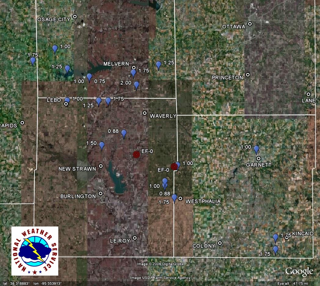
An upper level storm system pushed through the northern plains states during the afternoon hours of May 13th, and dragged a cold front across the region. The cold front initiated quick, robust thunderstorm development across east central Kansas. One supercell in particular tracked across portions of Osage and Coffey Counties and was a prolific hail producer. Stones up to 2.00" in diameter were reported to the National Weather Service in Topeka. This storm also produced a weak tornado to the northeast of Burlington--which was observed by the KMBC helicopter. The tornado touched down in an open field, caused no damage and was brief, so no survey will be conducted by the National Weather Service in Topeka. The storm produced a second tornado eight minutes later. It also touched down in an open field and caused no damage.
Tornado Summary
Tornado 1
Date: May 13, 2009 County: Coffey
Beginning Time: 5:52pm CDT Ending Time: 5:52pm CDT (brief)
Beginning Location: 9 NE Burlington Ending Location: 9 NE Burlington
Duration: <1 Minute
Path Length: <1 Mile
Maximum Width: 25 Yards
Deaths: 0
Injuries: 0
EF-Scale Rating: EF-0
Narrative: A brief tornado touched down in an open field to the northeast of Burlington, associated with a supercell thunderstorm that moved through east central Kansas the evening of May 13, 2009. No damage was reported.
Tornado 2
Date: May 13, 2009 County: Coffey
Beginning Time: 6:00pm CDT Ending Time: 6:00pm CDT (brief)
Beginning Location: 6 SW Harris Ending Location: 6 SW Harris
Duration: <1 Minute
Path Length: <1 Mile
Maximum Width: 25 Yards
Deaths: 0
Injuries: 0
EF-Scale Rating: EF-0
Narrative: A brief tornado touched down in an open field near the Coffey/Anderson County line, associated with the same supercell thunderstorm that produced tornado 1. No damage was reported.
Event Depiction
Hail Events depicted by blue placemark (labeled by magnitude)
Tornado Events depicted by red placemark (labeled by rating)
|
|
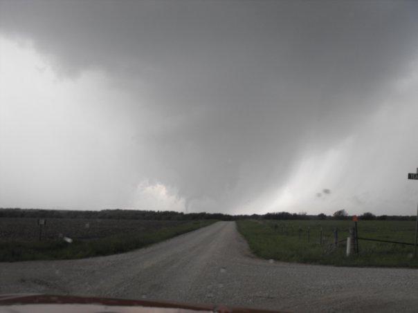
Below is a photograph of a funnel cloud (to the left of the dirt roadway), potentially a tornado at the time (ground somwehat obscured by trees) taken from the intersection of 18th Road and Yearling Road looking west down Yearling Road into Coffey County. Photo by J.D. Mersmen, used with permission.
 |
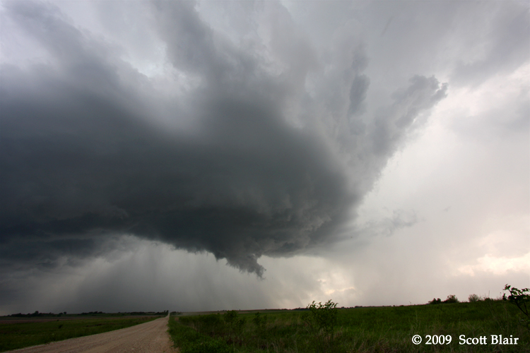
Below is a photograph of the storm, a few minutes after tornado 2 touched down, taken by Scott Blair and used with permission. Depicted is a view of the storm's updraft with weak rotation 4 miles southeast of Westphalia, KS.
 |