A heat wave over the Southwest will intensify this week, peaking and expanding into the Intermountain West and northern High Plains this weekend. Critical to extremely critical fire weather conditions are forecast from the Northwest and the northern Great Basin this weekend. Particularly Dangerous Situation Red Flag Warnings have been issued. Read More >
|
|
||||||||
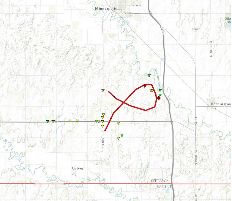
May 28th Ottawa County TornadoClick here to download the KML file
|
||||||||
|
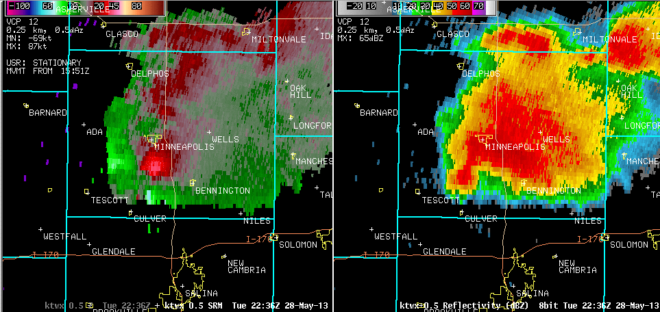
A tornado touched down around 545 pm CDT in southern Ottawa county and proceeded to become very large as it move slowly southeastward to a point just west of highway 81. The tornado then turned north and eventually moved back to the southwest toward the intersection of county road 106 and highway 18. The tornado was on the ground for around one hour and at times was between one quarter and one half mile wide. No serious injuries or fatalities occurred however over 100 head of cattle were lost. Damage to structures within the path yielded EF3 damage however supplemental data provided by mobile doppler radar sampled winds suggest that this could have been a violent tornado. As a result, the preliminary rating for this is a EF3 tornado however we will note that supplemental radar wind data suggest that it could have been stronger. This path is re-constructed off of radar, reports and known damage where evident and is not meant to be precise. |
||||||||
 |
||||||||
|