Dangerous heat will expand from the Gulf Coast into the Southern Plains and Desert Southwest through week's end. Additional extreme heat impacting the Pacific Northwest will shift to the northern Plains by the weekend. Tropical Storm Bertha is expected to continue to impact portions of the northern Gulf Coast from the western Florida Panhandle to southeastern Louisiana through tonight. Read More >
Topeka, KS
Weather Forecast Office
|
|
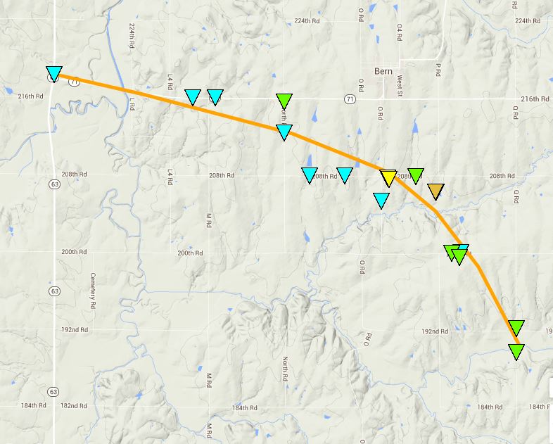
June 3, 2014 Bern TornadoClick here to download the KML file
|
.NEMAHA COUNTY EF3 TORNADO... RATING: EF-3 ESTIMATED PEAK WIND: 140 MPH PATH LENGTH /STATUTE/: 7.2 MILES PATH WIDTH /MAXIMUM/: 1000 YARDS FATALITIES: 0 INJURIES: 2 START DATE: 6/3/2014 START TIME: 1030 PM CDT START LOCATION: APPROX. 4 MILES WEST OF BERN END DATE: 6/3/2014 END TIME: 1043 PM CDT END LOCATION: APPROX. 3 MILES SOUTH OF BERN
|
US Dept of Commerce
National Oceanic and Atmospheric Administration
National Weather Service
Topeka, KS
1116 NE Strait Avenue
Topeka, KS 66616-1667
785-234-2592
Comments? Questions? Please Contact Us.