
Dangerous heat will expand from the Gulf Coast into the Southern Plains and Desert Southwest through week's end. Additional extreme heat impacting the Pacific Northwest will shift to the northern Plains by the weekend. Tropical Storm Bertha is expected to continue to impact portions of the northern Gulf Coast from the western Florida Panhandle to southeastern Louisiana through tonight. Read More >
Topeka, KS
Weather Forecast Office
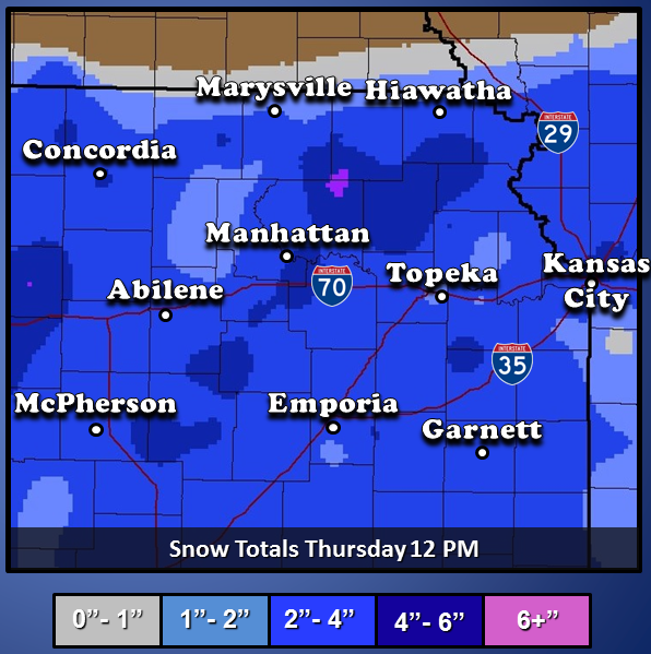
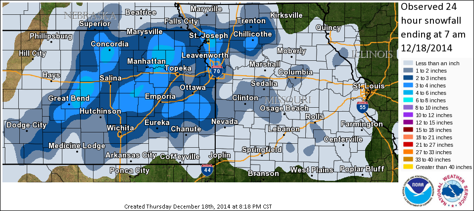
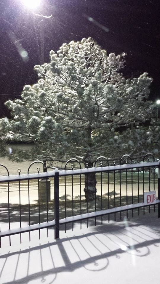
On December 17, 2014 a storm system moved across the central plains. With the cold air already in place most of this event was in the form of snow. There was a brief period of sleet at the onset of precipitation. The snow and sleet began in the evening hours of the 17th in central KS and then spread northeast. The heaviest snow occurred between 9 pm and 4am with widespread 2-3" and isolated areas that received 4-6".
 |
 |
 |
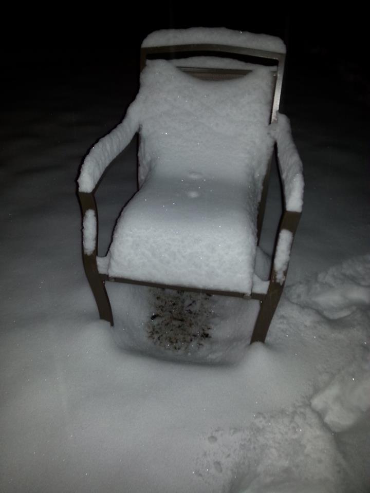 |
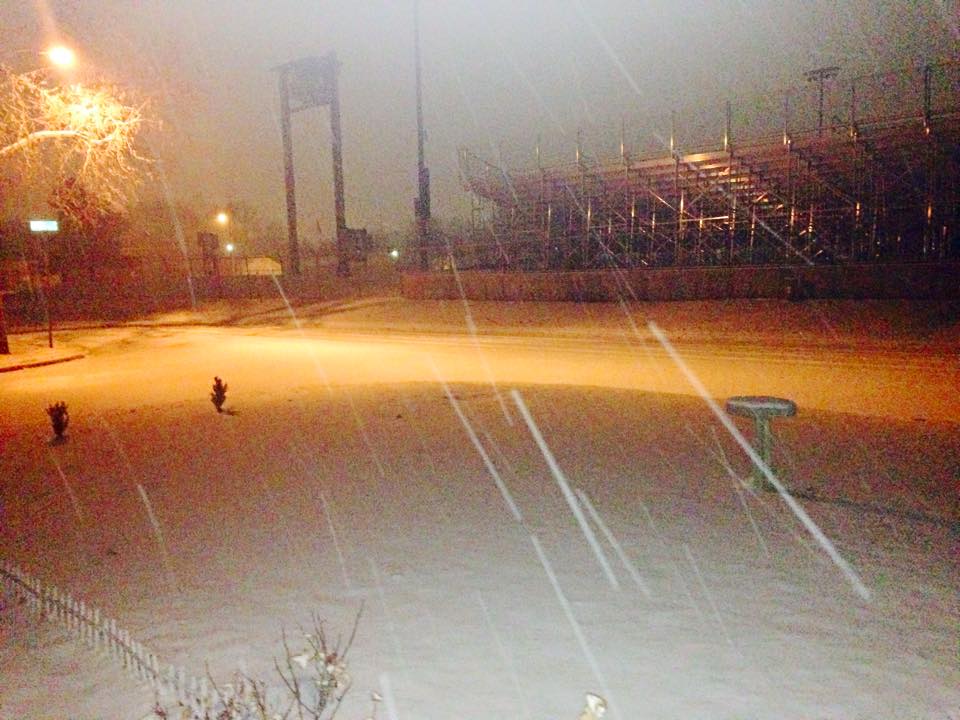
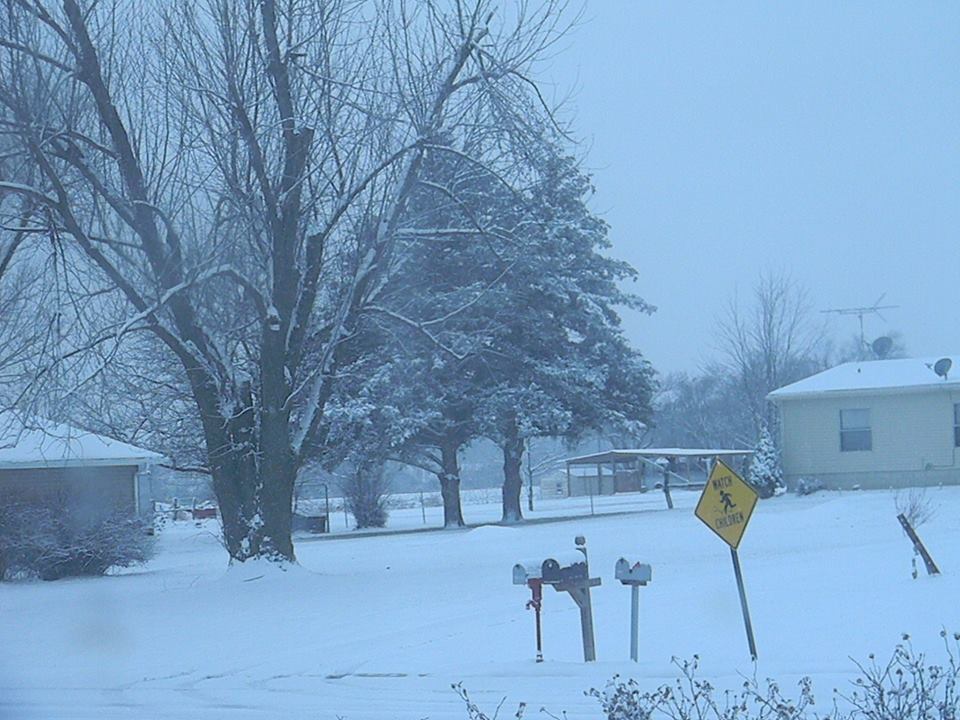
(Photos above courtesy of WIBW)
US Dept of Commerce
National Oceanic and Atmospheric Administration
National Weather Service
Topeka, KS
1116 NE Strait Avenue
Topeka, KS 66616-1667
785-234-2592
Comments? Questions? Please Contact Us.

