
Dangerous heat will expand from the Gulf Coast into the Southern Plains and Desert Southwest through week's end. Additional extreme heat impacting the Pacific Northwest will shift to the northern Plains by the weekend. Tropical Storm Bertha is expected to continue to impact portions of the northern Gulf Coast from the western Florida Panhandle to southeastern Louisiana through tonight. Read More >
Topeka, KS
Weather Forecast Office
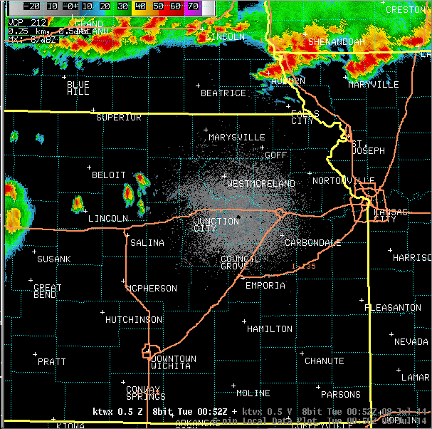
Radar imagery during the severe weather:
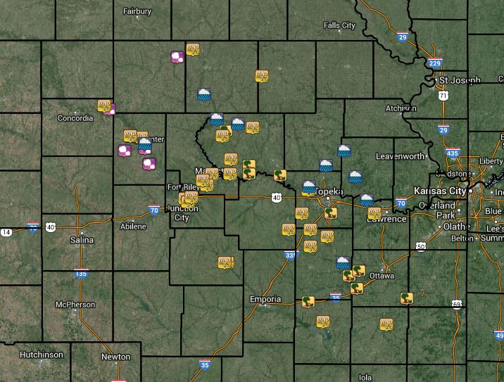
Map of severe weather reports - click for interactive view:
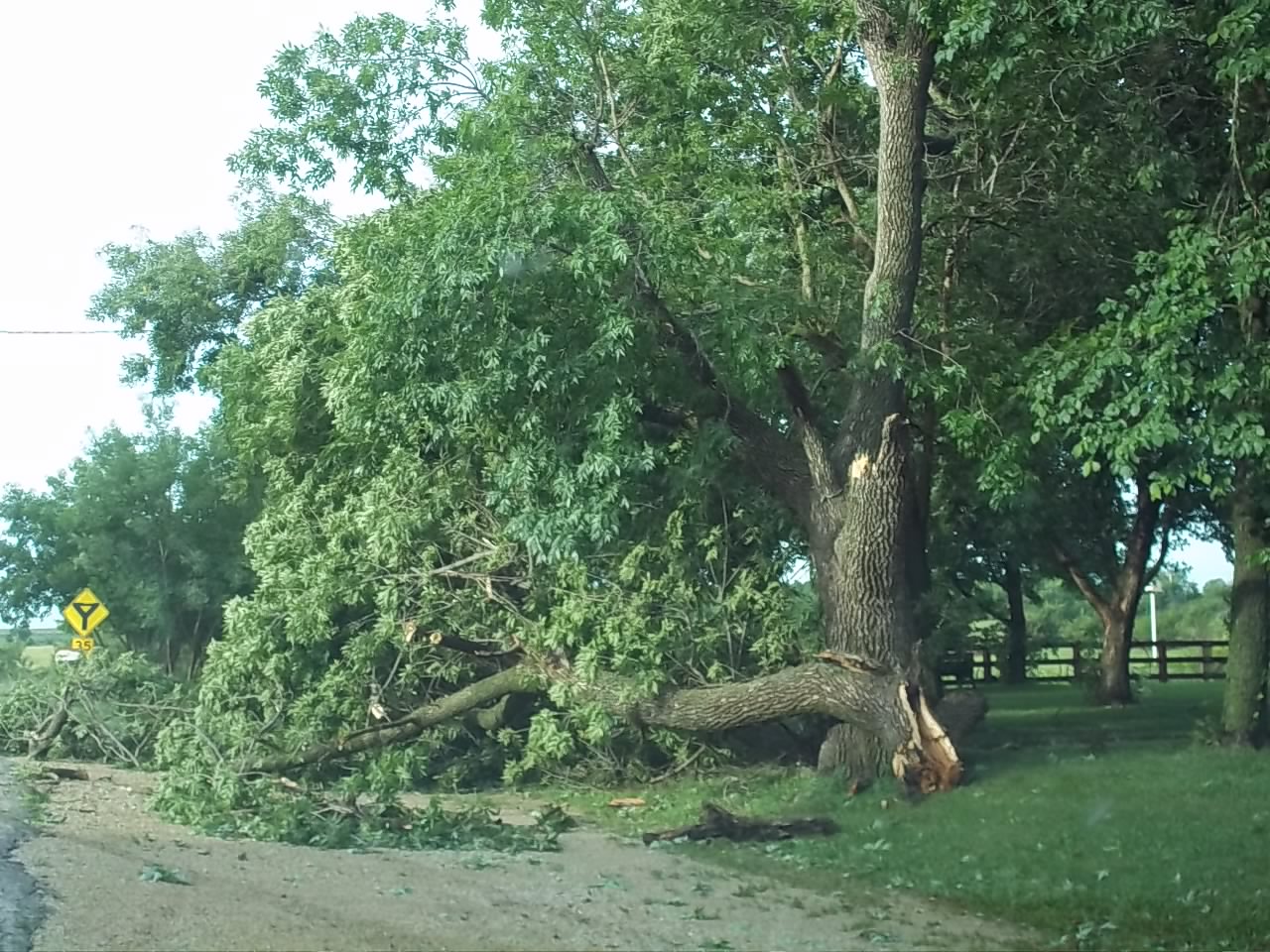
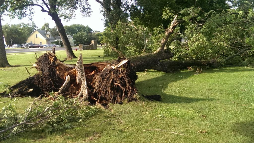
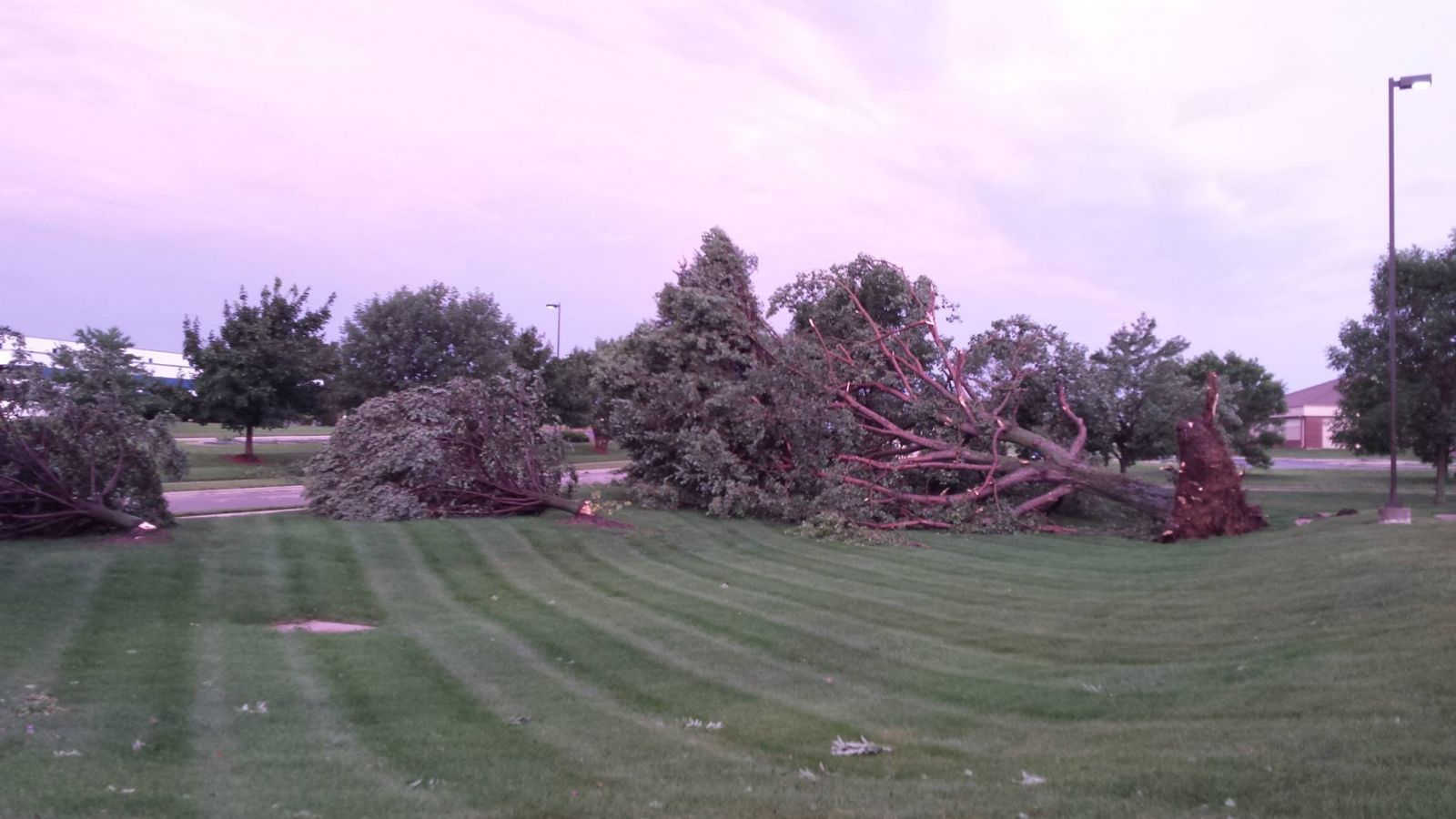
Images of wind damage:
In Fostoria, via Chris Trudo:
In Lyndon, via Douglas Watson:
Wakarusa Drive in Lawrence, via Arin Peters:
US Dept of Commerce
National Oceanic and Atmospheric Administration
National Weather Service
Topeka, KS
1116 NE Strait Avenue
Topeka, KS 66616-1667
785-234-2592
Comments? Questions? Please Contact Us.

