National Weather Service United States Department of Commerce

Severe Thunderstorms in the Ohio and Tennessee Valleys; Flash Flooding Possible in the Southwest

Scattered damaging winds, isolated severe hail, and a brief tornado or two are possible from the Upper Ohio to Tennessee Valleys during the late afternoon and evening. Across the Southwest, monsoonal moisture will continue to bring heavy rain and a threat for isolated to scattered flash flooding through Saturday. Read More >

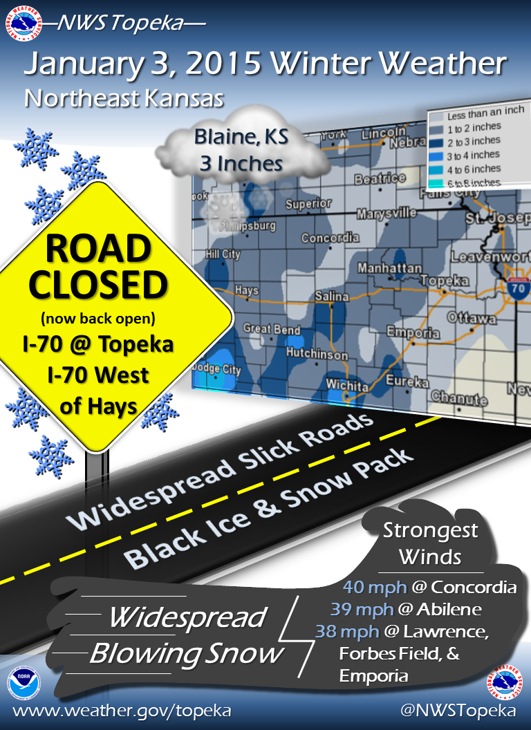
Storm Summary Graphic Snow Reports
Blaine, KS  3.0"
Hiawatha, KS  2.0"
Abilene, KS  2.0"
Westmoreland, KS  1.5"
St. George, KS  1.5"
1 W Concordia, KS  1.3"
Beatty, KS  1.0"
Billard Airport Topeka  1.0"
Fort Riley Airfield  1.0"
Miltonvale, KS  0.5"
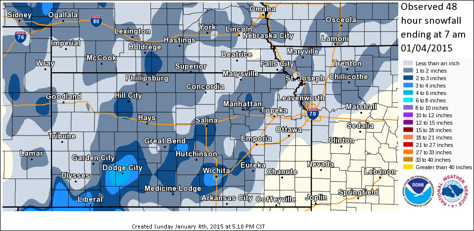
Snow Total Map Wind & Wind Chills
 
Coldest Wind Chills
Washington  -20 deg
Marysville  -18 deg
1 ESE Sabetha  -17 deg
Concordia  -17 deg
Strongest Wind Gusts
Concordia  40 mph
Abilene  39 mph
Lawrence  38 mph
Forbes Field  38 mph
Emporia  38 mph