
Strong to severe thunderstorms will continue this evening from eastern Texas into the lower Mississippi and Tennessee Valleys/southern Appalachians. The strongest storms could produce a few strong tornadoes (EF2+), damaging wind gusts, large hail, and locally heavy to excessive rainfall which may results in flash and urban flooding. Read More >
Overview
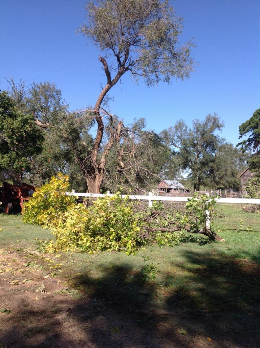
On October 4th 2016 a brief tornado went through portions of rural Clay county near Green causing damage to a home and several trees. In addition, strong winds up to 65 mph impacted southwest Shawnee county.Tornadoes:
|
Tornado -Near Green
Track Map 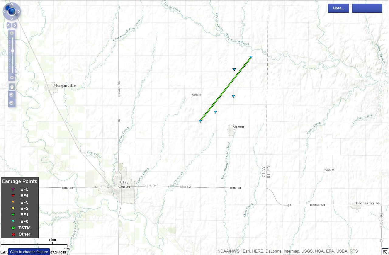 
Downloadable KMZ File |
||||||||||||||||
The Enhanced Fujita (EF) Scale classifies tornadoes into the following categories:
| EF0 Weak 65-85 mph |
EF1 Moderate 86-110 mph |
EF2 Significant 111-135 mph |
EF3 Severe 136-165 mph |
EF4 Extreme 166-200 mph |
EF5 Catastrophic 200+ mph |
 |
|||||
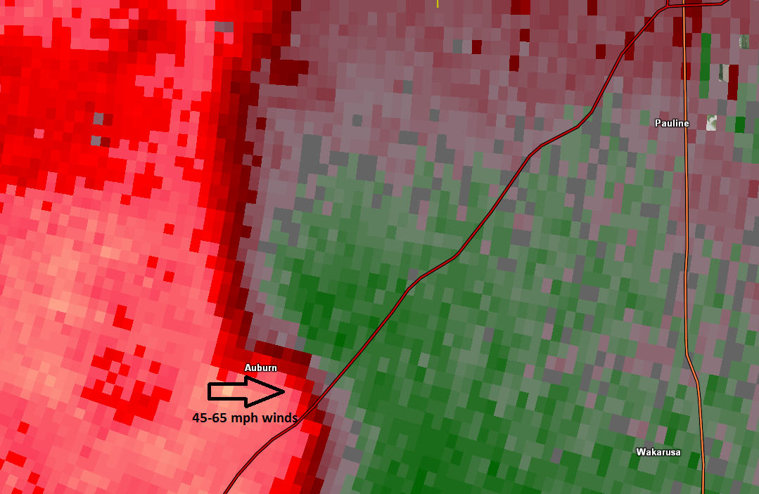
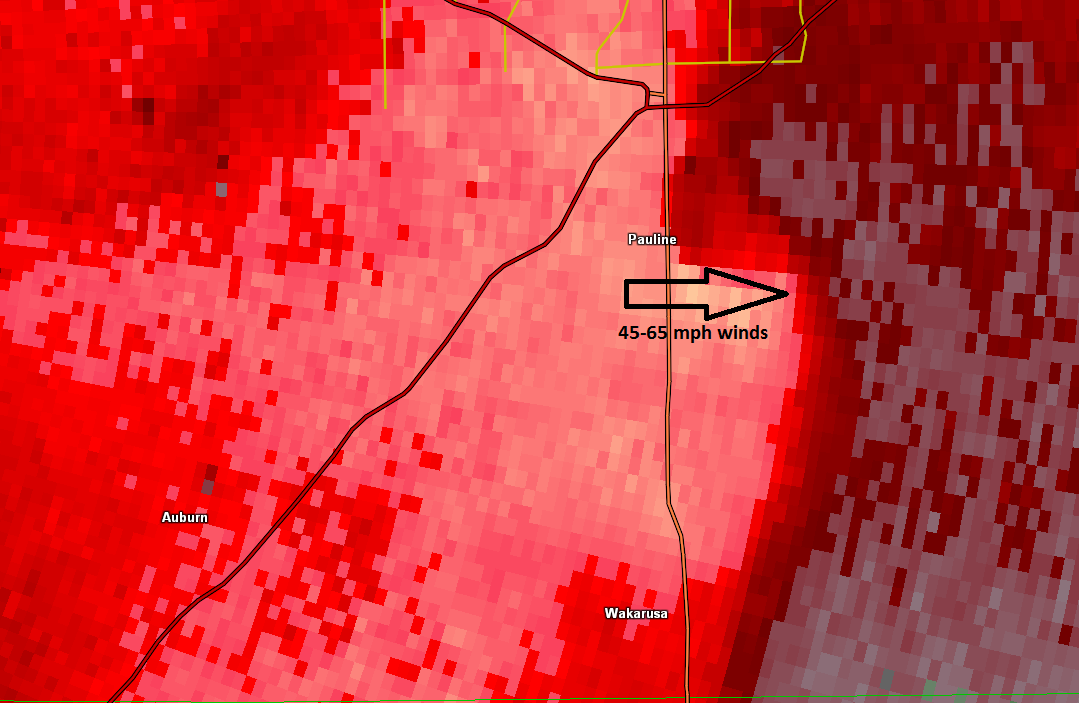
Winds in Shawnee County:
Later in the evening, a severe thunderstorm produced gusty winds from 45 to 65 mph. Tree damage was reported across portions of southwest Shawnee county.
 |
 |
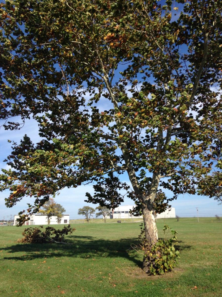 |
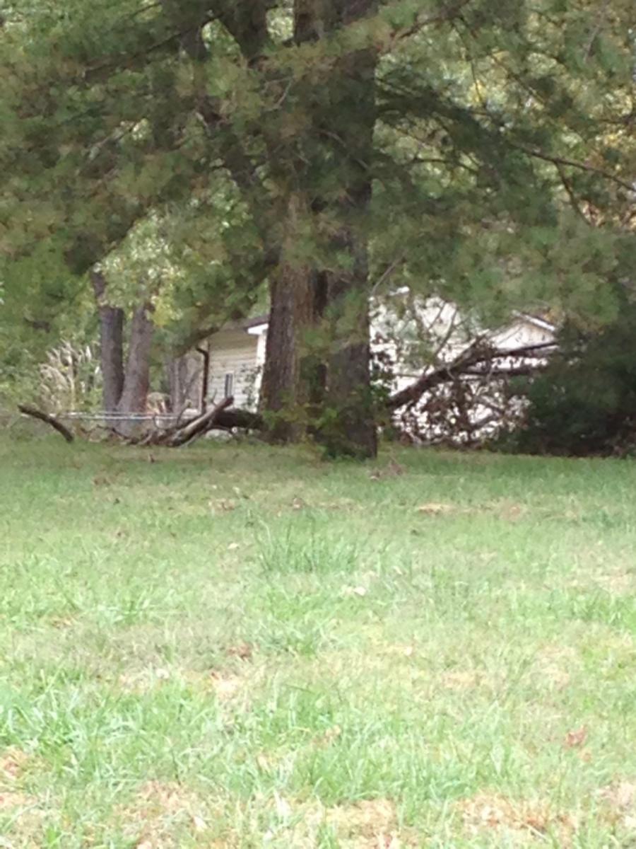
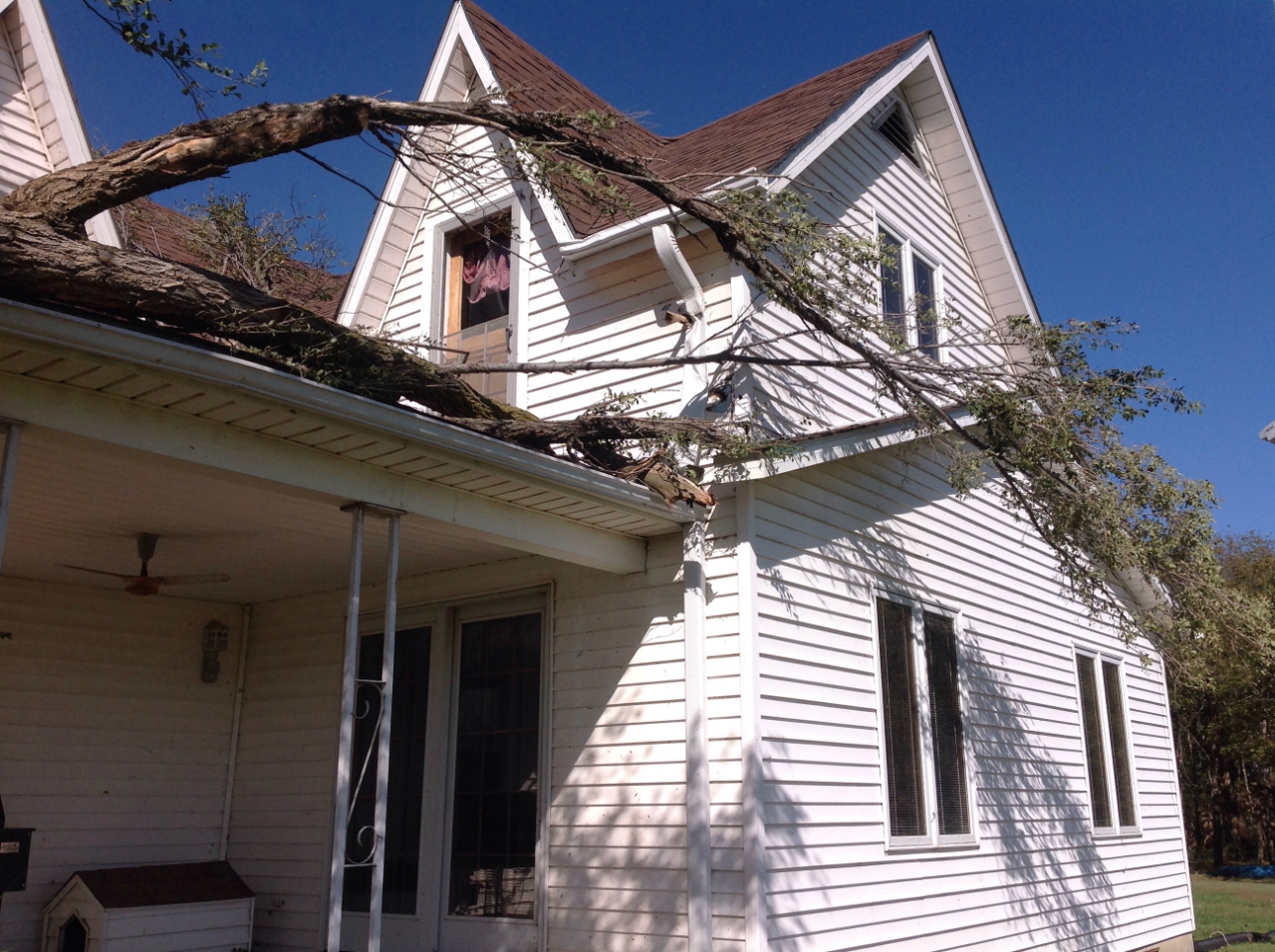
| Tree Damage | Tree Damage | Tree Damage |
Photos of Tornado Damage:
 |
 |
 |
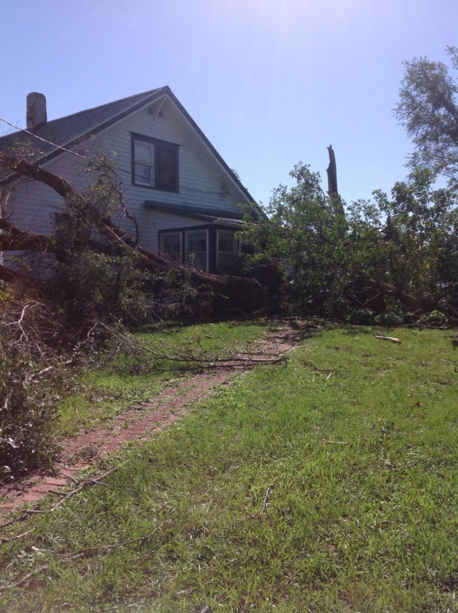 |
| Tree and House damage (NWS Survey) |
Tree and House damage (NWS Survey) |
Tree Damage (NWS Survey) |
Tree Damage (NWS Survey) |
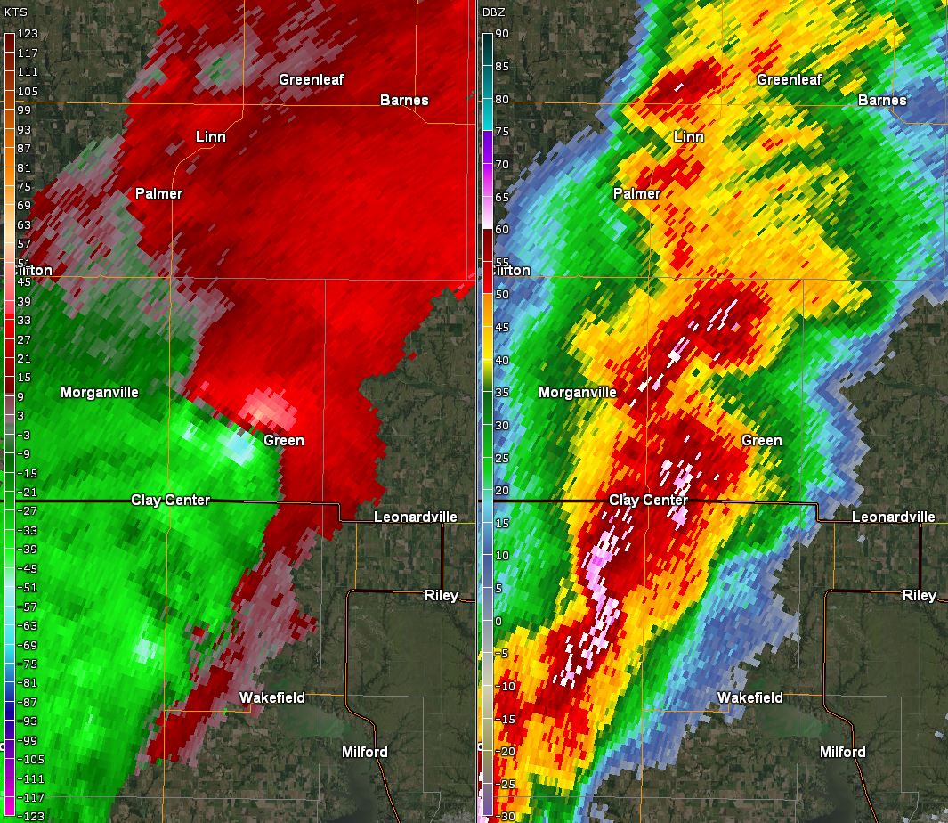
Radar:
 |
 |
 |
 |
| Radar images of tornado Velocity (left) Reflectivity( right) |
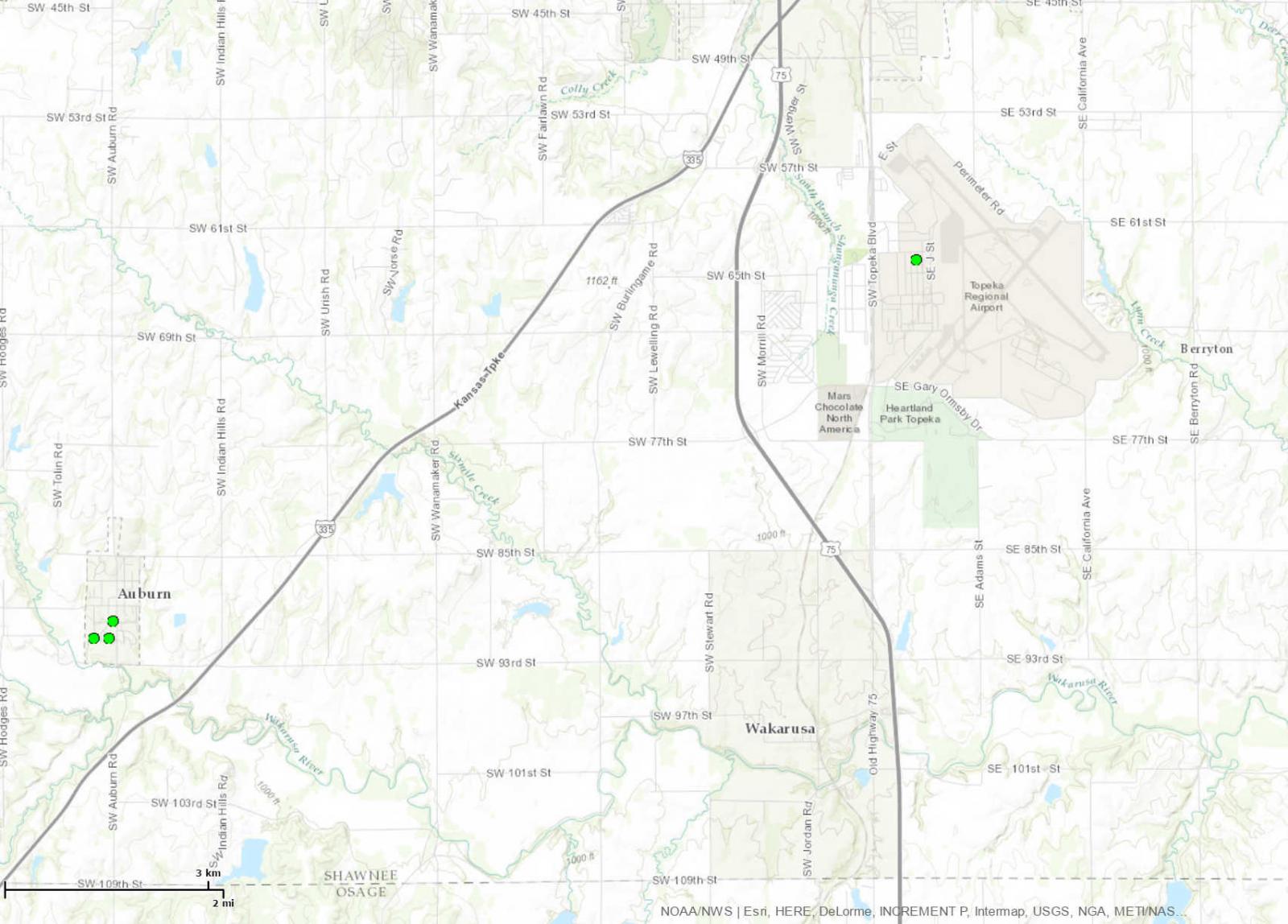
Bright red indicates strong winds estimated at 45-65 mph | Bright red indicates strong winds estimated at 45-65 mph | Tree Damage Points on Map |
 |
Media use of NWS Web News Stories is encouraged! Please acknowledge the NWS as the source of any news information accessed from this site. |
|

