Overview
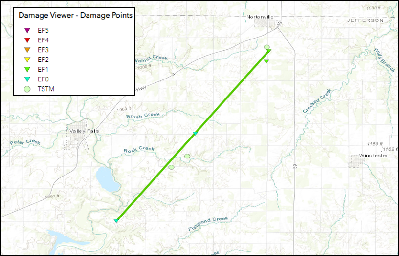
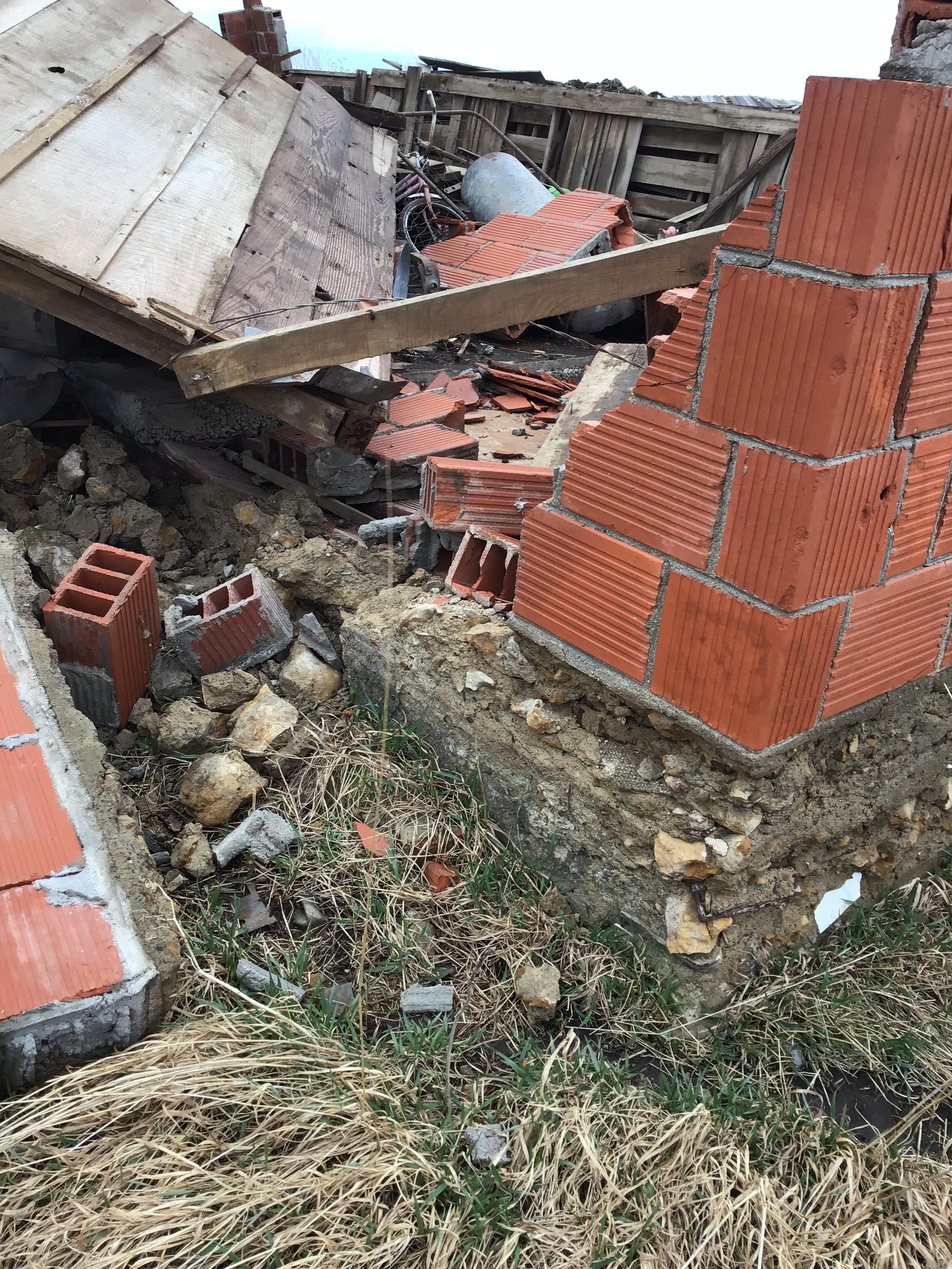
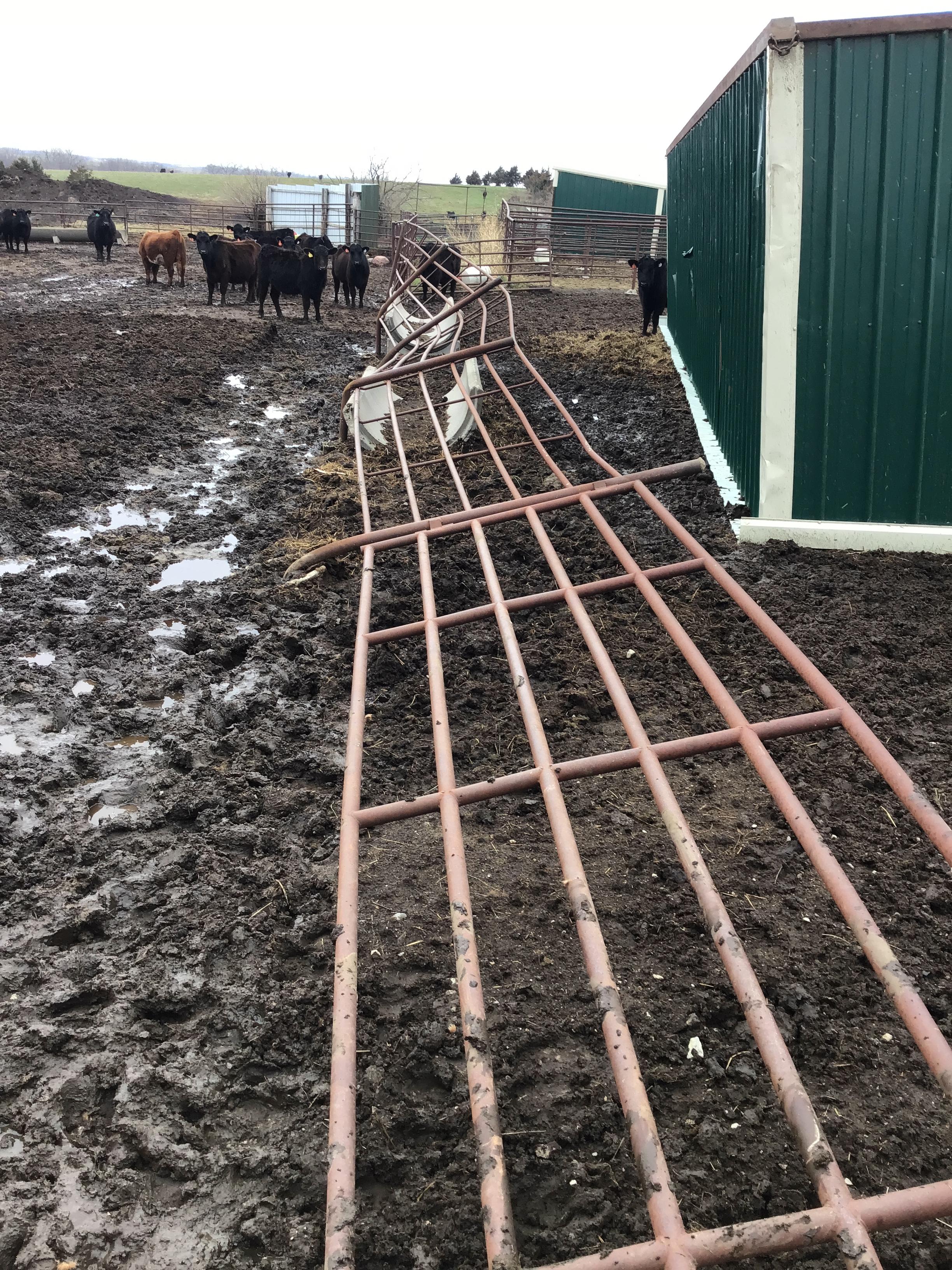
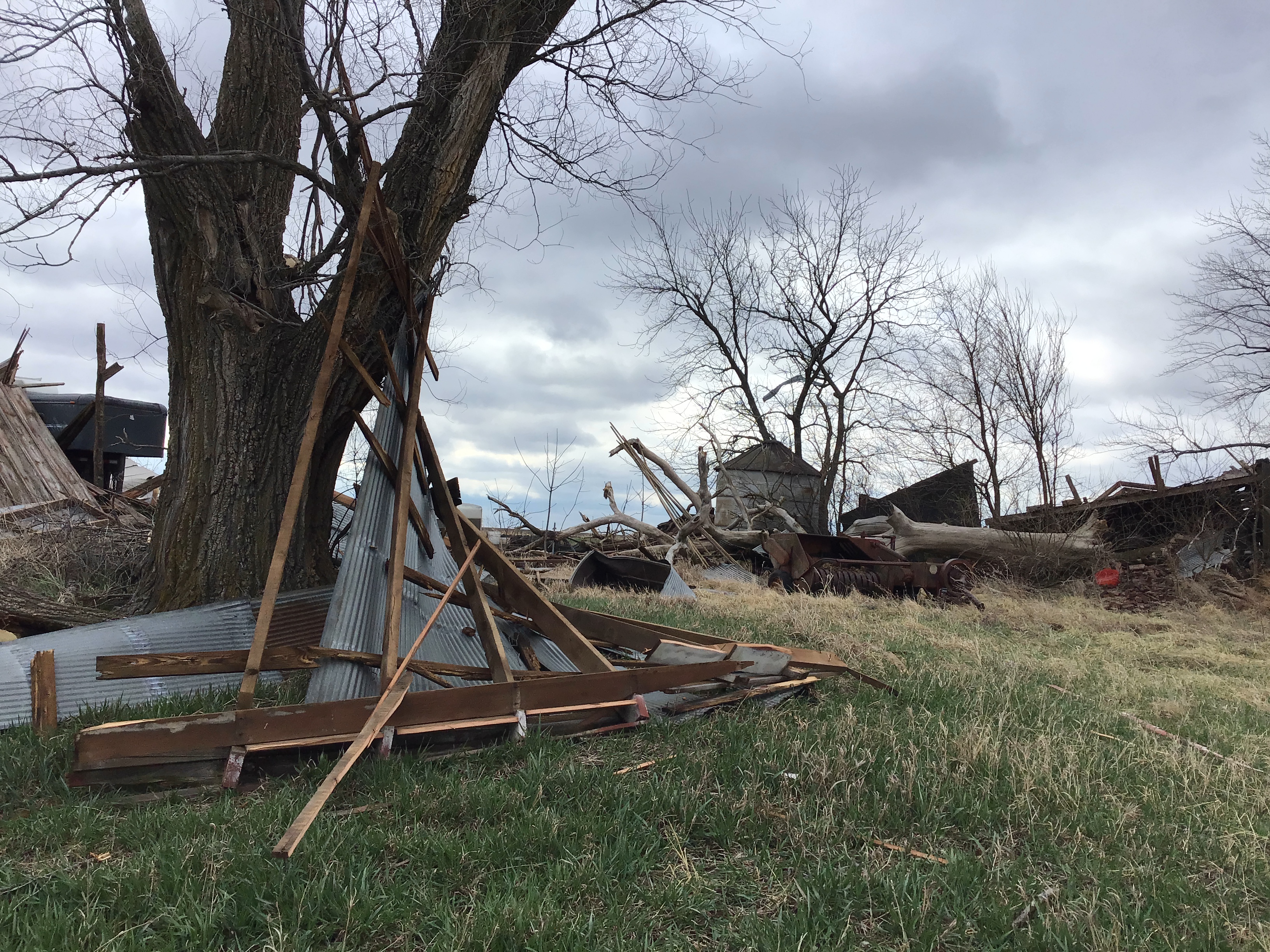
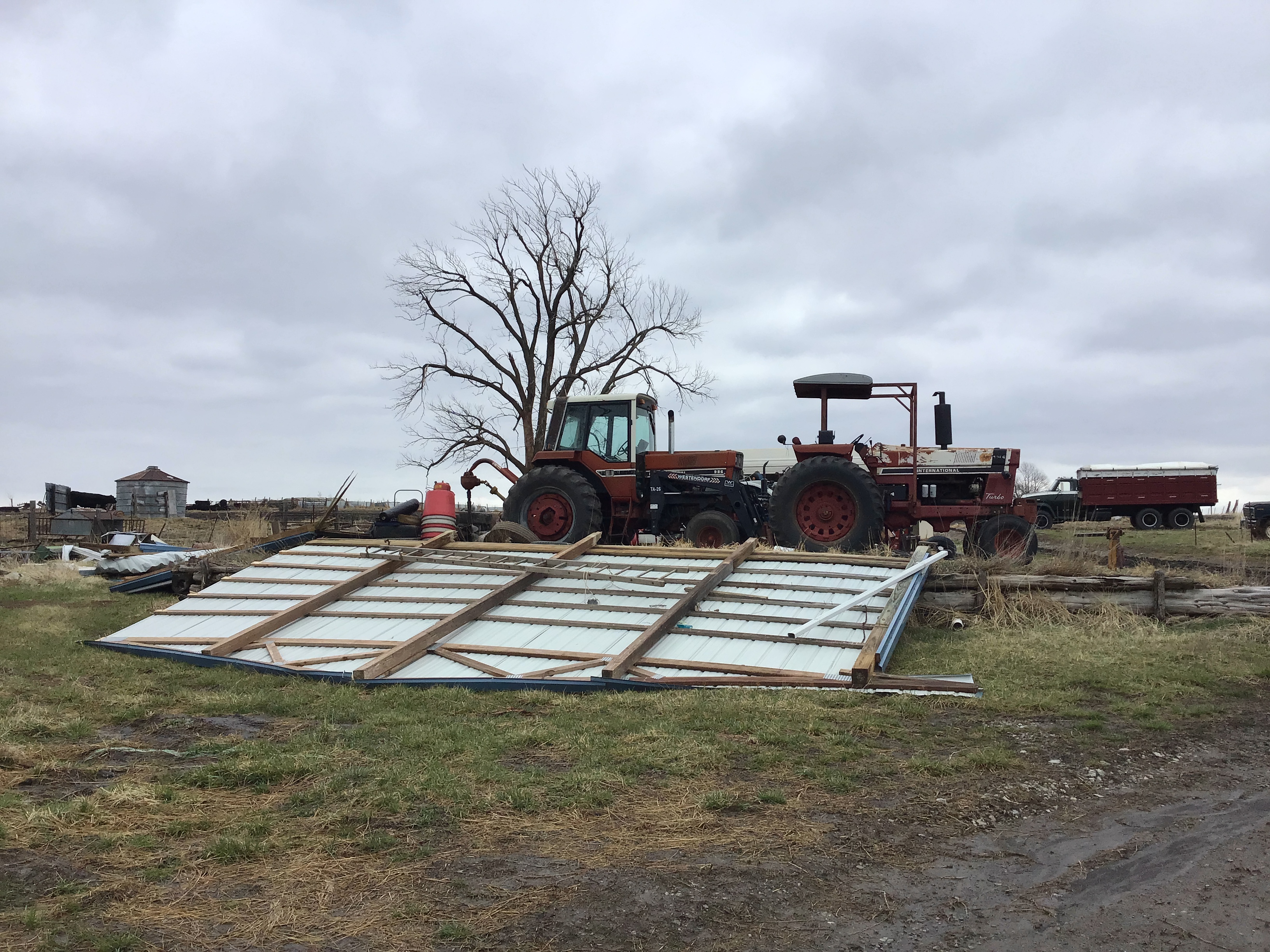
During the afternoon and evening hours of March 30, 2022, a line of storms progressed across northeast Kansas producing wind gusts of 50-60mph. Several circulations developed along the leading edge of the line with the strongest circulation producing a discontinuous tornado path across Jefferson County. The strongest damage, rated EF-1, was found at the end of the damage path south of Nortonville, KS.
Tornadoes
|
Tornado - 4 Miles NNE of Ozawkie
|
||||||||||||||||
|
||||||||||||||||
The Enhanced Fujita (EF) Scale classifies tornadoes into the following categories:
| EF0 Weak 65-85 mph |
EF1 Moderate 86-110 mph |
EF2 Significant 111-135 mph |
EF3 Severe 136-165 mph |
EF4 Extreme 166-200 mph |
EF5 Catastrophic 200+ mph |
 |
|||||
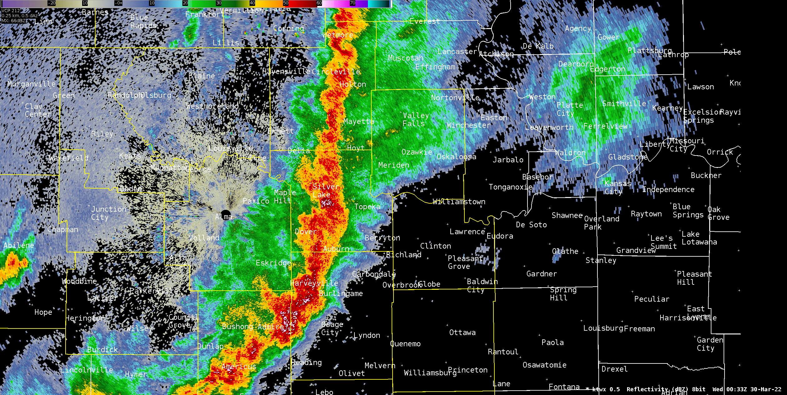
Radar
 |
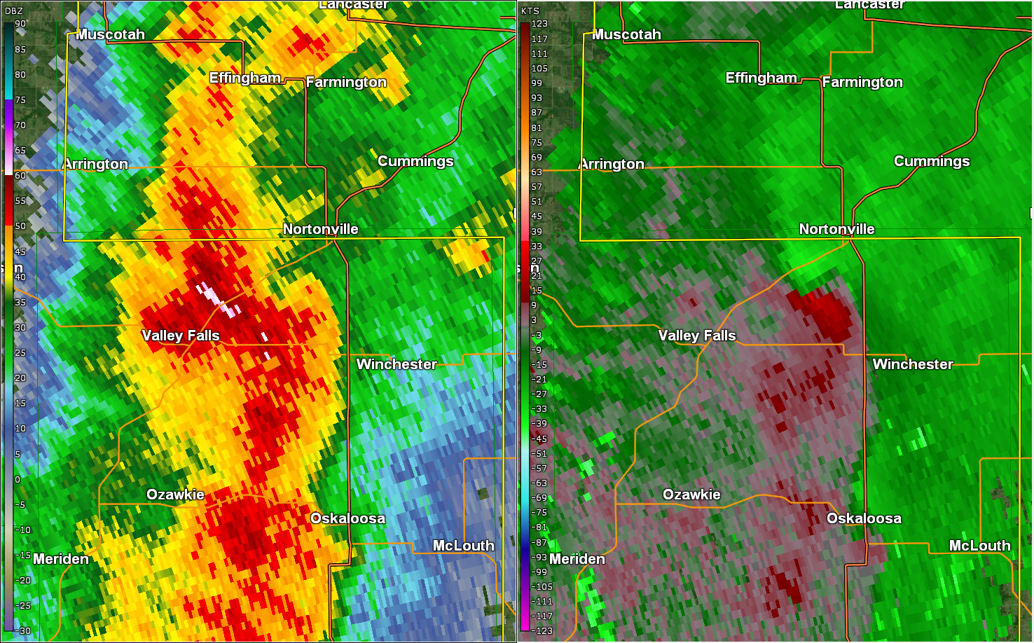 |
| Radar Loop from 7:33PM to 8:22PM. (Loop via AWIPS, NOAA) | Radar reflectivity (left) and storm-relative velocity (right) from KTWX radar at 8:04PM. (Image taken from GR2Analyst) |
 |
Media use of NWS Web News Stories is encouraged! Please acknowledge the NWS as the source of any news information accessed from this site. |
|