
Dangerous heat will expand from the Gulf Coast into the Southern Plains and Desert Southwest through week's end. Additional extreme heat impacting the Pacific Northwest will shift to the northern Plains by the weekend. Tropical Storm Bertha is expected to continue to impact portions of the northern Gulf Coast from the western Florida Panhandle to southeastern Louisiana through tonight. Read More >
Overview
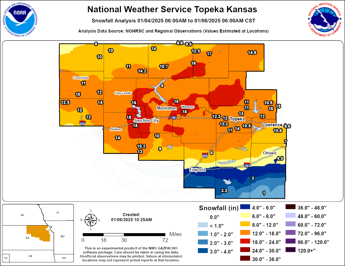
A high impact winter storm struck northeast Kansas on January 4-5, 2025. The storm began on Saturday, January 4 with an extended period of freezing drizzle. This freezing drizzle, falling with temperatures already in the low to mid 20s, caused major travel impacts even before any snow began. Precipitation briefly changed to sleet Saturday night before changing to heavy snow early Sunday morning. Bands of heavy snow continued into Sunday afternoon, at times with lightning and thunder, before finally tapering off Sunday evening. Accumulations ranged from 10-18 inches across a wide portion of the area, including both Manhattan and Topeka. Topeka officially recorded 14.1" of snow, the 3rd highest calendar day total on record. Winds gusting 30-40 mph resulted in snow drifts several feet high, keeping even highway road conditions from improving until later Monday afternoon. With the amount of snow, some side roads were not cleared until several days later.
Snow Totals
Map showing snowfall reports we received across the area. Contours are analyzed based on a combination of radar and observational data, as well as the observed point snowfall reports.
Photos
 |
 |
 |
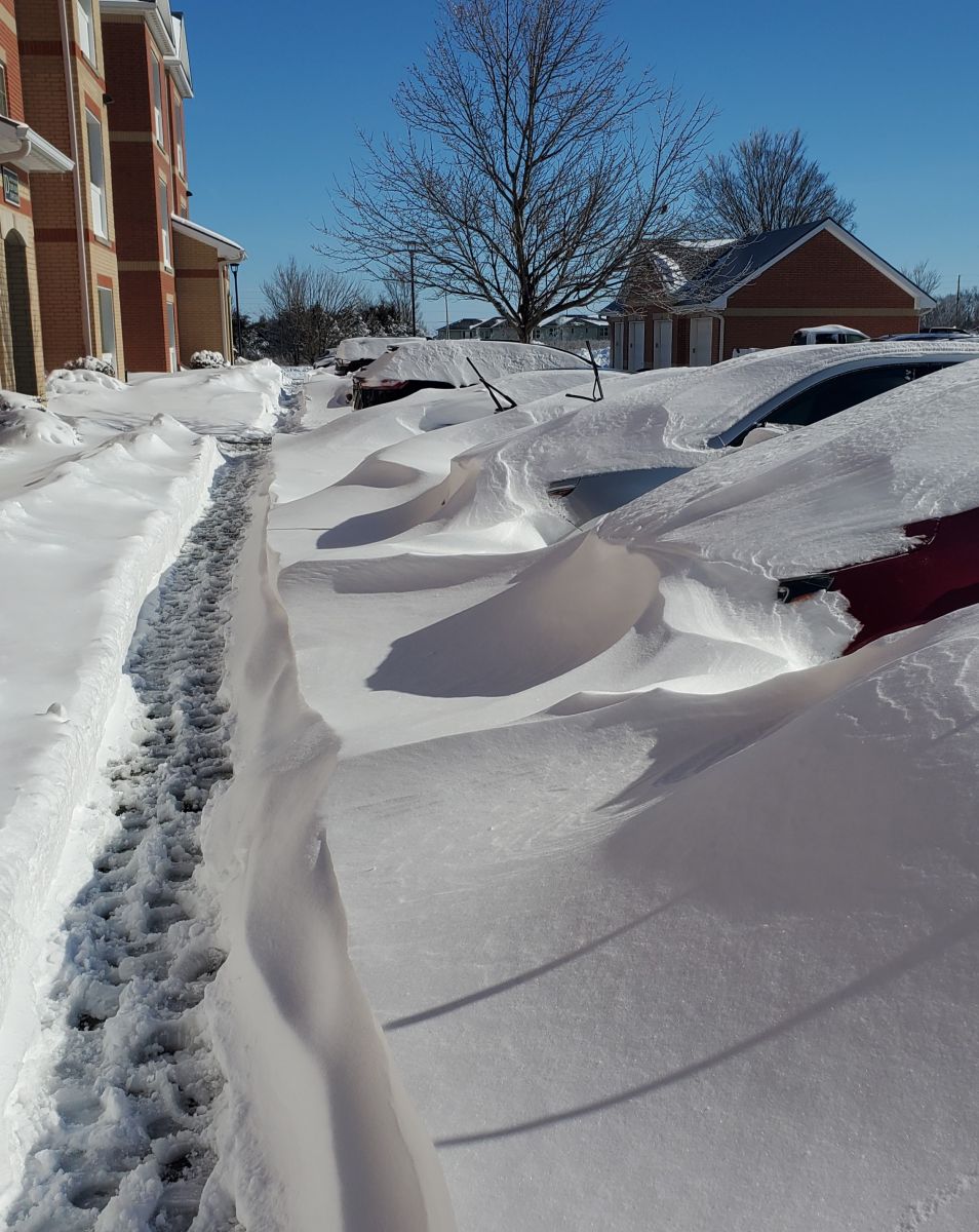 |
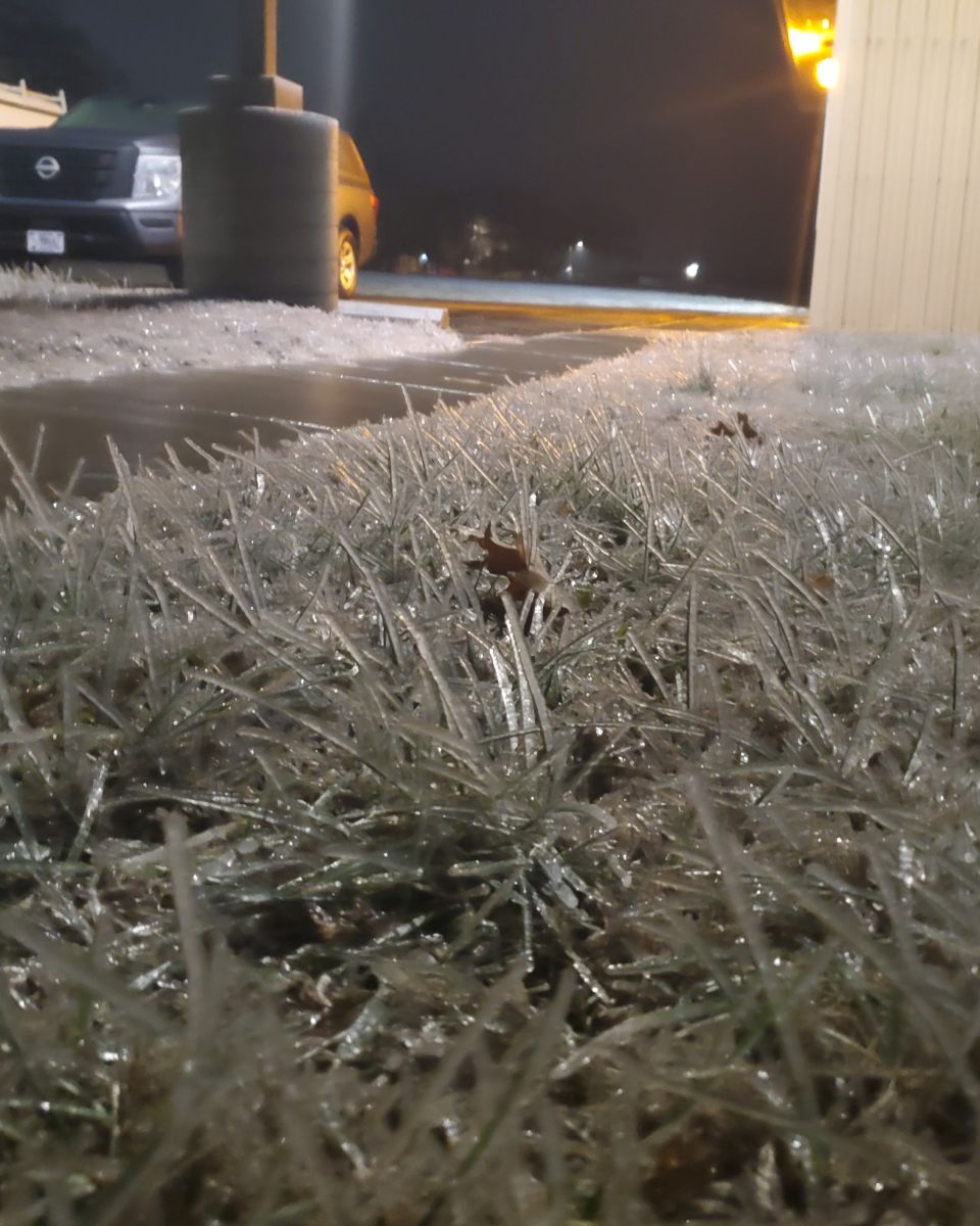
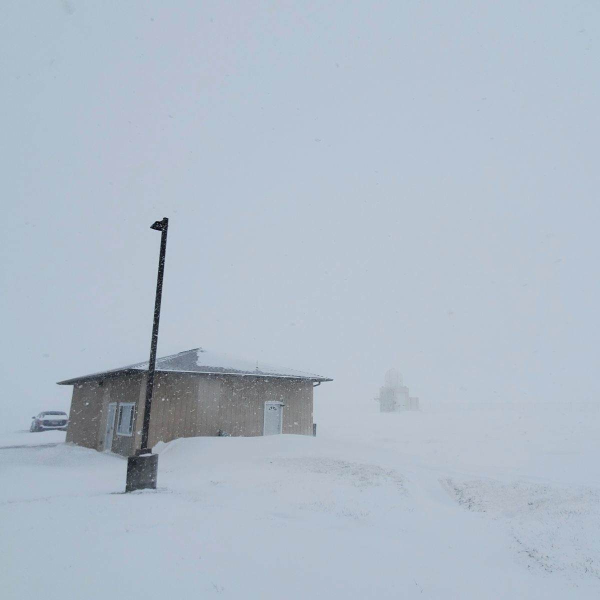
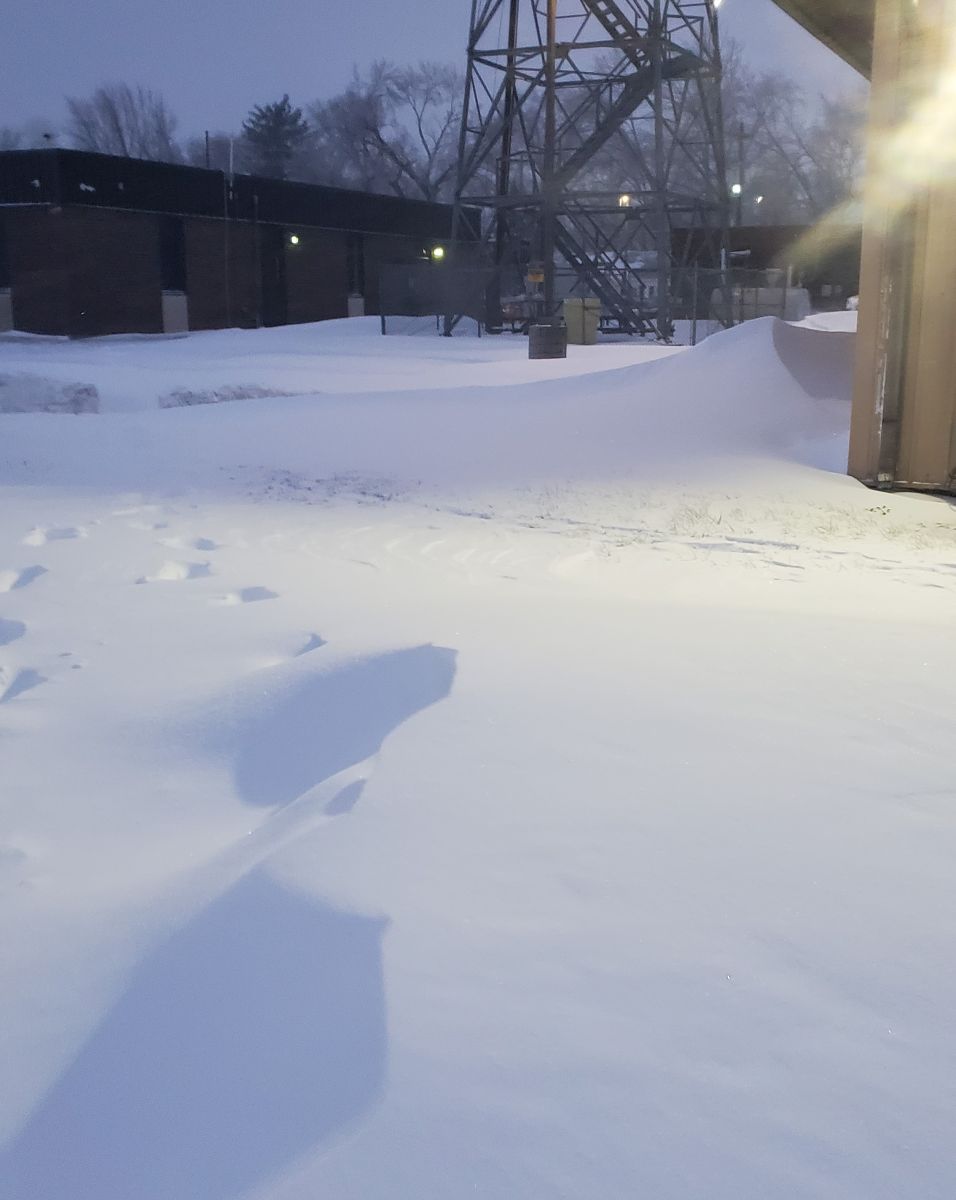
| Freezing drizzle on the afternoon of January 4 coated grass and made paved surfaces a sheet of ice. | Visibility below a quarter mile around the peak of the blizzard January 5. | Snow drifts several feet high on the evening of January 5. | Cars buried in snow in Lawrence the afternoon of January 6. |
Radar/Environment
 |
 |
 |
.png) |
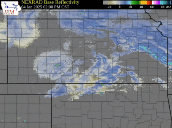
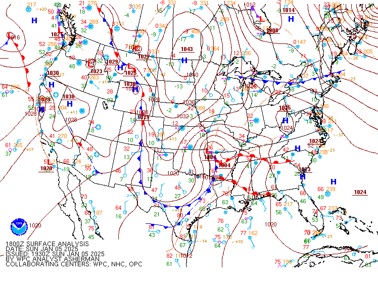
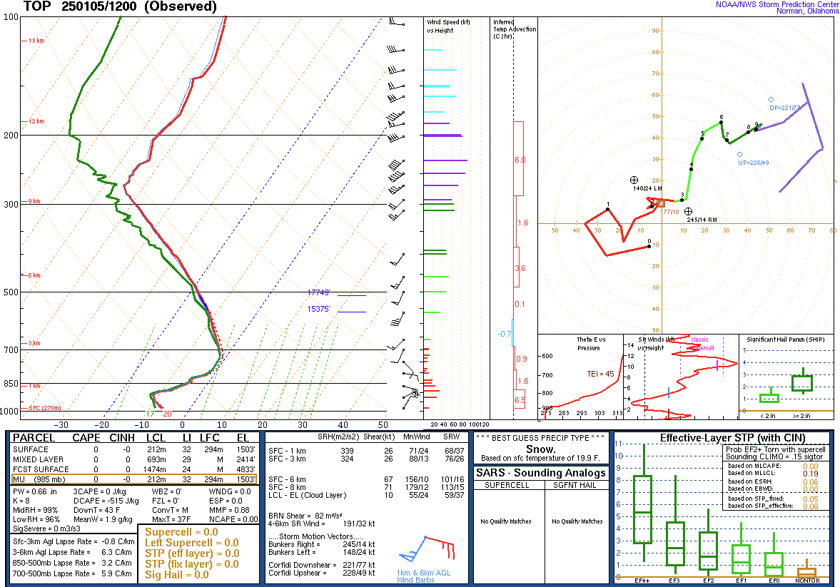
| Radar loop of the blizzard, courtesy of the Iowa State Mesonet. | WPC surface analysis at 18z (noon). | Sounding data from 6am on January 5, shortly after precipitation had turned to all snow. | Sounding data from 6pm on January 5, as snow was tapering off. Note colder temperatures and stronger winds. |
 |
Media use of NWS Web News Stories is encouraged! Please acknowledge the NWS as the source of any news information accessed from this site. |
|

