Dangerous heat will expand from the Gulf Coast into the Southern Plains and Desert Southwest through week's end. Additional extreme heat impacting the Pacific Northwest will shift to the northern Plains by the weekend. Tropical Storm Bertha is expected to continue to impact portions of the northern Gulf Coast from the western Florida Panhandle to southeastern Louisiana through tonight. Read More >
Overview
An early morning supercell produced two EF-1 tornadoes across Osage and Shawnee Counties. These tornadoes were rare for the time of the day. Since 1950 in the Topeka forecast area, only four other tornadoes had developed between the hours of 5 AM and 9 AM (CDT), and zero between the hours of 5:30 and 7:30 AM.Tornadoes:
|
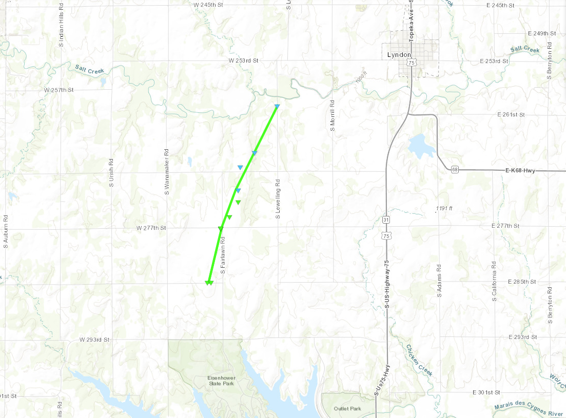
Tornado - Lyndon
|
||||||||||||||||
|
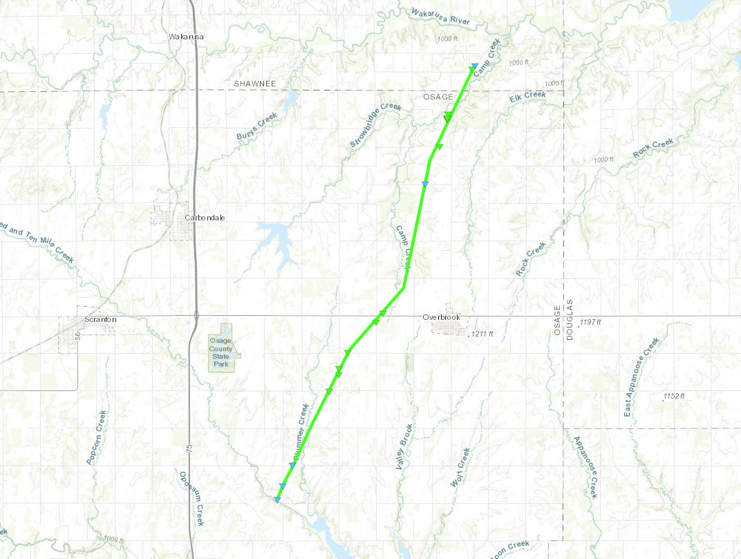
Tornado - Overbrook/Richland
|
||||||||||||||||
The Enhanced Fujita (EF) Scale classifies tornadoes into the following categories:
| EF0 Weak 65-85 mph |
EF1 Moderate 86-110 mph |
EF2 Significant 111-135 mph |
EF3 Severe 136-165 mph |
EF4 Extreme 166-200 mph |
EF5 Catastrophic 200+ mph |
 |
|||||
Radar
 |
 |
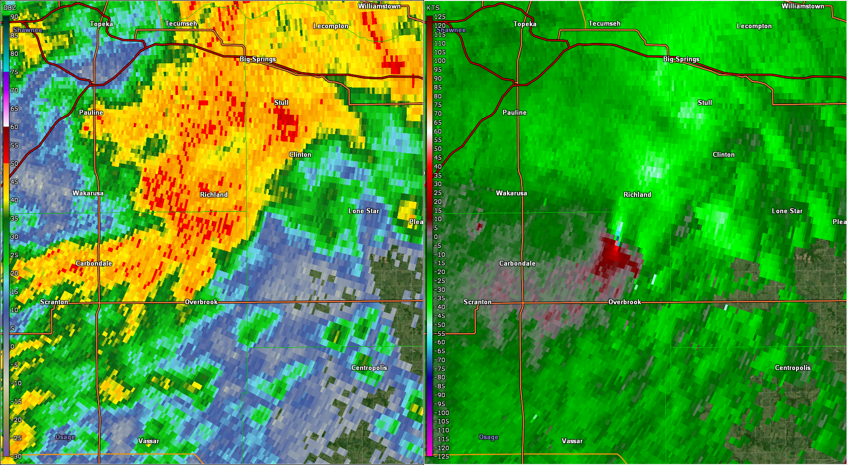 |
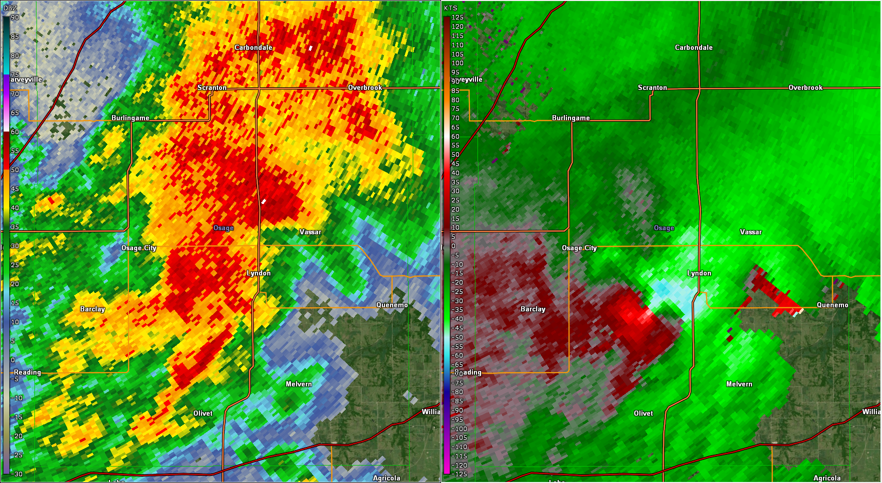
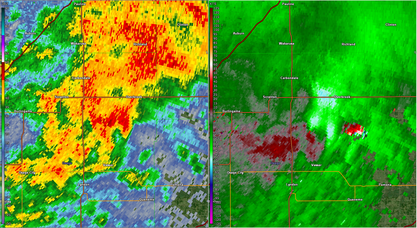
| Radar at 5:53 AM as the first tornado was near peak strength southwest of Lyndon. | Radar at 6:09 AM, shortly after the second tornado developed southwest of Overbrook. | Radar at 6:21 AM as the tornado was near peak strength between Overbrook and Richland. |
Environment
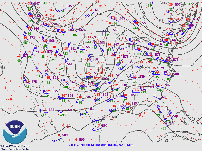
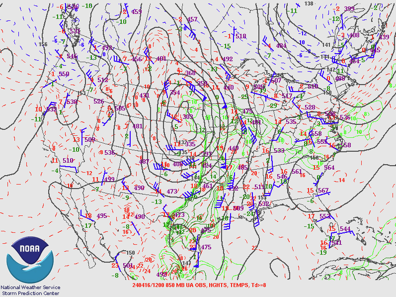
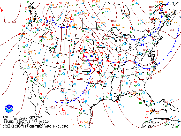
Synoptic pattern.
 |
 |
 |
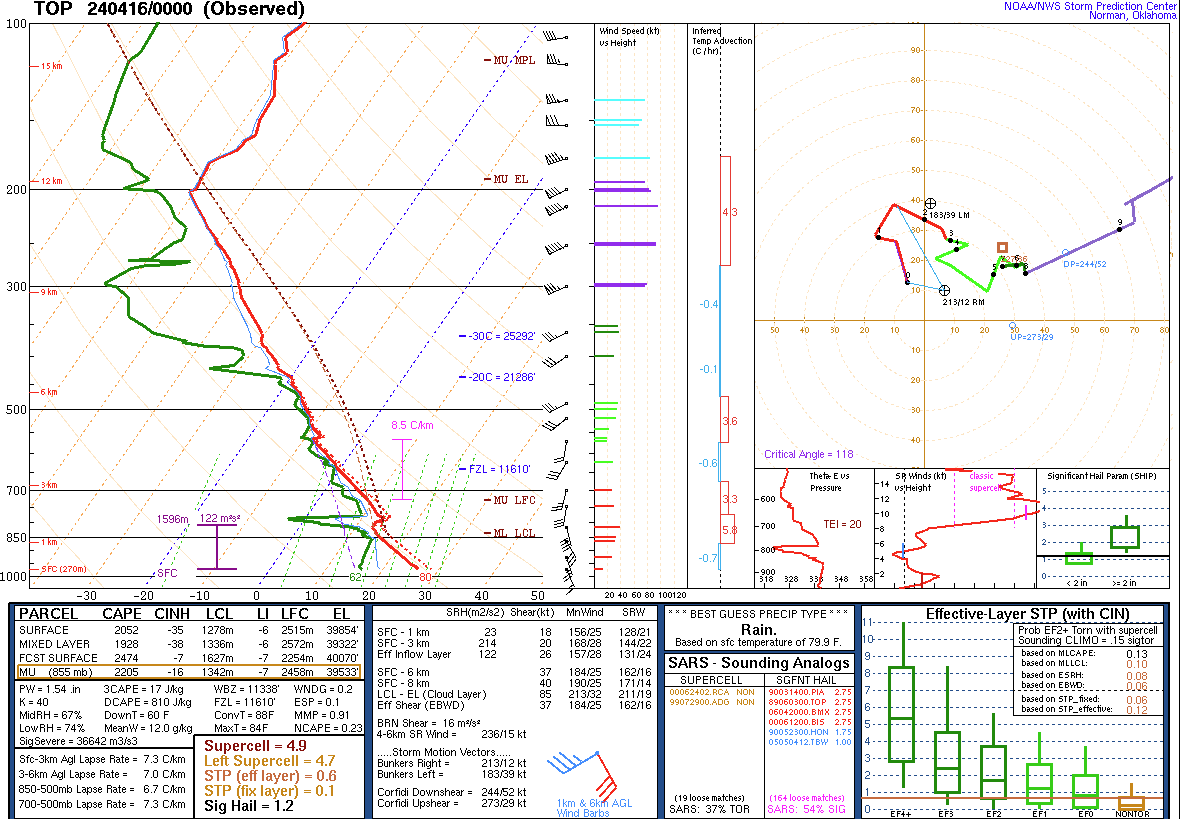 |
| 500 mb pattern at 12z (7AM). | 850 mb pattern at 12z (7AM). | Surface pattern at 12z (7AM). | Topeka sounding at 7 PM on 3/15. (7 AM sounding cancelled due to lightning.) |
Near-storm environment.
 |
 |
 |
 |
| Effective shear at 11z (6AM). | Effective helicity at 11z (6AM), | Surface based CAPE at 11z (6AM). | Significant Tornado Parameter at 11z (6AM) |
 |
Media use of NWS Web News Stories is encouraged! Please acknowledge the NWS as the source of any news information accessed from this site. |
|