
Widespread, life-threatening considerable flash flooding is expected in south-central Texas through at least Friday. Catastrophic river flooding and rapid rises on small streams, arroyos, and typically dry washes are expected in the Texas Hill Country. Wildfire smoke is impacting air quality across much of the Great Lakes region into the Northeast U.S. with Air Quality Alerts in effect. Read More >
Overview
|
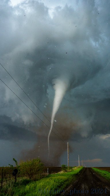
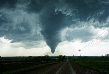
Severe thunderstorms developed during the afternoon and evening of April 30, 2024. These storms produced 1-2 inch diameter hail, significant damaging wind gusts exceeding 80MPH, and 4 tornadoes. The strongest tornado impacted the town of Westmoreland, producing EF-3 damage. |
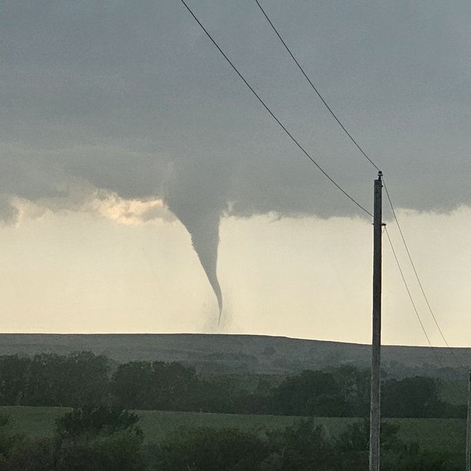
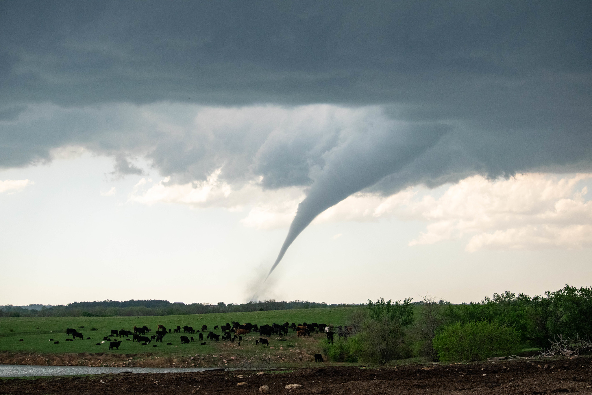 The Westmoreland EF-3 tornado shortly after it developed. |
Tornadoes:
|
Westmoreland Tornado
Track Map 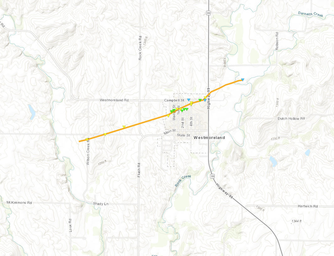 
Downloadable KMZ File |
||||||||||||||||
|
Centralia Tornado
Track Map 
Downloadable KMZ File |
||||||||||||||||
|
North Topeka Tornado
Track Map 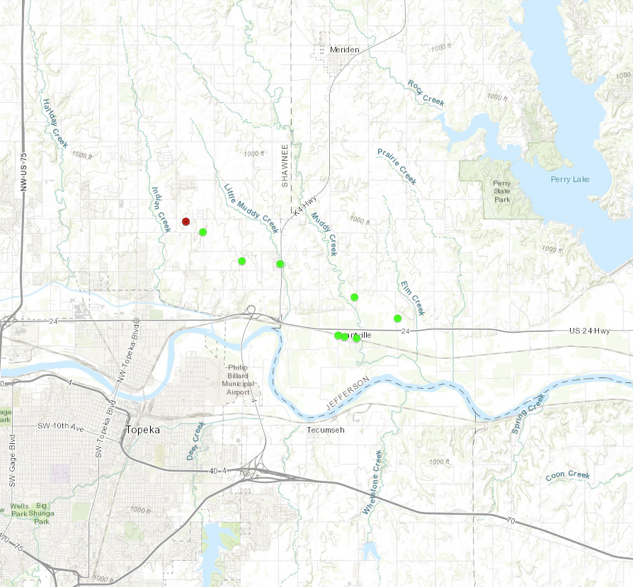
Downloadable KMZ File |
||||||||||||||||
|
Williamstown Tornado
Track Map 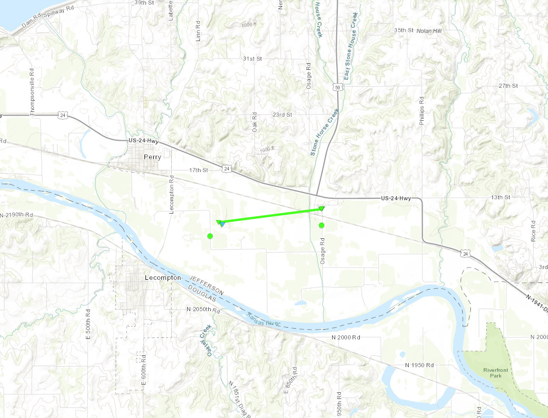
Downloadable KMZ File |
||||||||||||||||
The Enhanced Fujita (EF) Scale classifies tornadoes into the following categories:
| EF0 Weak 65-85 mph |
EF1 Moderate 86-110 mph |
EF2 Significant 111-135 mph |
EF3 Severe 136-165 mph |
EF4 Extreme 166-200 mph |
EF5 Catastrophic 200+ mph |
 |
|||||
Photos & Video
Westmoreland Tornado
 |
|
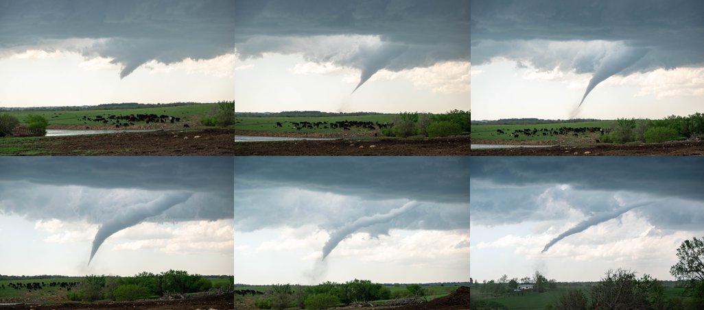 |
| Image courtesy of Hunter Hurley | Tornado shortly after it developed, viewed from around 7 miles to the southeast. | Stages of the Westmoreland tornado, from funnel to rope out. Each image roughly two minutes apart. |
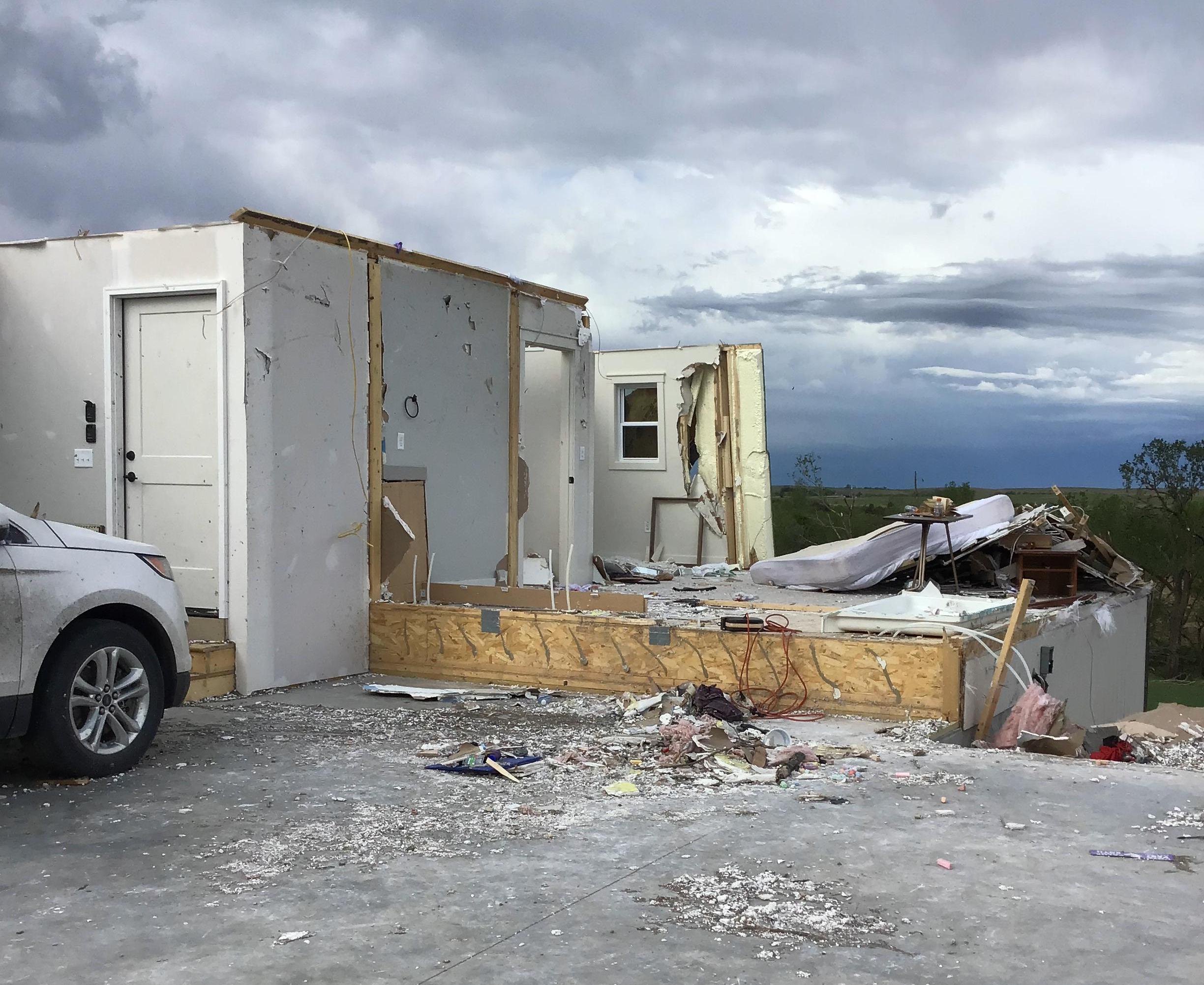
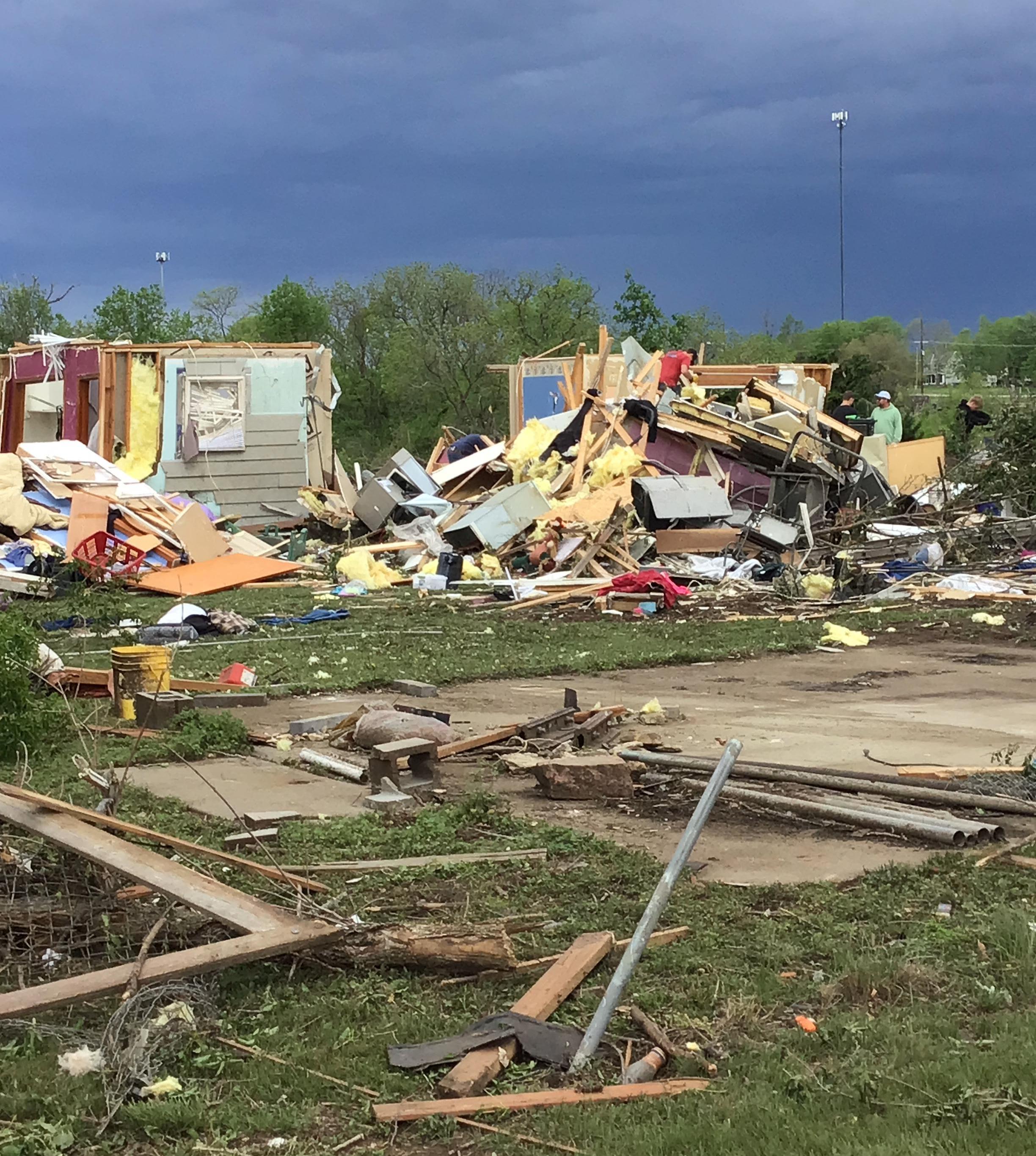
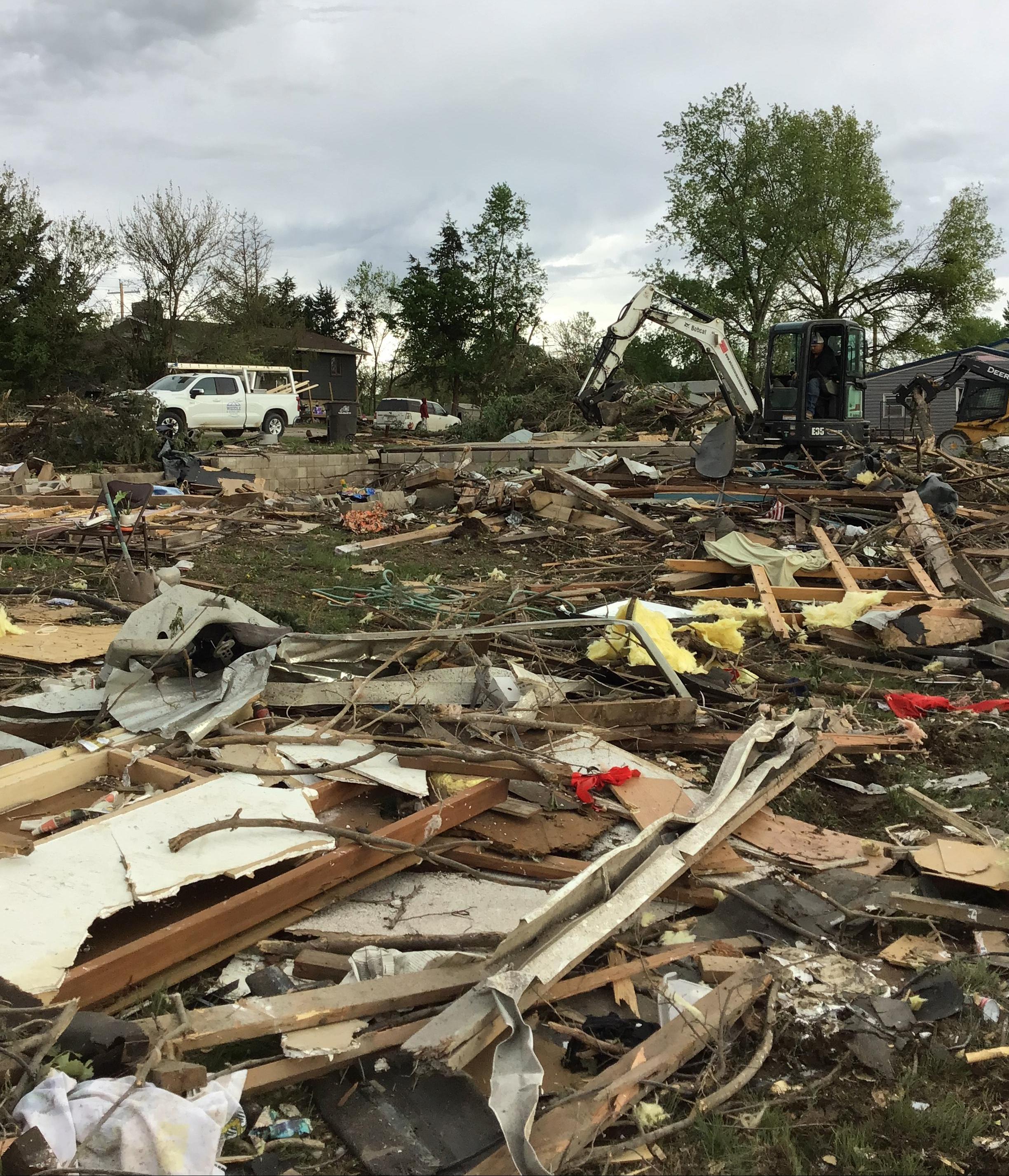
Westmoreland Damage Survey
 |
 |
 |
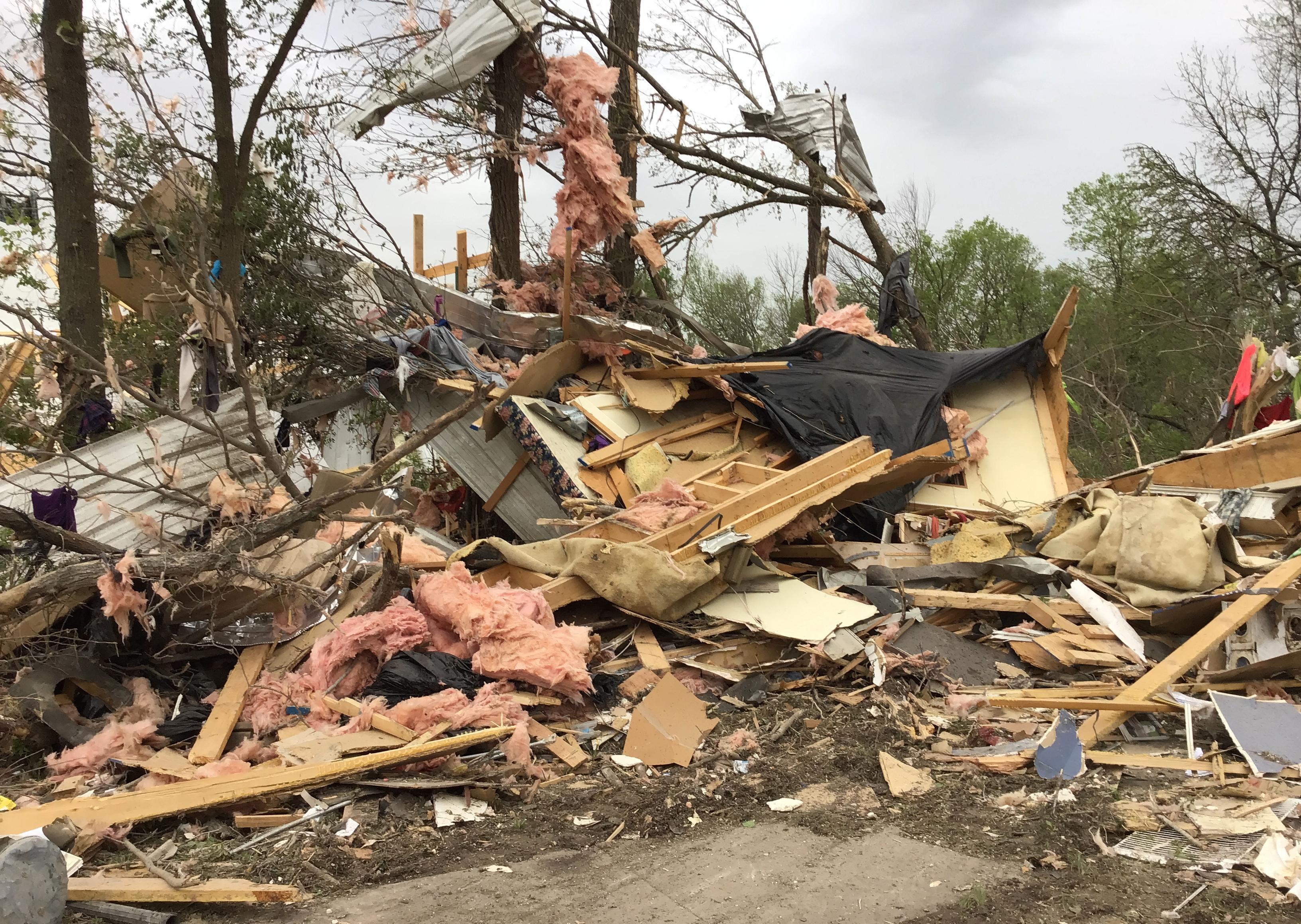 |
| EF-2 damage a mile west of Westmoreland. | EF-2 damage to a home on the west side of Westmoreland. | EF-3 damage to a home in Westmoreland. | Remains of a mobile home in Westmoreland, rated EF-2. |
 |
 |
| Image courtesy of Connor Healey | Image courtesy of Connor Healey. |
Radar
Westmoreland Tornado
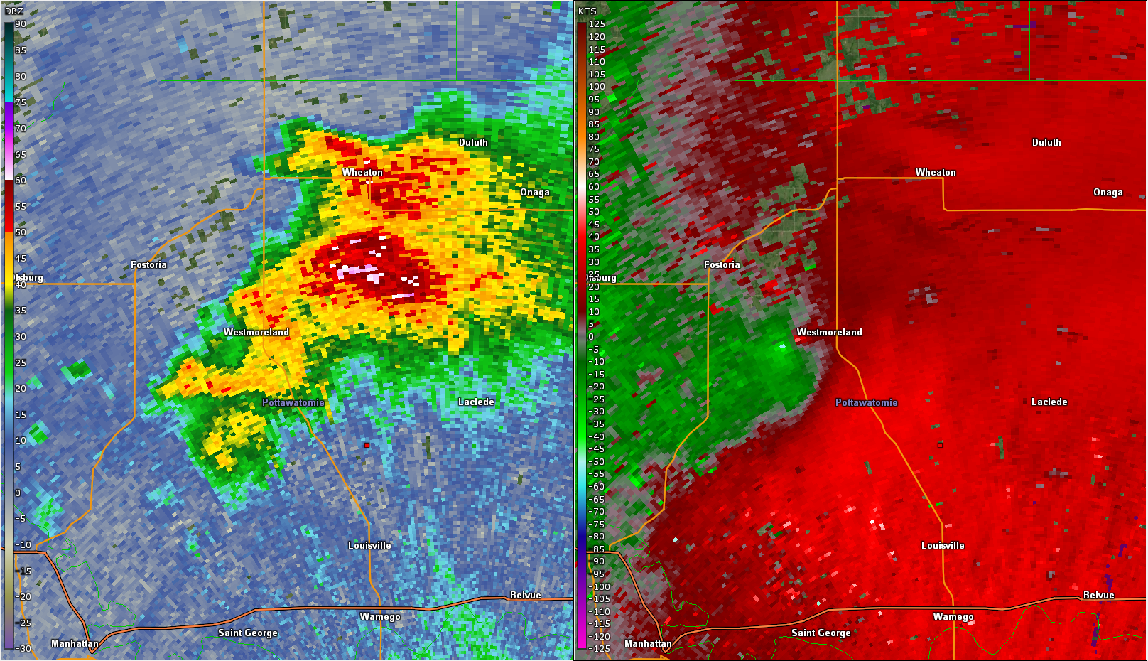 |
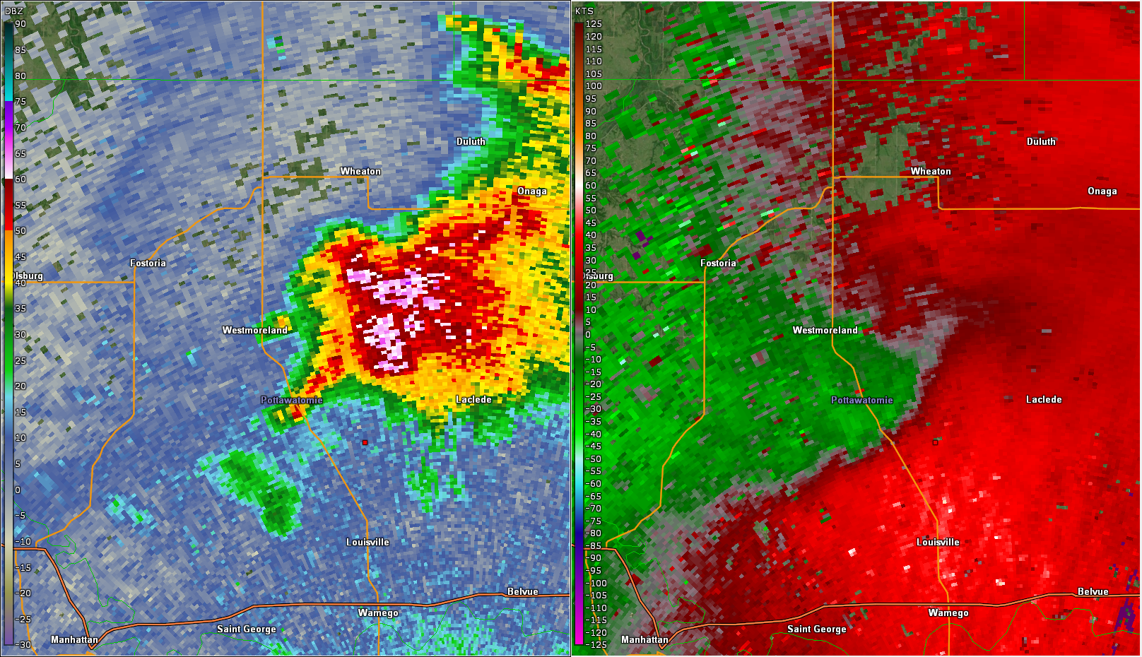 |
| Radar at 4:40 PM as the tornado developed just west of Westmoreland. | Radar at 4:50 PM as the tornado weakened on the east side of Westmoreland. |
Nemaha County Tornado
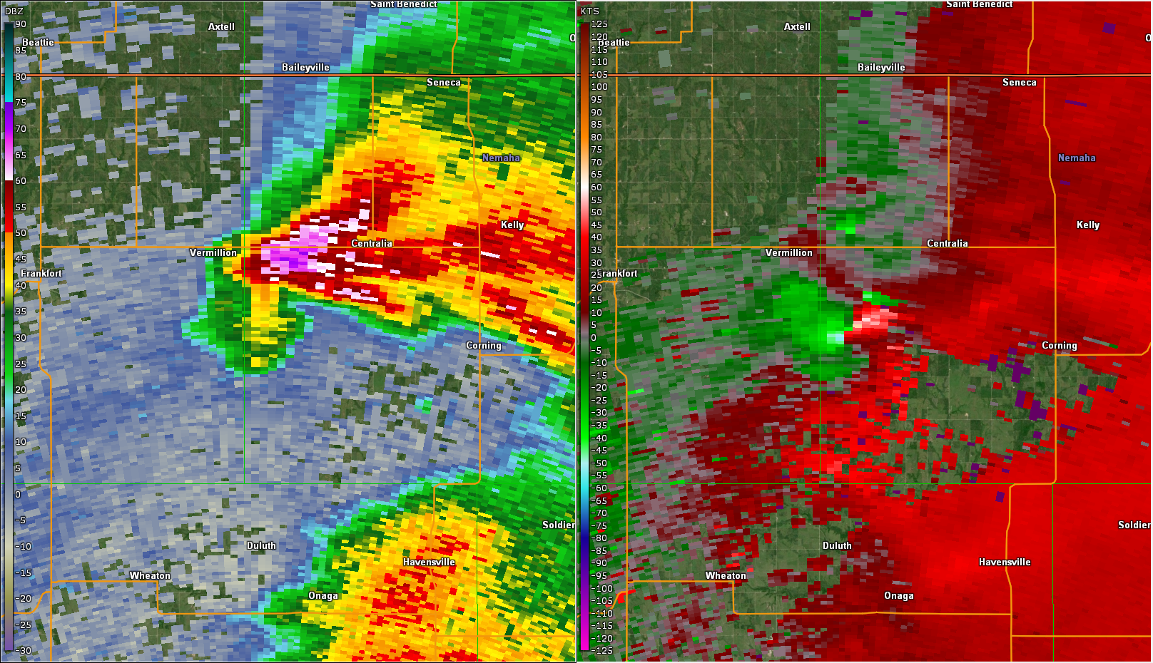 |
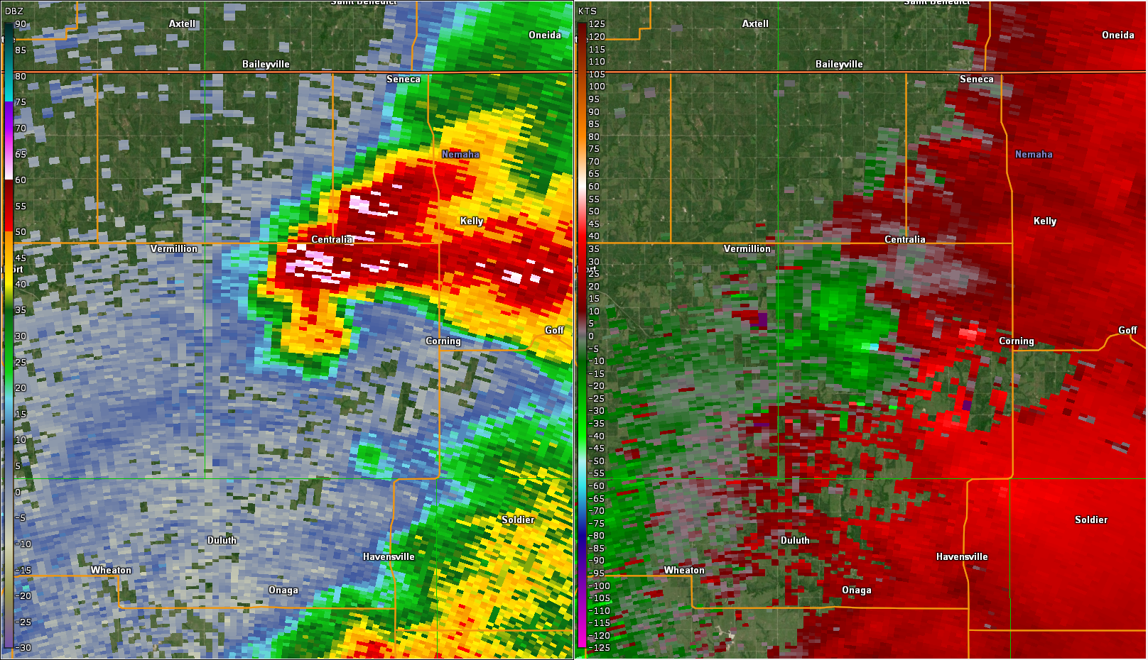 |
| Radar at 5:03 PM near the beginning of the tornado. | Radar at 5:11 towards the end of the tornado. |
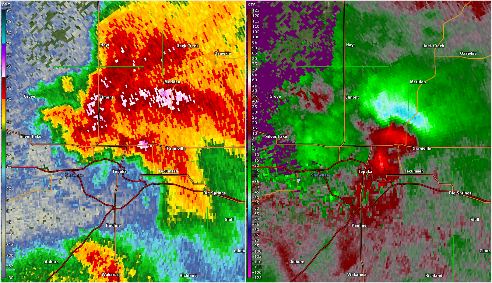
North Topeka and Williamstown Tornadoes
 |
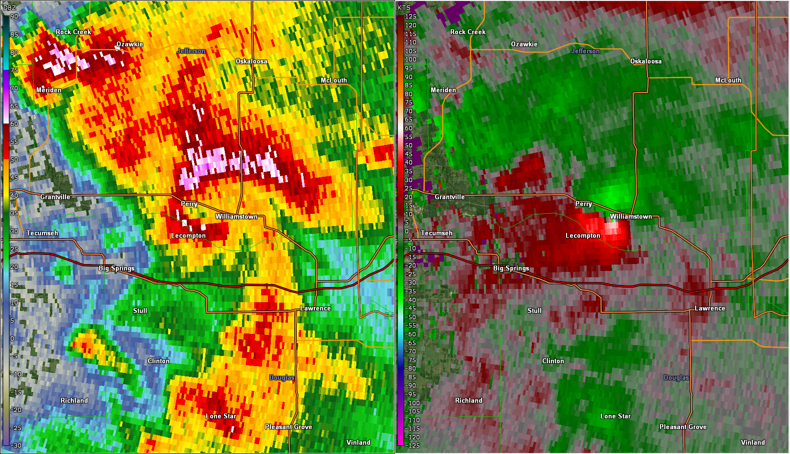 |
| Radar at 6:34 PM as the tornado briefly formed north of Topeka. | Radar at 6:59 PM as the Williamstown tornado was ongoing. |
Environment
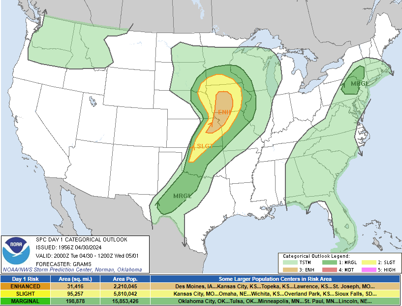
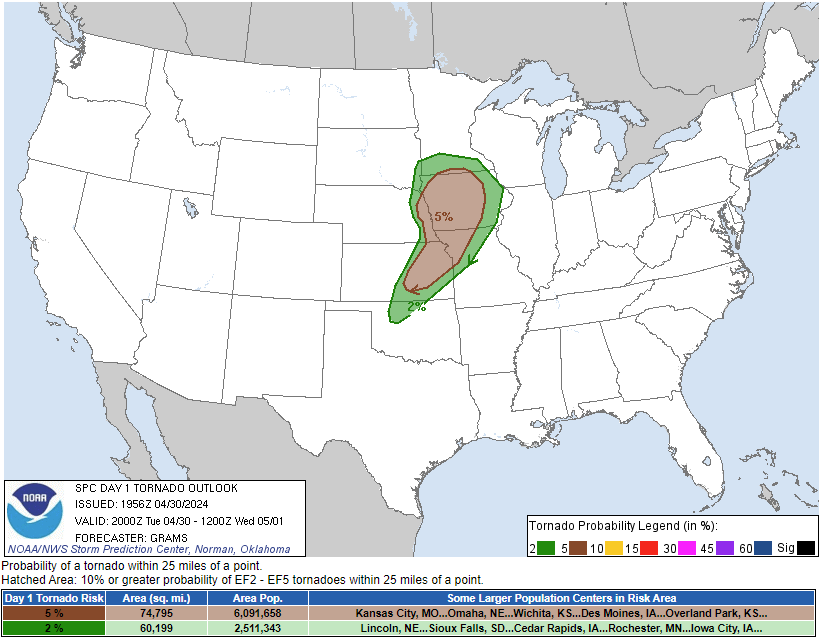
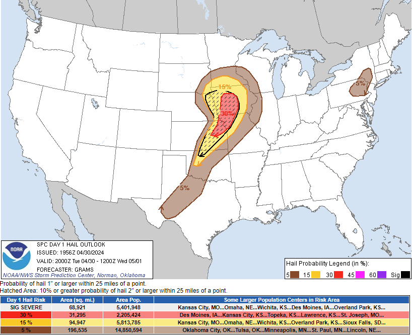
Storm Prediction Center Day 1 2000z Outlook
 |
 |
 |
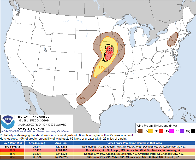 |
| Categorical Outlook | Tornado Outlook | Hail Outlook | Wind Outlook |
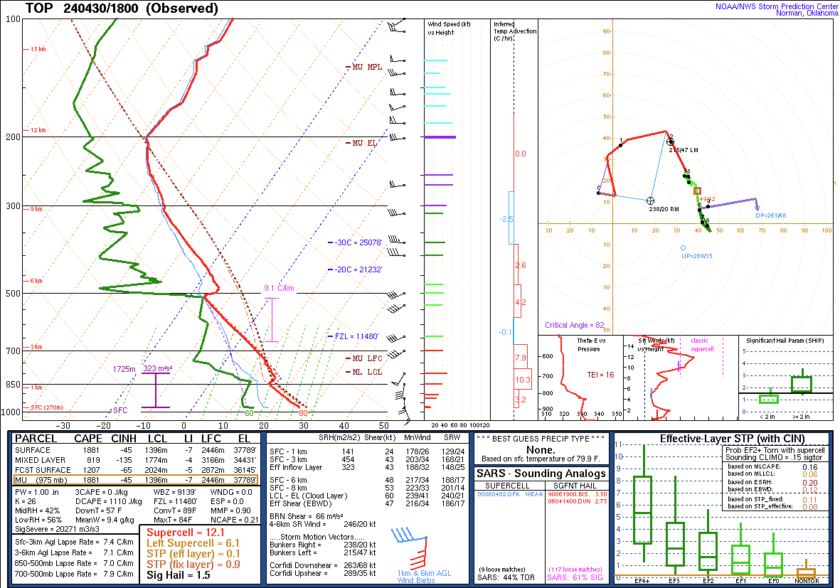
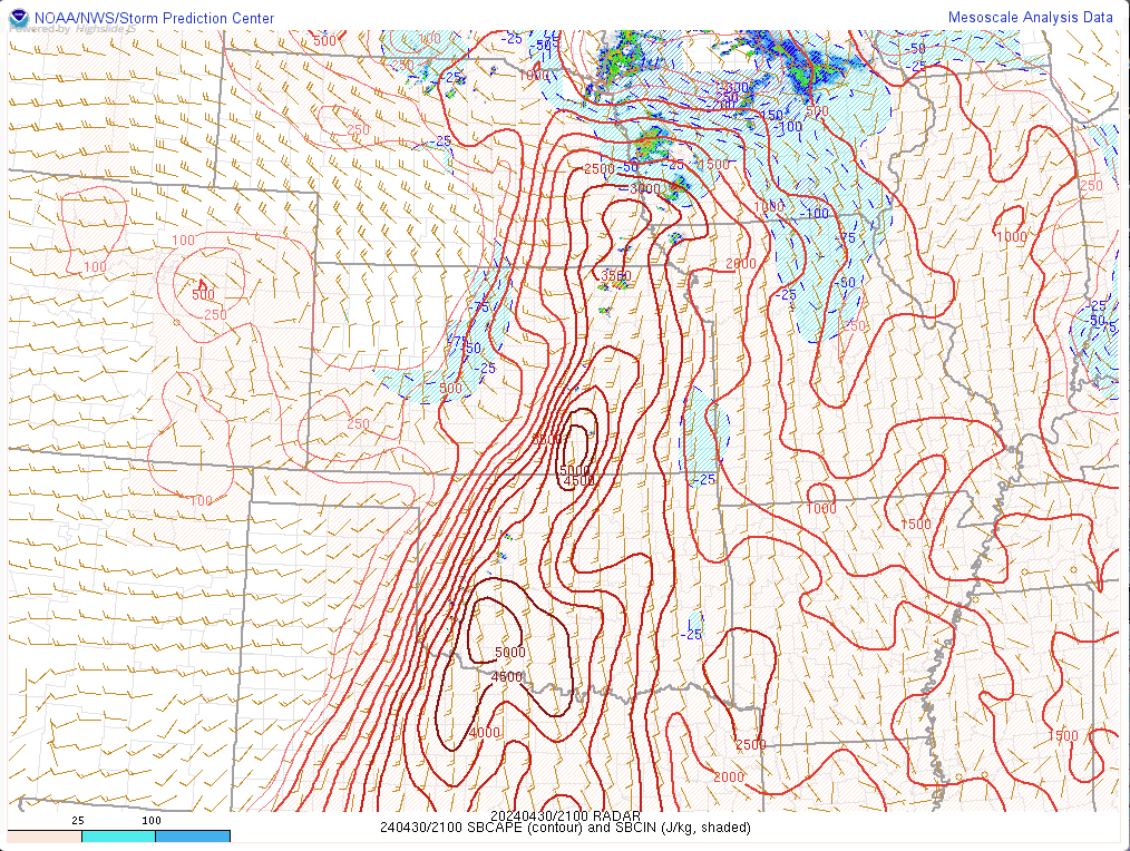
Near-storm environment summary.
 |
 |
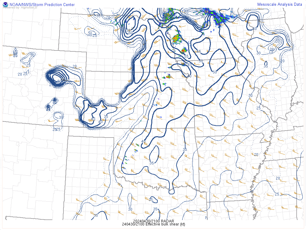 |
| 18z Sounding from TOP | Surface based CAPE at 4PM | Effective Shear at 4PM |
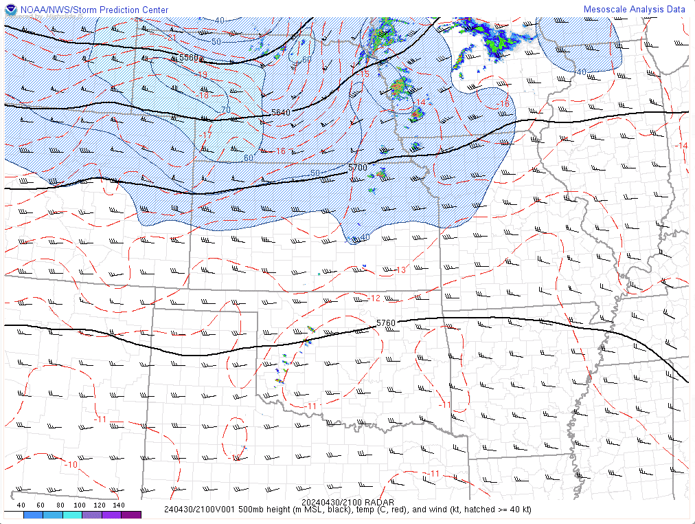
Additional environmental data.
 |
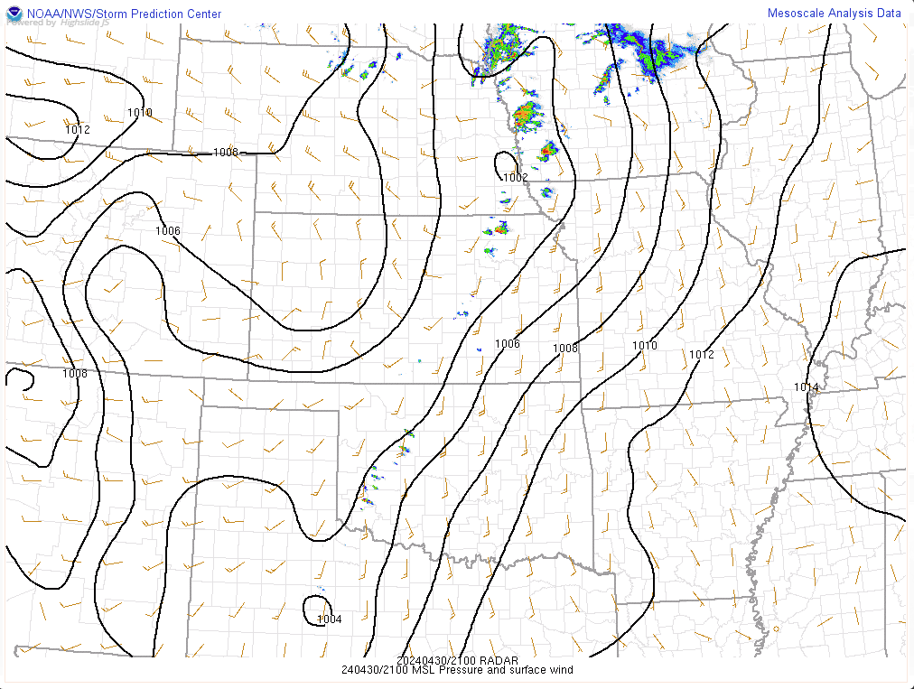 |
| 500 mb pattern at 4 PM. | Mean Sea Level Pressure at 4 PM. |
 |
Media use of NWS Web News Stories is encouraged! Please acknowledge the NWS as the source of any news information accessed from this site. |
|

