
Severe thunderstorms and heavy rain are expected across the central High Plains into parts of the central and southern Plains and in the the Mid-Atlantic today. Intense, dangerous heat will persist across the West, Southwest, and Southern Plains into the end of the week. Elevated to critical fire weather conditions expected in the Great Basin and Four Corners region. Read More >
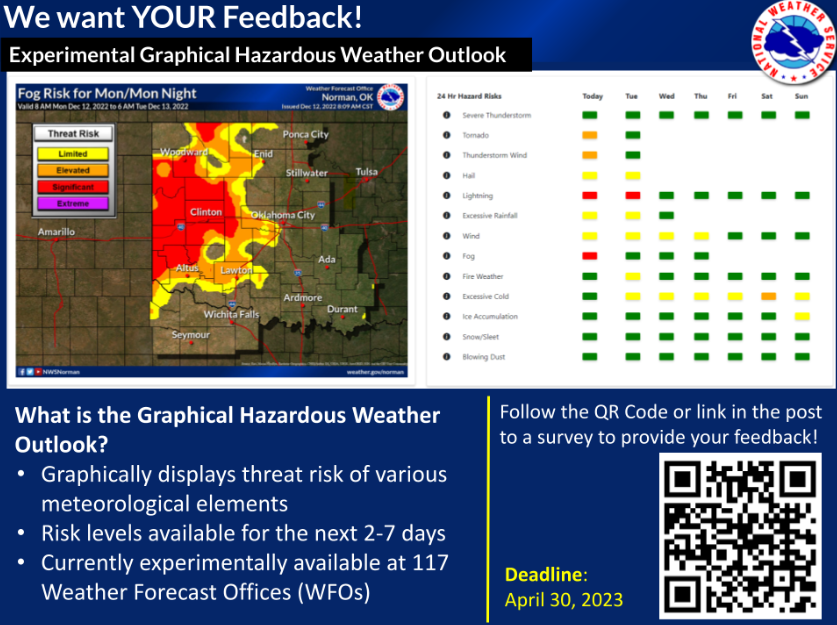
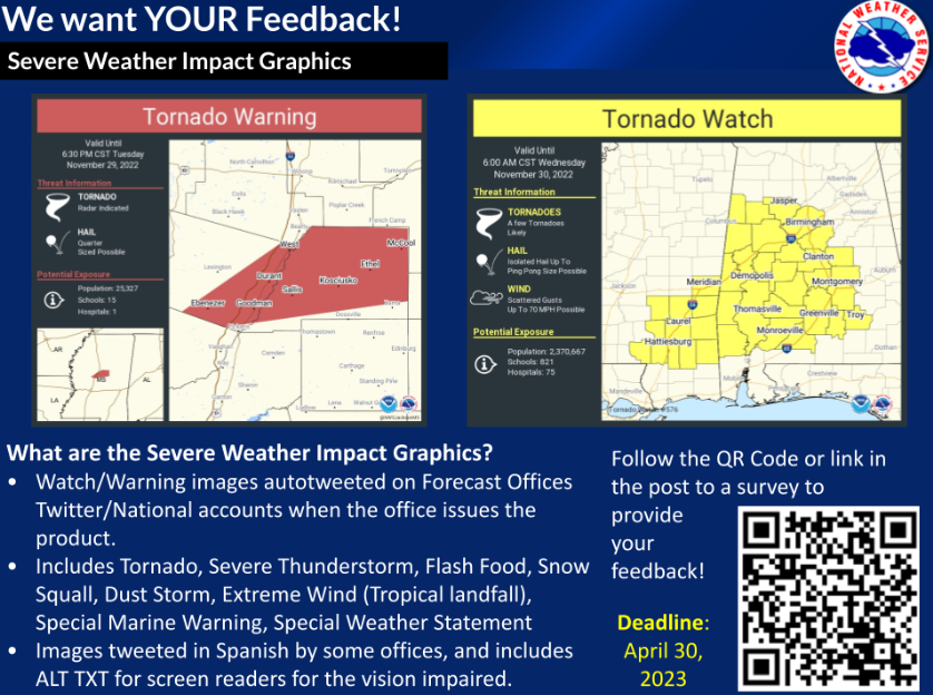
The National Weather Service (NWS) is seeking comment on two different products you may have seen utilized by your local Weather Forecast Offices (WFOs): The Graphical Hazardous Weather Outlook (GHWO) and the Severe Weather Impact Graphics seen posted on social media.
The GHWO graphically displays the risk associated with a wide range of meteorological threats for the next one to 7 days - it is currently available experimentally for 117 WFOs. More information can be found in this Public Information Statement and the slide below. Please provide your feedback on the GHWO through this associated survey.
The Severe Weather Impact Graphics are watch and warning graphics that are automatically tweeted by national or local NWS Twitter accounts when a WFO issues the associated product. The list of warnings and products produced include: Tornado, Severe Thunderstorm, Flash Food, Snow Squall, Dust Storm, Extreme Wind (Tropical landfall), Special Marine Warning, and Special Weather Statements. More information can be found in this Public Information Statement and the slide below. Please provide your feedback on the Severe Weather Impact Graphics through this associated survey.
Feedback for both the GHWO and the Severe Weather Impact Graphics is due by April 30th, 2023. Thank you for your help!

