Overview
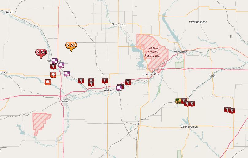
An isolated supercell thunderstorm formed over Ottawa County in north central KS on Wednesday, May 25, 2016, and this storm went on to produce 4 tornadoes. The first tornado touched down at around 6:08 PM 3 miles south of Minneapolis and was on the ground for approximately 1 minute. The second tornado that occurred was a long-track violent EF4 tornado that was on the ground for over an hour and up to a 1/2 mile wide at times. The tornado developed just north of Niles Kansas around 707pm and moved ESE damaging and destroying everything in its path as it passed 2-3 miles north of the city of Abilene. The tornado then appeared to weaken for a time as it moved to the northeast of Abilene however it re-intensified and took a southeast turn as it approached interstate 70 and then went on to produce the most severe damage after crossing interstate 70 just a mile or two southwest of the city of Chapman. The tornado then moved east passing 1 mile south of Chapman and finally dissipated between 835 and 840pm just west of the Dickinson and Geary County line.
Based on spotter reports, there were 2 additional tornadoes that developed from this same storm. The third tornado occurred approximately 3 miles south of Alta Vista in Morris County, and there were reports of structural damage to at least one barn and 4 power-line poles that were snapped. The fourth tornado occurred approximately 6 miles south of Eskridge in Wabaunsee County.
Following is a summary of the damage survey conducted by the National Weather Service.
Tornadoes:
|
Tornado - Near Niles, north of Abilene, to just south of Chapman, KS
|
||||||||||||||||||||||||||||||||
|
||||||||||||||||||||||||||||||||
Radar loops of the long-lived tornadic supercell
Storm Reports
Click on this link for an interactive version of this map and to view detailed information regarding each storm report received.
 |
|
Storm Reports from Wednesday, May 25th, 2016 |
 |
Media use of NWS Web News Stories is encouraged! Please acknowledge the NWS as the source of any news information accessed from this site. |
 |