Dangerous heat will expand from the Gulf Coast into the Southern Plains and Desert Southwest through week's end. Additional extreme heat impacting the Pacific Northwest will shift to the northern Plains by the weekend. Tropical Storm Bertha is expected to continue to impact portions of the northwestern Gulf Coast from south central Louisiana to the upper Texas coast today. Read More >
Overview
|
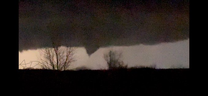
Severe thunderstorms developed on the evening of March 13, 2024. These storms produced large hail up to softball size, damaging winds, and two tornadoes. Both of these tornadoes were rated EF-2, the first in rural areas of Wabaunsee County northeast of Alta Vista and the second in Shawnee County just northwest of Rossville. |
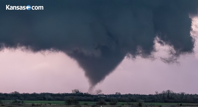 EF-2 tornado near Alta Vista. Image courtesy of Travis Heying of Kansas.com. |
Tornadoes:
|
Tornado 1 - Northeast of Alta Vista
|
||||||||||||||||
|
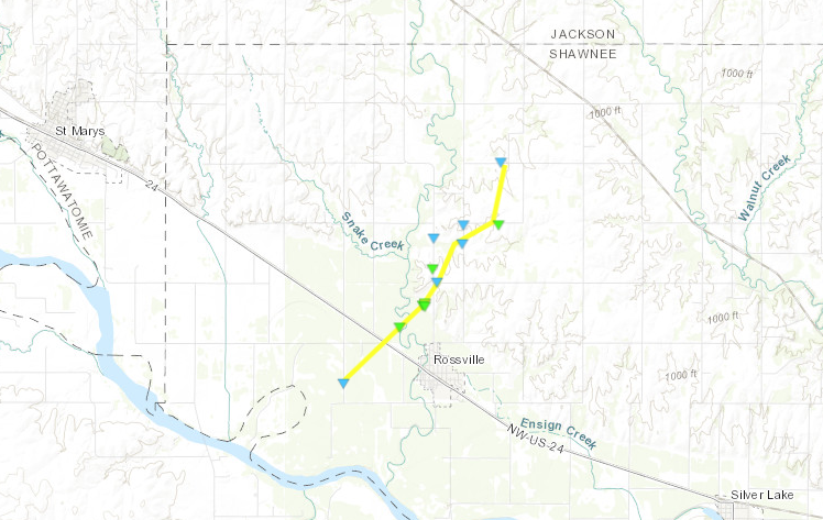
Tornado 2 - Rossville
|
||||||||||||||||
The Enhanced Fujita (EF) Scale classifies tornadoes into the following categories:
| EF0 Weak 65-85 mph |
EF1 Moderate 86-110 mph |
EF2 Significant 111-135 mph |
EF3 Severe 136-165 mph |
EF4 Extreme 166-200 mph |
EF5 Catastrophic 200+ mph |
 |
|||||
Photos
Tornadoes
 |
 |
 |
|
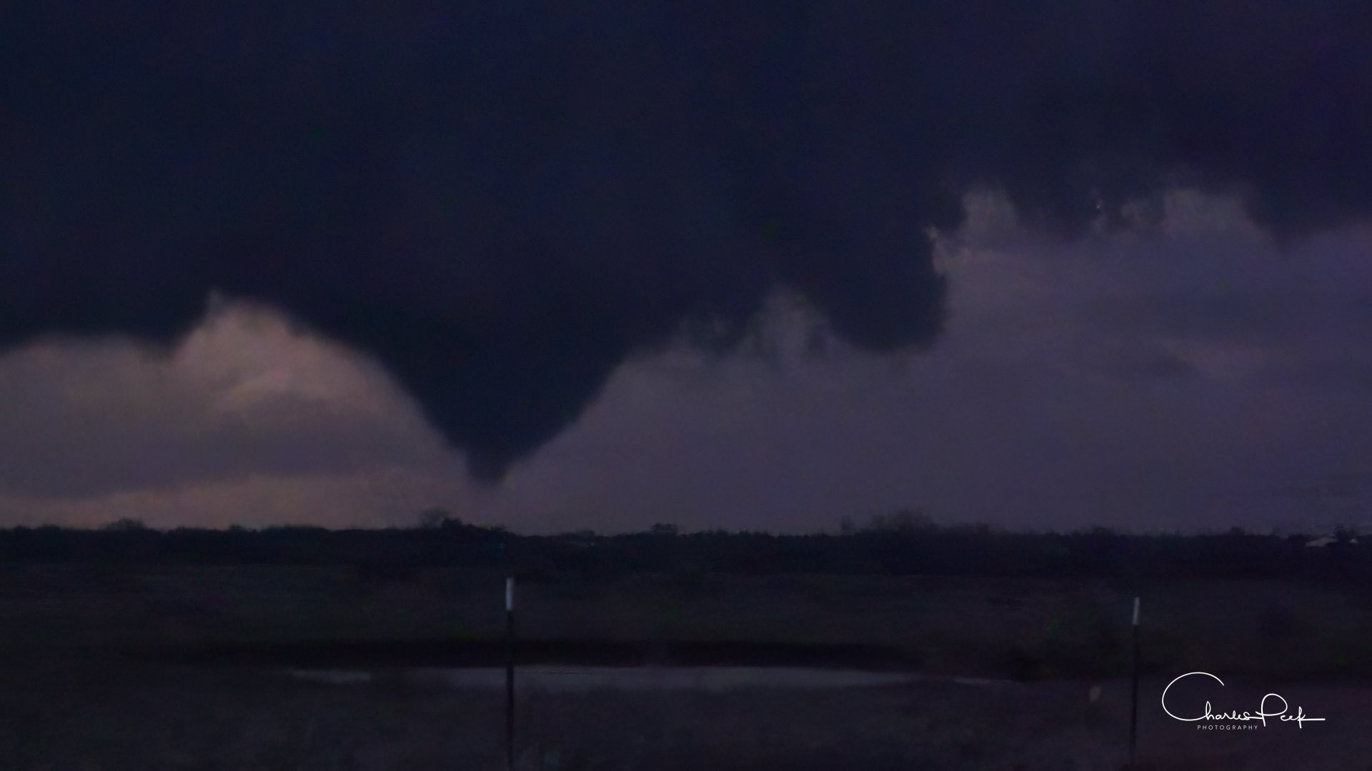
| Tornado near Alta Vista. (Image courtesy of Sierra Lindsey.) |
Tornado near Alta Vista. (Image courtesy of John Homenuk.) | Tornado near Alta Vista. (Image courtesy of Charles Peak. |
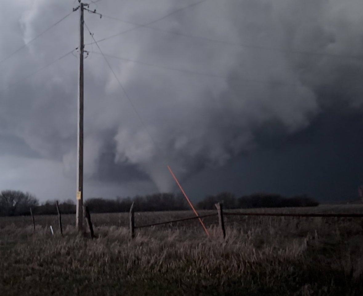
Tornado near Alta Vista. (Image courtesy of Travis Heying.) |
 |
 |
 |
 |
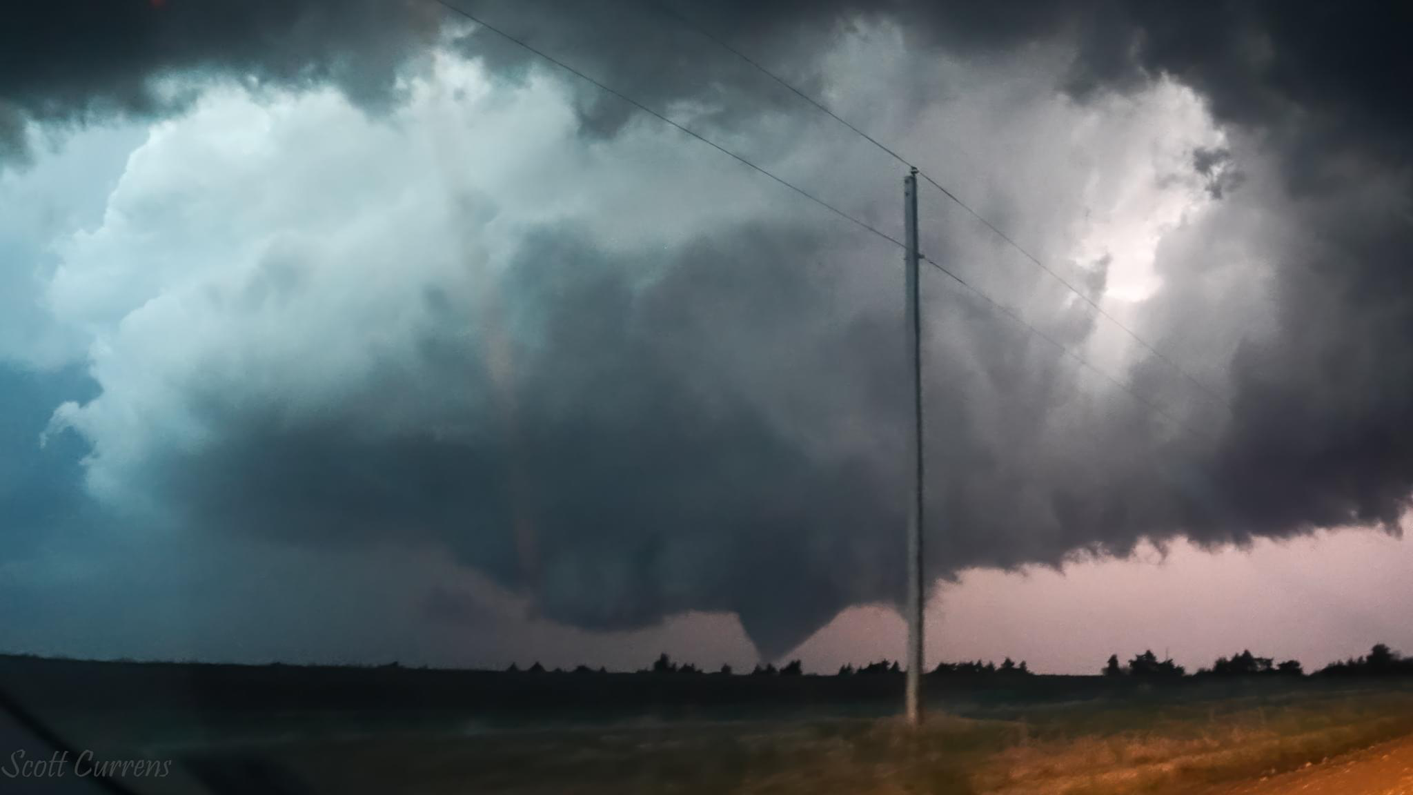
| Tornado near Alta Vista. (Image courtesy of Scott Currens.) |
Tornado near Alta Vista. (Image courtesy of Nick Gorman.) |
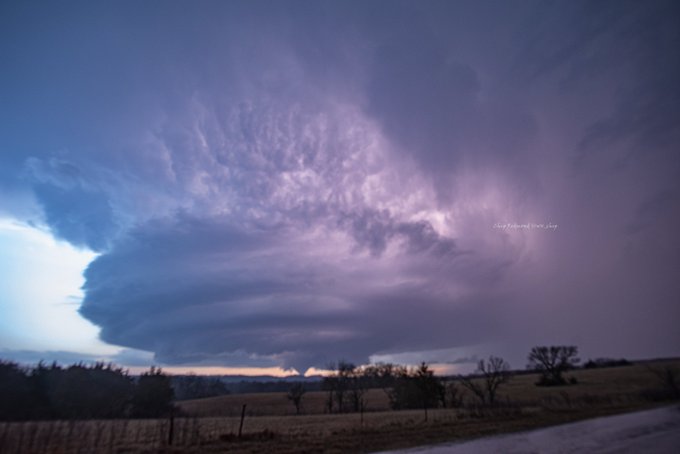
Tornado and wider supercell structure near Alta Vista. (Image courtesy of Chip Redmond.) |
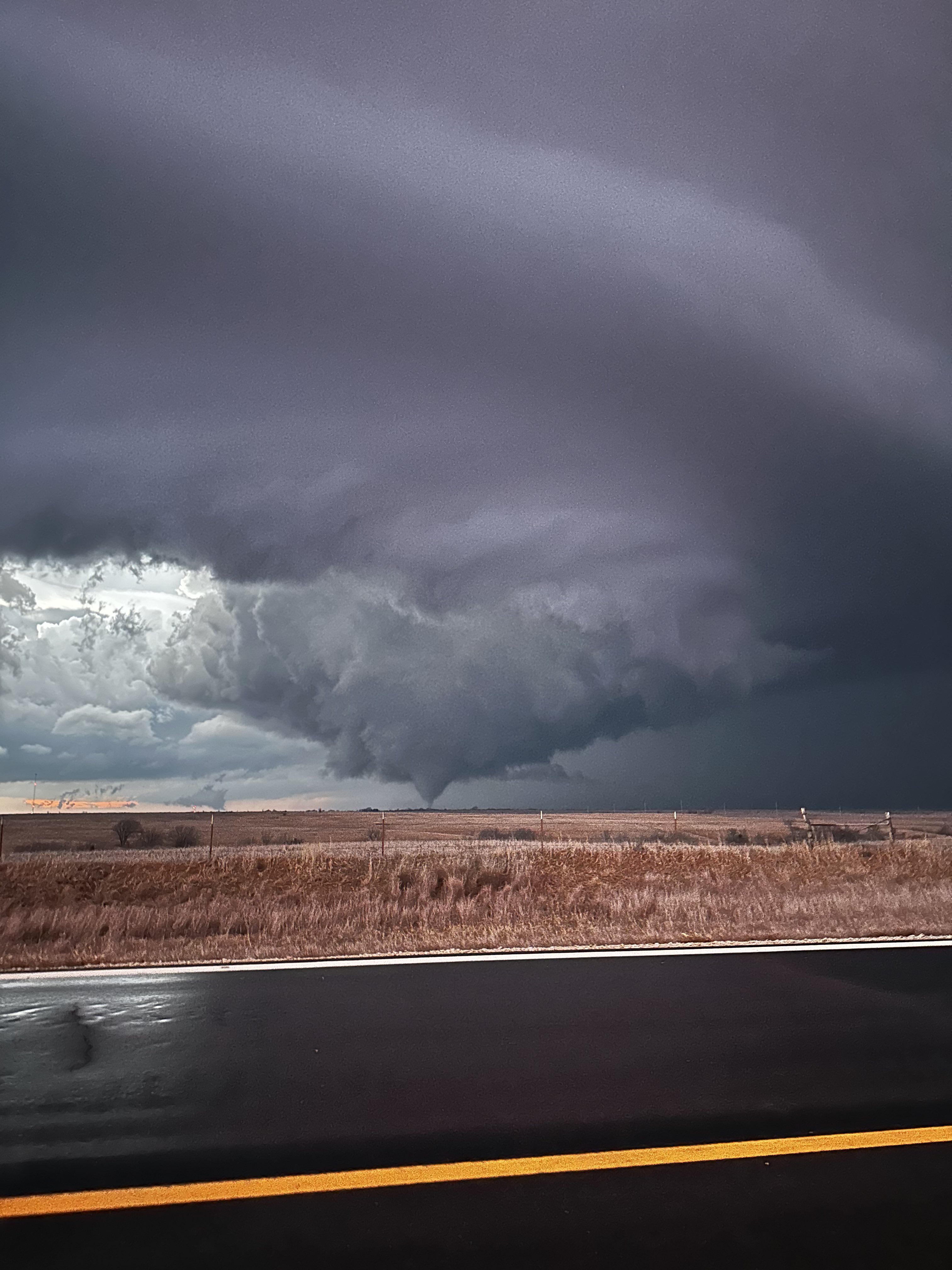
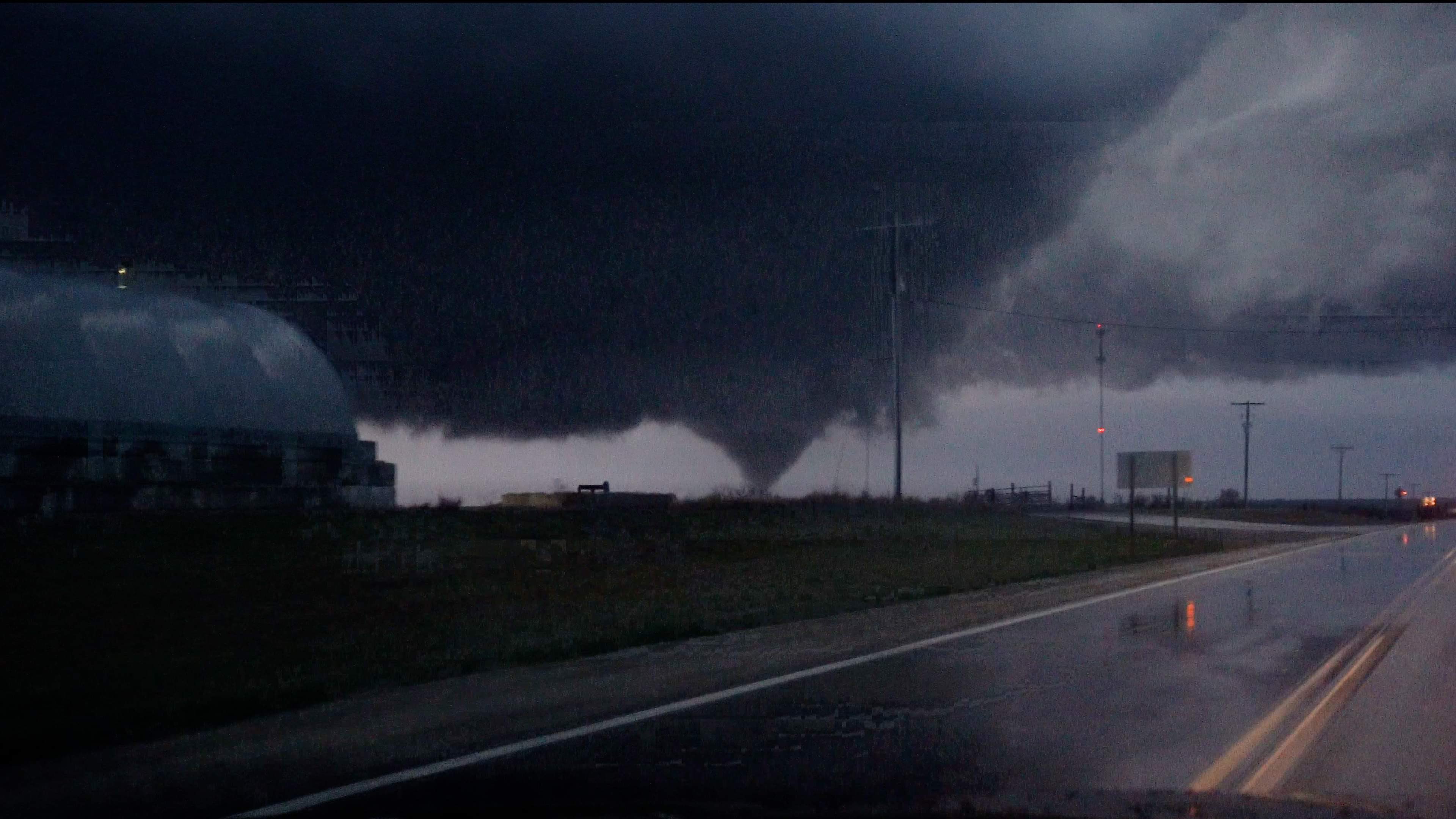
The tornado near Rossville, looking north from I-70. (Image courtesy of AJ Dome.) |
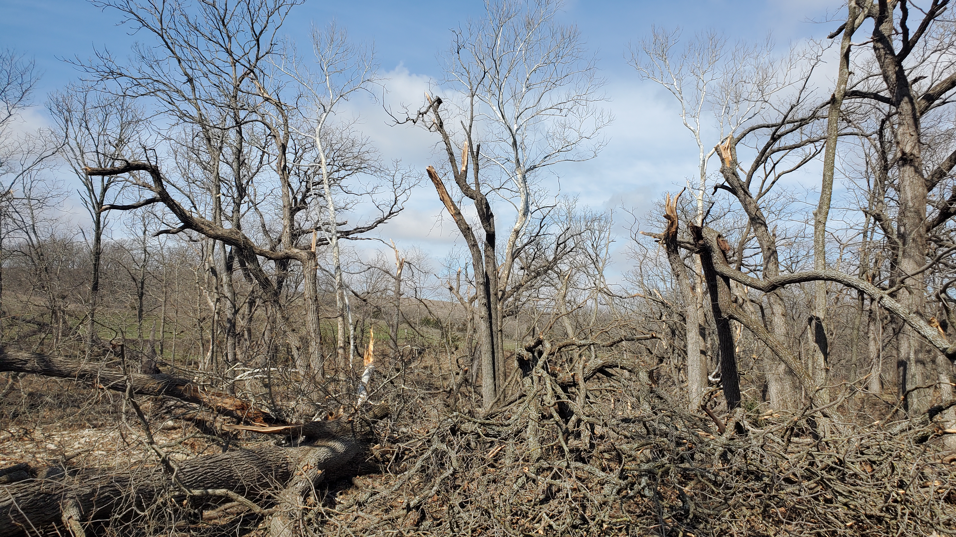
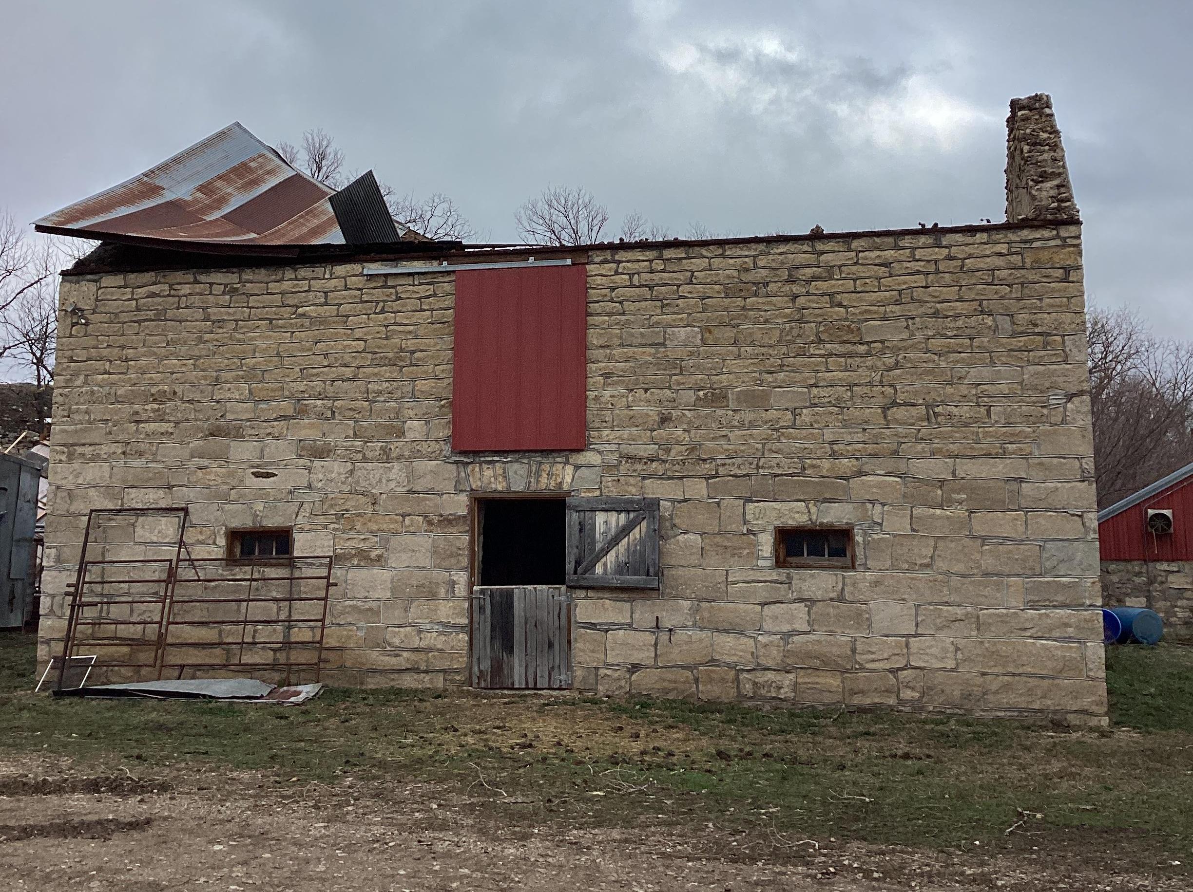
Damage Survey
 |
 |
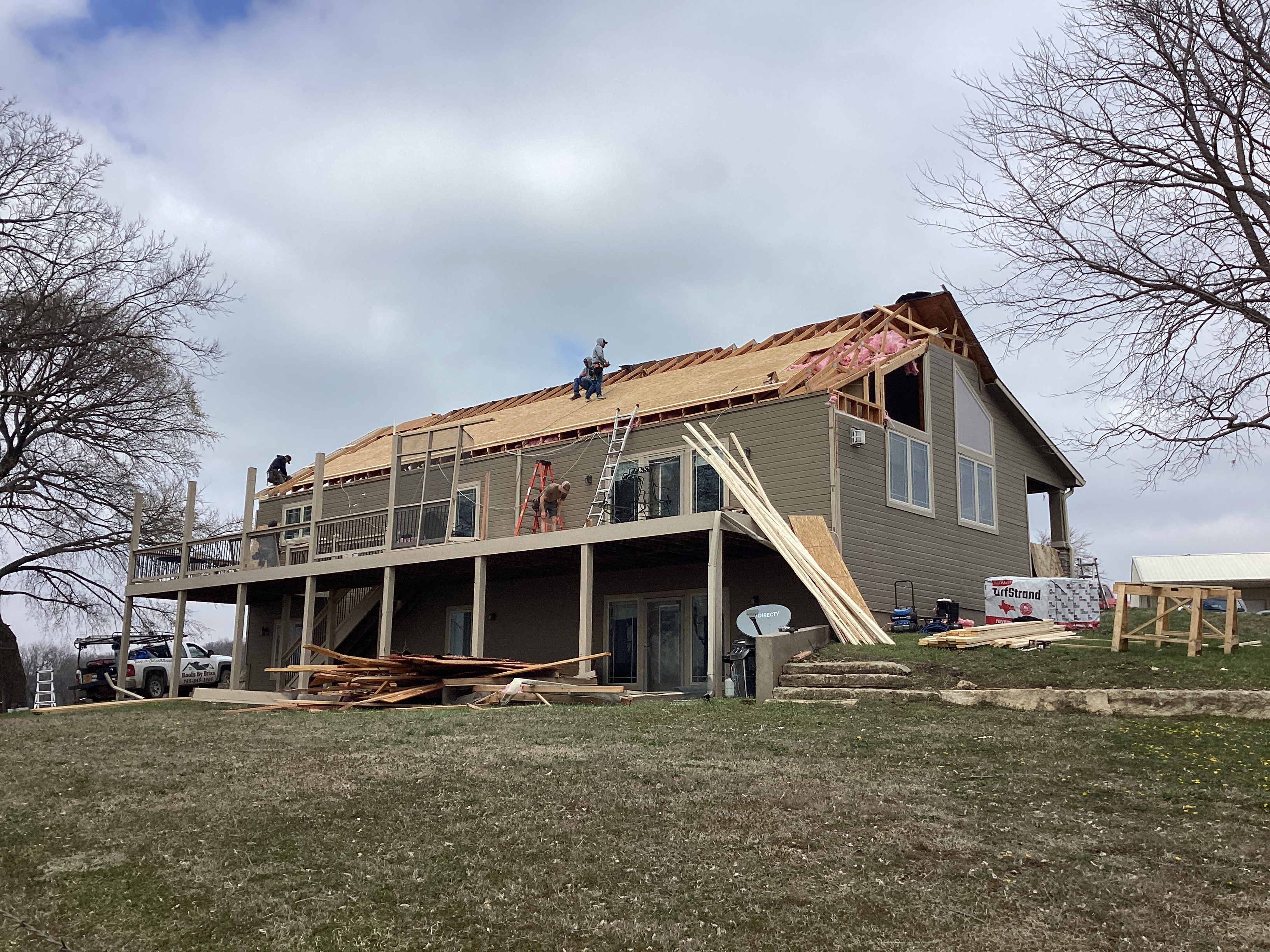 |
| EF-2 tree damage between Alta Vista and Volland. | EF-1 damage to a barn roof northeast of Volland. | EF-2 damage to a home northwest of Rossville. |
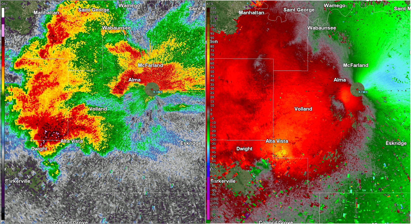
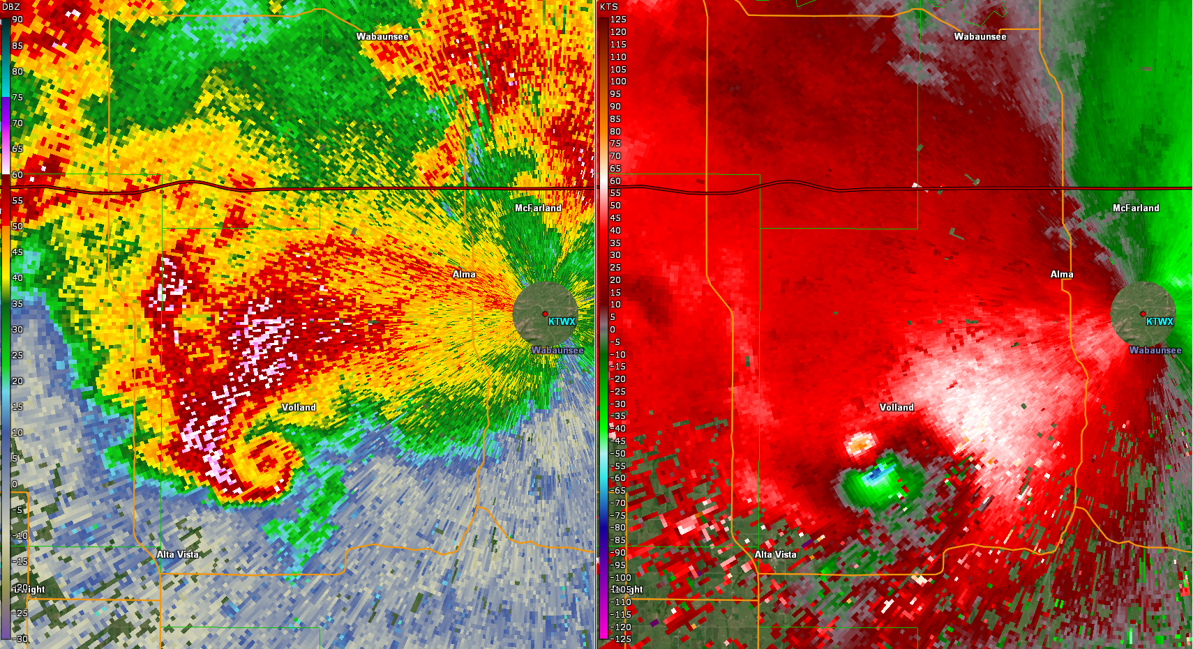
Radar
Header
 |
 |
 |
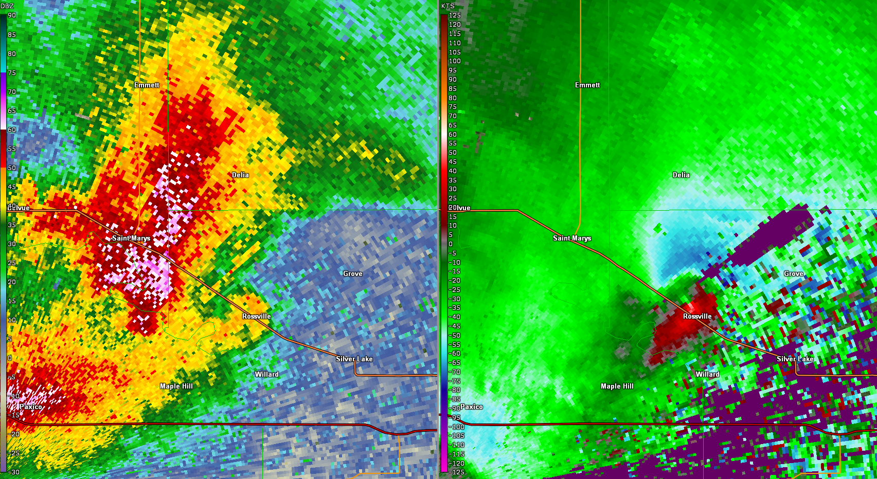 |
| Reflectivity (left) and storm-relative velocity (right) from the KTWX radar across western Wabaunsee County. | Zoomed radar view of the tornado near peak strength northeast of Alta Vista, around 7:56 PM CDT. Reflectivity on left and storm relative velocity on right. | Reflectivity (left) and storm-relative velocity (right) from the KTWX radar across northwest Shawnee and southern Jackson County. | Zoomed radar view of the tornado near peak strength northeast of Rossville, around 8:30 PM CDT. Reflectivity on left and storm relative velocity on right. |
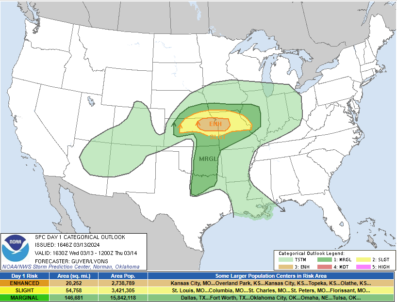
Environment
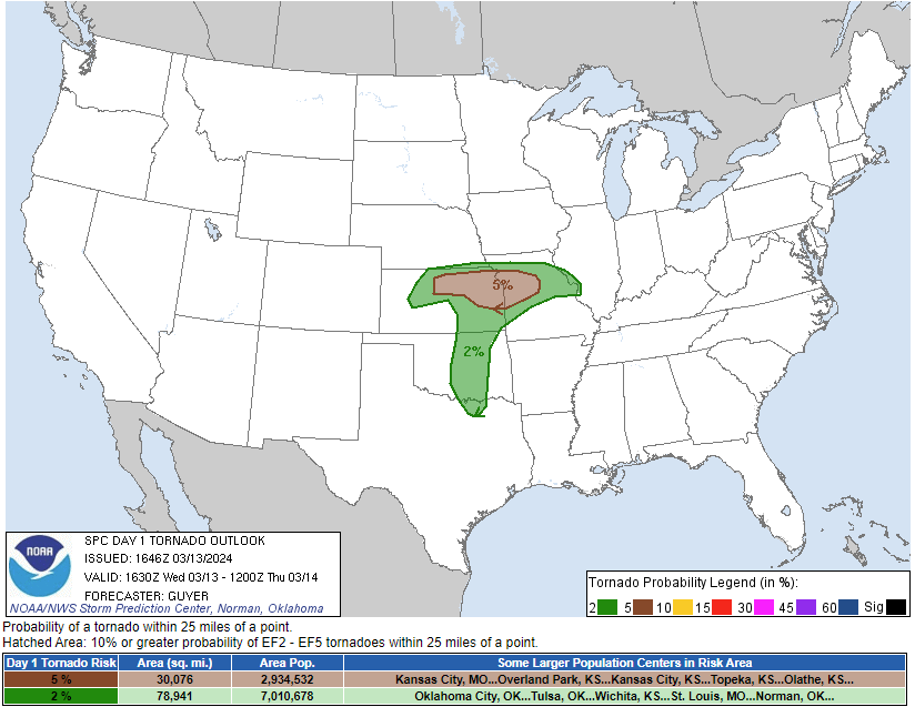
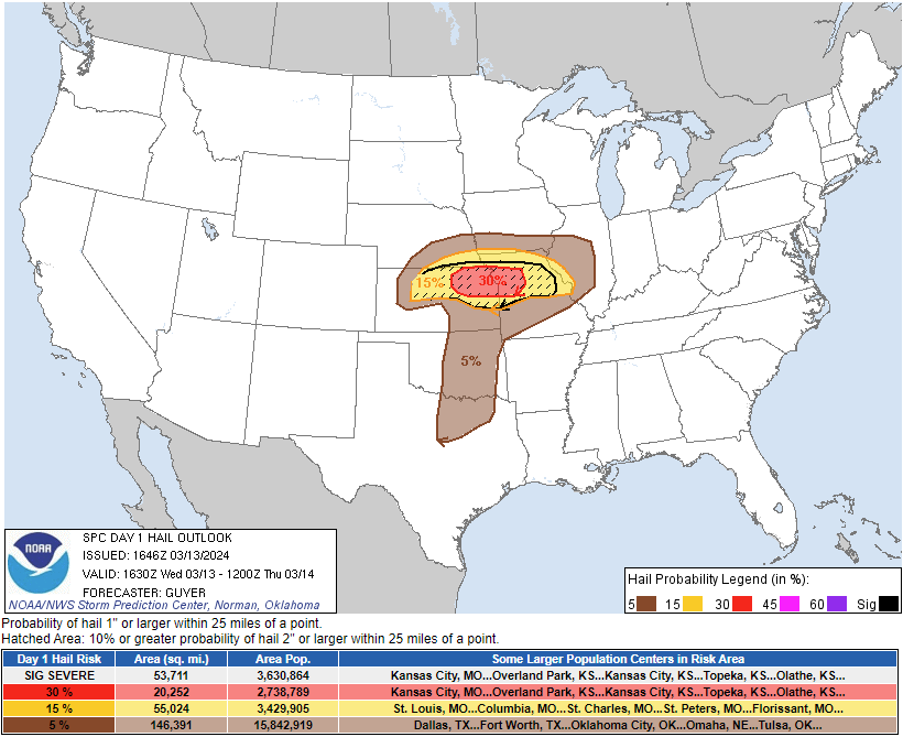
Storm Prediction Center Day 1 Outlook - 1630z
 |
 |
 |
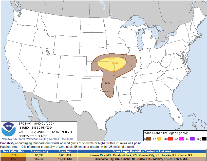 |
| Categorical Outlook | Tornado Outlook | Hail Outlook | Wind Outlook |
Severe weather parameters
 |
 |
 |
| 00 UTC (7 pm) upper air sounding at Topeka. | Mixed Layer CAPE valid at 7 pm. | Significant Tornado Parameter valid at 7 pm. |
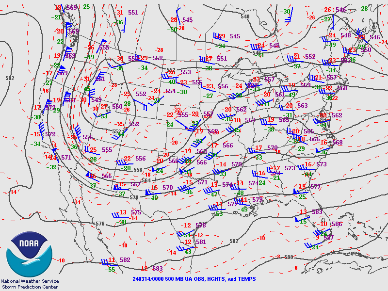
Synoptic Data
 |
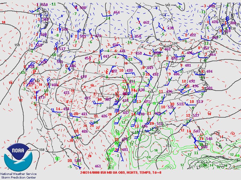 |
 |
| 500 mb pattern valid at 7 pm | 850 mb pattern valid at 7 pm | Mean sea level pressure and surface winds valid at 7 pm. |
 |
Media use of NWS Web News Stories is encouraged! Please acknowledge the NWS as the source of any news information accessed from this site. |
|