
Dangerous heat will expand from the Gulf Coast into the Southern Plains and Desert Southwest through week's end. Additional extreme heat impacting the Pacific Northwest will shift to the northern Plains by the weekend. Tropical Storm Bertha is expected to continue to impact portions of the northwestern Gulf Coast from south central Louisiana to the upper Texas coast today. Read More >
Overview
On the evening of October 6th, a strong storm system swept through northeast Kansas with a cold front. Severe storms that developed in the late afternoon quickly became severe with large hail up to golfball size, damaging winds, and two verified tornadoesTornadoes:
|
Tornado - Central Clay County
Track Map 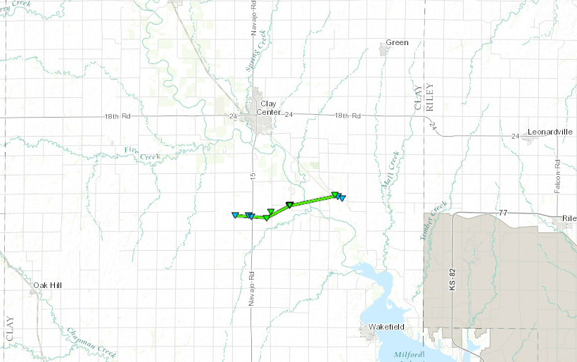 
Downloadable KMZ File |
||||||||||||||||
|
Tornado - Northern Clay and Southern
Track Map 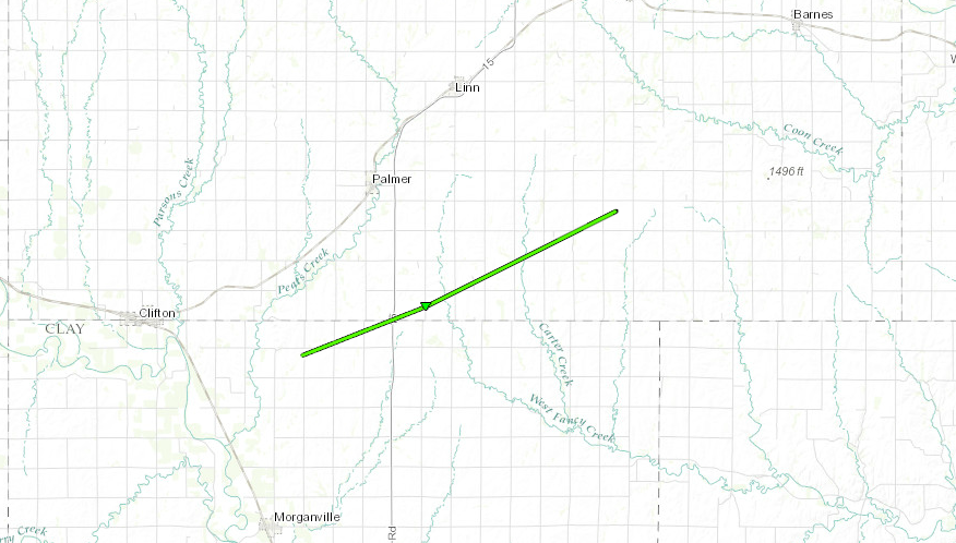
Downloadable KMZ File |
||||||||||||||||
The Enhanced Fujita (EF) Scale classifies tornadoes into the following categories:
| EF0 Weak 65-85 mph |
EF1 Moderate 86-110 mph |
EF2 Significant 111-135 mph |
EF3 Severe 136-165 mph |
EF4 Extreme 166-200 mph |
EF5 Catastrophic 200+ mph |
 |
|||||
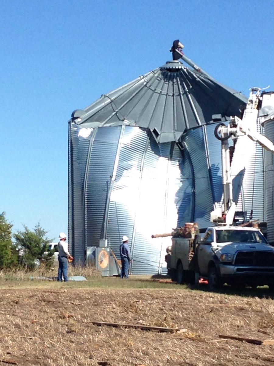
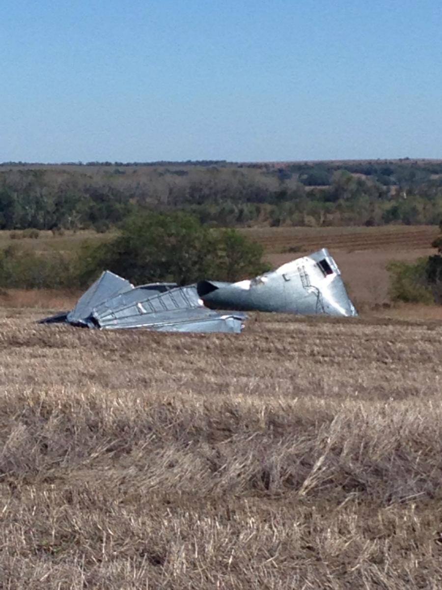
Photos & Video:
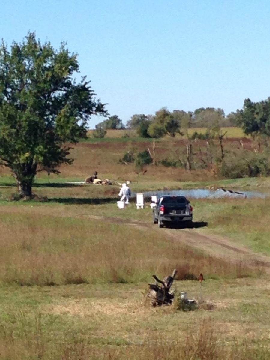
Damage photos south and southeast of Clay Center
 |
 |
 |
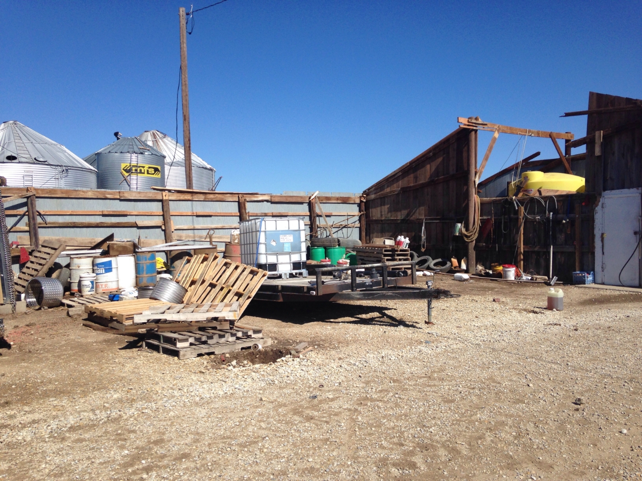 |
| Grain Bin south of Clay center | Grain Bin south of Clay Center | Hunting Cabin Destroyed | Farm Outbuilding destroyed |
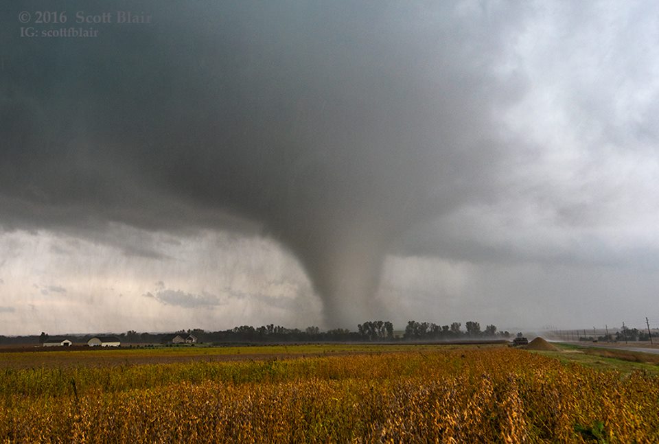
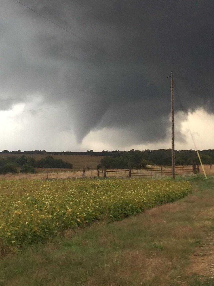
Tornado pictures from storm south of Clay Center
 |
 |
||
| Tornado south of Clay Center Courtesy of Scott Blair |
Tornado south of Clay Center Courtesy of Jonathan Napora |
Radar:
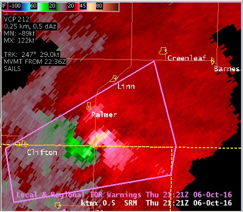
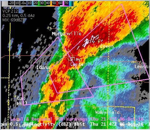
Two tornadic supercells over north central Kansas
 |
 |
 |
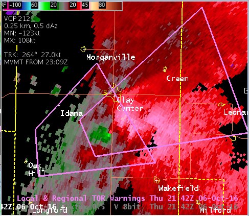 |
| Northern supercell reflectivity along Clay/Washington county line south of Palmer at 421 PM | Northern supercell velocity along Clay/Washington county line south of Palmer at 421 PM | Supercell reflectivity for tornado south of Clay Center at 442 PM | Supercell velocity for tornado south of Clay Center at 442 PM |
 |
Media use of NWS Web News Stories is encouraged! Please acknowledge the NWS as the source of any news information accessed from this site. |
|

