
A slow moving front will produce a threat for heavy rainfall and severe weather from the southwest into the western High Plains through the weekend. Heavy rainfall and isolated flash flooding and gusty winds will be possible this weekend into early next week in portions of southern Florida. Coastal flooding impacts remain possible through the weekend along the Southeast and Mid-Atlantic coasts Read More >
Overview
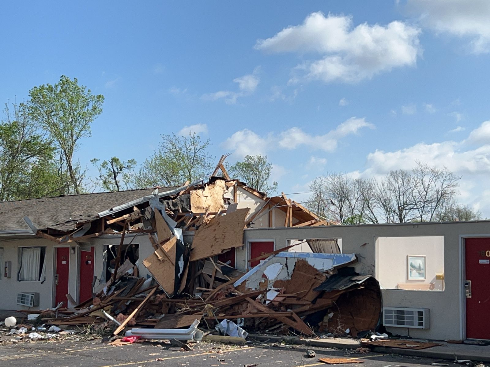
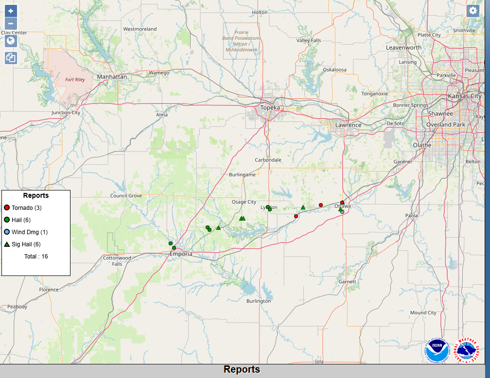
| On Monday evening (4/13/26), scattered severe storms developed across portions of east central Kansas. Very large hail up to baseball size (2.75 inches) were reported from Lyon, Osage, and Franklin counties. Additionally, two tornadoes were confirmed, one of which produced a wide swath of EF-2 damage across Ottawa in Franklin county. Fortunately, no one was seriously injured from these events. Timelapse to right is of the rain wrapped tornado near Ottawa, KS, as seen from due east (courtesy of Daniel Reese). |  |
Tornadoes:
|
Tornado - OTTAWA
Track Map  
Downloadable KMZ File |
||||||||||||||||
|
Tornado - QUENEMO
Track Map 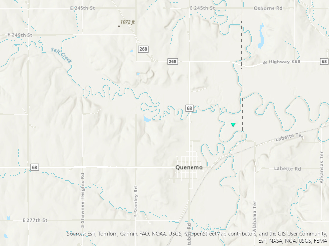
Downloadable KMZ File |
||||||||||||||||
The Enhanced Fujita (EF) Scale classifies tornadoes into the following categories:
| EF0 Weak 65-85 mph |
EF1 Moderate 86-110 mph |
EF2 Significant 111-135 mph |
EF3 Severe 136-165 mph |
EF4 Extreme 166-200 mph |
EF5 Catastrophic 200+ mph |
 |
|||||
Hail
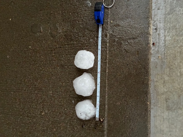
Large hail up to baseball size was reported Monday evening in and around Ottawa.
 |
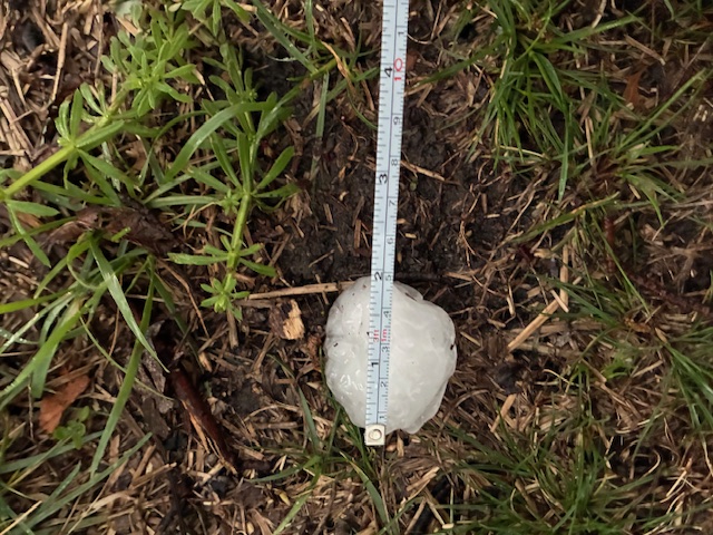 |
| Hail Up to 2 Inches in Diameter in Ottawa (courtesy of Kevin Snider) | Hail Up to 2 Inches in Diameter in Ottawa (courtesy of Kevin Snider) |
Photos & Video
Tornadoes and Damage
 |
 |
 |
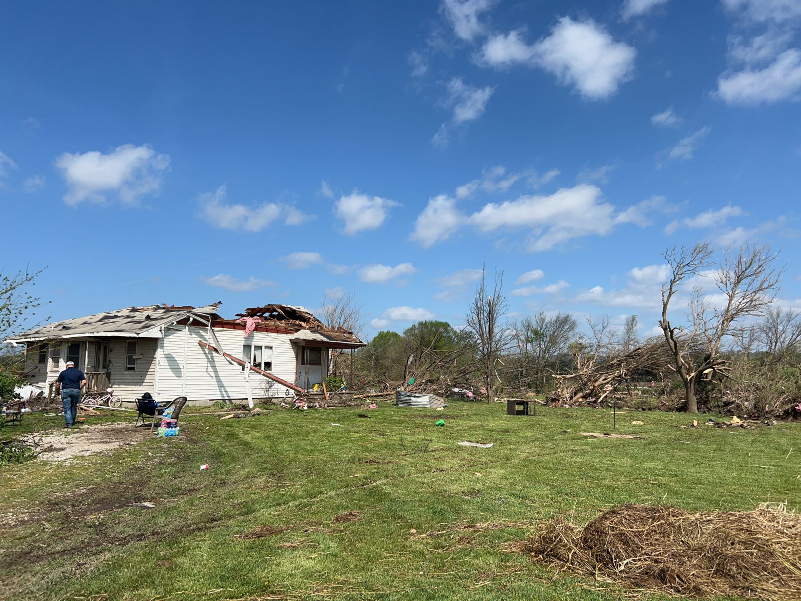 |
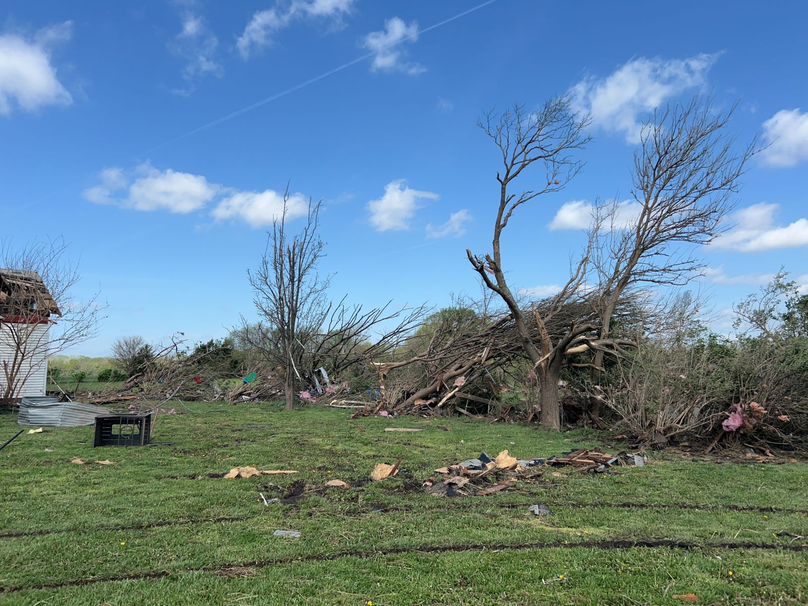
| Courtesy of John Kulmann. Ottawa Kansas took a direct hit from a significant tornado. This was the tornado near the 15th Street area, East of main. | Tree Damage in Ottawa | Damage to Motel in Ottawa | Damage to Home Near Ottawa |
Radar
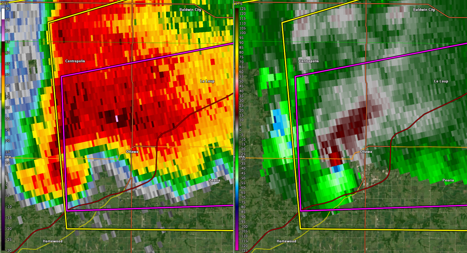
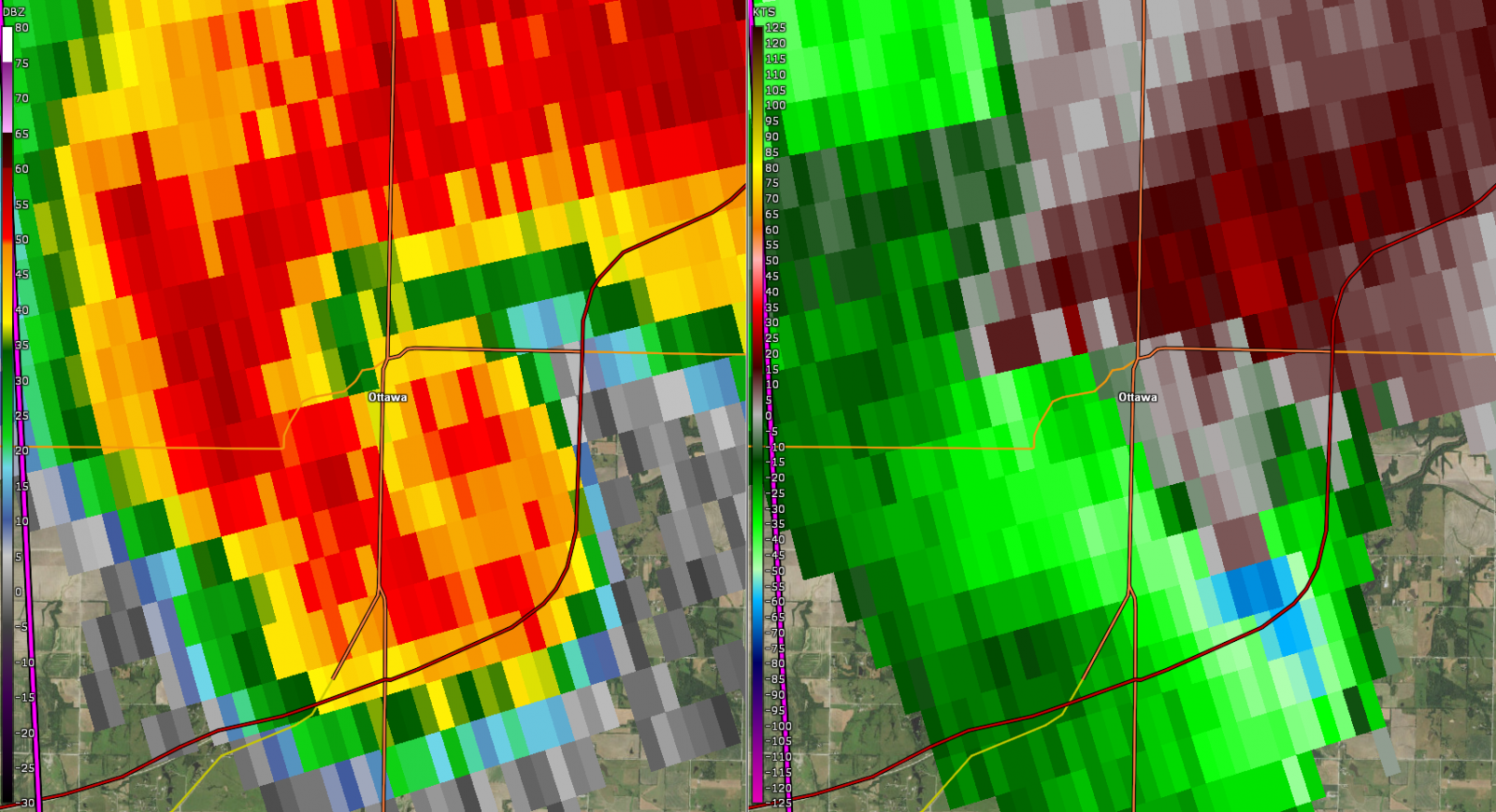
Tornado Reflectivity and Velocity Images from Ottawa and Quenemo
 |
 |
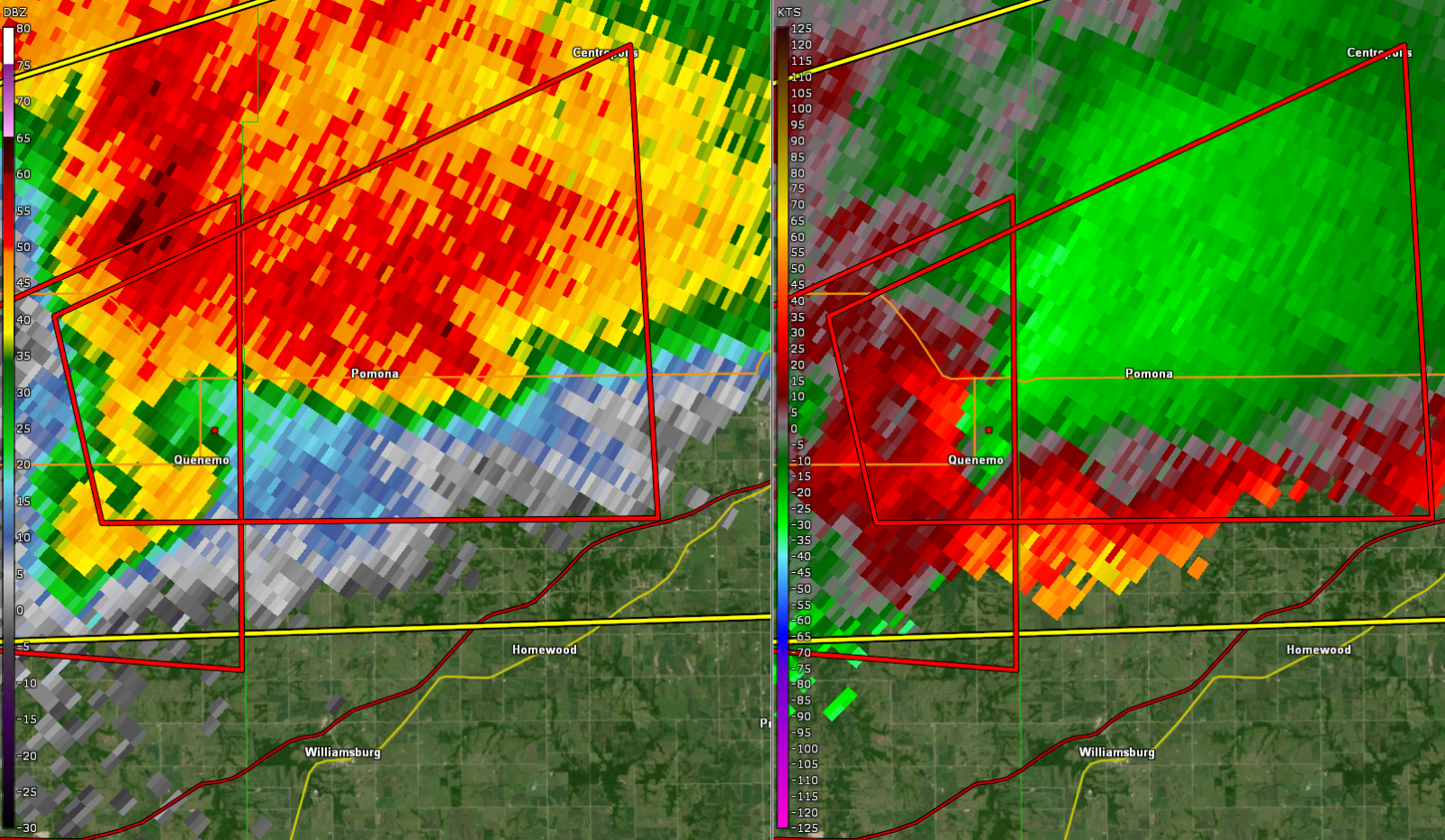 |
| KEAX Reflectivity and Velocity of Ottawa Tornado at 7:26 PM CDT | KEAX Reflectivity and Velocity of Ottawa Tornado at 7:39 PM CDT | KTWX Reflectivity and Velocity of Quenemo Tornado at 7:02 PM CDT |
 |
Media use of NWS Web News Stories is encouraged! Please acknowledge the NWS as the source of any news information accessed from this site. |
|



 Follow us on X
 Follow us on Facebook
 Follow us on YouTube
 TOP RSS Feed