Heavy lake effect snow and gusty winds, including some local blizzard conditions, will continue into Thanksgiving Day across the Great Lakes then lingering through Friday night for Lakes Erie and Ontario. Confidence is increasing for another winter storm to develop over the northern and central Rockies Friday and track across the central Plains through the Midwest and Great Lakes this weekend. Read More >
A severe weather outbreak pummeled Northeast Kansas on Thursday over 60 reports of large hail, damaging thunderstorm wind gusts or flooding rains. A complete list of the reports from this event can be found by visiting https://mesonet.agron.iastate.edu/lsr/#TOP/201509100500/201509111700/0101
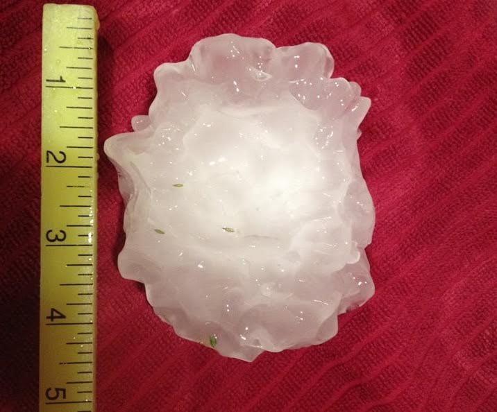
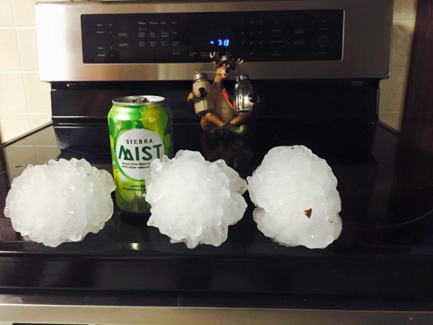
The storms began as what are called supercells across Northcentral Kansas around 5pm. These storms were responsible for producing very large hail across Washington and Riley Counties where baseball to softball size hail was documented. In fact, a hailstone to the size of a softball was recorded in Randolph in Riley County Kansas northwest of Manhattan, Kansas. The photos below are from Randolph and are courtesy of WIBW and KSNT TV.
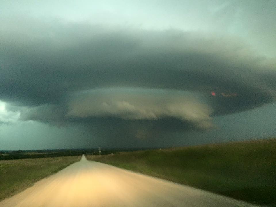
The storms retained their supercell characteristics which includes a rotating updraft which is called a mesocyclone. If viewed from the east or southeast these mesocyclones can be quite impressive visually. Images below are taken of supercells from near Linn in Washington County that went on to produce softball size hail. The picture below is courtesy of WIBW TV.
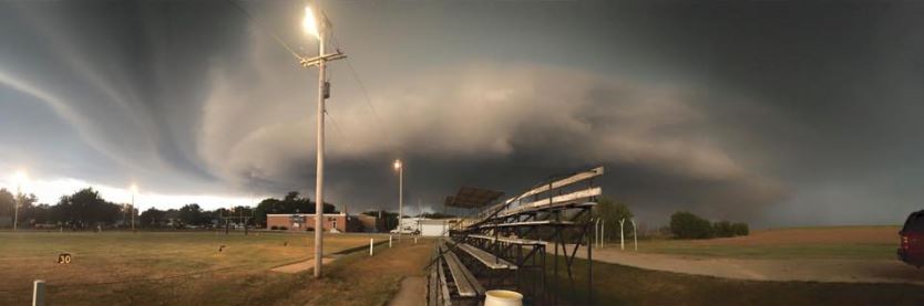
The storms retained their supercell structure into Wabaunsee County. In fact, one supercell was able to generate low level rotation and NWS Topeka issued a tornado warning for the storm as it moved into far southeast Wabaunsee and southwest Shawnee County. The photo below is of the supercell as it moved across Wabaunsee County courtesy of WIBW TV.
The supercell thunderstorm in the image above moved southeast and did end up producing a brief weak tornado in extreme southeast Wabaunsee and southwest Shawnee County between 815 and 820 pm CDT. The approximate path of the tornado is below.
.jpg)
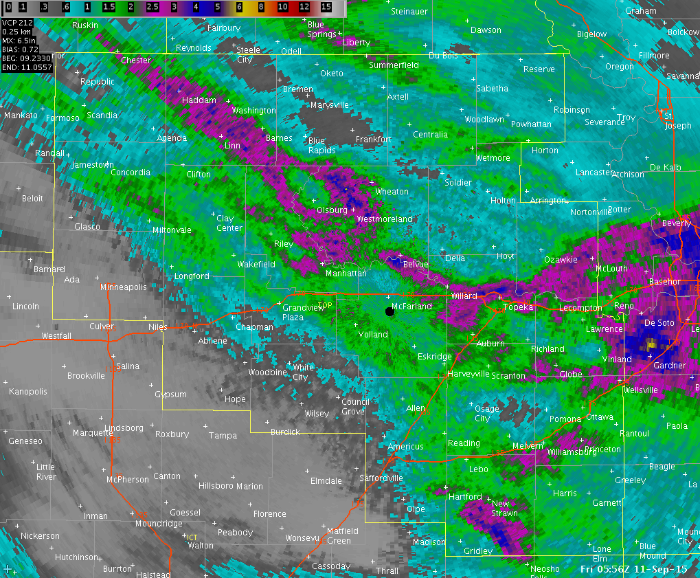
Shortly thereafter the storms transitioned into more of a line where damaging straight line winds become a greater risk and the hail threat diminished. At the same time areas to the north of the now bowing line found themselves under the nearly stationary pivoting area of torrential rains along the I-70 corridor including Topeka. See the image below.
.gif)
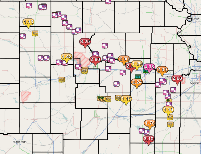
Areas along Interstate 70 including the City of Topeka were on the north side of the developing line of storms where torrential rains ended up dumping over 3 inches of rain in one hour. In fact, Topeka Billard Airport ASOS recorded 3.41 inches in one hour between 9 pm and 10 pm. One hour rainfall rates of 3.41 inches are considered to be a 50 to 100 year event for Topeka according to NOAA Atlas point precipitation frequency data found at https://hdsc.nws.noaa.gov/hdsc/pfds/pfds_map_cont.html?bkmrk=ks Numerous water rescues ensued across the city of Topeka due to the incredible rainfall rates and resulting flash flooding. The image below is the storm total rainfall map for this event. Many areas around Topeka received 2-4 inches of rain.