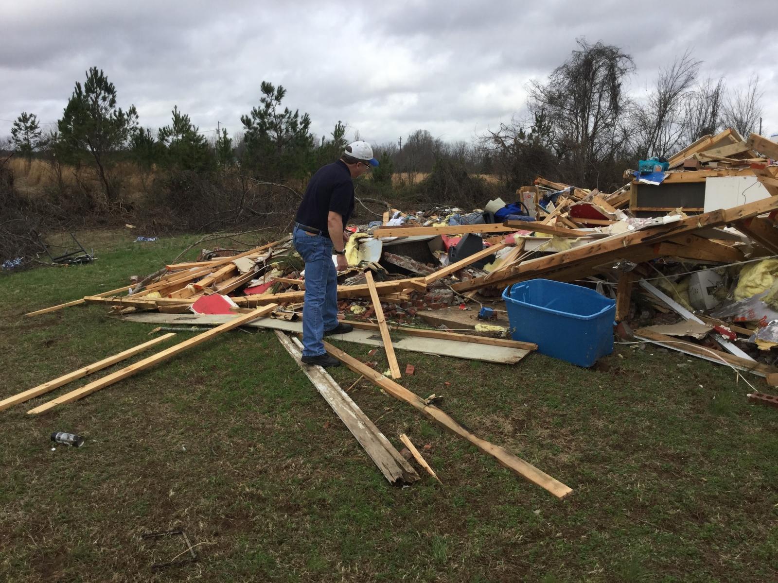
Damage survey team member (Gary Woodall) inspect homes destroyed in the December 23, 2015, tornadoes in northern Mississippi. |
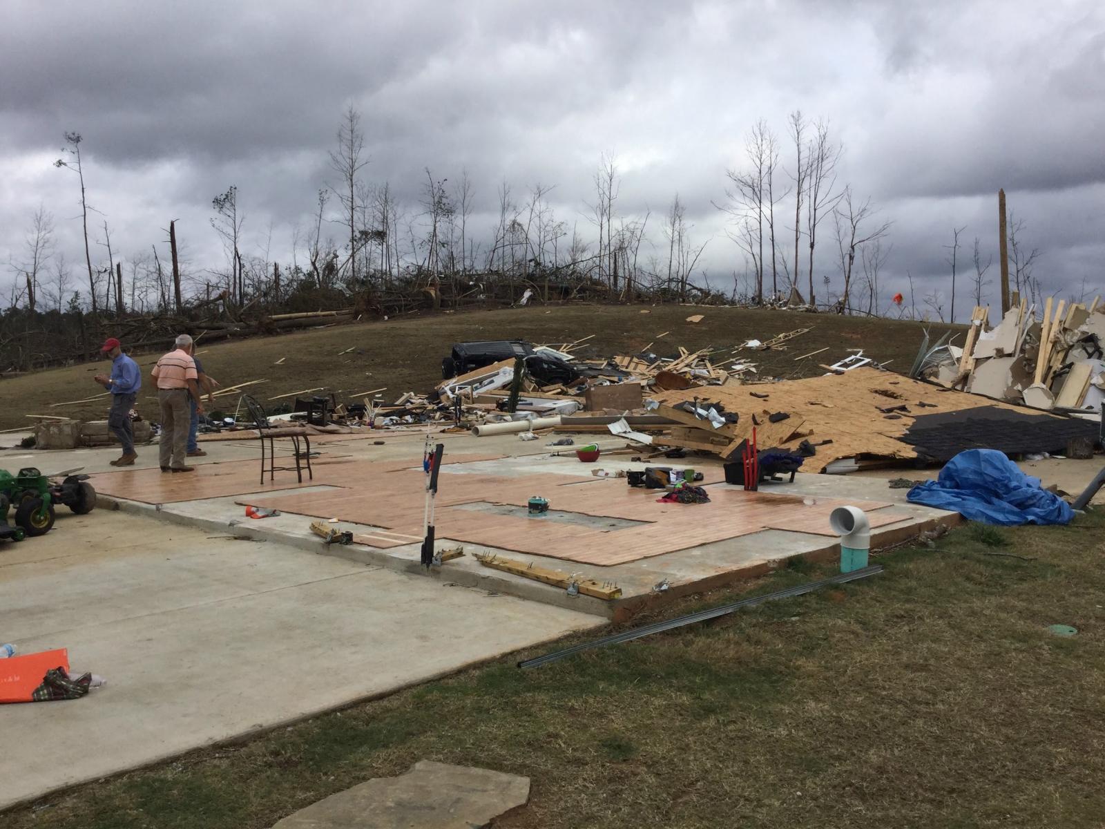
Damage survey team members (Jim Belles and Benton County officials) inspect homes destroyed in the December 23, 2015 tornadoes in northern Mississippi. |
Imagine it's late evening, the sun has set, and you’re a meteorologist for the National Weather Service (NWS) exhausted from working a 13–hour day providing forecasts and warnings for a significant severe weather event that moved through your forecast area. Although the powerful storm system that produced several tornadoes earlier in the day has exited the region, this event is not completely over. As severe weather reports filter into the office, it becomes clear that a couple of the tornadoes caused significant damage, and you’ll be heading out to conduct a damage survey first thing in the morning. Get some rest..another long day lies ahead.
The scenario above is a common occurrence for meteorologists in the National Weather Service, as was recently illustrated by the tornado outbreak across the southern U.S. in late December. In order to increase our understanding of severe weather, scientists at the NWS often survey the storm damage, in particular the damage caused by tornadoes. Since tornadic winds are rarely measured by instruments at the surface, forecasters use the Enhanced Fujita (EF) scale to estimate the wind speed and rate the tornado between EF0 (weakest) and EF5 (strongest).
Trying to determine the strength of the tornado is a lot like forensic meteorology - you have to piece together clues from the damage scene in order to determine how strong the winds were that caused it. You have to analyze not only the extent of the damage, but also the structural integrity of the object (tree, powerline, house, barn, etc) that was involved. For example, complete destruction of building may not be caused by EF4 winds (>165 mph) or EF5 winds (>200 mph) if the building was poorly built. Forecasters must keep this in mind as they look at countless damage indicators along the path of the tornado, and eventually rate the tornado based on the worst damage that occurred.
The Enhanced Fujita Scale is named after Tetsuya Theodore “Ted” Fujita, who was a severe storms researcher and professor at the University of Chicago. His meticulous approach to the orientation and magnitude of storm damage revolutionized our understanding of bow echoes, microbursts, and tornadoes. Brian Smith, now the Warning Coordination Meteorologist at the National Weather Service Office in Omaha, Nebraska, was once a student under Dr. Fujita in the early 1980s. “It was a very rewarding experience,” Smith said. “He was a master of photogrammetry - trying to figure out where you were from the aerial photos. He was very detailed, and you were on your guard to make sure you were right.” Fujita’s attention to detail continues to be an important part of the damage survey process. “Patience is also an important part,” Smith said. “You have to do a thorough analysis to piece together what happened.”
Another key component of the damage survey process is interacting with the people who were affected by the tornado. “It's a sobering thing,” Smith said. “You see things, the horror people have gone through. I feel uneasy at times when I’m out there on foot taking pictures of the damage, because I feel like I’m walking on their sorrows, like I’m intruding. It's the most difficult part of the job, because then you start thinking about your own family. It's a very humbling experience.”
Most people are quite understanding considering what they just went though. “A lot of times when you tell them who you are, they open up and start talking,” Smith said, “and that’s part of the grieving process. You feel more welcome when they do that.”
Gary Woodall, the Warning Coordination Meteorologist at the National Weather Service in Memphis, Tennessee, had this to say about his interactions with people: “In the vast majority of cases people want to share their story. It’s encouraging to hear accounts of people who followed the tornado safety tips and survived. It's especially rewarding when they talk about getting advanced warning with the NOAA Weather Radio and sirens and they want to thank you.”
One thing that has changed considerably over the past 30 years is the technology used to conduct a damage survey. As Brian Smith recalled, “I remember years ago using maps, pencil, pens, and an odometer as a guide.” Advancements with digital cameras and GPS help make the survey process more accurate. Within the past few years, a new software developed by the National Weather Service, called the Damage Assessment Toolkit (DAT), harnesses the power of smartphones and tablets. Using these devices, with just a few finger taps, forecasters can now take pictures of the damage, rate the damage using the EF scale, and upload the information to a server that can be viewed instantaneously back at the local NWS office. All the images are geocoded and can be easily mapped out to calculate the exact track of the tornado. At times, aerial surveys are also done to get a scope of the damage track. High-resolution satellite imagery is another tool that can be requested to help forecasters determine the exact track of the tornado by looking at vegetation scars. Brian hopes in the future that drones may also be used to gather information from a bird’s eye view.
A looming question that you may have is how is this information from the damage survey used, and what benefits does it have?According to Gary Woodall, documenting the intensity of tornadoes, “helps with creating a tornado climatology and aids in our preparedness campaigns. It’s also useful for researchers.” Another important benefit, he added, is “for internal training of forecasters to compare the near storm environment and radar signatures to the damage.” His last point about the near storm environment is arguably the most important.
By studying tornado climatology gathered through damage surveys and comparing it to past weather conditions from that day, meteorologists are able to better understand the atmospheric conditions in place prior to significant severe weather outbreaks. In addition, computer models continue to improve and make more accurate predictions of when these conditions are expected to occur. The combination of better understanding and better predictions of the atmosphere leads to improved severe weather forecasts. These improvements would not be possible without the information gathered from damage surveys. Future advancements to build a Weather-Ready Nation are sure to come from this database as well.

