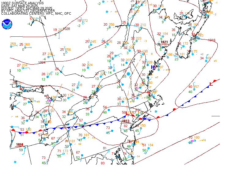
Deep tropical moisture will lead to widespread showers and thunderstorms capable of producing flash flooding through early next week over the Southwest and Four Corners. A coastal storm is expected to develop off the southeast U.S. coast tonight and is expected to strengthen and bring flooding, dangerous rip currents, gusty winds and heavy rain up much of the East Coast through early next week. Read More >
For ATC Planning Purposes Only
.AVIATION /14Z FRIDAY THROUGH TUESDAY/...
VFR conditions are expected through tonight. Winds become more
southeasterly this afternoon, bringing in marine stratocu
around 5KFT for the I-95 terminals.

A coastal low develops along the Southeast U.S. coast this weekend,
then moves north along the Mid-Atlantic coast through the start of
next week. This is going to bring showers, some steady rain, breezy
conditions and likely sub-VFR conditions Saturday evening through
Sunday night.

Sub-VFR conditions remain possible Monday morning as precipitation
lingers due to a nearby coastal low. VFR conditions return Monday
evening and persist through Tuesday as high pressure builds
overhead. Northwest winds gust 20-25 knots for metro terminals with
MRB and CHO gusting 15-20 knots. Winds lighten slightly on Tuesday,
gusting 15 to 20 knots in the afternoon.

AVIATION...AVS/KLW/KRR
Update as of: 1010 AM EDT Fri Oct 10 2025
098

FTUS41 KLWX 101422 AAA

TAFBWI

TAF AMD

KBWI 101422Z 1014/1118 06006KT P6SM FEW035

     FM101600 12007KT P6SM SCT050

     FM110000 10003KT P6SM BKN050

     FM110800 05003KT P6SM BKN040

     FM111400 08008KT P6SM BKN030=
TAFCHO (View previous versions )
765

FTUS41 KLWX 101132

TAFCHO

TAF

KCHO 101132Z 1012/1112 03005KT P6SM OVC035

     FM101500 13008KT P6SM SCT050

     FM110200 VRB02KT P6SM BKN050=
TAFDCA (View previous versions )
096

FTUS41 KLWX 101422 AAA

TAFDCA

TAF AMD

KDCA 101422Z 1014/1118 04006KT P6SM FEW050

     FM101700 14007KT P6SM SCT050

     FM110400 08005KT P6SM BKN050

     FM110800 02006KT P6SM BKN040

     FM111400 06008KT P6SM BKN030=
TAFIAD (View previous versions )
097

FTUS41 KLWX 101422 AAA

TAFIAD

TAF AMD

KIAD 101422Z 1014/1118 03003KT P6SM FEW050

     FM101600 14008KT P6SM SCT050

     FM110500 36003KT P6SM BKN040

     FM111400 05007KT P6SM BKN030=
TAFMRB (View previous versions )
768

FTUS41 KLWX 101132

TAFMRB

TAF

KMRB 101132Z 1012/1112 00000KT P6SM SKC

     FM101500 15007KT P6SM SCT050

     FM110200 00000KT P6SM FEW050=
TAFMTN (View previous versions )
769

FTUS41 KLWX 101132

TAFMTN

TAF

KMTN 101132Z 1012/1112 VRB03KT P6SM SKC

     FM101600 11007KT P6SM SCT045

     FM110400 00000KT P6SM BKN050=
Meteorological Impact Statement
FAUS20 KZDC 172025
ZDC MIS 01 VALID 172025-172300
...FOR ATC PLANNING PURPOSES ONLY...
THE ZNY CWSU WILL BACK-UP ZDC CWSU BETWEEN 21Z-01Z.
=

