Canadian wildfire smoke will push into the Midwest, worsening air quality. A frontal system brings severe storms from the Northern Plains to the Mid‑Atlantic the next few days. Heavy Gulf Coast rain is possible as we closely monitor tropical development, while monsoonal storms persist in the Southwest with heavy rainfall. Hazardous heat expands from the Plains into the Lower Mississippi Valley. Read More >
|
NY TRACON Strategic Planning Aid (SPA) For ATC Planning Purposes Only - Page refreshes every 5 minutes - See AviationWeather.gov if data is not current |
***DATA BEST VIEWED IN CHROME BROWSER***

YELLOW TABS indicate TAF updated within last 30 minutes. RED TABS indicate TAF updated within last 5 minutes.
IMPORTANT: ITWS wind directions are magnetic. METAR/TAF winds are true. Add 13 degrees to METAR/TAF wind to get the magnetic direction.
Latest METAR:Older TAFs
TAF Impact Board
ITWS Winds (GRAPH)
5-min ASOS Data
Hourly Temperature Forecast
General Public Forecast
IMPORTANT: ITWS wind directions are magnetic. METAR/TAF winds are true. Add 13 degrees to METAR/TAF wind to get the magnetic direction.
Latest METAR:Older TAFs
TAF Impact Board
ITWS Winds (GRAPH)
5-min ASOS Data
Hourly Temperature Forecast
General Public Forecast
IMPORTANT: ITWS wind directions are magnetic. METAR/TAF winds are true. Add 13 degrees to METAR/TAF wind to get the magnetic direction.
Latest METAR:Older TAFs
TAF Impact Board
ITWS Winds (GRAPH)
5-min ASOS Data
Hourly Temperature Forecast
General Public Forecast
IMPORTANT: ITWS wind directions are magnetic. METAR/TAF winds are true. Add 13 degrees to METAR/TAF wind to get the magnetic direction.
Latest METAR:Older TAFs
TAF Impact Board
5-min ASOS Data
Hourly Temperature Forecast
General Public Forecast
IMPORTANT: ITWS wind directions are magnetic. METAR/TAF winds are true. Add 13 degrees to METAR/TAF wind to get the magnetic direction.
Latest METAR:Older TAFs
TAF Impact Board
5-min ASOS Data
Hourly Temperature Forecast
General Public Forecast
IMPORTANT: ITWS wind directions are magnetic. METAR/TAF winds are true. Add 13 degrees to METAR/TAF wind to get the magnetic direction.
Latest METAR:Older TAFs
TAF Impact Board
5-min ASOS Data
Hourly Temperature Forecast
General Public Forecast
Click on Radar and Satellite images below for a loop.
|
Radar Loop
|
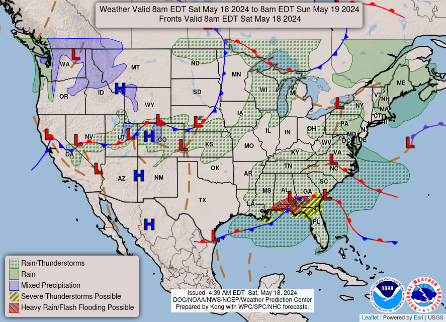
Current Weather Map
|
|
Visible Satellite Loop
|
Infrared Satellite Loop
|
|
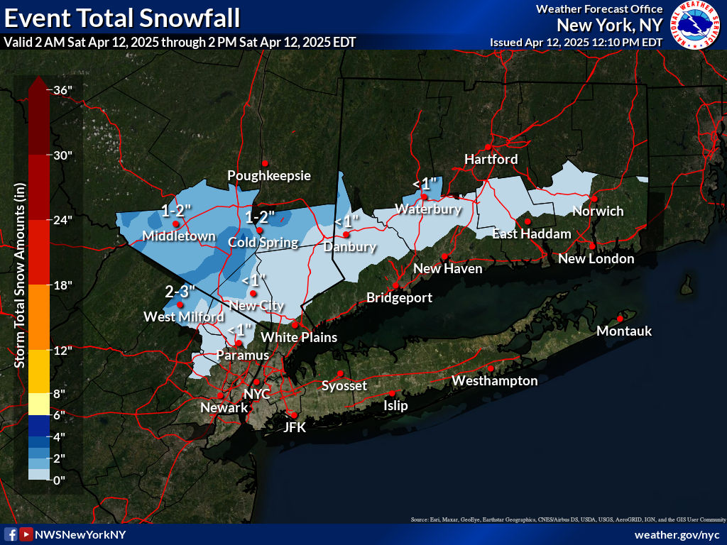
Expected Snowfall
|
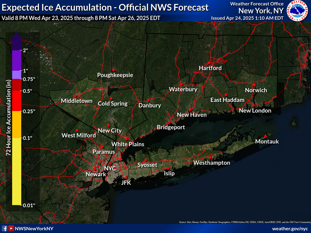
Expected Ice Accumulation
|

Click on images below to enlarge.
(Updated daily April 1 - September 30)
|
Radar Loop
|
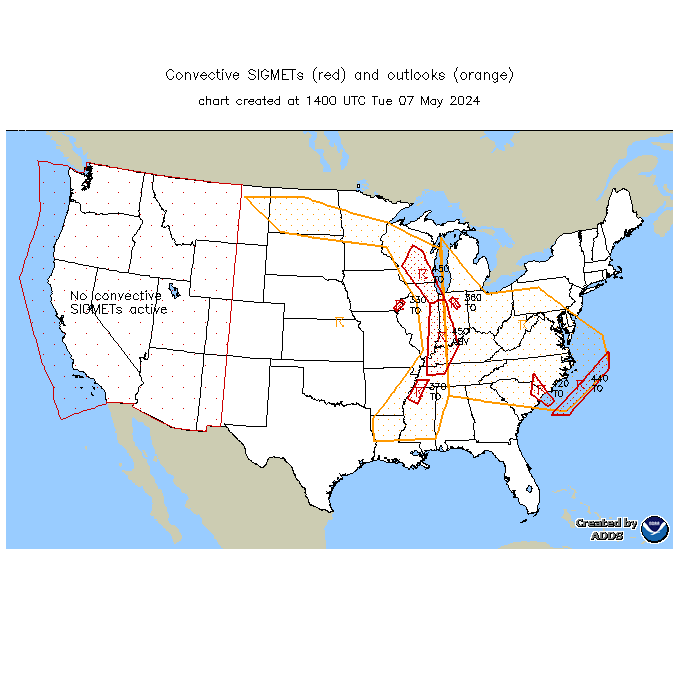
Convective SIGMETs
|
TFM Convective Forecast (TCF)
|
|
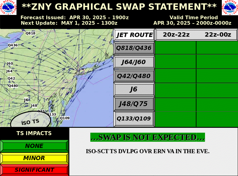
Day 1 SWAP Forecast
|
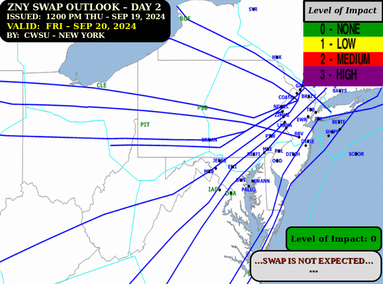
Day 2 SWAP Outlook
|
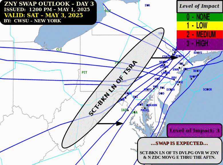
Day 3 SWAP Outlook
|
|
SPC Day 1 Convective Outlook
|
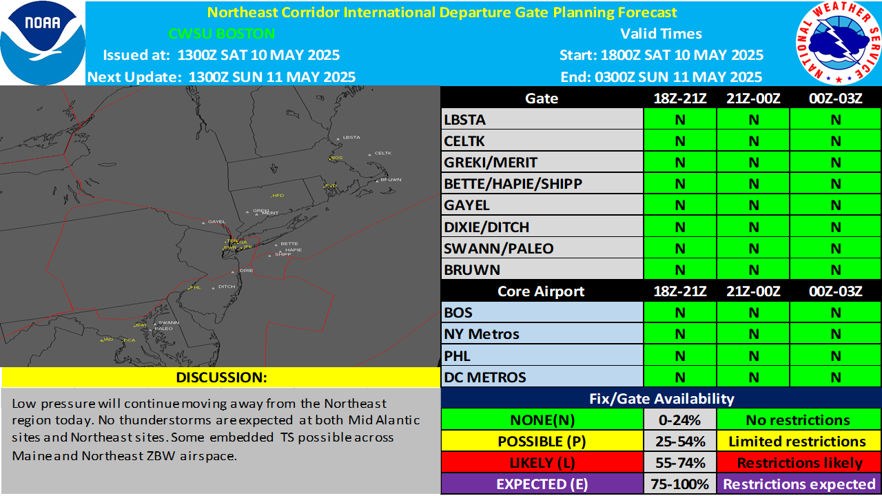
International Departure Gate Forecast
|
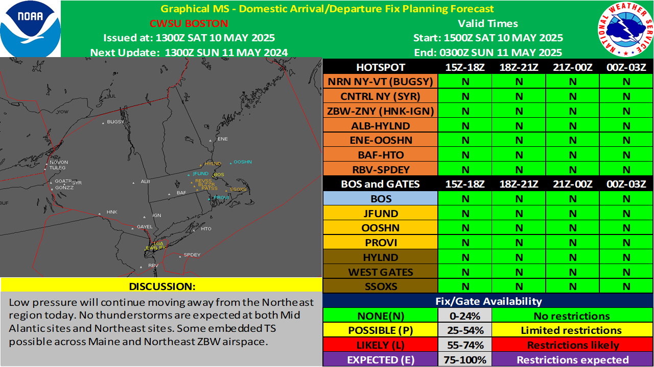
Domestic Arrival/Departure Fix Forecast
|
|
CIP/FIP Icing Guidance 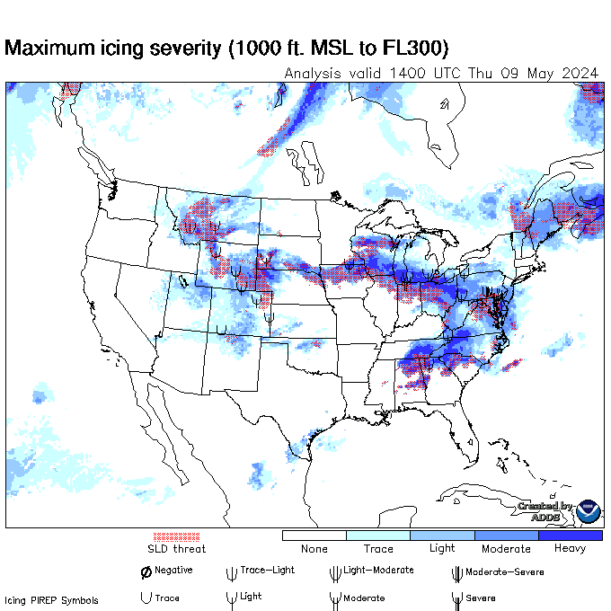 |
Current Icing SIGMETs
|
Recent Icing PIREPs
|
|
00-03 hr Icing AIRMETs
|
03-06 hr Icing AIRMETs
|
06-09 hr Icing AIRMETs
|
|
|
|
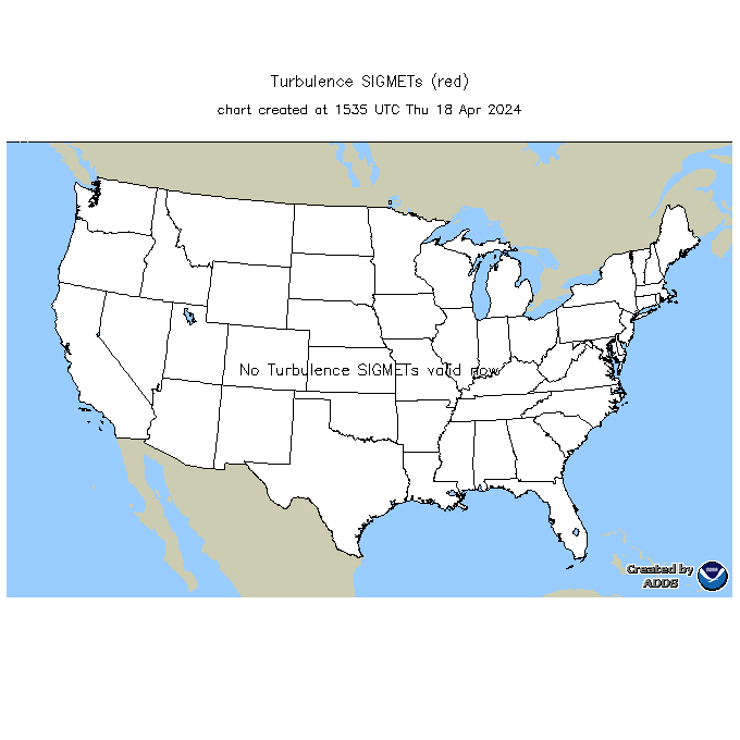
Current Turb SIGMETs
|
Recent Turb/LLWS PIREPs
|
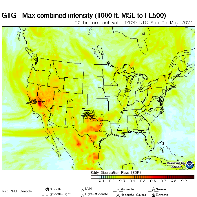
Turbulence Guidance (GTG)
|
|
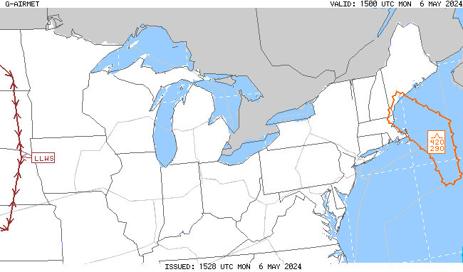
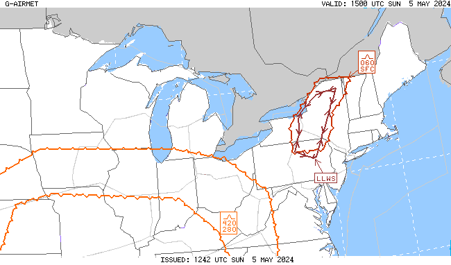
00-03 hr Turb/LLWS AIRMETs
|
03-06 hr Turb/LLWS AIRMETs
|
06-09 hr Turb/LLWS AIRMETs
|
|
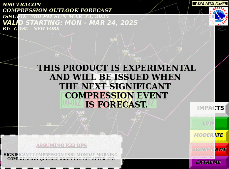
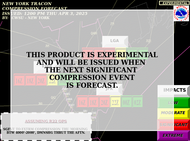
N90 Compression Outlook
|
N90 Compression TDA
|