
A cold front will cross the Great Lakes and Northeast U.S. through Monday with gusty winds and areas of rain showers. A strong atmospheric river is expected to move into the Pacific Northwest by midweek bringing a threat for moderate to heavy rainfall, gusty winds, and mountain snows for parts of Washington, Oregon, northern California, and the Sierra Nevada. Read More >
Overview
|
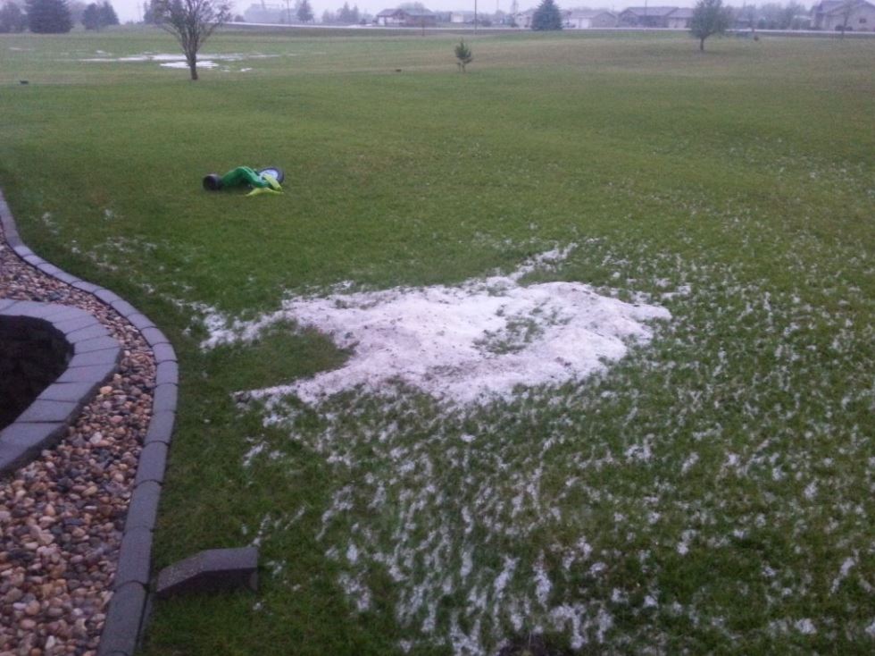
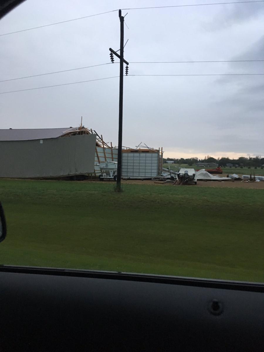
An early morning storm system impacted parts of central and east central South Dakota. While large hail fell in the Pierre area, parts of Hamlin and Deuel counties were the hardest hit. This area experienced winds in the 80 to 90 mph range, along with large hail. Northwest of Castlewood multiple power poles were downed blocking the intersection of Highways 81 and 22. In the city of Castlewood winds caused structural damage, tree damage, and the wind-driven hail broke through windows and punched holes in siding. The assisted living was evacuated due to damage on the north end of the building. No travel was advised in the city due to debris blocking roadways. Further southeast, hail up to the size of golf balls damaged homes in the town of Astoria. Significant crop damage was also noted along the path of this storm. |
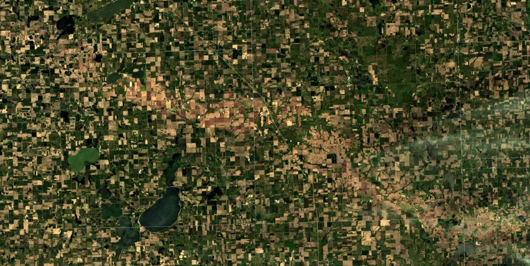 Image from the Sentinel 2A Satellite via Carl Jones, showing a hail scar across the landscape |
Wind & Hail:
Pierre
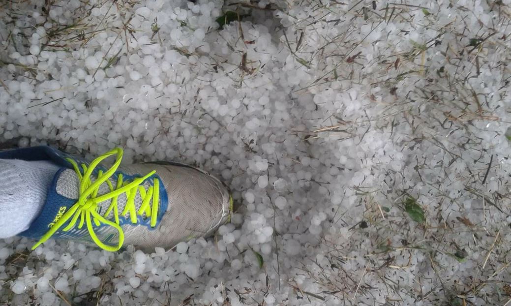
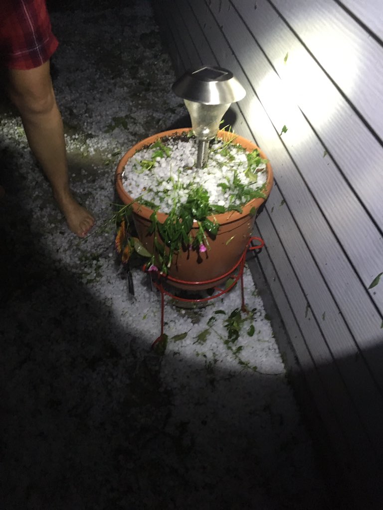
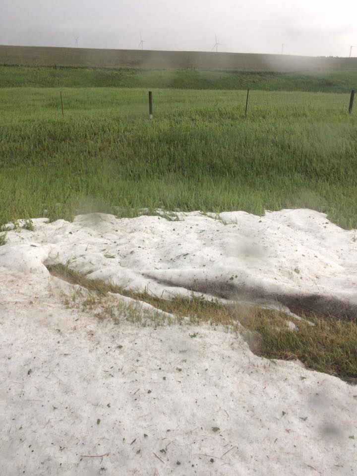
Hail ranging in size from nickels to golf balls fell in Pierre, SD. In some locations there was so much hail that it accumulated in drifts.
 |
 |
| Hail covering ground near the Pierre airport. Photo Credit: Rae Herron | Drifts of hail In PIerre. Photo Credit: Rae Herron |
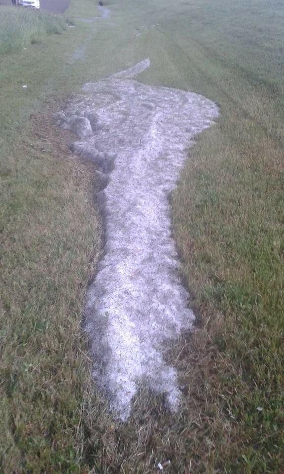
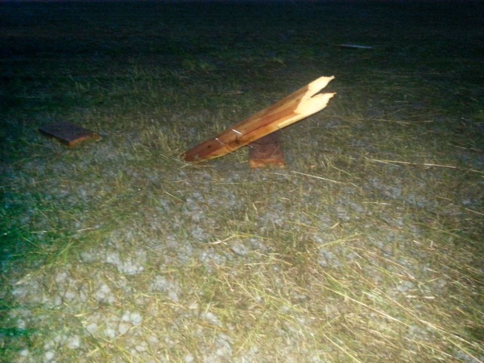
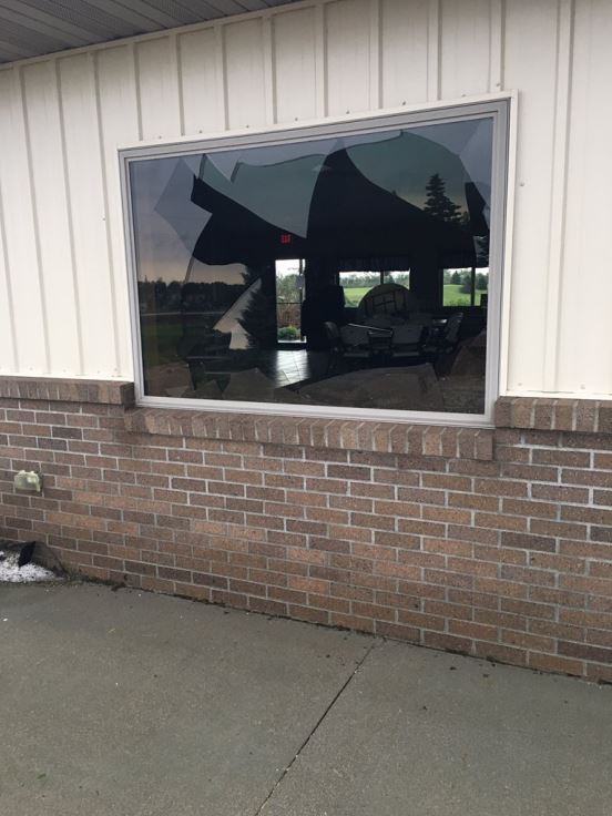
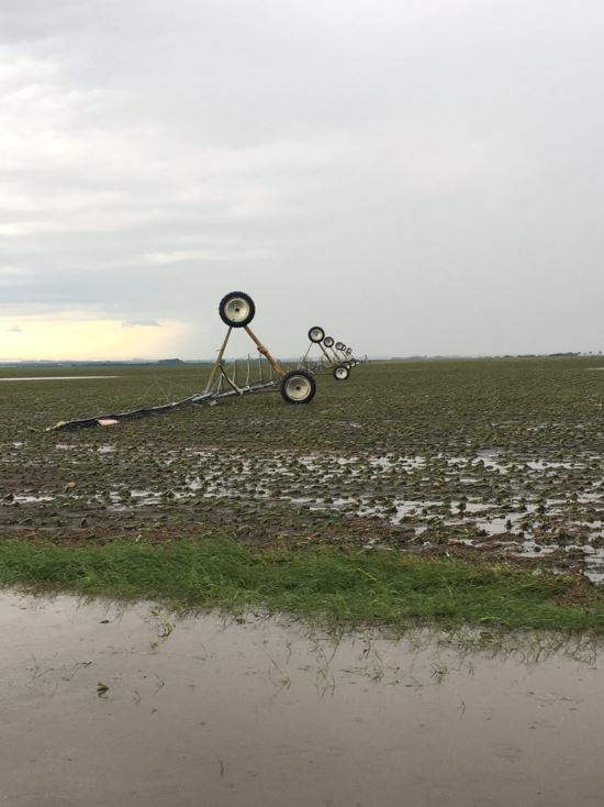
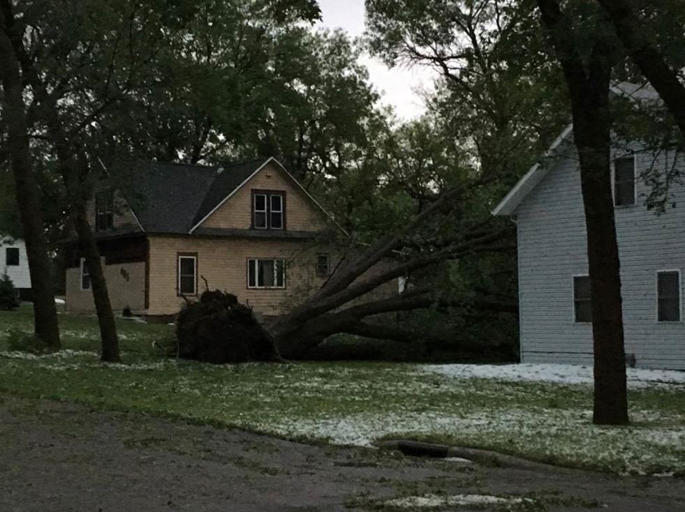
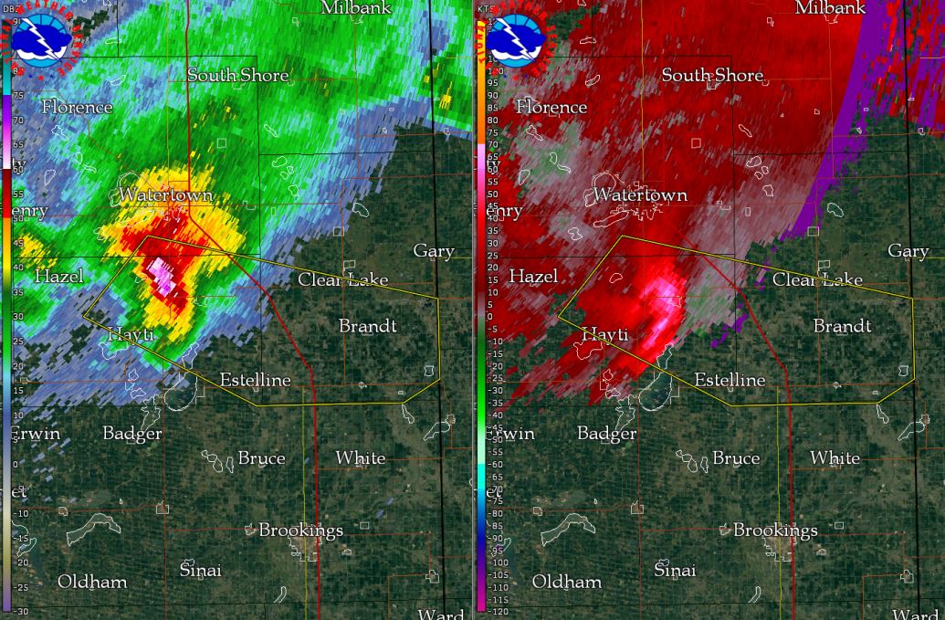
Castlewood
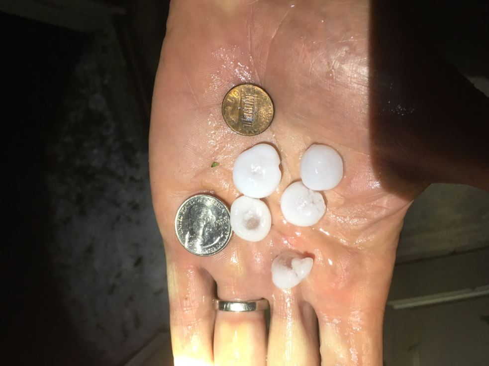
80 to 90 mph straight-line winds combined with large amounts of hail (some as large as quarters) to do significant damage in the city of Castlewood and the surrounding areas.
 |
 |
 |
 |
| Drifts of hail in Castlewood. Photo Credit: Kevin Pribbenow | Wood driven into the ground. Photo Credit: Kevin Pribbenow | Structural damage to a storage unit. Photo Credit: Brittany Davis | Plants destroyed from hail. Photo Credit: Brittany Davis |
 |
 |
 |
 |
| Nickel size hail in Castlewood. Photo Credit: Brittany Davis | Broken window In Castlewood. Photo Credit: Carson Borer | Tipped irrigation equipment. Photo Credit: Carson Borer | Uprooted tree in Castlewood. Photo Credit: Tayt Alexander |
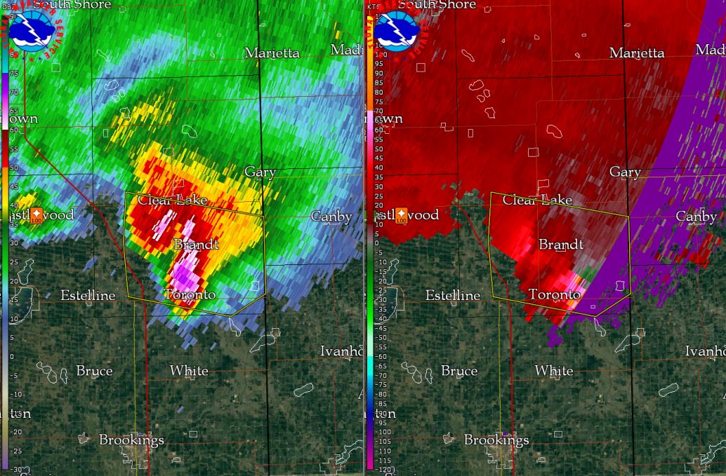
Toronto/Astoria Area
Strong straight-line winds and hail up to the size of golf balls did damage in and around the Toronto/Astoria area.
 |
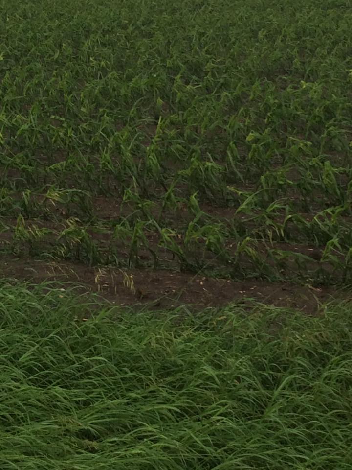 |
| Drifts of hail 1 mile west of Toronto. Photo Credit: Barry Parkin | Corn damage 1 mile west of Toront. Photo Credit: Barry Parkin |
Radar:
 |
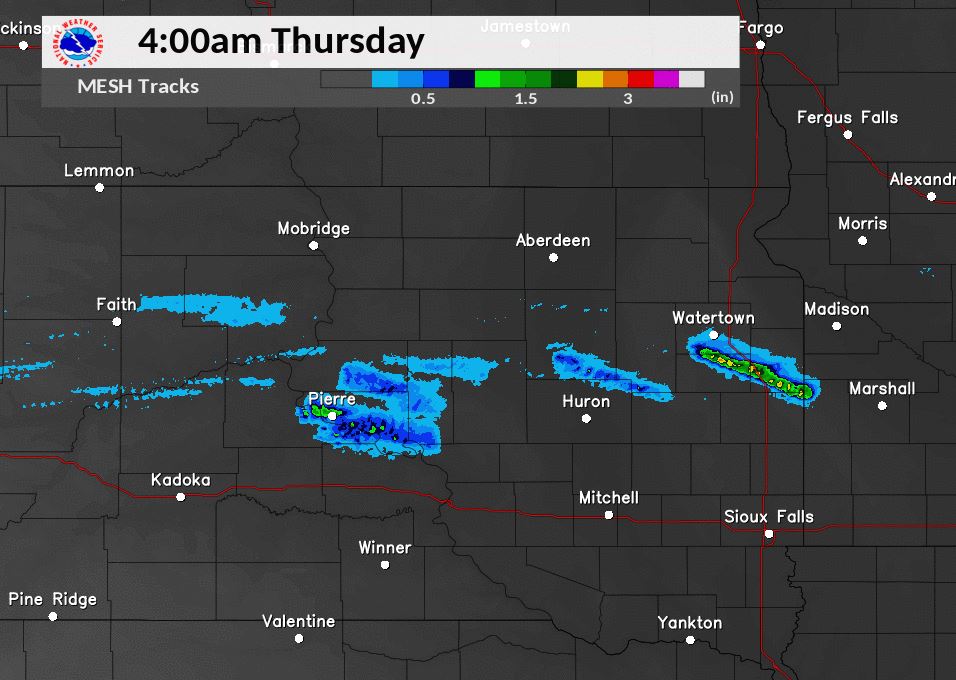 |
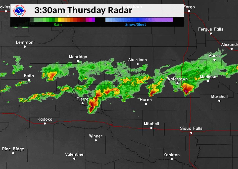
| Radar reflectivity overview at 3:30 am on June 22nd, 2017 | Radar estimated hail size between 3 and 4 AM on June 22nd, 2017. |
 |
 |
 |
|
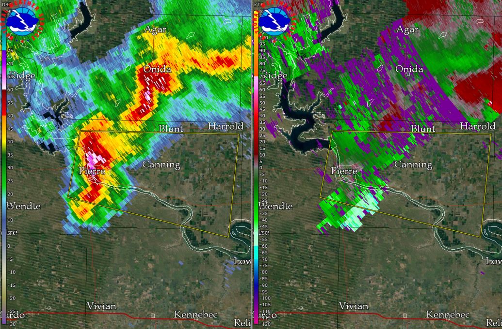
Radar Reflectivity & Velocity Pierre @ 3:04 AM |
Radar Reflectivity & Velocity Castlewood @ 3:12 AM |
Radar Reflectivity & Velocity Astoria @ 3:42 AM |
Storm Reports
PRELIMINARY LOCAL STORM REPORT...SUMMARY
NATIONAL WEATHER SERVICE ABERDEEN SD
120 PM CDT THU JUN 22 2017

..TIME...   ...EVENT...      ...CITY LOCATION...     ...LAT.LON...
..DATE...   ....MAG....      ..COUNTY LOCATION..ST.. ...SOURCE....
            ..REMARKS..

0500 AM     HAIL             1 SSW CHANTLER CREEK RE 44.47N 100.63W
06/22/2017  E1.00 INCH       STANLEY            SD   PUBLIC

            STRONG WINDS ESTIMATED AROUND 40 MPH AS
            WELL, BUT NO NOTICEABLE DAMAGE.

0348 AM     TSTM WND DMG     1 W TORONTO             44.57N 96.66W
06/22/2017                   DEUEL              SD   TRAINED SPOTTER

            LAYED-OVER CORN AND HAIL DRIFTS.

0320 AM     HAIL             CASTLEWOOD              44.73N 97.03W
06/22/2017  E1.00 INCH       HAMLIN             SD   TRAINED SPOTTER


0351 AM     HAIL             ASTORIA                 44.56N 96.55W
06/22/2017  E1.75 INCH       DEUEL              SD   TRAINED SPOTTER

            DESTROYED CROPS AND DAMAGED HOMES IN
            ASTORIA.

0310 AM     TSTM WND DMG     4 W CASTLEWOOD          44.73N 97.11W
06/22/2017                   HAMLIN             SD   EMERGENCY MNGR

            MULTIPLE TREES DOWNED BLOCKING INTERSECTION
            OF HIGHWAYS 81 AND 22 AT KONES CORNER.
            CORRECTION TO PREVIOUS REPORT FOR LOCATION.

0435 AM     TSTM WND GST     8 NNE GANN VALLEY       44.14N 98.95W
06/22/2017  E60 MPH          BUFFALO            SD   PUBLIC

            ESTIMATED WINDS OF AT LEAST 60 MPH. HAY
            BALES BLOWN OVER. TIME BASED ON RADAR.

0340 AM     HAIL             7 SE CARPENTER          44.58N 97.80W
06/22/2017  E1.00 INCH       CLARK              SD   PUBLIC

            NO DAMAGE NOTICEABLE. TIME BASED ON RADAR.

0519 AM     HAIL             2 NNE PIERRE            44.40N 100.31W
06/22/2017  E1.00 INCH       HUGHES             SD   TRAINED SPOTTER


0309 AM     TSTM WND DMG     4 ESE THOMAS            44.73N 97.13W
06/22/2017                   HAMLIN             SD   EMERGENCY MNGR

            16 TO 20 POWER POLES DOWN. POWER OUTAGES AS
            WELL.

0519 AM     HAIL             FORT PIERRE             44.37N 100.38W
06/22/2017  E0.88 INCH       STANLEY            SD   PUBLIC


0308 AM     HAIL             3 NE PIERRE             44.41N 100.28W
06/22/2017  E1.75 INCH       HUGHES             SD   BROADCAST MEDIA
 |
Media use of NWS Web News Stories is encouraged! Please acknowledge the NWS as the source of any news information accessed from this site. |
|

