National Weather Service United States Department of Commerce

A Wintry Mix in the Northeast; Rain and High Elevation Snow Returns to California

A clipper system tracking across the U.S./Canadian border will bring snowfall and mixed precipitation across the Northeast. A modest atmospheric river associated with a Pacific system will bring lower elevation/coastal rain, high elevation snow/wintry mix, and gusty winds in California into the Intermountain West. Read More >

Aviation Weather


Aviation Weather Center

Federal Aviation Administration

Before departure call 1-800-WX-BRIEF for the latest weather and to file flight plans

Terminal Aerodrome Forecasts (TAFs)


Map of TAF Locations

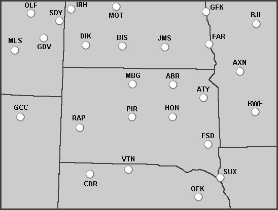
Click on a location on the map or select a location from the list below:


Aberdeen (ABR) Alexandria (AXN) Bemidji (BJI)
Bismarck (BIS) Chadron (CDR) Dickinson (DIK)
Fargo (FAR) Gillette (GCC) Glendive (GDV)
Grand Forks (GFK) Huron (HON) Jamestown (JMS)
Miles City (MLS) Minot (MOT) Mobridge (MBG)
Norfolk (OFK) Pierre (PIR) Rapid City (RAP)
Redwood Falls (RWF) Sidney (SDY) Sioux City (SUX)
Sioux Falls (FSD) Valentine (VTN) Watertown (ATY)
Williston (IAH) Wolf Point (OLF)  


Forecast Discussions (Including Aviation Discussions)


Aberdeen

Sioux Falls Rapid City
Bismarck Grand Forks Minneapolis


Satellite Imagery


Latest GOES-East Satellite Images


Other Information


TAF - Norfolk, NE TAF - Chadron, NE TAF - Valentine, NE TAF - Sioux City, IA TAF - Sioux Falls, SD TAF - Rapid City, SD TAF - Pierre, SD TAF - Huron, SD TAF - Watertown, SD TAF - Aberdeen, SD TAF - Mobridge, SD TAF - Redwood Falls, MN TAF - Alexandria, MN TAF - Bemidji, MN TAF - Fargo, ND TAF - Grand Forks, ND TAF - Jamestown, ND TAF - Bismarck, ND TAF - Dickinson, ND TAF - Minot, ND TAF - Williston, ND TAF - Gillette, WY TAF - Miles City, MT TAF - Glendive, MT TAF - Sidney, MT TAF - Wolf Point, MT