Heavy lake effect snow and gusty winds, including some local blizzard conditions, will continue into Thanksgiving Day across the Great Lakes then lingering through Friday night for Lakes Erie and Ontario. Confidence is increasing for another winter storm to develop over the northern and central Rockies Friday and track across the central Plains through the Midwest and Great Lakes this weekend. Read More >
Overview
|
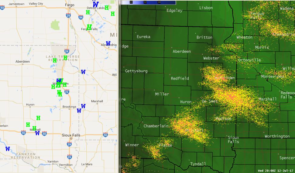
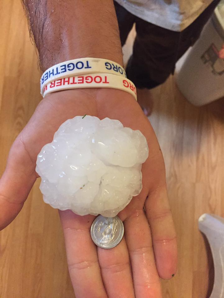
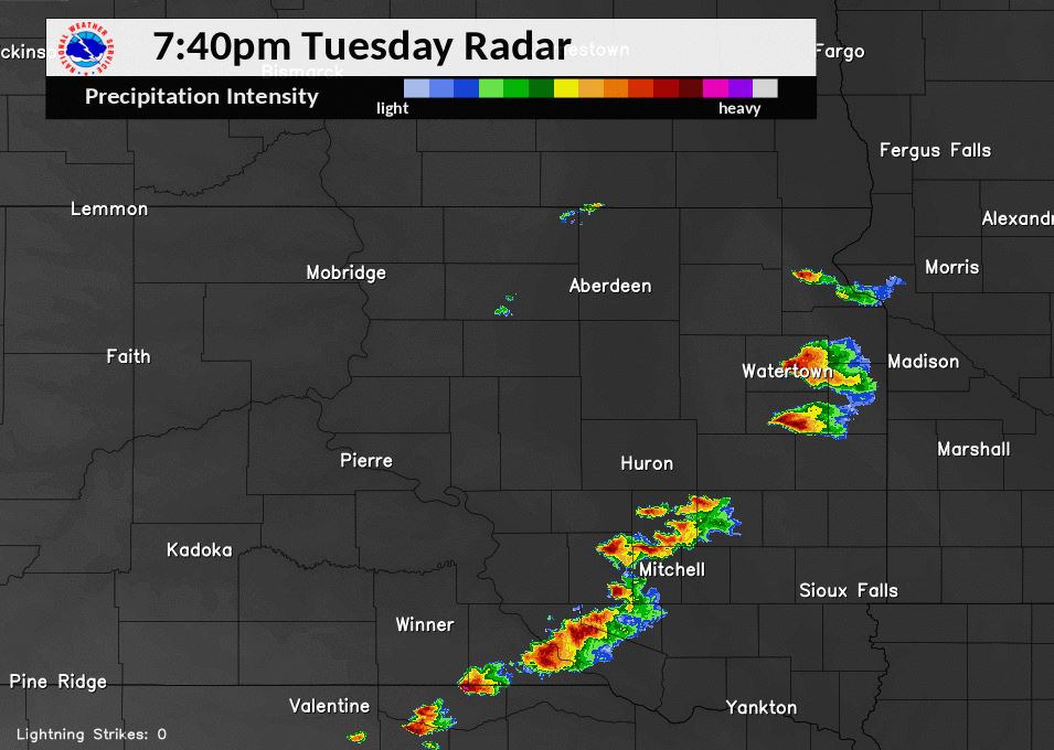
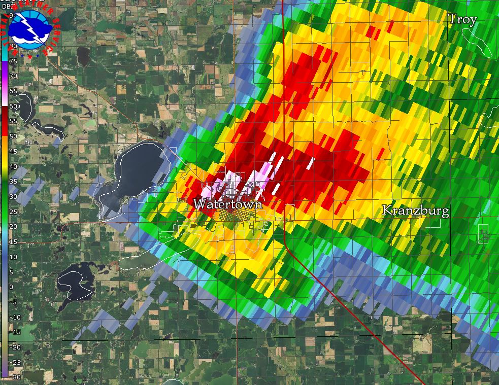
On the evening of July 11th, strong storms developed along a front and tracked across parts of eastern South Dakota. The strongest storms produced large hail and damaging winds. The hardest hit area was around Watertown, SD where hail the size of baseballs fell. There was also a 75 mph wind gust recorded at the Watertown Regional Airport, as well as locally torrential rainfall. |
Right: Cloud-to-ground lightning strikes. Data courtesy of Vaisala - U.S. National Lightning Detection Network |
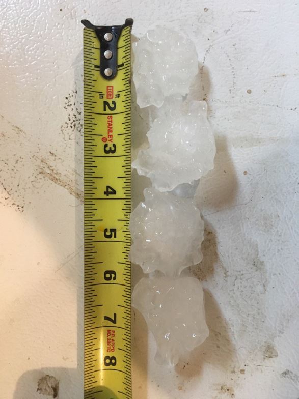
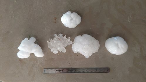
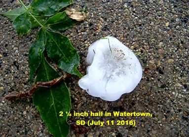
Hail
 |
 |
 |
 |
| Large Hail in Watertown Photo Credit: Jim Sutton | Large Hail in Watertown Photo Credit: @derickj_e | Large Hail in Watertown Photo Credit: Mason Sheehan | Large Hail in Watertown Photo Credit: Austin Drew |
 |
 |
 |
|
| Large Hail in Watertown Photo Credit: Whitney Hagen | Large Hail in Watertown Photo Credit: Eric McPeek | Large Hail in Watertown Photo Credit: Kristen Dunn | |
 |
 |
 |
|
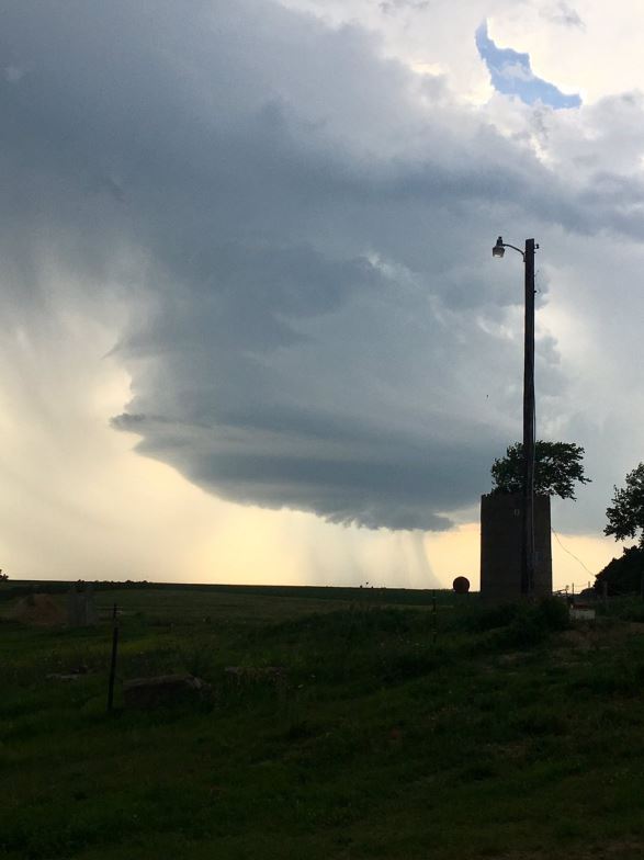
| Large hail in Watertown. Photo Credit: Joe Sorensen | Large hail of roughly 3" diameter in Watertown. Photo Credit: Owen McElroy | Wall cloud spotted near Watertown. Photo Credit: Brittany Davis |
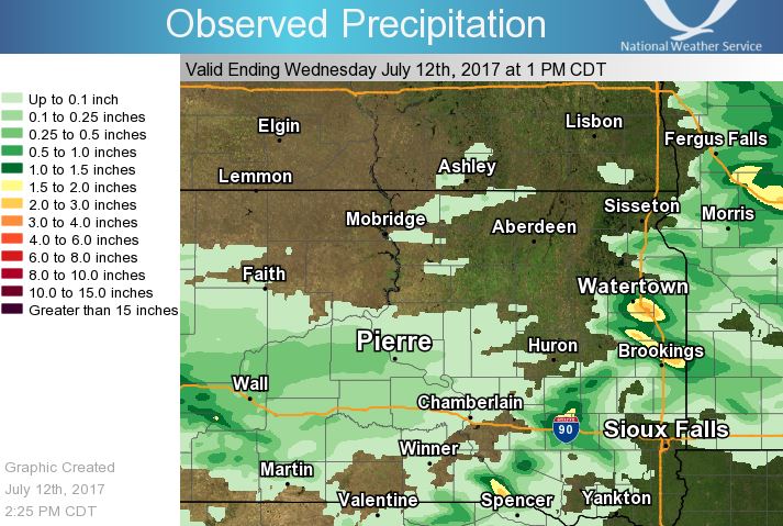
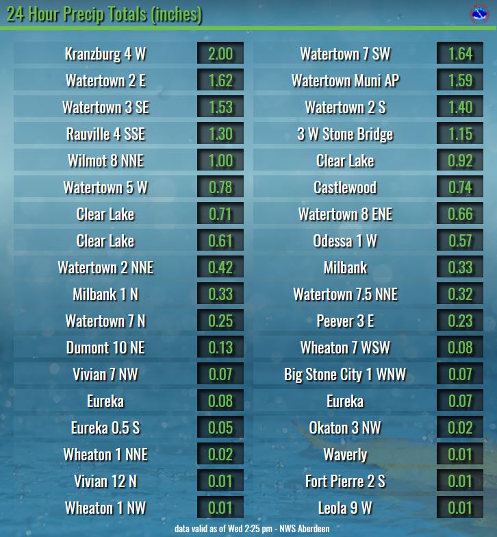
Rainfall
 |
|||
| 24 hour radar estimated rainfall above. Locally heavy rain was observed while many areas stayed dry. | |||
 |
|||
| 24 hour rainfall total reports listed above. Reports relayed to us but not listed above are 3.4" about 5 miles south of Kranzburg and 0.79" in Hayti, SD |
Radar & Satellite:
1 minute GOES-16 Satellite Data. The GOES-16 data posted on this page are preliminary, non-operational data and are undergoing testing. Users bear all responsibility for inspecting the data prior to use and for the manner in which the data are utilized.
 |
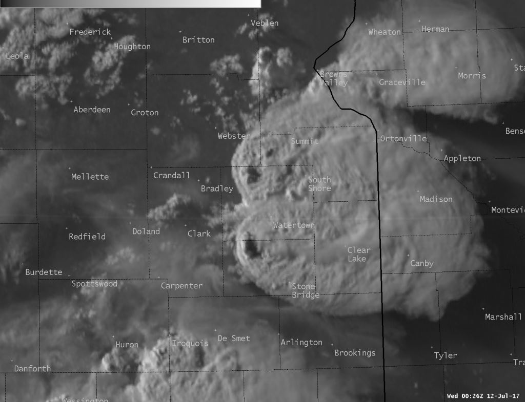 |
| Radar Reflectivity Overview at 7:40 pm CDT July 11th | GOES-16 Visible Satellite Imagery at 7:26 pm CDT July 11th. Note: Storms appear slightly shifted to the northeast of where they struck due to the nature of the positioning of the satellite |
 |
|
| While several storms produced large hail/damaging winds in Watertown, the above radar reflectivity loop (from 7:34 to 7:56 pm) highlights the supercell storm that produced 3" hail and 75 mph winds. | GOES-16 Infrared Satellite Imagery at 7:27 pm CDT July 11th. Note: Storms appear slightly shifted to the northeast of where they struck due to the nature of the positioning of the satellite |
 |
Media use of NWS Web News Stories is encouraged! Please acknowledge the NWS as the source of any news information accessed from this site. |
|