
A storm and trailing cold front will continue to slowly move through the Gulf Coast and Southeast U.S. through this weekend with widespread rain showers and isolated thunderstorms. A fast-moving clipper storm may bring several inches of snow to the north-central Plains, Midwest, eastern Great Lakes, and Northeast regions this weekend. Read More >
Overview
|
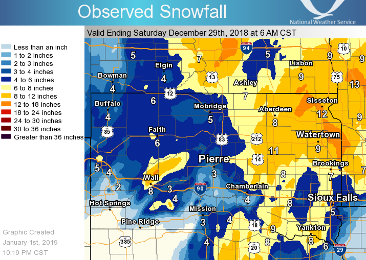
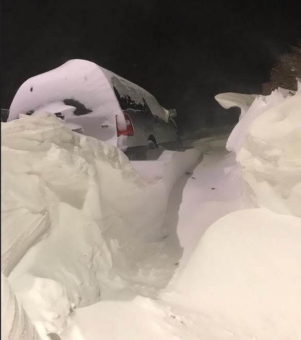
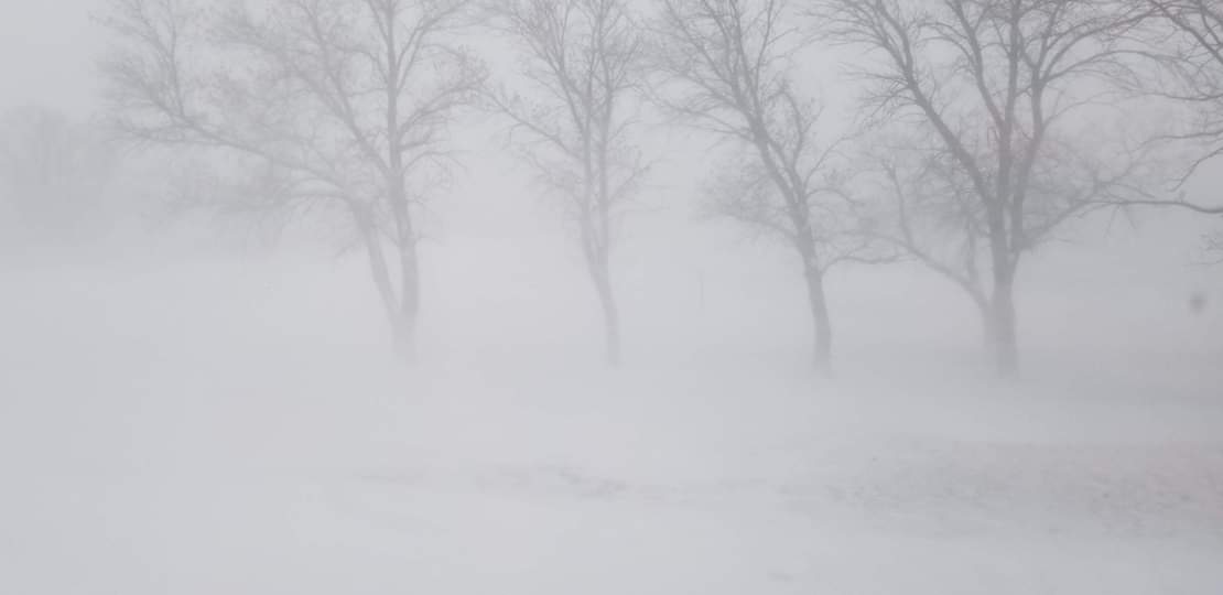
Beginning on the evening of the 26th of December, a strong low pressure system lifted up from southeast Colorado/southwest Kansas and into eastern Nebraska/western Iowa and finally into Wisconsin on Friday the 28th of December. This generated two distinct rounds of snowfall and mixed precipitation. The first occurred the evening of the 26th and dumped snow mostly on the western two thirds of the South Dakota, along with some freezing rain in the central part of the state. The second affected primarily the eastern half of the state with areas along and east of the Coteau being the hardest hit. Along with the second wave of snow, very strong winds created whiteout blizzard conditions for most of the northeast quadrant of South Dakota. Widespread storm total snowfalls of 6-12" were recorded across much of the state. |
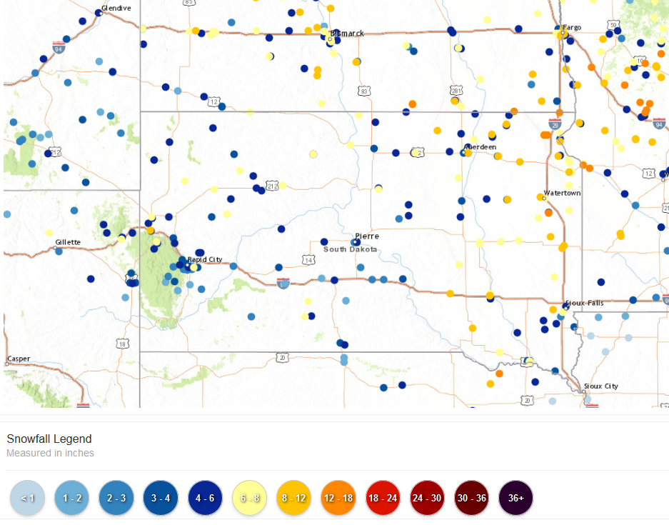 Snowfall Reports Over the Duration of the Storm |
Snow/Blizzard
Photos & Video
 |
 |
 |
 |
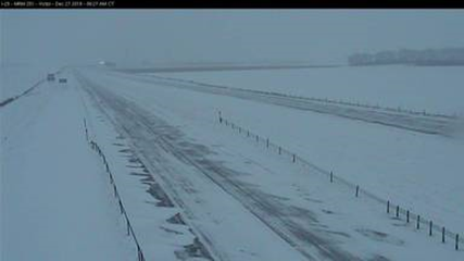
| I-29 Near Victor at 9:15 AM Thursday SD DOT |
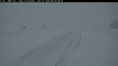
I-29 Near Brandt at 8:44 AM Thursday SD DOT |
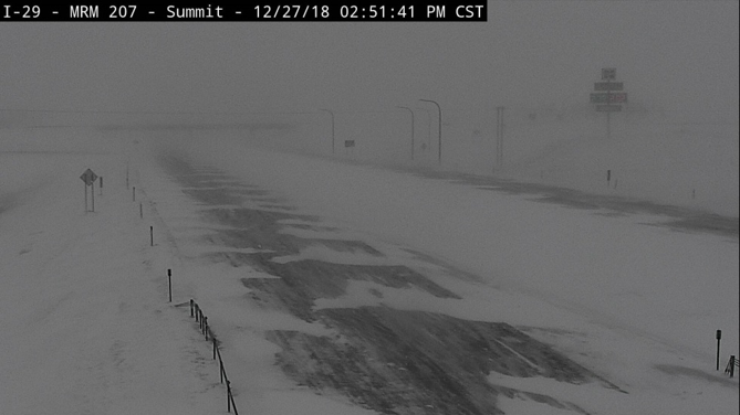
I-29 Near Summit at 2:51 PM Thursday SD DOT |
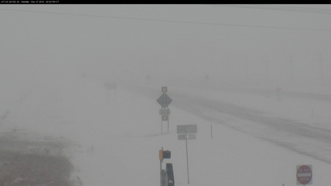
US-281 Near Mellette at 2:53 PM Thursday SD DOT |
 |
 |
.jpg) |
 |
| Northeast SD on I-29 Thursday Afternoon SD Highway Patrol |
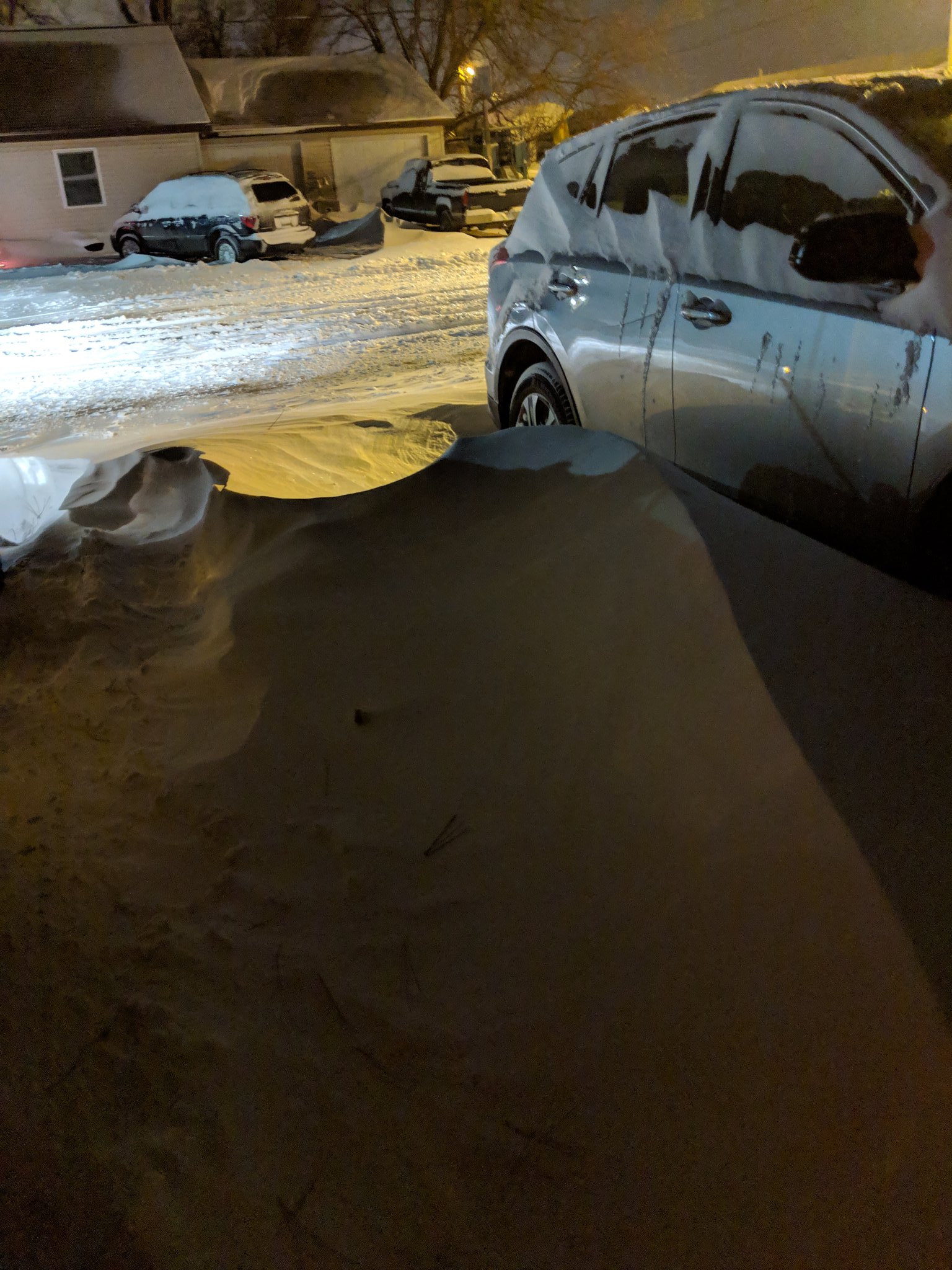
Watertown Photo Courtesy of Brent Nathaniel |
Watertown Photo Courtesy of Mike Tanner |
Watertown Photo Courtesy of Mike Tanner |
 |
 |
 |
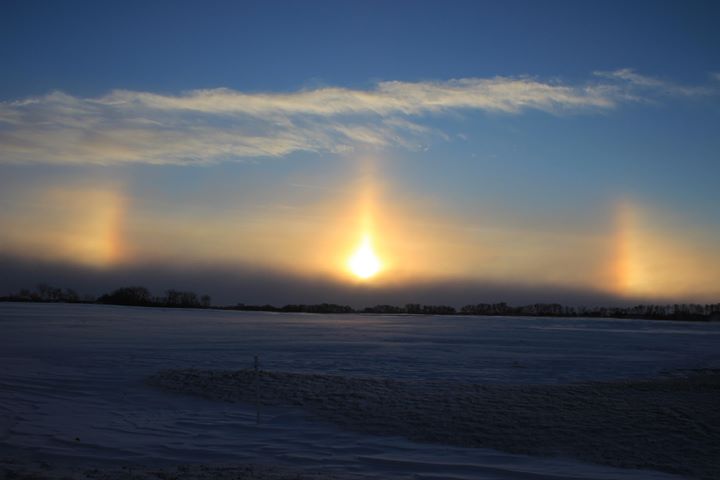 |
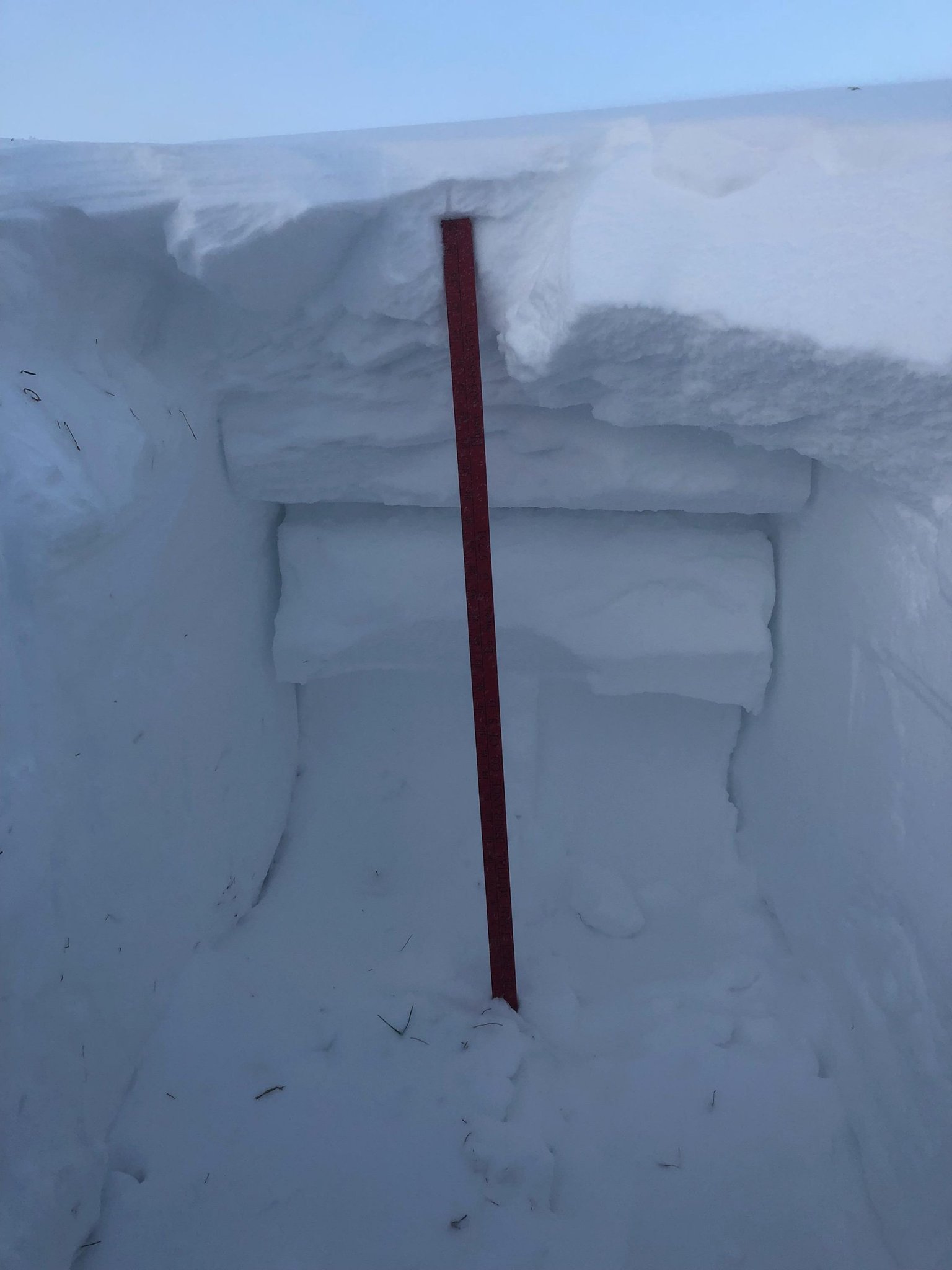
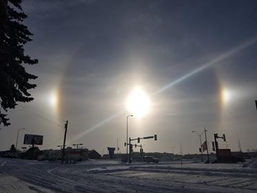
| Snow drifts, morning of Dec 28th at the NWS office in Aberdeen, SD. Photo from NWS employee | Near white-out conditions in Mina around 3 pm on Dec 27th during a 50+ mph wind gust. Photo from NWS employee | Sun dogs in Watertown on the 28th with the arrival of arctic air. Courtesy of Kristen Dunn | Sun dogs in Aberdeen on the 28th with the arrival of arctic air. Courtesy of Mike Scott |
Radar
 |
 |
 |
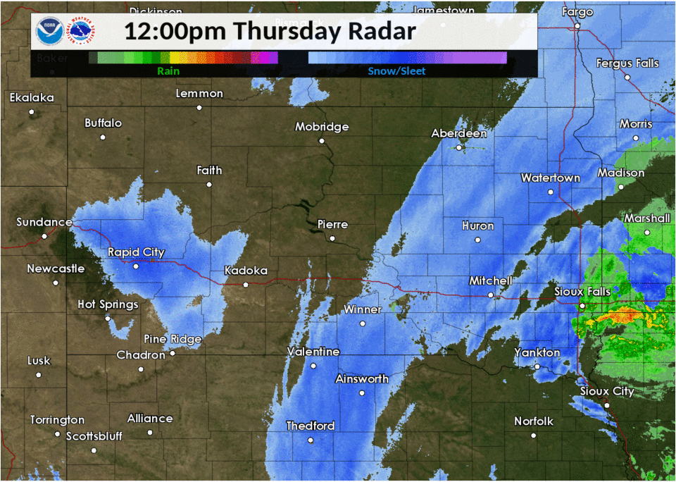 |
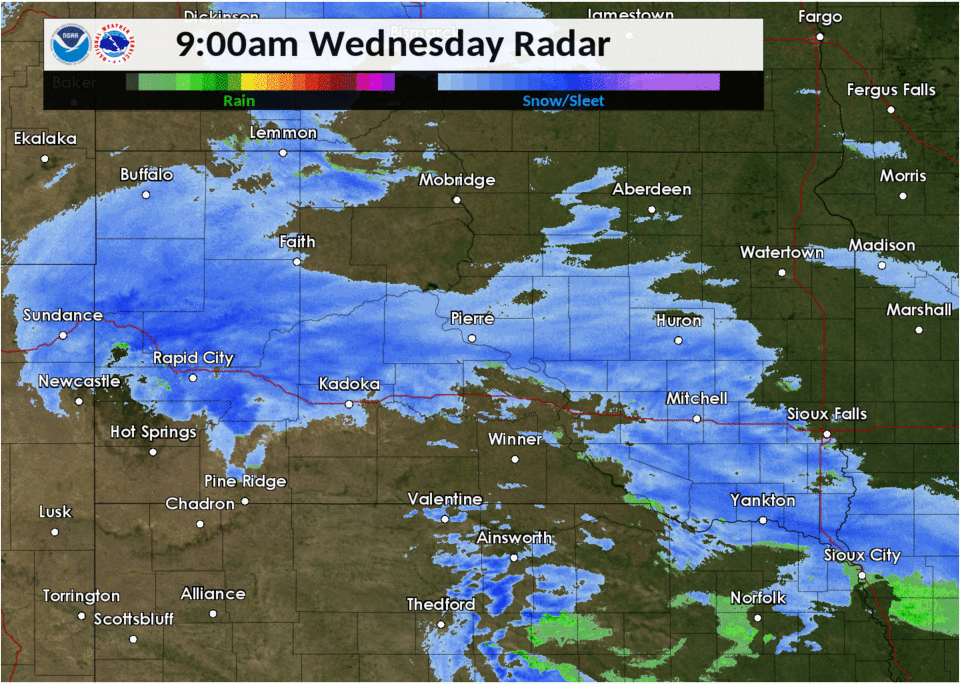
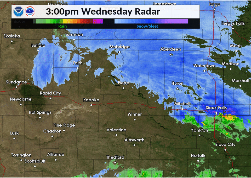
| Radar Imagery: December 26, 2018 9:00 AM - 3:00 PM | Radar Imagery: December 26, 2018 3:00 AM - 9:00 PM | Radar Imagery: December 27, 2018 6:00 AM - 12:00 PM | Radar Imagery: December 27, 2018 12:00 PM - 6:00 PM |
Storm Reports
Snowfall Reports

..TIME...   ...EVENT...      ...CITY LOCATION...     ...LAT.LON...
..DATE...   ....MAG....      ..COUNTY LOCATION..ST.. ...SOURCE....
            ..REMARKS..
1200 PM     HEAVY SNOW       ANDOVER                 45.41N 97.90W
12/28/2018  M10.2 INCH       DAY                SD   CO-OP OBSERVER

            STORM TOTAL SNOW.

1200 PM     HEAVY SNOW       WATERTOWN               44.91N 97.17W
12/28/2018  M10.0 INCH       CODINGTON          SD   BROADCAST MEDIA

            STORM TOTAL SNOW - RELAYED VIA SOCIAL MEDIA.

1032 AM     HEAVY SNOW       ORTONVILLE              45.30N 96.44W
12/28/2018  E15.0 INCH       BIG STONE          MN   BROADCAST MEDIA


0915 AM     HEAVY SNOW       ODESSA                  45.26N 96.33W
12/28/2018  E13.0 INCH       BIG STONE          MN   PUBLIC

            STORM TOTAL SNOW - RELAYED VIA SOCIAL MEDIA.

0915 AM     HEAVY SNOW       GETTYSBURG              45.01N 99.95W
12/28/2018  M6.6 INCH        POTTER             SD   CO-OP OBSERVER

            STORM TOTAL SNOW.

0900 AM     HEAVY SNOW       SISSETON                45.66N 97.05W
12/28/2018  M12.5 INCH       ROBERTS            SD   CO-OP OBSERVER

            STORM TOTAL SNOW.

0900 AM     SNOW             MURDO                   43.89N 100.71W
12/28/2018  M5.3 INCH        JONES              SD   CO-OP OBSERVER

            STORM TOTAL SNOW.

0820 AM     HEAVY SNOW       WHEATON                 45.81N 96.50W
12/28/2018  M10.1 INCH       TRAVERSE           MN   PUBLIC

            STORM TOTAL SNOW - RELAYED VIA SOCIAL MEDIA.

0800 AM     HEAVY SNOW       WILMOT                  45.41N 96.86W
12/28/2018  M10.5 INCH       ROBERTS            SD   CO-OP OBSERVER

            STORM TOTAL SNOW.

0800 AM     HEAVY SNOW       WHEATON                 45.81N 96.50W
12/28/2018  M9.1 INCH        TRAVERSE           MN   CO-OP OBSERVER

            STORM TOTAL SNOW.

0800 AM     HEAVY SNOW       WEBSTER                 45.34N 97.52W
12/28/2018  M8.0 INCH        DAY                SD   CO-OP OBSERVER

            STORM TOTAL SNOW.

0800 AM     HEAVY SNOW       COLUMBIA                45.61N 98.31W
12/28/2018  M7.0 INCH        BROWN              SD   PUBLIC

            STORM TOTAL SNOW.

0800 AM     HEAVY SNOW       HAYTI                   44.66N 97.20W
12/28/2018  M6.7 INCH        HAMLIN             SD   CO-OP OBSERVER

            STORM TOTAL SNOW.

0700 AM     HEAVY SNOW       3 W SISSETON            45.66N 97.11W
12/28/2018  M12.5 INCH       ROBERTS            SD   CO-OP OBSERVER

            STORM TOTAL SNOW.

0700 AM     HEAVY SNOW       4 N VICTOR              45.93N 96.84W
12/28/2018  M12.5 INCH       ROBERTS            SD   CO-OP OBSERVER

            STORM TOTAL SNOW.

0700 AM     HEAVY SNOW       BRITTON                 45.79N 97.75W
12/28/2018  M10.5 INCH       MARSHALL           SD   CO-OP OBSERVER

            STORM TOTAL SNOW.

0700 AM     HEAVY SNOW       BROWNS VALLEY           45.59N 96.83W
12/28/2018  M9.4 INCH        TRAVERSE           MN   CO-OP OBSERVER

            STORM TOTAL SNOW.

0700 AM     HEAVY SNOW       ROSCOE                  45.45N 99.33W
12/28/2018  M6.8 INCH        EDMUNDS            SD   CO-OP OBSERVER

            STORM TOTAL SNOW.

0700 AM     SNOW             SELBY                   45.50N 100.03W
12/28/2018  M3.6 INCH        WALWORTH           SD   CO-OP OBSERVER

            STORM TOTAL SNOW.

0645 AM     SNOW             PIERRE                  44.37N 100.32W
12/28/2018  M4.5 INCH        HUGHES             SD   CO-OP OBSERVER

            STORM TOTAL SNOW.

0645 AM     SNOW             PIERRE                  44.37N 100.32W
12/28/2018  M4.5 INCH        HUGHES             SD   CO-OP OBSERVER

            STORM TOTAL SNOW.

0600 AM     HEAVY SNOW       CASTLEWOOD              44.72N 97.03W
12/28/2018  M12.6 INCH       HAMLIN             SD   CO-OP OBSERVER

            STORM TOTAL SNOW.

0600 AM     HEAVY SNOW       CLARK                   44.88N 97.73W
12/28/2018  M9.0 INCH        CLARK              SD   CO-OP OBSERVER

            STORM TOTAL SNOW.

0523 AM     HEAVY SNOW       3 ESE ABERDEEN          45.45N 98.41W
12/28/2018  M8.3 INCH        BROWN              SD   OFFICIAL NWS OBS

            STORM TOTAL SNOWFALL.

0845 PM     BLIZZARD         7 ENE CORONA            45.36N 96.63W
12/27/2018                   ROBERTS            SD   PUBLIC

            ZERO VISIBILITY ALONG WITH 12 INCHES OF
            SNOW. REPORT RELAYED VIA SOCIAL MEDIA.

0800 PM     BLIZZARD         2 E GLENHAM             45.54N 100.23W
12/27/2018                   WALWORTH           SD   PUBLIC

            ZERO VISIBILITY REPORTED ALONG PORTIONS OF
            HIGHWAY 12 BETWEEN MOBRIDGE AND SELBY.

0700 PM     BLIZZARD         CLEAR LAKE              44.76N 96.68W
12/27/2018                   DEUEL              SD   PUBLIC

            HAVE HAD BLIZZARD CONDITIONS SINCE LATE
            AFTERNOON. REPORT RELAYED VIA SOCIAL MEDIA.

0600 PM     HEAVY SNOW       TIMBER LAKE             45.43N 101.07W
12/27/2018  M6.0 INCH        DEWEY              SD   CO-OP OBSERVER

            STORM TOTAL SNOW. STILL SNOWING.

0510 PM     BLIZZARD         4 ENE HOVEN             45.26N 99.69W
12/27/2018                   EDMUNDS            SD   NWS EMPLOYEE

            WHITE OUT CONDITIONS.

0510 PM     BLIZZARD         1 ESE MINA              45.44N 98.74W
12/27/2018                   EDMUNDS            SD   NWS EMPLOYEE

            NEAR ZERO VISIBILITY ON U.S. HIGHWAY 12 NEAR
            MINA.

0430 PM     BLIZZARD         3 SSW ASHTON            44.95N 98.51W
12/27/2018                   SPINK              SD   PUBLIC

            VISIBILITY LESS THAN A 1/4 MILE, WHITE OUT
            CONDITIONS AT TIMES BETWEEN REDFIELD AND
            ASHTON.

0340 PM     HEAVY SNOW       LEOLA                   45.72N 98.94W
12/27/2018  M10.8 INCH       MCPHERSON          SD   CO-OP OBSERVER

            UPDATED STORM TOTAL SNOW. STILL SNOWING.

0329 PM     BLIZZARD         2 NE MINA               45.46N 98.73W
12/27/2018                   EDMUNDS            SD   NWS EMPLOYEE

            WHITE OUT CONDITIONS.

0326 PM     BLIZZARD         GETTYSBURG              45.01N 99.95W
12/27/2018                   POTTER             SD   PUBLIC

            200 FEET TO 1/4 MILE VISIBILITY ALONG THE
            OUTSKIRTS OF GETTYSBURG - REPORT RELAYED VIA
            SOCIAL MEDIA.

0325 PM     BLIZZARD         BROWNS VALLEY           45.59N 96.83W
12/27/2018                   TRAVERSE           MN   PUBLIC

            WHITE OUT CONDITIONS - REPORT RELAYED VIA
            SOCIAL MEDIA.

0316 PM     BLIZZARD         BLUNT                   44.52N 99.99W
12/27/2018                   HUGHES             SD   PUBLIC

            NEAR WHITE OUT CONDITIONS - REPORT RELAYED
            VIA SOCIAL MEDIA.

0302 PM     BLIZZARD         WEBSTER                 45.34N 97.52W
12/27/2018                   DAY                SD   PUBLIC

            LESS THAN A QUARTER MILE VISIBILITY.

0301 PM     BLIZZARD         1 WNW VAYLAND           44.50N 98.81W
12/27/2018                   HAND               SD   PUBLIC

            VISIBILITY BETWEEN 1/10 AND 1/4 MILE AND ICE
            PACKED ROADS - REPORT RELAYED VIA SOCIAL
            MEDIA.

0300 PM     BLIZZARD         ONIDA                   44.70N 100.07W
12/27/2018                   SULLY              SD   LAW ENFORCEMENT

            LESS THAN ONE QUARTER MILE VISIBILITY
            REPORTED.

0253 PM     BLIZZARD         HOUGHTON                45.76N 98.21W
12/27/2018                   BROWN              SD   PUBLIC

            LESS THAN 1/4 MILE VISIBILITY - REPORT
            RELAYED VIA SOCIAL MEDIA.

0250 PM     BLIZZARD         WATERTOWN               44.91N 97.17W
12/27/2018                   CODINGTON          SD   PUBLIC

            LESS THAN 1/4 MILE VISIBILITY IN WATERTOWN
            ON EAST 212. RELAYED VIA SOCIAL MEDIA.

0247 PM     BLIZZARD         MILBANK                 45.22N 96.63W
12/27/2018                   GRANT              SD   PUBLIC

            ONE QUARTER MILE OR LESS VISIBILITY IN
            MILBANK - RELAYED VIA SOCIAL MEDIA.

0235 PM     BLIZZARD         2 WSW ABERDEEN          45.46N 98.52W
12/27/2018                   BROWN              SD   DEPT OF HIGHWAYS

            SDDOT REPORTS VISIBILITY LESS THAN ONE
            QUARTER MILE FOR HIGHWAY 12 FROM THE
            JUNCTION OF HIGHWAY 83 EAST TO SUMMIT.

0235 PM     BLIZZARD         BRITTON                 45.79N 97.75W
12/27/2018                   MARSHALL           SD   DEPT OF HIGHWAYS

            SDDOT REPORTS VISIBILITY OF ONE QUARTER MILE
            OR LESS ON HIGHWAY 10 FROM BRITTON TO THE
            MN, SD BORDER.

0235 PM     BLIZZARD         4 NNE TOLSTOY           45.26N 99.59W
12/27/2018                   EDMUNDS            SD   NWS EMPLOYEE

            200 FOOT VISIBILITY SINCE 0900 CST.

0235 PM     BLIZZARD         LEOLA                   45.72N 98.93W
12/27/2018                   MCPHERSON          SD   DEPT OF HIGHWAYS

            SDDOT REPORTS ONE QUARTER MILE VISIBILITY
            FROM LEOLA TO BRITTON ON HIGHWAY 10.

0230 PM     BLIZZARD         HIGHMORE                44.53N 99.44W
12/27/2018                   HYDE               SD   DEPT OF HIGHWAYS

            SDDOT REPORTS ONE QUARTER MILE VISIBILITY OR
            LESS FROM HIGHMORE TO I-90 ON HIGHWAY 47.

0143 PM     FREEZING RAIN    3 SE WATERTOWN          44.89N 97.12W
12/27/2018  U0.00 INCH       CODINGTON          SD   PUBLIC

            REPORT RELAYED VIA FACEBOOK.

1130 AM     BLIZZARD         MILBANK                 45.22N 96.64W
12/27/2018                   GRANT              SD   DEPT OF HIGHWAYS

            SDDOT REPORTS VISIBILITY LESS THAN ONE
            QUARTER MILE ON HIGHWAY 15 FROM MILBANK
            SOUTH TO HIGHWAY 212.

1130 AM     BLIZZARD         DOLAND                  44.89N 98.11W
12/27/2018                   SPINK              SD   DEPT OF HIGHWAYS

            DOLAND TO 1 WEST OF CLARK, SDDOT REPORTS
            VISIBILITY LESS THAN ONE QUARTER MILE ON
            HIGHWAY 212.

0730 AM     HEAVY SNOW       MOBRIDGE                45.54N 100.44W
12/27/2018  M6.3 INCH        WALWORTH           SD   CO-OP OBSERVER


0700 AM     SNOW             4 ESE HERREID           45.82N 100.01W
12/27/2018  M5.5 INCH        CAMPBELL           SD   COCORAHS

            COCORAHS STATION SD-CP-6, HERREID 3 ESE.

0700 AM     SNOW             2 WNW SPOTTSWOOD        44.67N 98.55W
12/27/2018  M4.5 INCH        SPINK              SD   COCORAHS

            COCORAHS STATION SD-SP-1, TULARE 4.5 SSW.

0700 AM     SNOW             1 W ROSCOE              45.45N 99.35W
12/27/2018  M4.0 INCH        EDMUNDS            SD   CO-OP OBSERVER

            CO-OP OBSERVER STATION ROSS2, ROSCOE.

0700 AM     SNOW             12 N HIGHMORE           44.69N 99.44W
12/27/2018  M4.0 INCH        HYDE               SD   COCORAHS

            COCORAHS STATION SD-HY-1, HIGHMORE 12.4 N.

0700 AM     SNOW             16 W POLO               44.82N 99.44W
12/27/2018  M4.0 INCH        HYDE               SD   COCORAHS

            COCORAHS STATION SD-HY-6, HIGHMORE 21.3 N.

0700 AM     SNOW             FORT PIERRE             44.36N 100.37W
12/27/2018  M2.5 INCH        STANLEY            SD   COCORAHS

            COCORAHS STATION SD-ST-6, FORT PIERRE.

0700 AM     SNOW             PRESHO                  43.90N 100.06W
12/27/2018  M2.0 INCH        LYMAN              SD   COCORAHS

            COCORAHS STATION SD-LY-1, PRESHO.

0700 AM     SNOW             9 N HOLABIRD            44.65N 99.60W
12/27/2018  M2.0 INCH        HYDE               SD   COCORAHS

            COCORAHS STATION SD-HY-8, HOLABIRD 8.5 N.

0700 AM     SNOW             9 NNE VIVIAN            44.05N 100.26W
12/27/2018  M2.0 INCH        LYMAN              SD   COCORAHS

            COCORAHS STATION SD-LY-5, PRESHO 13.8 NW.

0600 AM     SNOW             7 E HAYES               44.37N 100.89W
12/27/2018  M4.0 INCH        STANLEY            SD   CO-OP OBSERVER

            CO-OP OBSERVER STATION AYES2, HAYES 6 E.

0900 PM     SNOW             11 E GREENWAY           45.94N 99.48W
12/26/2018  E4.0 INCH        MCPHERSON          SD   COCORAHS


0700 PM     SNOW             POLLOCK                 45.90N 100.29W
12/26/2018  M6.0 INCH        CAMPBELL           SD   CO-OP OBSERVER


0600 PM     SNOW             1 NE TIMBER LAKE        45.43N 101.07W
12/26/2018  M5.0 INCH        DEWEY              SD   CO-OP OBSERVER

            CO-OP OBSERVER STATION TLKS2, TIMBER LAKE.

0600 PM     SNOW             KENNEBEC                43.90N 99.86W
12/26/2018  M2.7 INCH        LYMAN              SD   CO-OP OBSERVER
Peak Winds

 |
Media use of NWS Web News Stories is encouraged! Please acknowledge the NWS as the source of any news information accessed from this site. |
|

