
Cold temperatures will continue across much of the eastern U.S. into today. Heavy lake effect snow continues into today east of Lakes Erie and Ontario. Two Pacific cold fronts will cross the Pacific Northwest early this week followed by another atmospheric river. Heavy rain and gusty winds are expected through midweek, with the potential for renewed urban and river flooding. Read More >
Aberdeen, SD
Weather Forecast Office
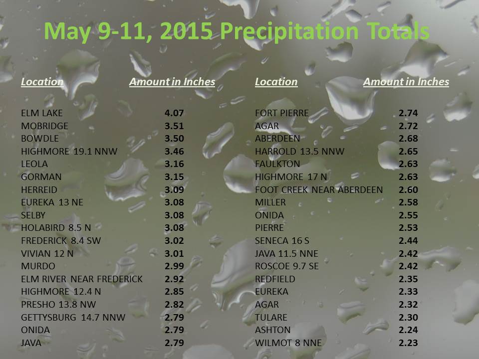
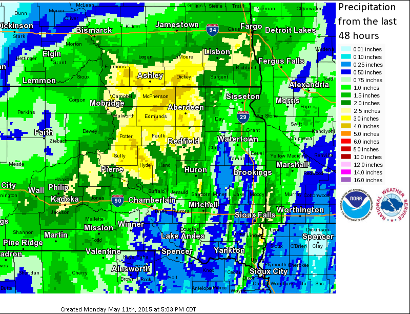
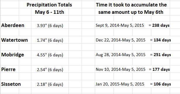
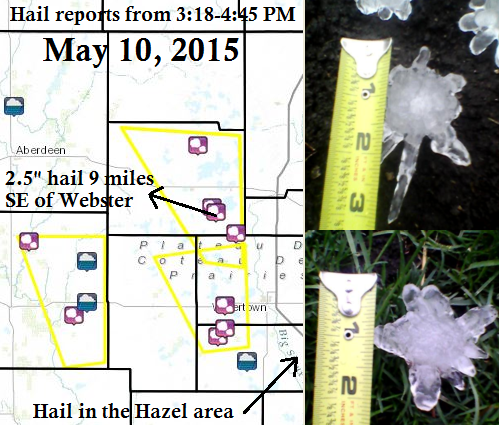
May 9-11, 2015 featured a powerful spring low pressure system the wreaked havoc across South Dakota. Western and central parts of the state experienced heavy snow, eastern parts severe hail, and most everyone received very heavy and beneficial rainfall that put a dent in the drought. A few records were even set on May 10th for daily rainfall: Watertown with 1.38" (1.27" in 1936), Mobridge with 2.48" (0.86" in 1956), and Pierre with 1.52" (0.92" in 2010). Pierre also tied a record for most snow on the 10th - a trace. The same area that experienced thunderstorms and hail on the 10th observed a period of snow the very next morning! Below are several images that depict more of the details.
An EF-2 tornado also hit Delmont, SD at 10:45 am on Mother's Day, May 10th. Find much more information from the NWS office in Sioux Falls here.

US Dept of Commerce
National Oceanic and Atmospheric Administration
National Weather Service
Aberdeen, SD
824 391st Ave S.
Aberdeen, SD 57401-9311
605-225-0519
Comments? Questions? Please Contact Us.

