
Scattered areas of heavy rain continue to produce isolated flash flooding across the Florida peninsula. Anomalous moisture will combine with a cold front and will bring heavy rain and scattered flash flooding across the Mid-South, Ohio and Tennessee Valleys today and Tuesday. Above average temperatures will continue to be found ahead of the cold front from the Midwest to the Northeast. Read More >
Weather History - January 1st
Local and Regional Events:
January 25, 2010:
A large upper-level low-pressure area combined with a cold surface high-pressure area building in from the north brought light snow and extreme winds creating widespread blizzard conditions across north-central and northeast South Dakota. Snowfall amounts of 1 to 4 inches combined with north winds of 25 to 40 mph gusting up to 55 mph, created frequent whiteout conditions across the area. Travel was significantly affected or halted, and several schools were closed. Interstate-29 was closed from the North Dakota border and south on the 25th until the morning of the 26th. The blizzard hampered efforts to restore power to the thousands of customers from the previous winter storm. The snowfall began in the morning hours from 6 to 10 am and ended when the blizzard conditions subsided.
U.S.A and Global Events for January 25th:
1821: The Hudson River was frozen solid amid the coldest winter in forty-one years. Thousands of persons crossed the ice from New York City to New Jersey, and refreshment taverns were set up in the middle of the river to warm pedestrians. Click HERE for more information from the New York Times.
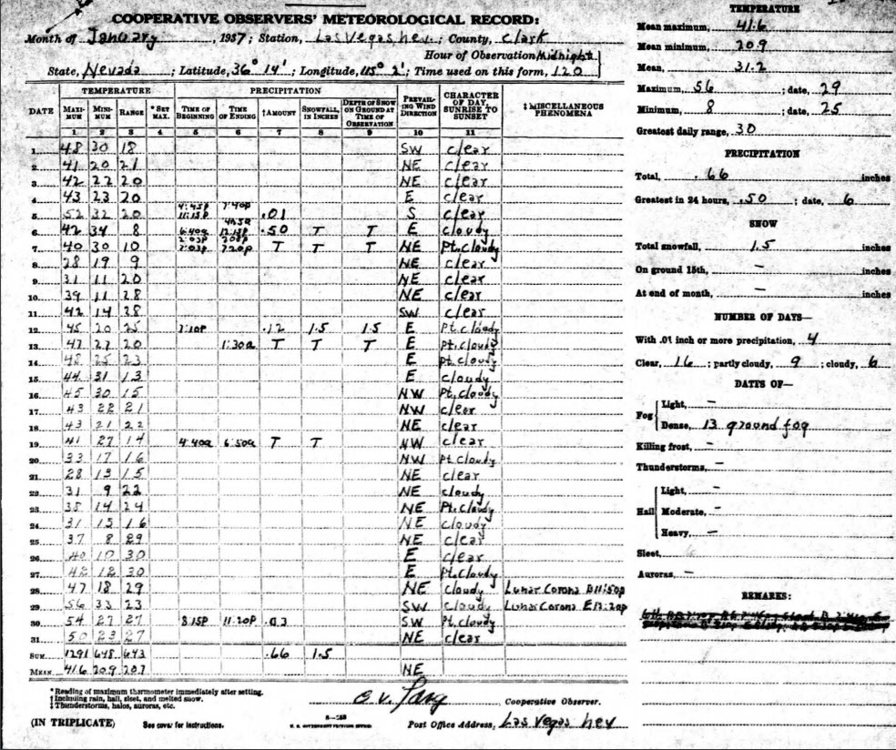
1937: Las Vegas, Nevada dropped to 8 degrees above zero, setting a record low for the city.
1949: Las Vegas, Nevada, recorded 4.7 inches of snow. This brought the monthly snowfall total to 16.7 inches which still ranks as their snowiest month on record. Click HERE for an aerial photograph of snow surrounding the Flamingo Hotel.
Click HERE for more This Day in Weather History from the Southeast Regional Climate Center.

