Overview
|
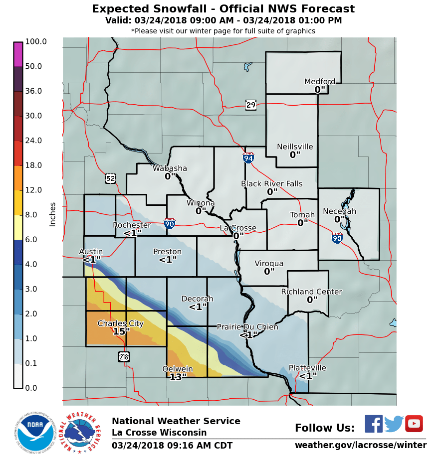
An area of heavy snow setup during the evening of March 23rd across far southern Minnesota into northern Iowa. This band remained nearly stationary overnight and into the following morning, increasing in intensity. Snowfall rates were 1-3" per hour producing snow covered roads and limited visibilities. A band of snowfall of 12 to 16" fell from the Charles City, Osage Iowa area, southeast towards Oelwein. Snowfall totals were MUCH less to the north and east of there where many communities ended up with hardly a snow flake. |
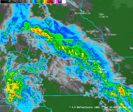 Radar loop from 11 pm March 23 to 1 pm March 24 2018​​ Radar loop from 11 pm March 23 to 1 pm March 24 2018​​ |
Snowfall Reports
...Snowfall Reports for March 23-24, 2018...

Location                     Amount

IOWA

...Chickasaw County...
Fredericksburg               14.0 in
New Hampton                  14.0 in
Ionia 2W                     12.0 in
New Hampton 2S               11.0 in
Alta Vista 3WSW              10.0 in
North Washington              9.5 in
Little Turkey 2S              7.5 in

...Clayton County...
Edgewood                      7.0 in
Elkader 6SSW                  6.9 in
Strawberry Point              6.5 in
Volga 1NE                     5.8 in

...Fayette County...
Fayette                       8.2 in
Fayette 2NNW                  7.0 in
West Union                    6.5 in
Wadena 4NW                    6.0 in

...Floyd County...
Nora Springs 2.4SSE          17.0 in
Rockford 1WNW                16.0 in
Charles City                 14.0 in
Charles City 3NNE            14.0 in
Nashua 2SW                   13.5 in
Rockford 4E                  13.0 in

...Howard County...
Elma                          5.6 in
Saratoga 2WSW                 3.5 in
Riceville 6E                  3.5 in
Cresco 5NW                    0.5 in

...Mitchell County...
Osage 3SSW                   16.0 in
St Ansgar                    14.8 in
Osage 1S                     12.0 in
Carpenter 2NNE               10.5 in
Riceville                     4.9 in
Mcintire                      1.7 in

...Winneshiek County...
Spillville                    3.0 in
Calmar                        2.3 in

MINNESOTA

...Mower County...
Lyle                          9.0 in
Austin 4WSW                   5.8 in
Austin 1E                     3.5 in
Lansing 2NE                   0.5 in

Observations are collected from a variety of sources with varying
equipment and exposures. We thank all volunteer weather observers
for their dedication. Not all data listed are considered official.
Services:
 |
 |
 |
 |
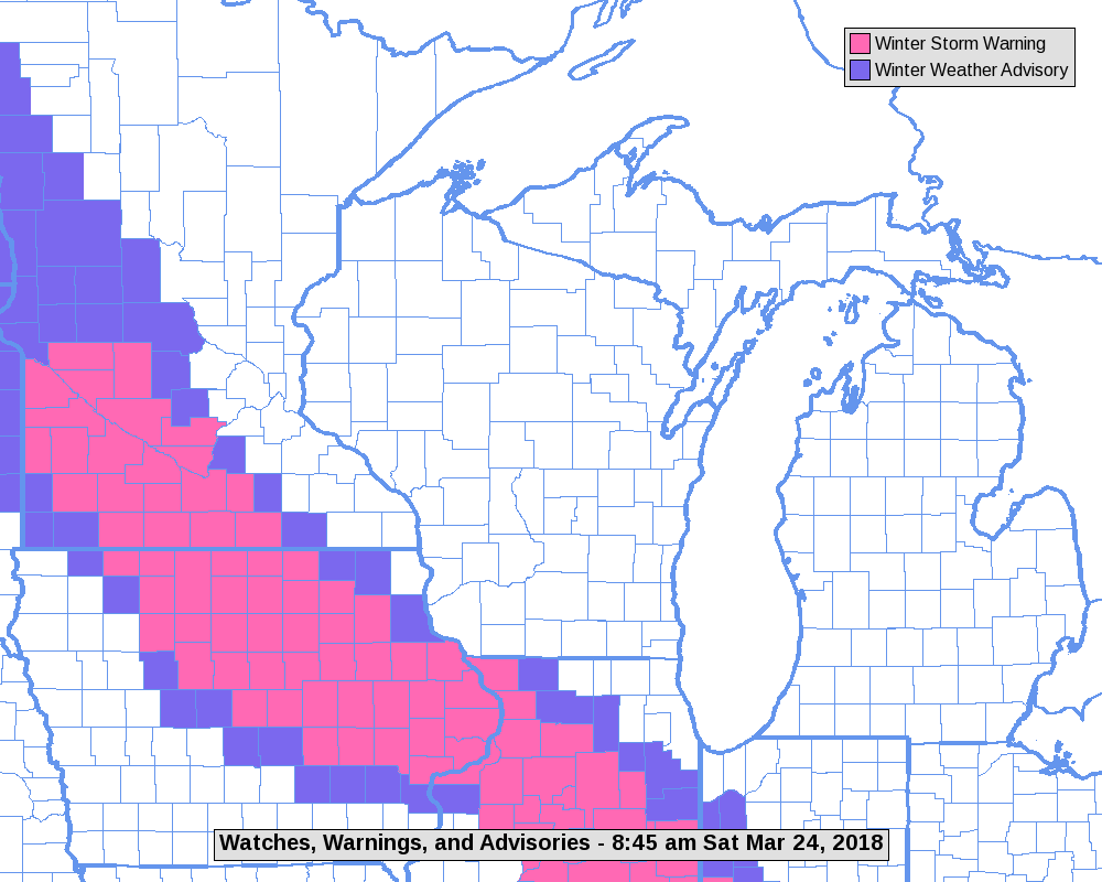
| Map showing advisories and warnings for March 24, 2018 (Map courtesy of NWS Green Bay) |
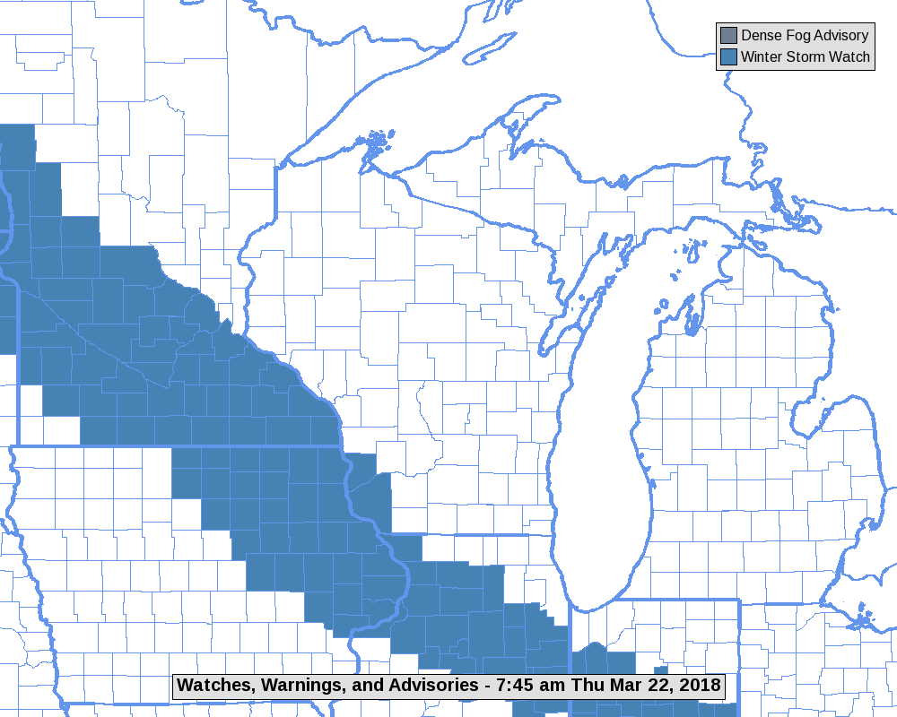
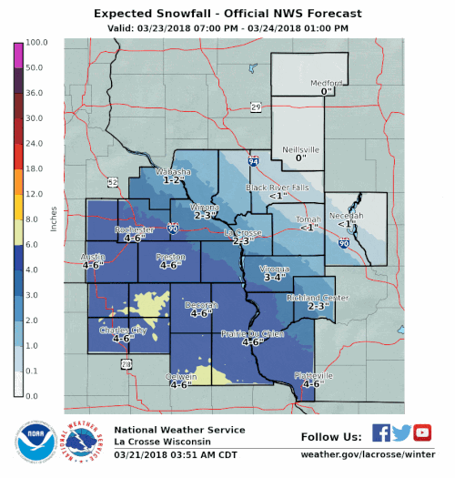
Animation of advisory and warning forecasts as storm approached | Snow forecast ending March 24th |
Snow forecast animation as the storm approached (Starting March 21 2018) |
Photos/Video:
 |
 |
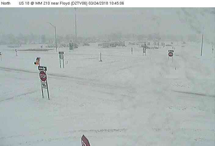
| Near Floyd, IA (Photo courtesy of IowaDOT) |
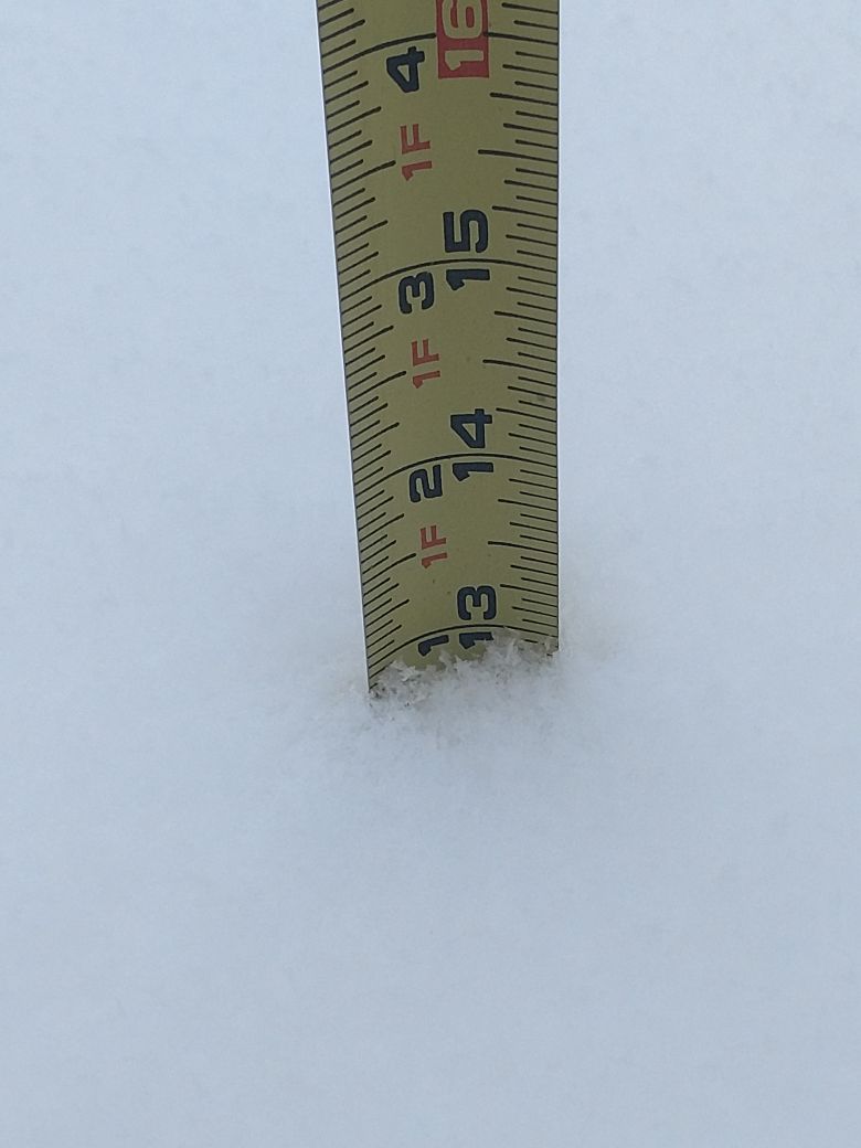
Snow depth near Rockford, IA (Photo courtesy of Brad Gorman) |
 |
Media use of NWS Web News Stories is encouraged! Please acknowledge the NWS as the source of any news information accessed from this site. |
|


 Weather Story
 Weather Map
 Local Radar