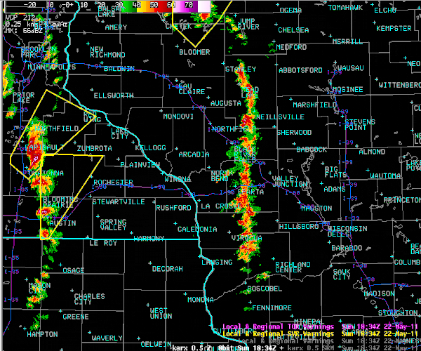
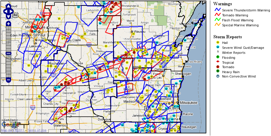
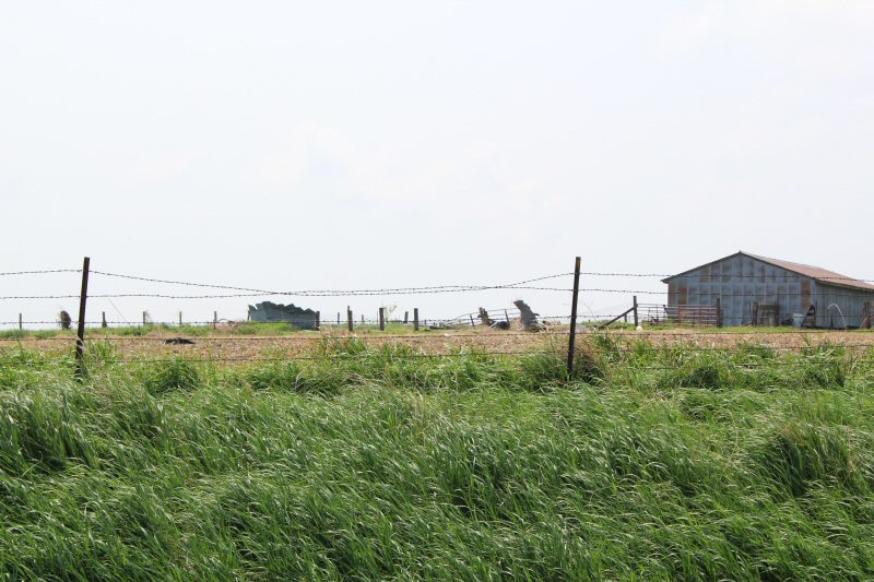
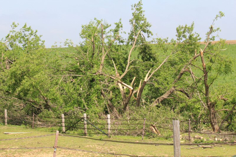
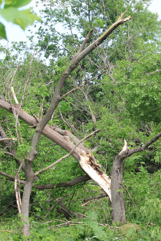
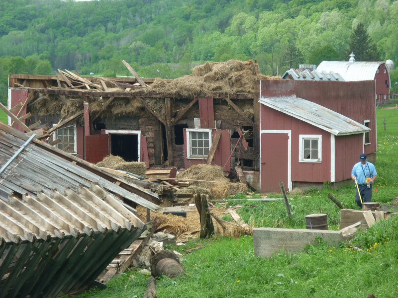
Storm Reports
PRELIMINARY LOCAL STORM REPORT...SUMMARY
NATIONAL WEATHER SERVICE LA CROSSE WI
850 PM CDT TUE MAY 24 2011
..TIME... ...EVENT... ...CITY LOCATION... ...LAT.LON...
..DATE... ....MAG.... ..COUNTY LOCATION..ST.. ...SOURCE....
..REMARKS..
1134 AM HAIL ROCHESTER 44.01N 92.48W
05/22/2011 E0.25 INCH OLMSTED MN TRAINED SPOTTER
NW SIDE OF ROCHESTER
1134 AM HAIL LA CROSSE 43.83N 91.23W
05/22/2011 E0.75 INCH LA CROSSE WI NWS EMPLOYEE
ALONG STATE STREET
1255 PM HAIL 2 E LA CROSSE 43.83N 91.19W
05/22/2011 E0.75 INCH LA CROSSE WI AMATEUR RADIO
LA CROSSE WFO, MOSTLY PEA SIZE-WITH A FEW 3/4
1258 PM HAIL 2 S LA CROSSE 43.80N 91.23W
05/22/2011 E0.25 INCH LA CROSSE WI TRAINED SPOTTER
0153 PM HAIL HAYFIELD 43.89N 92.85W
05/22/2011 E1.00 INCH DODGE MN PUBLIC
0153 PM HAIL NEILLSVILLE 44.56N 90.59W
05/22/2011 E0.88 INCH CLARK WI AMATEUR RADIO
0208 PM HAIL 2 ESE MANTORVILLE 44.05N 92.72W
05/22/2011 E0.50 INCH DODGE MN AMATEUR RADIO
0208 PM HAIL 1 W KASSON 44.03N 92.77W
05/22/2011 E0.88 INCH DODGE MN TRAINED SPOTTER
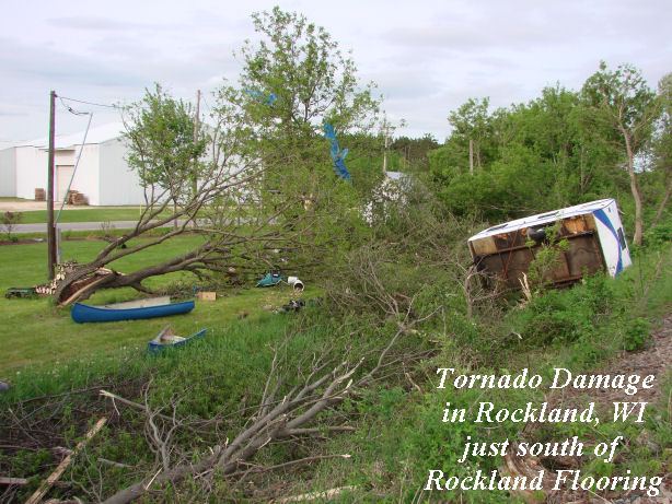
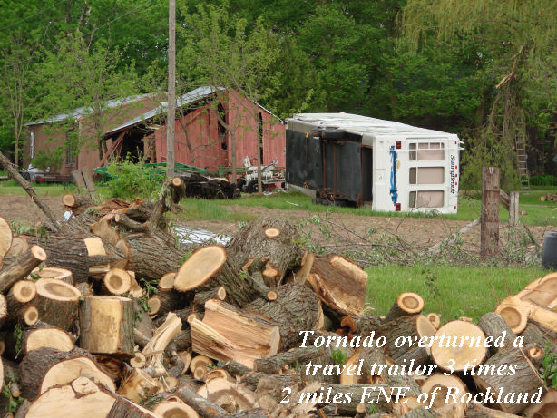
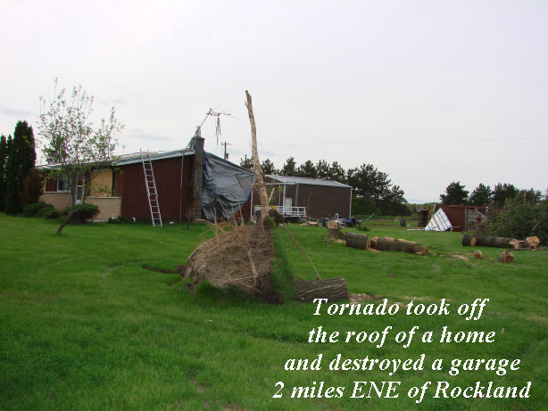
0214 PM HAIL 3 E ELROY 43.74N 90.21W
05/22/2011 E0.88 INCH JUNEAU WI PUBLIC
0215 PM HAIL BYRON 44.03N 92.65W
05/22/2011 E0.50 INCH OLMSTED MN PUBLIC
0230 PM HAIL MAUSTON 43.80N 90.08W
05/22/2011 E0.25 INCH JUNEAU WI BROADCAST MEDIA
0230 PM HAIL 5 N MAUSTON 43.87N 90.08W
05/22/2011 E1.25 INCH JUNEAU WI AMATEUR RADIO
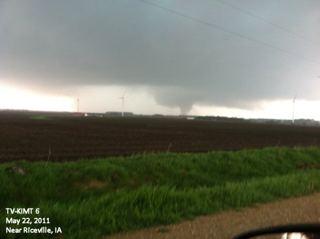
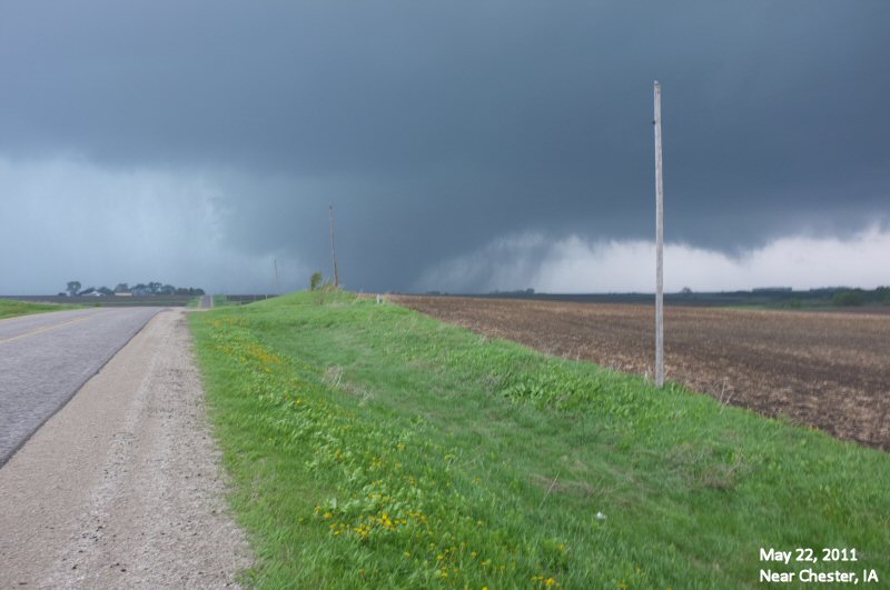
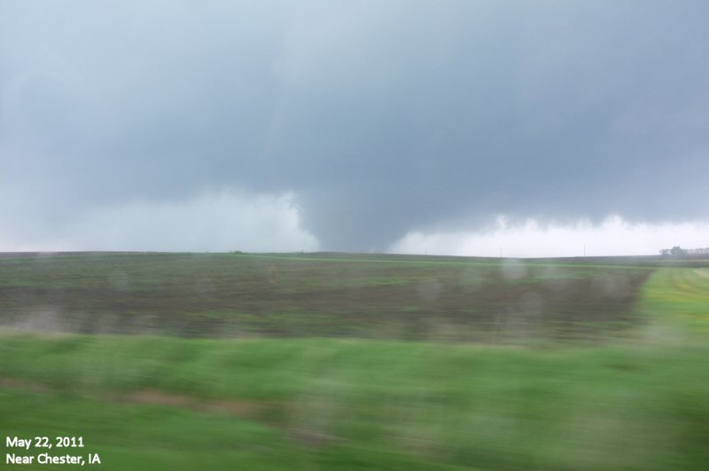
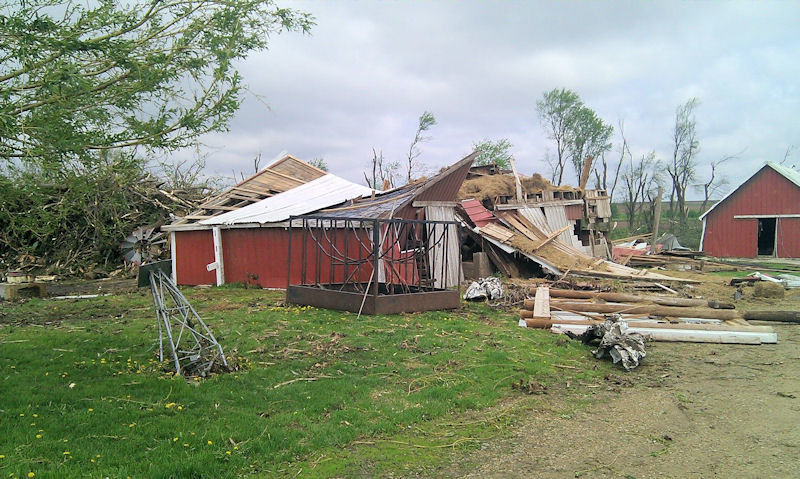
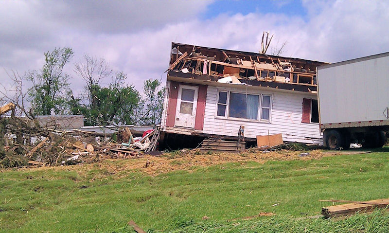
0233 PM     TORNADO          4 NE RICEVILLE          43.40N 92.50W
05/22/2011                   HOWARD             IA   NWS STORM SURVEY

            DAMAGE SURVEY CONDUCTED 5/23. THE TORNADO BEGAN 4.2 MILES
            NORTHEAST OF RICEVILLE WITH EF1 DAMAGE. IT REACHED ITS
            MAXIMUM STRENGTH EF2 AND SIZE 250 YARDS WIDE 2.5 MILES
            SOUTH OF CHESTER IOWA. THE PATH CONTINUED NORTHEAST INTO
            FILLMORE COUNTY MINNESOTA DISSIPATING AT 329 PM 2 MILES
            NORTHEAST OF HARMONY MINNESOTA.
0244 PM HAIL MAUSTON 43.80N 90.08W
05/22/2011 E2.75 INCH JUNEAU WI EMERGENCY MNGR
0245 PM TSTM WND DMG 5 E MCINTIRE 43.44N 92.49W
05/22/2011 HOWARD IA AMATEUR RADIO
SEVERE DAMAGE TO A HOME
0252 PM HAIL BIG FLATS 44.12N 89.80W
05/22/2011 E1.00 INCH ADAMS WI PUBLIC
0259 PM TSTM WND DMG 3 SSW CHESTER 43.45N 92.39W
05/22/2011 HOWARD IA TRAINED SPOTTER
POWER LINES DOWN
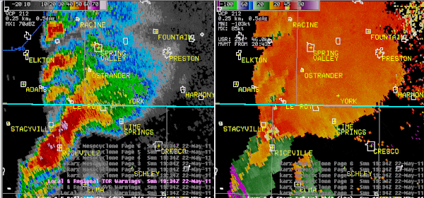
0302 PM TORNADO YORK 43.53N 92.27W
05/22/2011 FILLMORE MN PUBLIC
TORNADO ON GROUND.
0302 PM TSTM WND DMG 2 S CHESTER 43.46N 92.36W
05/22/2011 HOWARD IA TRAINED SPOTTER
SIGNIFICANT DAMAGE TO HOME/FARM
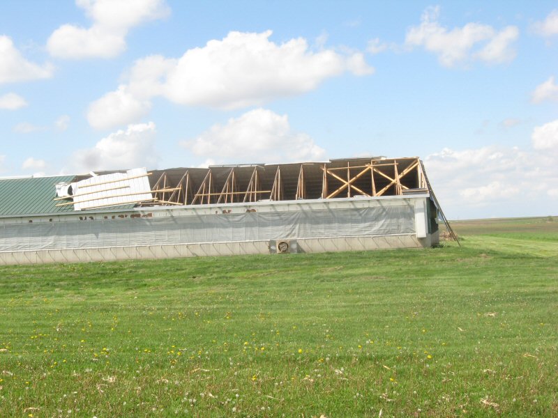
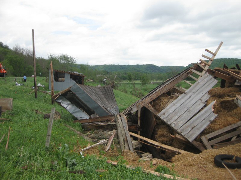
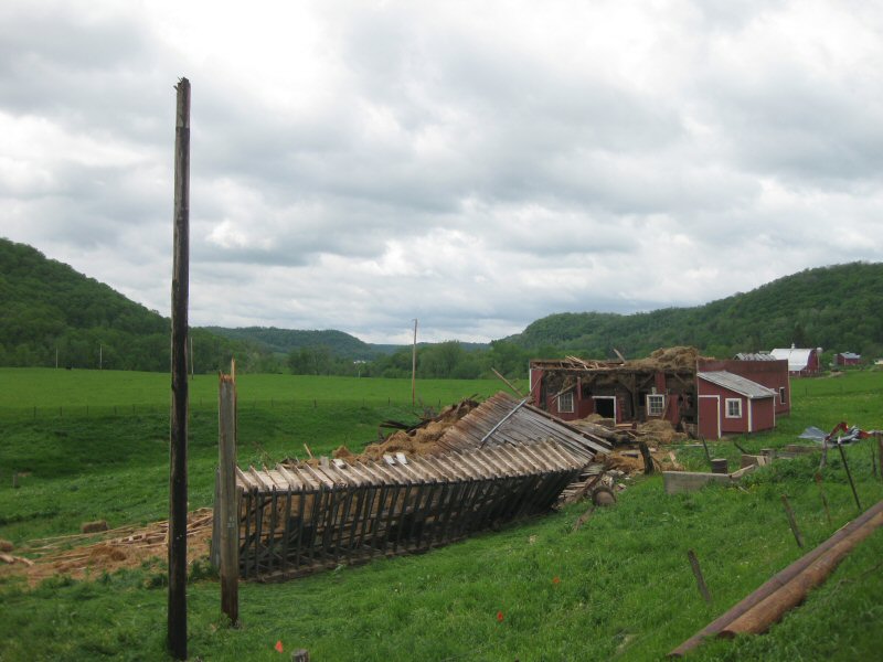
0304 PM TSTM WND DMG 3 N GRANGER 43.54N 92.10W
05/22/2011 FILLMORE MN PUBLIC
BARN DAMAGED 3 MILES NORTH OF GRANGER
0304 PM HAIL FRIENDSHIP 43.97N 89.82W
05/22/2011 E1.25 INCH ADAMS WI PUBLIC
CRACKED WINDSHIELDS OF AUTOS
0320 PM TORNADO 5 W HARMONY 43.56N 92.11W
05/22/2011 FILLMORE MN EMERGENCY MNGR
COUNTY RD 44/15. TORNADO ON GROUND
0321 PM TORNADO 6 N GRANGER 43.59N 92.10W
05/22/2011 FILLMORE MN PUBLIC
TORNADO ON GROUND.
0325 PM HAIL PRESTON 43.67N 92.08W
05/22/2011 M0.25 INCH FILLMORE MN STORM CHASER
IN ADDITION TO THE HAIL 1.21 INCHES OF RAIN FELL
0325 PM FUNNEL CLOUD 4 N OELWEIN 42.73N 91.91W
05/22/2011 FAYETTE IA EMERGENCY MNGR
PEA-SIZED HAIL AS WELL.
0327 PM TORNADO N HARMONY 43.56N 92.01W
05/22/2011 FILLMORE MN PUBLIC
DAMAGE TO SILOS...ROOFS. 1/2 N OF HARMONY
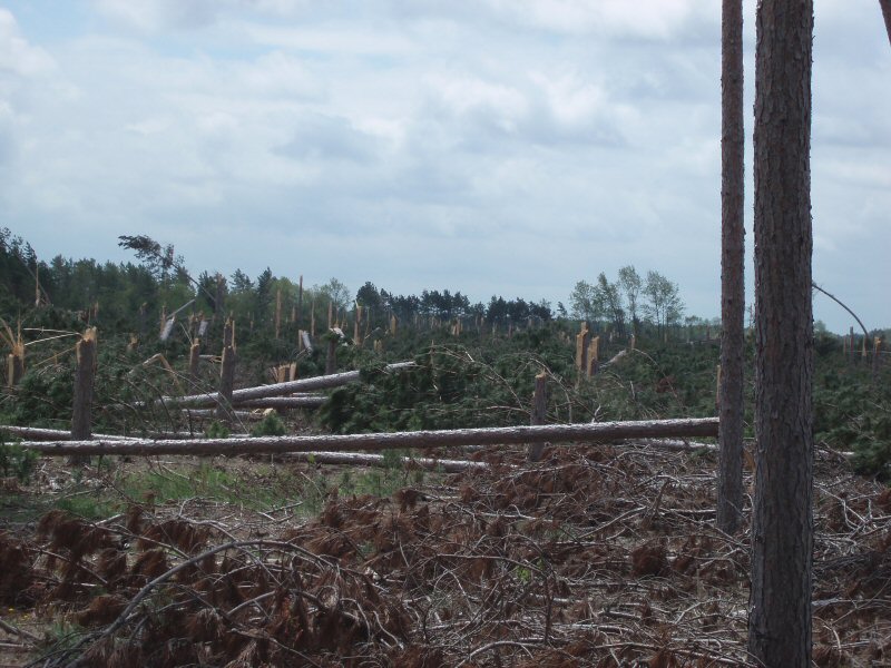
0337 PM     TORNADO          RANDALIA                42.86N 91.89W
05/22/2011                   FAYETTE            IA   NWS STORM SURVEY

            STORM SURVEY CONDUCTED 5/24. TORNADO BEGAN 3 MILES EAST
            OF SUMNER...ABOUT A HALF MILE NORTH OF INTERSECTION OF
            HWY 93 AND U AVENUE. CONTINUED EAST NORTHEAST FOR ABOUT 8
            MILES...PASSING JUST NORTH OF RANDALIA AND ENDING 2 MILES
            NORTHWEST OF FAYETTE AT 345 PM. EF-1 DAMAGE. MAX PATH
            WIDTH 70 YARDS.
0347 PM     TORNADO          4 WNW MAYNARD           42.80N 91.95W
05/22/2011                   FAYETTE            IA   EMERGENCY MNGR

            EM REPORTS POSSIBLE TORNADO TRACK WITH DOWNED TREES AND
            DAMAGED FARMS.
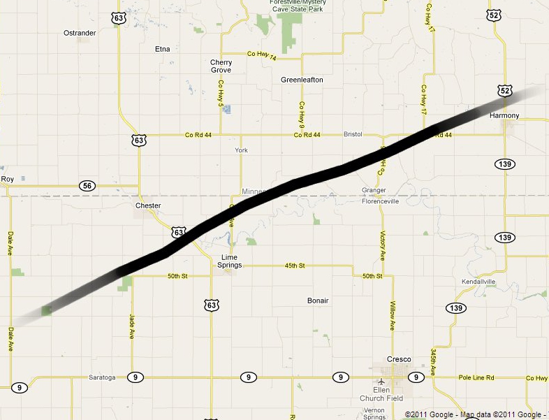
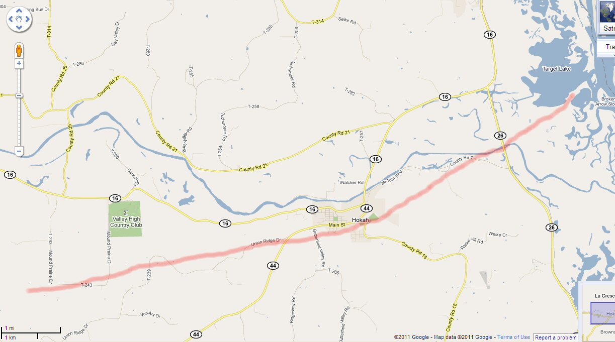
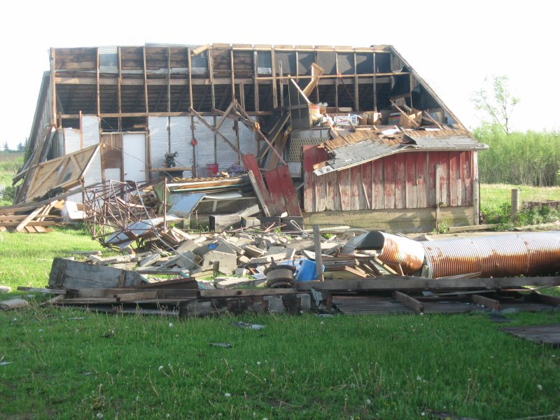
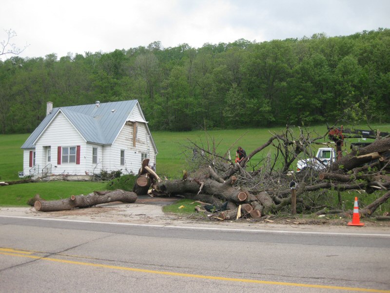
0400 PM     TORNADO          3 NW CALEDONIA          43.66N 91.54W
05/22/2011                   HOUSTON            MN   NWS STORM SURVEY

            STORM SURVEY CONDUCTED 5/23. THE TORNADO BEGAN ONE HALF
            MILE WEST OF THE INTERSECTION OF HIGHWAY 22 AND 76 IN
            CENTRAL HOUSTON COUNTY. THE MOST SIGNIFICANT DAMAGE WAS 5
            MILES WEST-SOUTHWEST OF HOKAH WITH EF2 DAMAGE AND A
            MAXIMUM WIDTH OF 100 YARDS. THE PATH CONTINUED NORTHEAST
            WITH THE TORNADO DISSIPATING 3 MILES EAST NORTHEAST OF
            HOKAH AT 420 PM. TOTAL PATH LENGTH WAS 14 MILES.
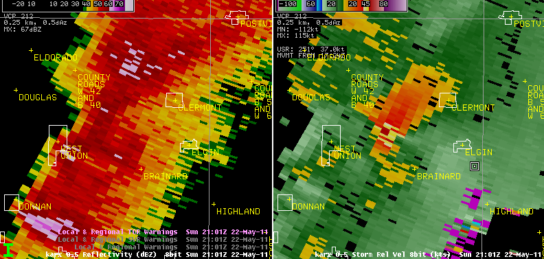
0401 PM     TORNADO          5 E WEST UNION          42.96N 91.71W
05/22/2011                   FAYETTE            IA   NWS STORM SURVEY

            STORM SURVEY CONDUCTED 5/24. TORNADO TOUCHED DOWN 5 MILES
            EAST OF WEST UNION NEAR INTERSECTION OF HWY B64 AND G
            AVENUE. PATH CONTINUED EAST NORTHEAST FOR ABOUT 1 MILE
            BEFORE LIFTING 2 MILES SOUTHWEST OF CLERMONT AT 403 PM.
            EF-0 DAMAGE. MAX PATH WIDTH 50 YARDS.
0401 PM HAIL WEST UNION 42.96N 91.81W
05/22/2011 M2.00 INCH FAYETTE IA BROADCAST MEDIA
DELAYED REPORT
0405 PM HAIL FAYETTE 42.84N 91.80W
05/22/2011 E0.50 INCH FAYETTE IA PUBLIC
0415 PM TSTM WND GST HOKAH 43.76N 91.35W
05/22/2011 E60.00 MPH HOUSTON MN AMATEUR RADIO
0416 PM TSTM WND DMG HOKAH 43.76N 91.35W
05/22/2011 HOUSTON MN AMATEUR RADIO
1 FOOT DIAMETER PINE TREE SNAPPED. WIND ESTIMATED 60 MPH.
0417 PM HAIL ELGIN 42.96N 91.63W
05/22/2011 E1.50 INCH FAYETTE IA PUBLIC
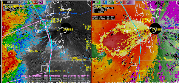
0421 PM TORNADO 2 S LA CRESCENT 43.80N 91.30W
05/22/2011 HOUSTON MN AMATEUR RADIO
POSSIBLE BRIEF TORNADO TOUCHDOWN. SEVERAL TREES SNAPPED
OFF AND BRANCHES THROWN. 80 YARDS WIDE DAMAGE JUST NORTH
OF ROOT RIVER ON HWY 26. REPORTED BY OFF DUTY NWS
EMPLOYEE.
0422 PM FUNNEL CLOUD 7 S LA CROSSE 43.73N 91.23W
05/22/2011 LA CROSSE WI PUBLIC
FC REPORT ON TARGET LAKE. SOUTHERN LA CROSSE COUNTY.
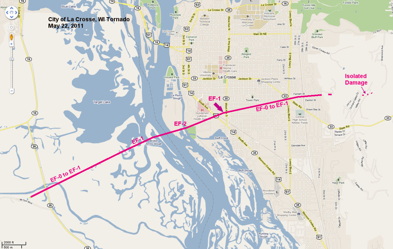
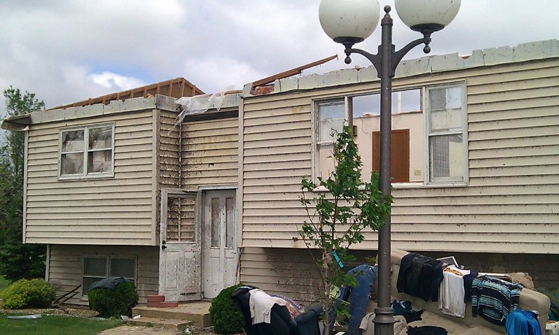
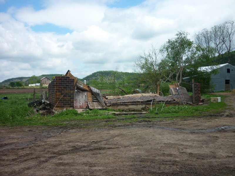
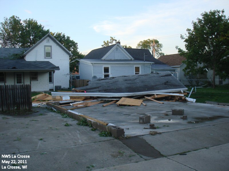
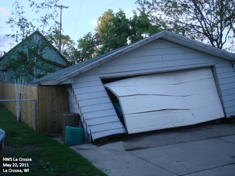
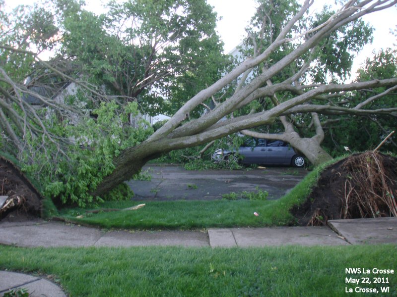
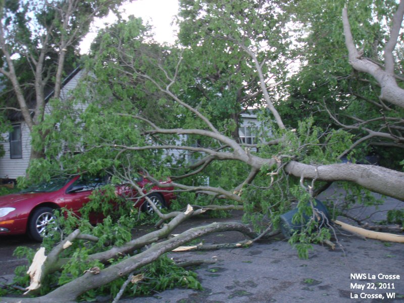
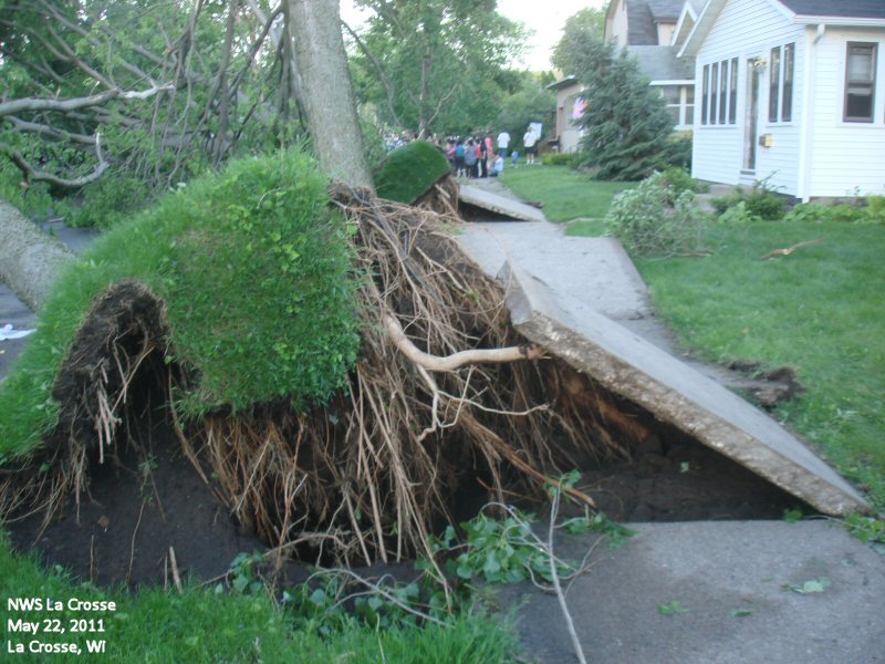
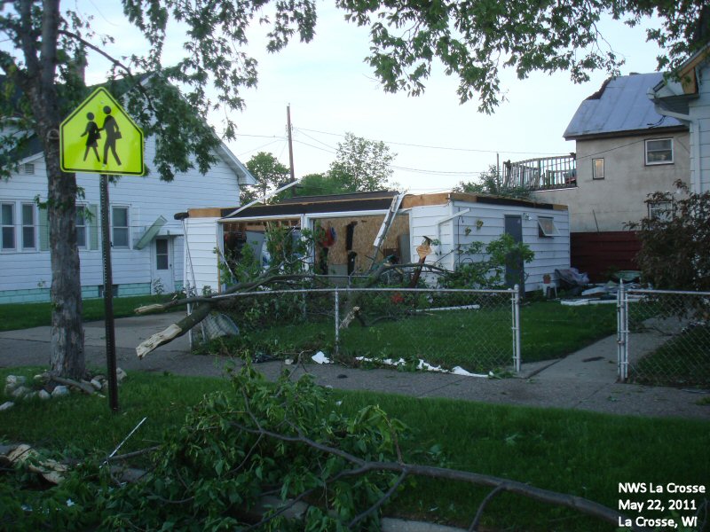
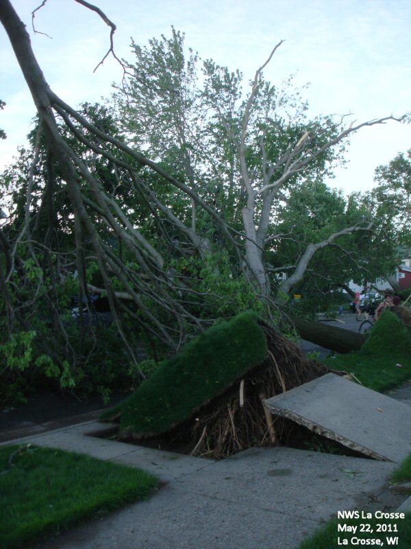
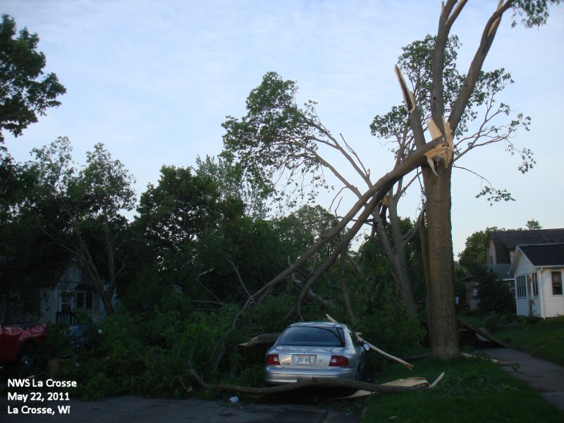
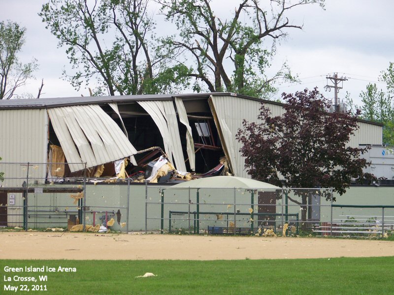
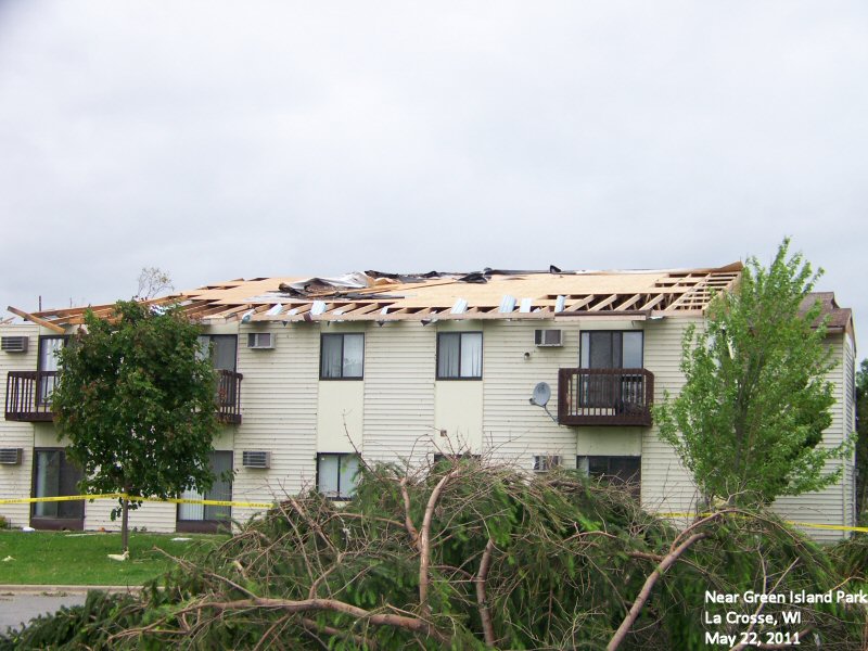
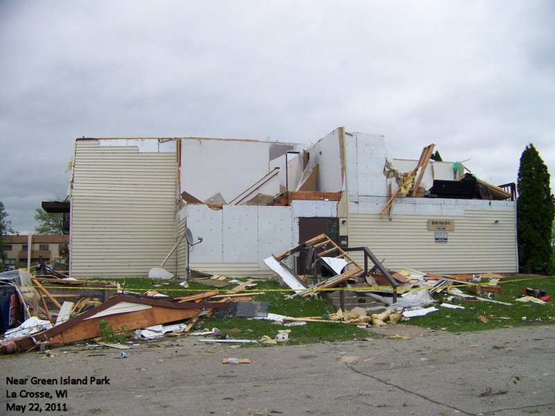
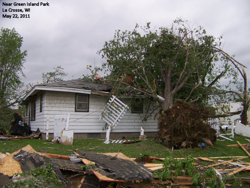
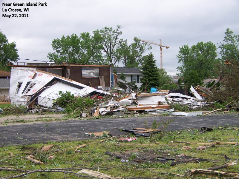
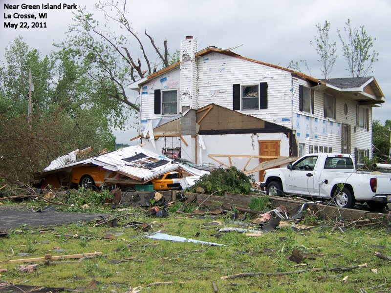
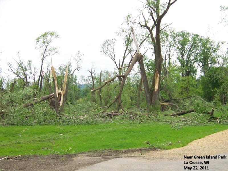
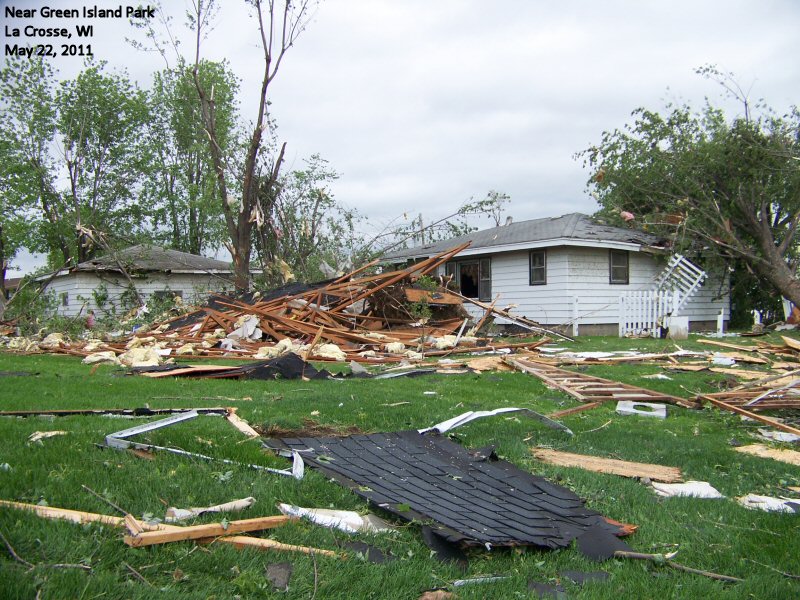
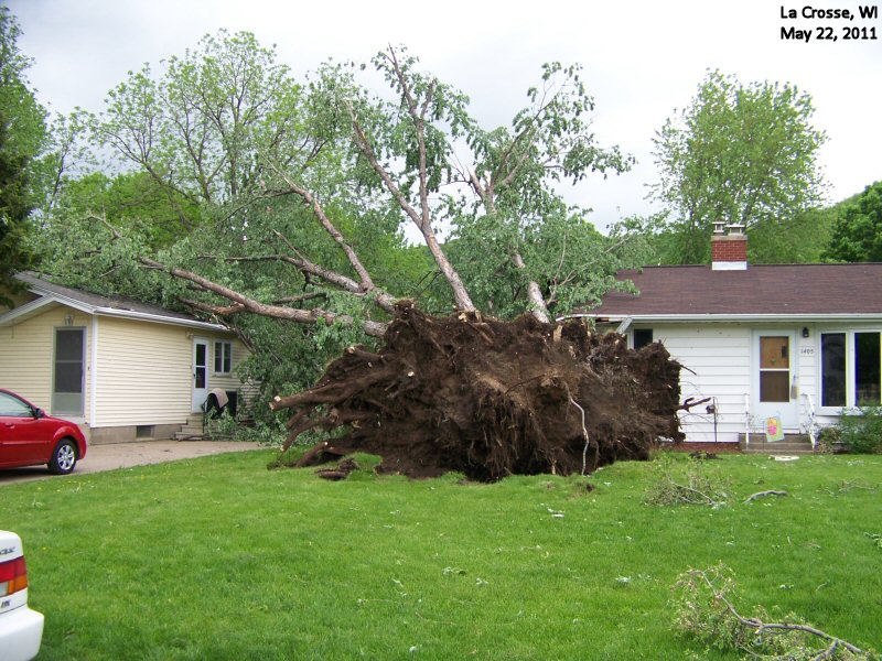
0423 PM     TORNADO          LA CROSSE               43.83N 91.23W
05/22/2011                   LA CROSSE          WI   NWS STORM SURVEY

            DAMAGE SURVEY CONDUCTED 5/23. TORNADO MOVED OFF THE
            MISSISSIPPI RIVER AT 423 PM NEAR GREEN ISLAND PARK
            CAUSING LOWER END EF-2 DAMAGE. THE PATH CONTINUED
            EAST-NORTHEAST FOR ABOUT 2.3 MILES CAUSING EF-1 TO EF-0
            DAMAGE UNTIL IT LIFTED AT 427 PM.
0425 PM     TSTM WND DMG     LA CROSSE               43.83N 91.23W
05/22/2011                   LA CROSSE          WI   AMATEUR RADIO

            TREE DOWN NEAR 19TH AND DENTON
0426 PM     TSTM WND GST     LA CROSSE               43.83N 91.23W
05/22/2011  M87 MPH          LA CROSSE          WI   AMATEUR RADIO

            MEASURED NEAR 16TH STREET AND DENTON IN LA CROSSE AS
            TORNADO PASSED BY. ANEMOMETER IS AT 35 FEET.
0429 PM     HAIL             1 E CALEDONIA           43.63N 91.48W
05/22/2011  E2.00 INCH       HOUSTON            MN   AMATEUR RADIO

            REPORTED BY OFF DUTY NWS EMPLOYEE AT 445PM. TIME OF EVENT
            ESTIMATED BY RADAR. SOME MELTING OF HAIL HAD ALREADY
            OCCURRED.

0429 PM     TSTM WND GST     FRENCH ISLAND           43.86N 91.26W
05/22/2011  M54.00 MPH       LA CROSSE          WI   AWOS

            MEASURED AT LA CROSSE AIRPORT

0430 PM     HAIL             9 W LA CRESCENT         43.83N 91.48W
05/22/2011  E0.25 INCH       HOUSTON            MN   AMATEUR RADIO

0430 PM     HAIL             9 W LA CRESCENT         43.83N 91.48W
05/22/2011  E0.25 INCH       HOUSTON            MN   PUBLIC
0435 PM     TSTM WND DMG     2 ESE BARRE MILLS       43.82N 91.08W
05/22/2011                   LA CROSSE          WI   NWS STORM SURVEY

            SOME TOPS OF TREES WERE BROKEN OFF ALONG COUNTY ROAD M.

0437 PM     TSTM WND DMG     5 E BARRE MILLS         43.84N 91.02W
05/22/2011                   LA CROSSE          WI   NWS STORM SURVEY

            A FEW TREES BLOWN DOWN ALONG COUNTY ROAD II
0438 PM HAIL ONALASKA 43.89N 91.22W
05/22/2011 E0.88 INCH LA CROSSE WI AMATEUR RADIO
0440 PM HAIL 2 S HOLMEN 43.93N 91.26W
05/22/2011 E0.25 INCH LA CROSSE WI PUBLIC
0442 PM FUNNEL CLOUD WADENA 42.84N 91.66W
05/22/2011 FAYETTE IA EMERGENCY MNGR
0447 PM TSTM WND DMG 1 N GILMAN 45.18N 90.81W
05/22/2011 TAYLOR WI LAW ENFORCEMENT
POWER POLE AND TREE LIMBS DOWN ALONG BABIT AVENUE ON THE
NORTH SIDE OF GILMAN. TIME RADAR ESTIMATED.
0453 PM HAIL 3 ESE BRAINARD 42.92N 91.64W
05/22/2011 E1.75 INCH FAYETTE IA TRAINED SPOTTER
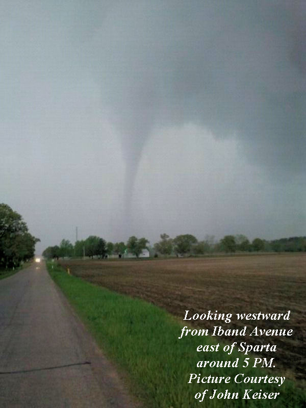
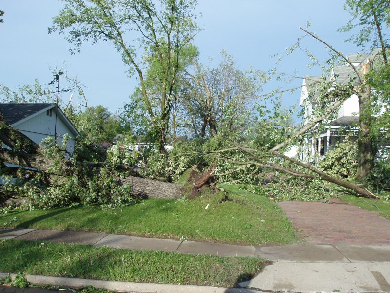
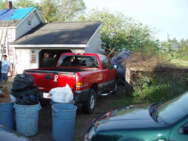
0455 PM TSTM WND DMG 1 S SPARTA 43.93N 90.81W
05/22/2011 MONROE WI AMATEUR RADIO
SOME TREES SNAPPED OFF AND BILLBOARDS DOWN.
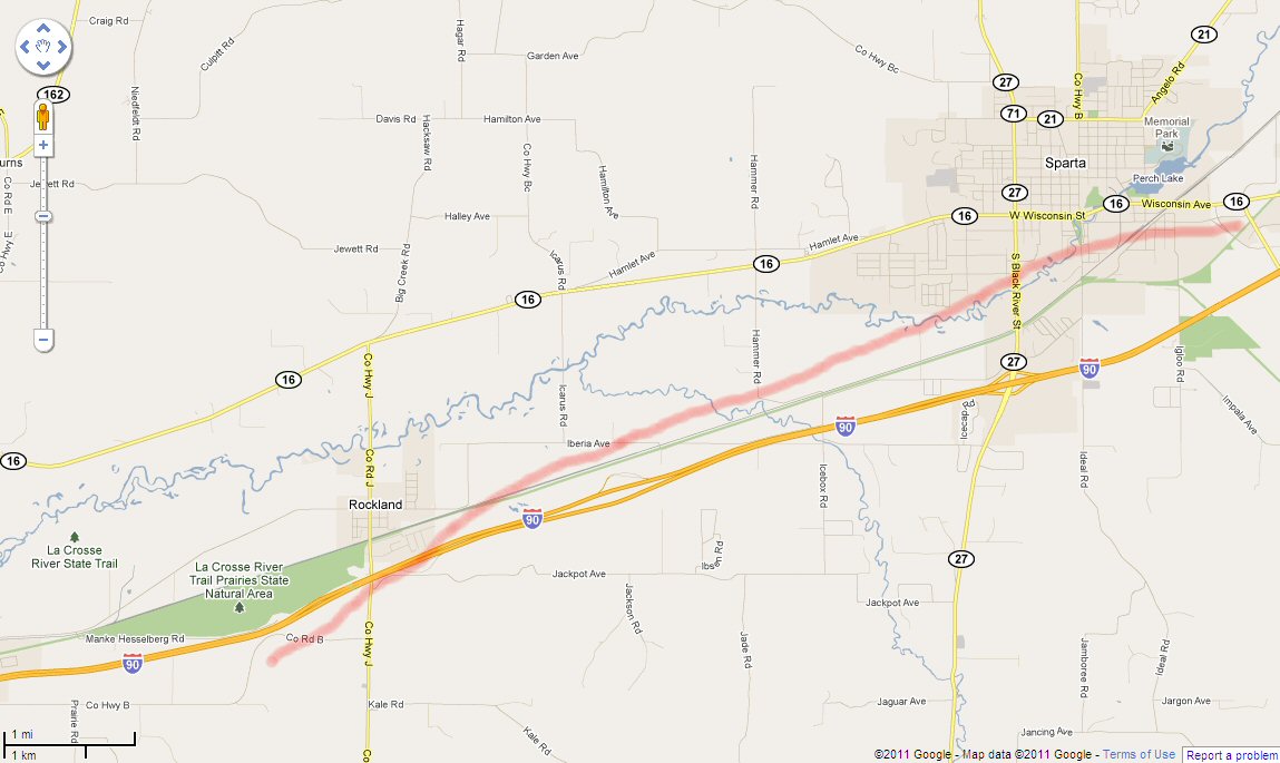
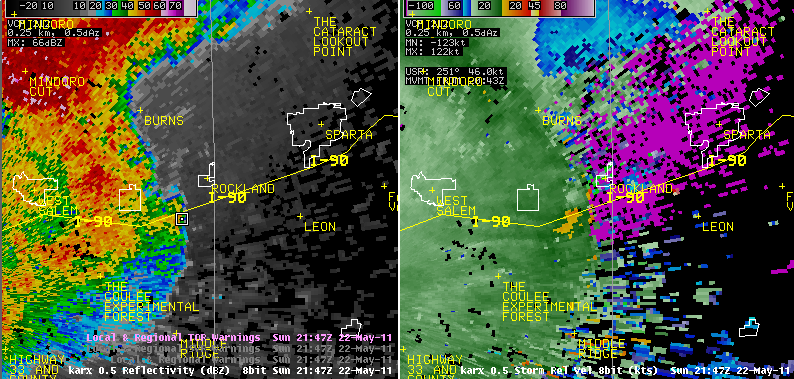
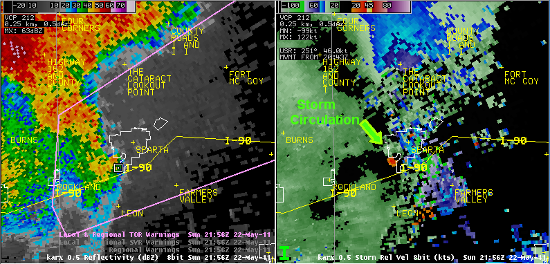
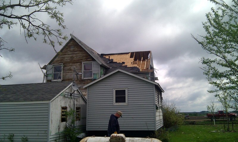
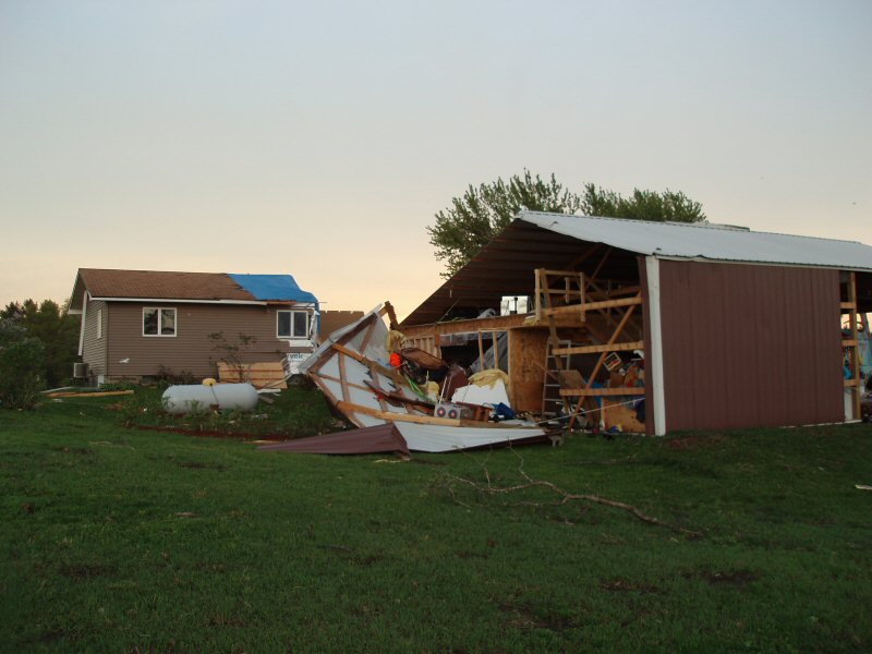
0455 PM     TORNADO          1 SW SPARTA             43.93N 90.82W
05/22/2011                   MONROE             WI   NWS STORM SURVEY

            TORNADO FORMED AT 455 PM AND TRACKED 2 MILES WITH A
            MAXIMUM WIDTH OF 70 YARDS AND EF1 DAMAGE. THE TORNADO
            DISSIPATED AT 500 PM 2 MILES SOUTHEAST OF SPARTA.
0456 PM TSTM WND DMG 1 S SPARTA 43.93N 90.81W
05/22/2011 MONROE WI AMATEUR RADIO
CARS FLIPPED...TURNED...DEBRIS IMPACT HAS DESTROYED
NUMEROUS WINDOWS AT BRENNEGEN CHEV DEALER.
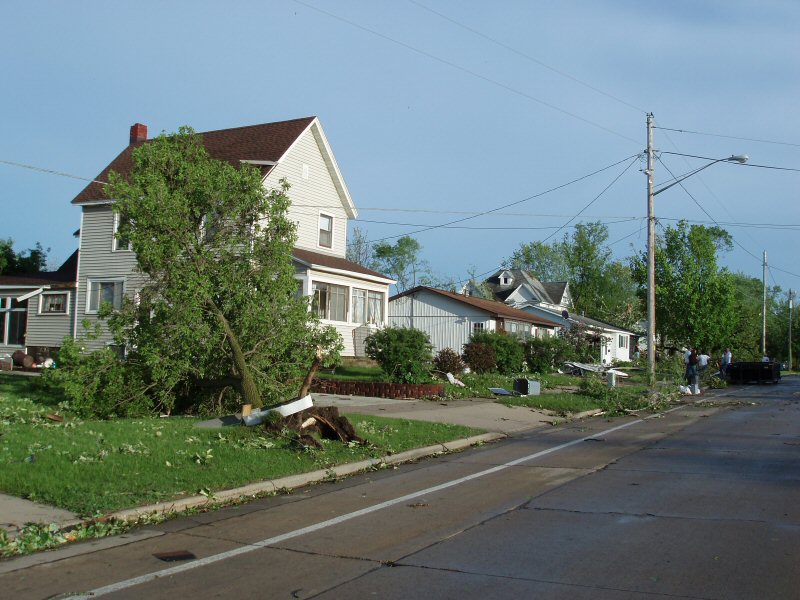
0456 PM TORNADO S SPARTA 43.94N 90.81W
05/22/2011 MONROE WI NWS STORM SURVEY
PRELIMINARY DAMAGE ASSESSMENT BY NWS. LOW END EF1 TORNADO
ON SOUTH SIDE OF SPARTA. 70 YARDS WIDE BUT NOT A
CONTINUOUS PATH TOWARD WARRENS. TIME ESTIMATED BY SPOTTER
REPORTS AND RADAR.
0456 PM TORNADO 1 S SPARTA 43.93N 90.81W
05/22/2011 MONROE WI AMATEUR RADIO
AT I90 EXIT 25
0458 PM TSTM WND GST 1 S SPARTA 43.93N 90.81W
05/22/2011 E60.00 MPH MONROE WI AMATEUR RADIO
0459 PM HAIL BARRE MILLS 43.84N 91.12W
05/22/2011 E1.00 INCH LA CROSSE WI TRAINED SPOTTER
0500 PM TORNADO 8 N GILMAN 45.28N 90.81W
05/22/2011 TAYLOR WI FIRE DEPT/RESCUE
REPORTED BY FIRE DEPARTMENT
0500 PM TORNADO SPARTA 43.94N 90.81W
05/22/2011 MONROE WI BROADCAST MEDIA
DAMAGE TO BUILDINGS ON SOUTH SIDE OF SPARTA
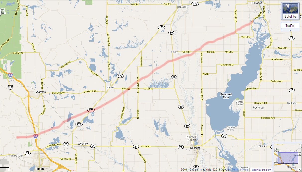
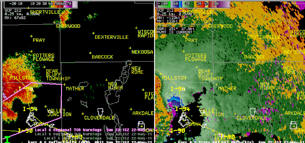
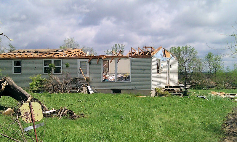
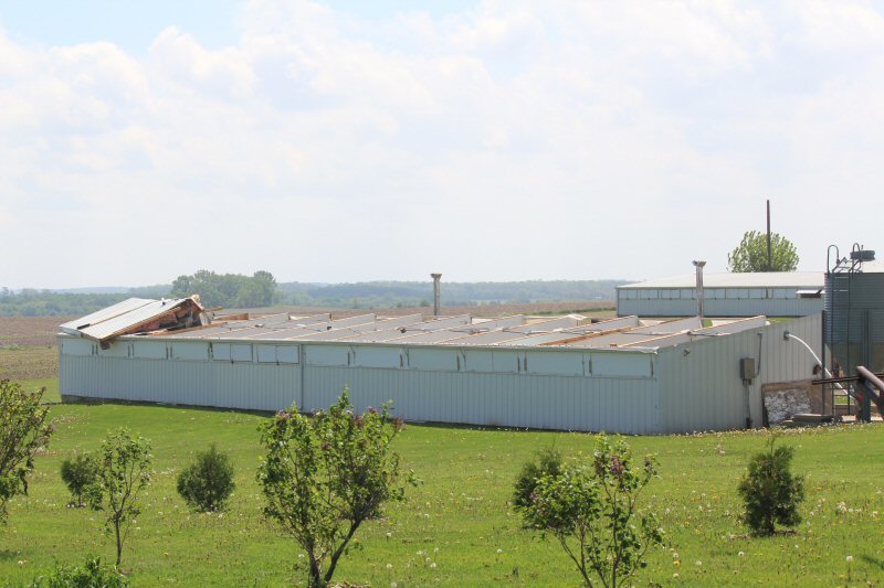
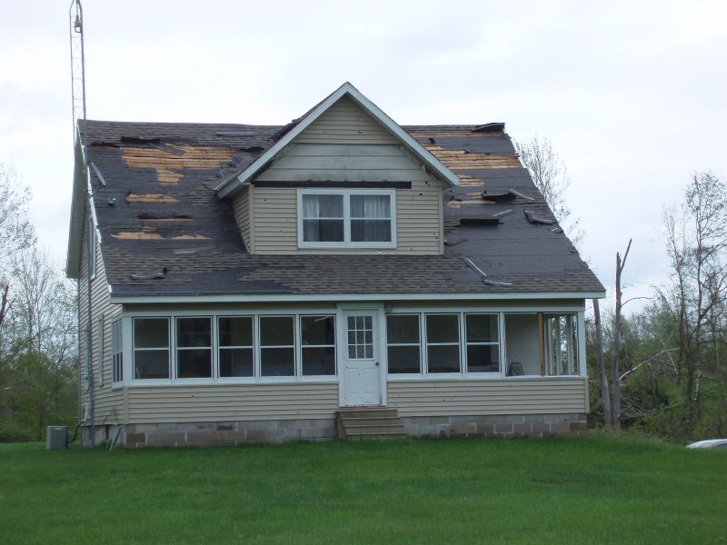
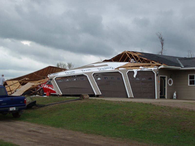
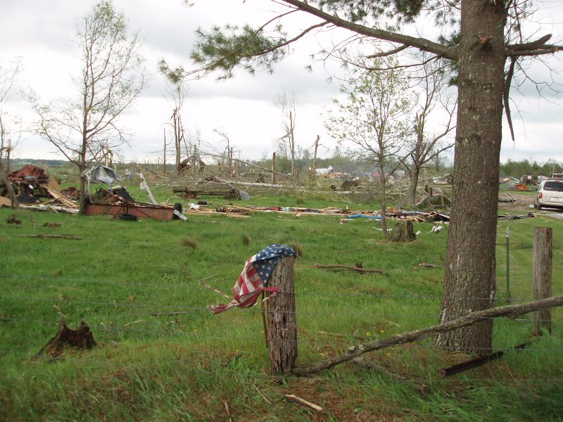
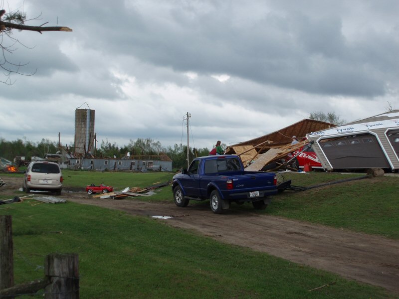
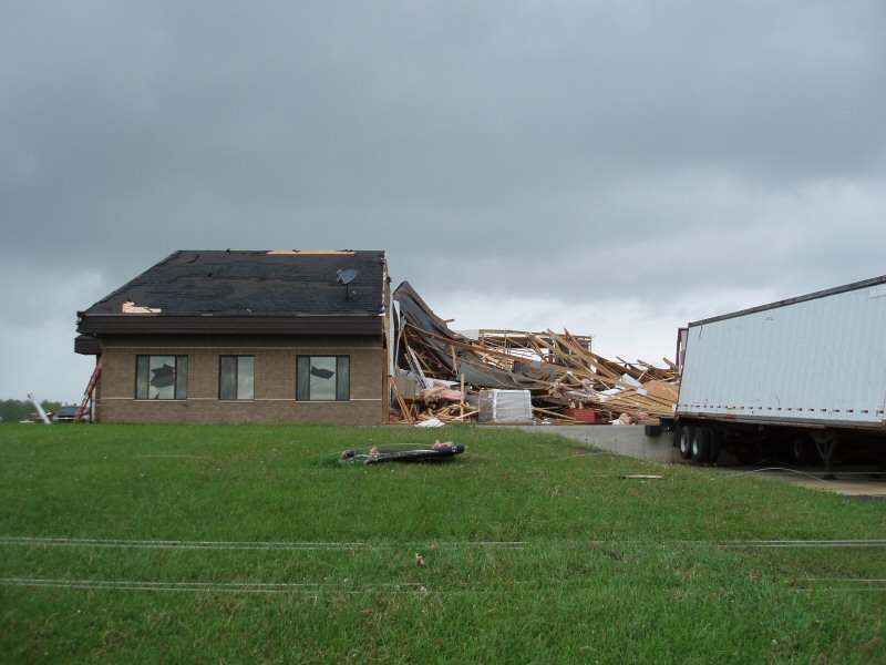
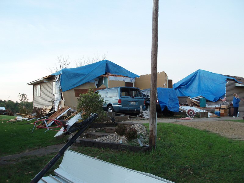
0515 PM     TORNADO          4 NW TOMAH              44.03N 90.56W
05/22/2011                   MONROE             WI   NWS STORM SURVEY

            DAMAGE SURVEY WAS DONE 5/23. TORNADO FORMED 4 MILES
            NORTHWEST OF TOMAH NEAR COUNTY ROAD M. THE MAXIMUM DAMAGE
            WAS EF2 IN SEVERAL LOCATIONS ALONG ITS PATH. AT ITS
            WIDEST POINT IT WAS 800 YARDS WIDE. THE TORNADO
            DISSIPATED AT 605 PM 3 MILES SOUTHWEST OF NEKOOSA.
0518 PM HAIL 5 WSW WARRENS 44.10N 90.59W
05/22/2011 E1.50 INCH MONROE WI TRAINED SPOTTER
0521 PM FUNNEL CLOUD 1 N CURTISS 44.97N 90.44W
05/22/2011 CLARK WI EMERGENCY MNGR
NORTH OF CURTISS.
0524 PM TSTM WND DMG 2 NW TOMAH 44.01N 90.53W
05/22/2011 MONROE WI AMATEUR RADIO
ROFF DAMAGE...DEBRIS...AND TREE DAMAGE ON EGRESS AVE N OF
COUNTY E.
0530 PM FUNNEL CLOUD HANNIBAL 45.25N 90.78W
05/22/2011 TAYLOR WI TRAINED SPOTTER
POSSIBLY TOUCHED DOWN.
0549 PM TORNADO MATHER 44.15N 90.30W
05/22/2011 JUNEAU WI EMERGENCY MNGR
NUMEROUS TREES BLOCKING HIGHWAY 173 AT MATHER.
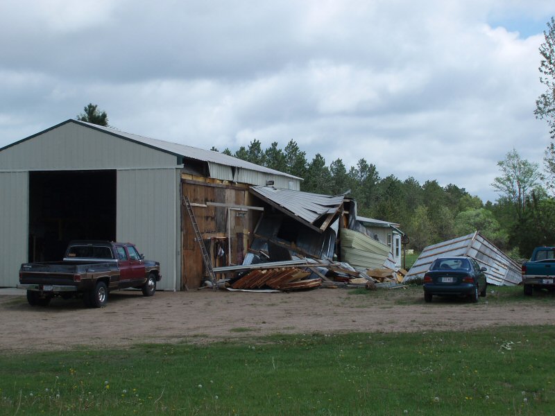
0556 PM TSTM WND DMG 3 E FINLEY 44.21N 90.07W
05/22/2011 JUNEAU WI LAW ENFORCEMENT
TWO HOUSES WITH STRUCTURAL DAMAGE ALONG COUNTY ROAD F
EAST OF FINLEY
0556 PM TSTM WND DMG 3 E FINLEY 44.21N 90.07W
05/22/2011 JUNEAU WI LAW ENFORCEMENT
A HIGH POWER TRANSMISSION LINE COLLAPSED NEAR COUNTY ROAD
F AND 13TH AVE ALONG THE FINLEY AND ARMENIA TOWNSHIP
LINES.
0556 PM HAIL 7 W RICHLAND CENTER 43.34N 90.52W
05/22/2011 E1.50 INCH RICHLAND WI AMATEUR RADIO
AT HIGHWAY ZZ AND 14.
0557 PM HAIL 7 WNW RICHLAND CENTER 43.38N 90.51W
05/22/2011 E1.25 INCH RICHLAND WI AMATEUR RADIO
ON COUNTY ROAD ZZ.
0601 PM HAIL 2 N RICHLAND CENTER 43.37N 90.38W
05/22/2011 E1.00 INCH RICHLAND WI TRAINED SPOTTER
0606 PM HAIL 4 N RICHLAND CENTER 43.40N 90.38W
05/22/2011 E1.75 INCH RICHLAND WI TRAINED SPOTTER
ON HWY 80
&&


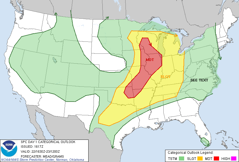


 Weather Story
 Weather Map
 Local Radar