
An arctic cold front will move through the Great Lakes and Northeast on Thursday, bringing moderate to heavy snow, strong winds, and possible whiteout conditions through Thursday afternoon. A storm system interacting with Gulf moisture will bring moderate to heavy rainfall to the western and central Gulf Coast on Thursday. Isolated instances of flash flooding will be possible. Read More >
|
Download Tornado Tracks and view damage photos in Google Earth
PRELIMINARY LOCAL STORM REPORT
NATIONAL WEATHER SERVICE COLUMBIA SC
301 PM EDT MON MAY 03 2010
.TIME... ...EVENT... ...CITY LOCATION... ...LAT.LON
.DATE... ....MAG.... ..COUNTY LOCATION..ST.. ...SOURCE.
..REMARKS..
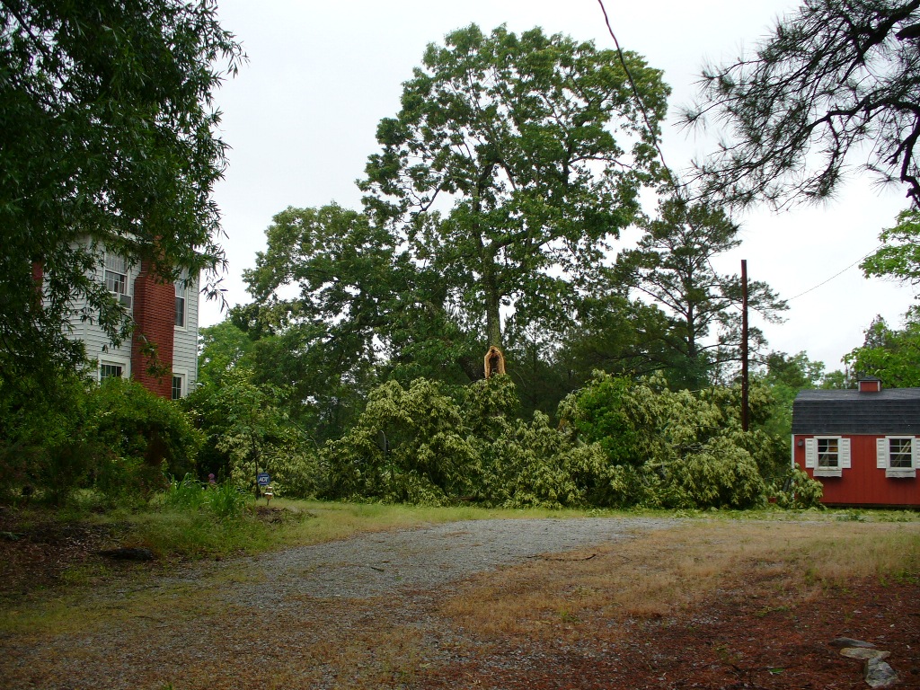
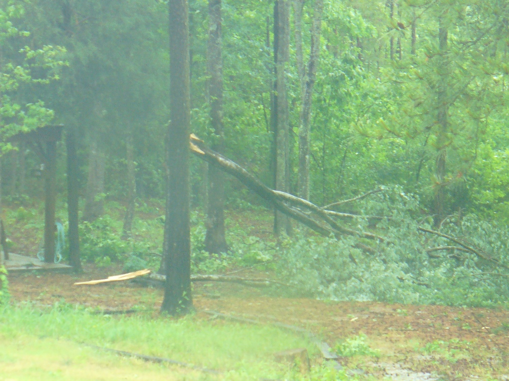
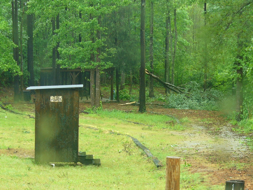
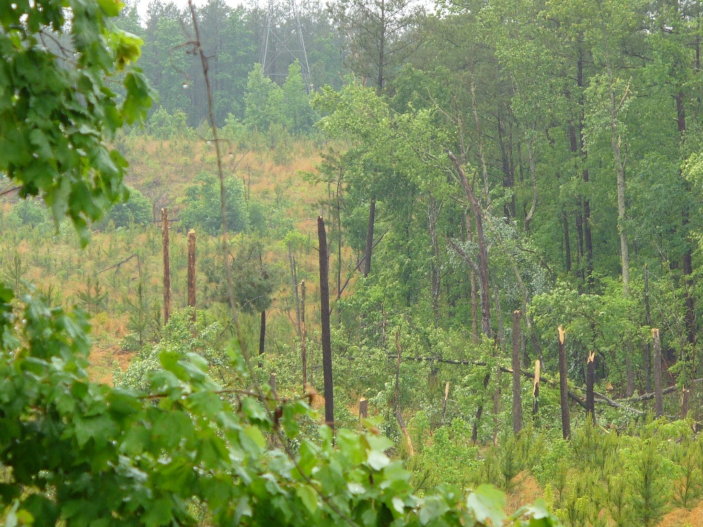
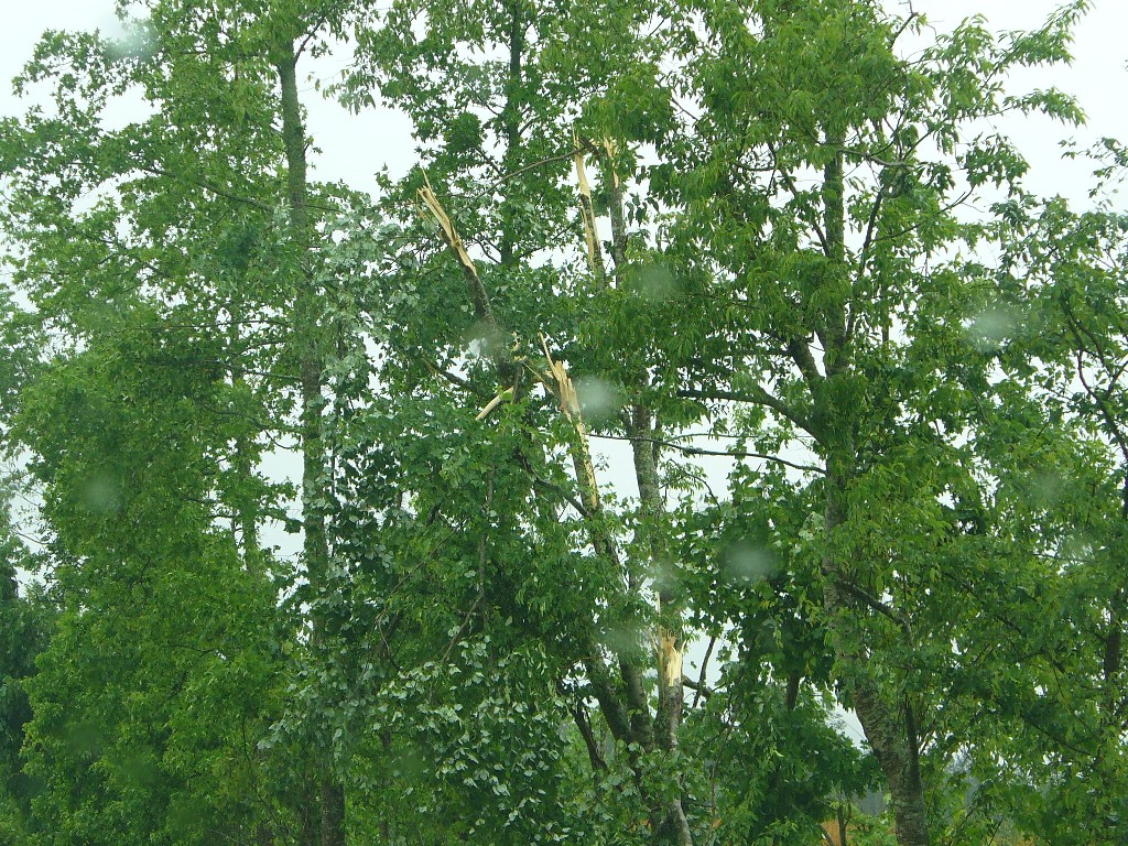
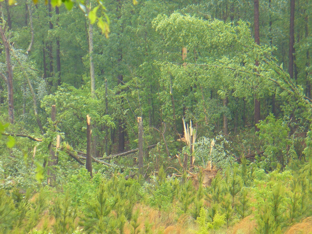
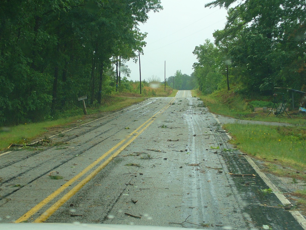
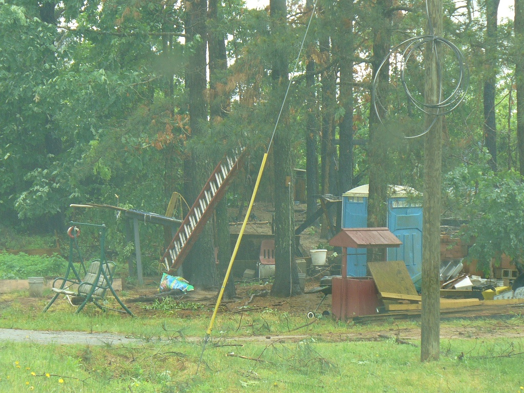
1027 AM TORNADO 9 SE CARLISLE 34.51N 81.33W
05/03/2010 FAIRFIELD SC NWS STORM SURVEY
AN EF1 TORNADO TOUCHED DOWN IN NORTHWEST FAIRFIELD COUNTY
NEAR SC215 AND SHELTON ROAD AND CONTINUED EAST AND PEAKED
NEAR CLOWNEY ROAD TAKING DOWN MANY TREES AND DOING MINOR
DAMAGE TO A HOME AND OUTBUILDINGS.
|

