National Weather Service United States Department of Commerce

Prolonged Atmospheric River in the Northwest; Snow in the North-Central US

A prolonged atmospheric river will bring heavy rainfall which may lead to widespread urban and river flooding, heavy mountain snow, along with gusty winds to the Pacific Northwest into the northern Rockies through much of the week. A clipper will bring a period of snow across the upper Midwest and the Great Lakes into Tuesday, before a stronger system bring more wintry impacts. Read More >

An area of low pressure moved across the northern Gulf of America on Friday, February 12th, then across central Florida Friday night. The system intensified as it moved up along the Southeast coast and away from the area Friday night into Saturday.  Cold air was in place over the Midlands and Central Savannah River Area, which led snow being the dominate precipitation type for this event.


The snow began around 4 pm Friday evening, February, 12th and continued through the early morning hours on Saturday, February 13th.  The snow became heavy at times between 5:30 pm and 11 pm, making roadways treacherous and several thousand homes lost power Friday night.  The average total snowfall across the region was around 4-6 inches but ranged from 3 to 8 inches with a couple of locations reporting near 9 inches.

...Snowfall Reports from around Central SC and East Central GA...

...Snowfall amounts and how they compare to the Record Books...

...Snowfall Pictures from Across the County Warning Area...

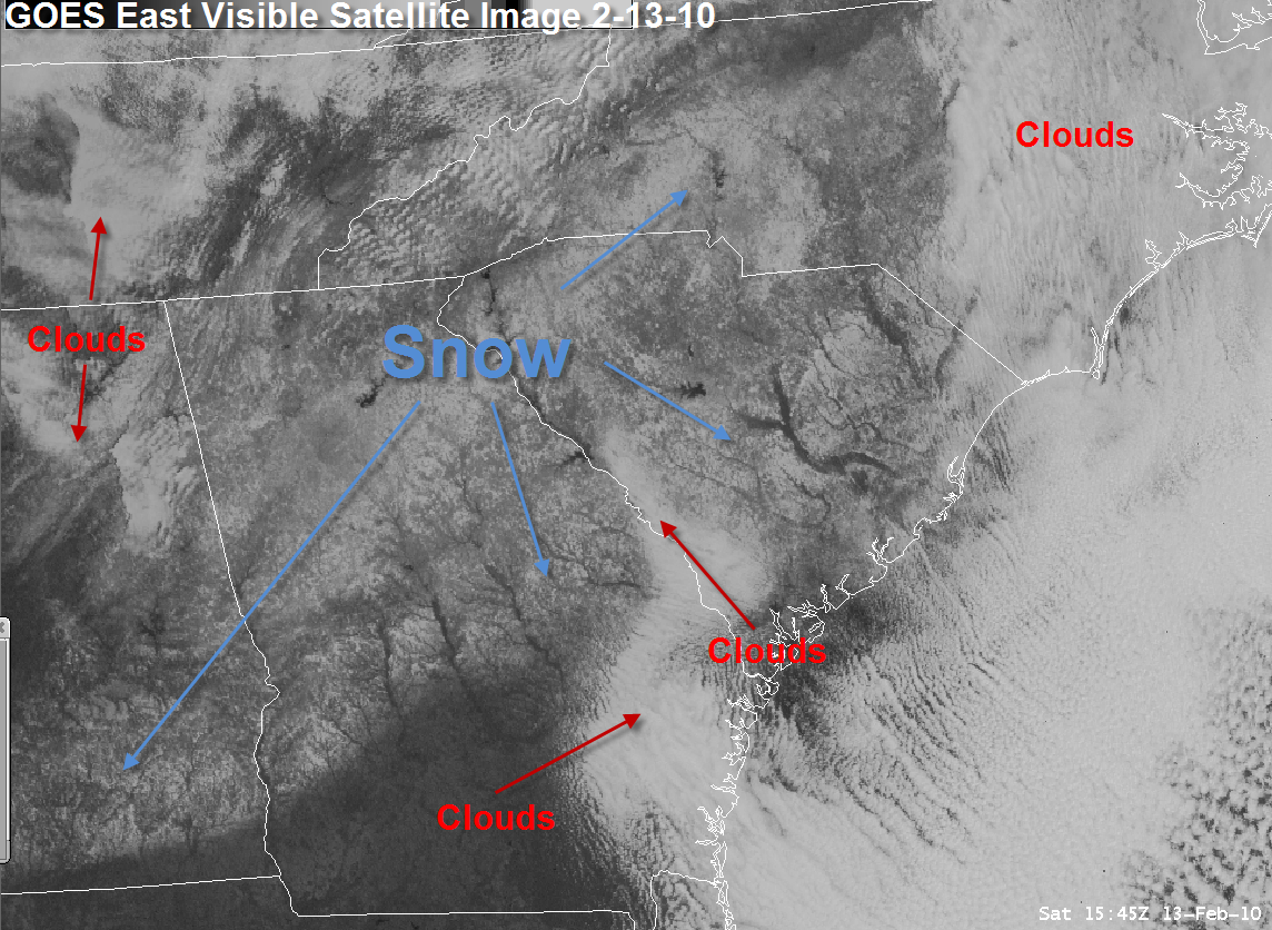
...Visible Satellite Image the day after the Event...


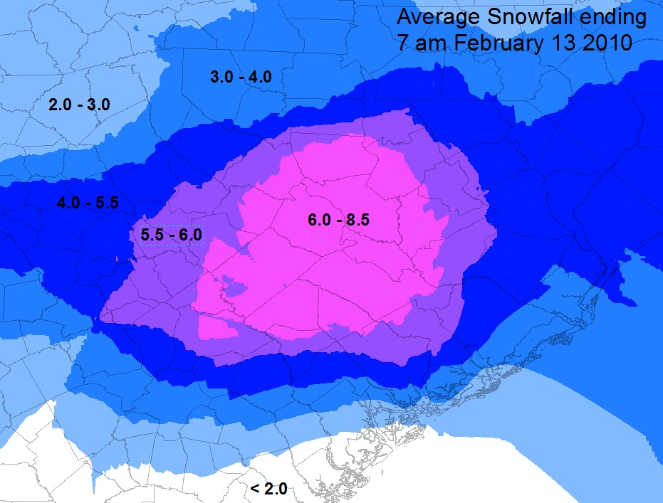
Preliminary Snowfall Totals

(Click map for larger image)

Prelim Tracks